When an emergency hits, it’s all hands on deck. And with emergencies occurring more frequently and with greater intensity, these hands are extremely busy. Timely and accurate information helps ensure a speedy response, and, for an affected community, a speedy response quite literally saves lives. To meet this need, emergency management agencies must increase their response capabilities during critical events.
However, while emergency managers juggle increasing hazards and threats, their success is often hampered by limited access to technology and a lack of technical staff capable of handling coordination and communication activities. This information latency can further delay response efforts and result in additional loss of life and property.
The Emergency Management Operations solution helps agencies implement a data-driven approach that ensures that emergency managers are aware of rapidly changing conditions and can communicate disruptions to critical services and any evacuation notices to stakeholders in a community. The newest version of the solution, available now, also includes several key enhancements that make emergency coordination and response even more effective.
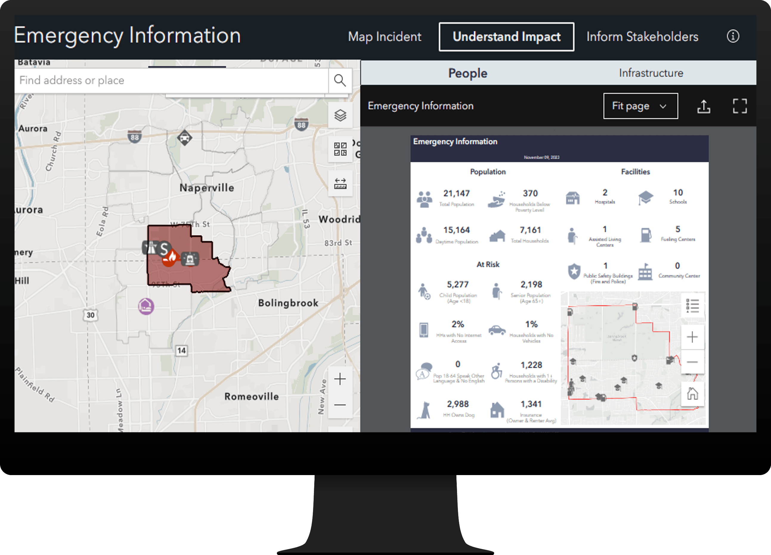
Manage emergency information
Mapping an incident helps operations staff understand the impact the incident has on public infrastructure and human populations. With the new Emergency Information Manager app, staff can quickly map an incident. Infographics and summaries are provided to show the impact on the community. They can then use that knowledge to map road closures, road blocks, detours, shelters, and distribution sites, as well as to create evacuation and shelter-in-place notices. The app can also be used to brief key decision makers and to keep the public informed.

Update community lifelines
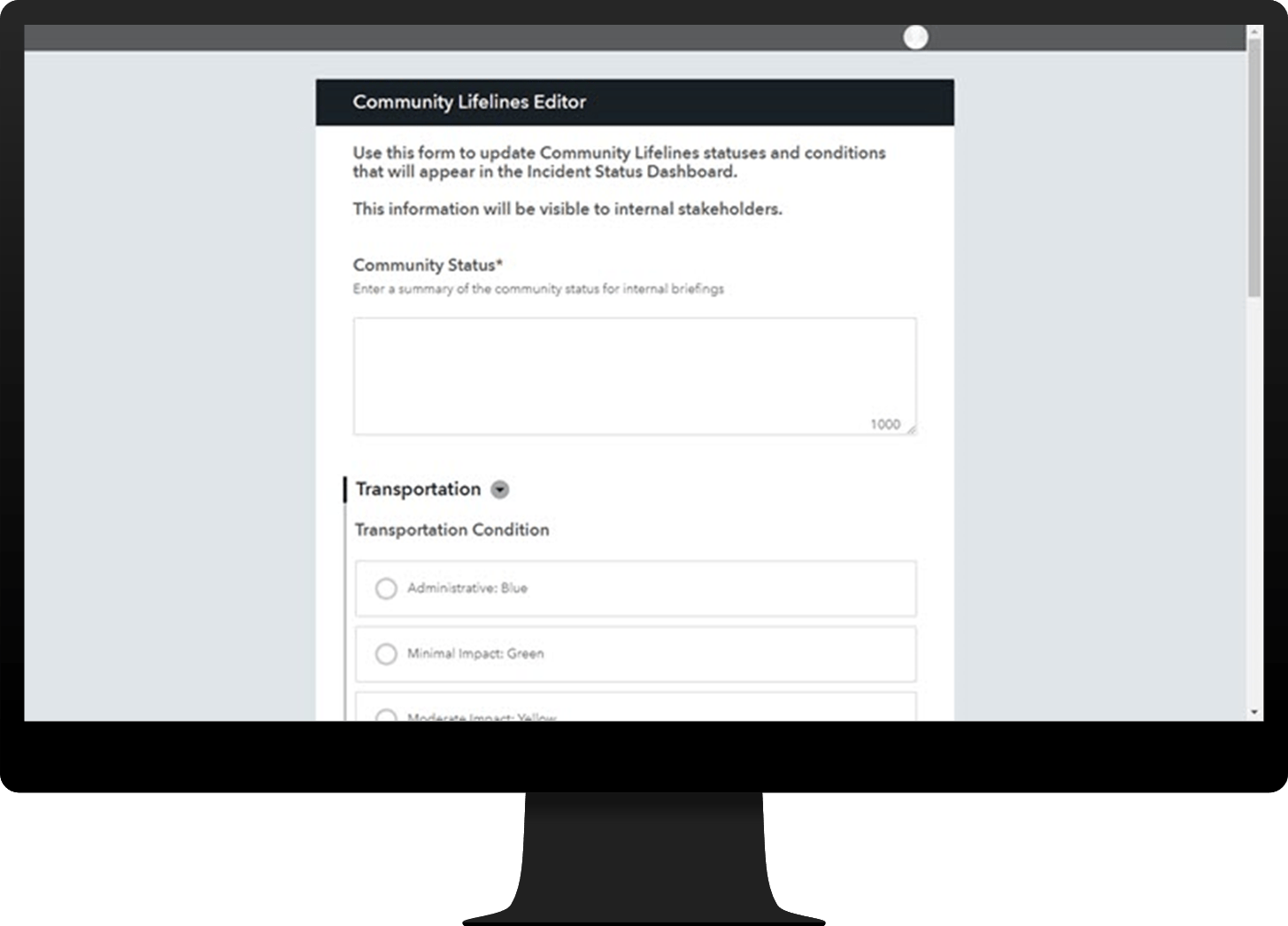
Community lifelines are fundamental community services essential to human health and safety. Uninterrupted operation of these services is vital, emergency or not, and communication about disruptions is a critical element of emergency management. The Federal Emergency Management Agency (FEMA) has established Community Lifelines to identify and track the status of these services. Emergency management agencies must do their part in keeping their lifelines up to date during an emergency.
To streamline this process, the solution now includes the Community Lifelines Editor survey. This form allows operations staff to document community lifeline status and efficiently communicate disruptions to critical services and plans to restore them. The app allows staff to update lifelines specific to their individual roles. The survey remembers previous submissions, which means that you can edit one lifeline while retaining the status of other lifelines already submitted.

The solution also includes the Public Message Editor survey, which can be used to quickly share emergency status updates with the public.
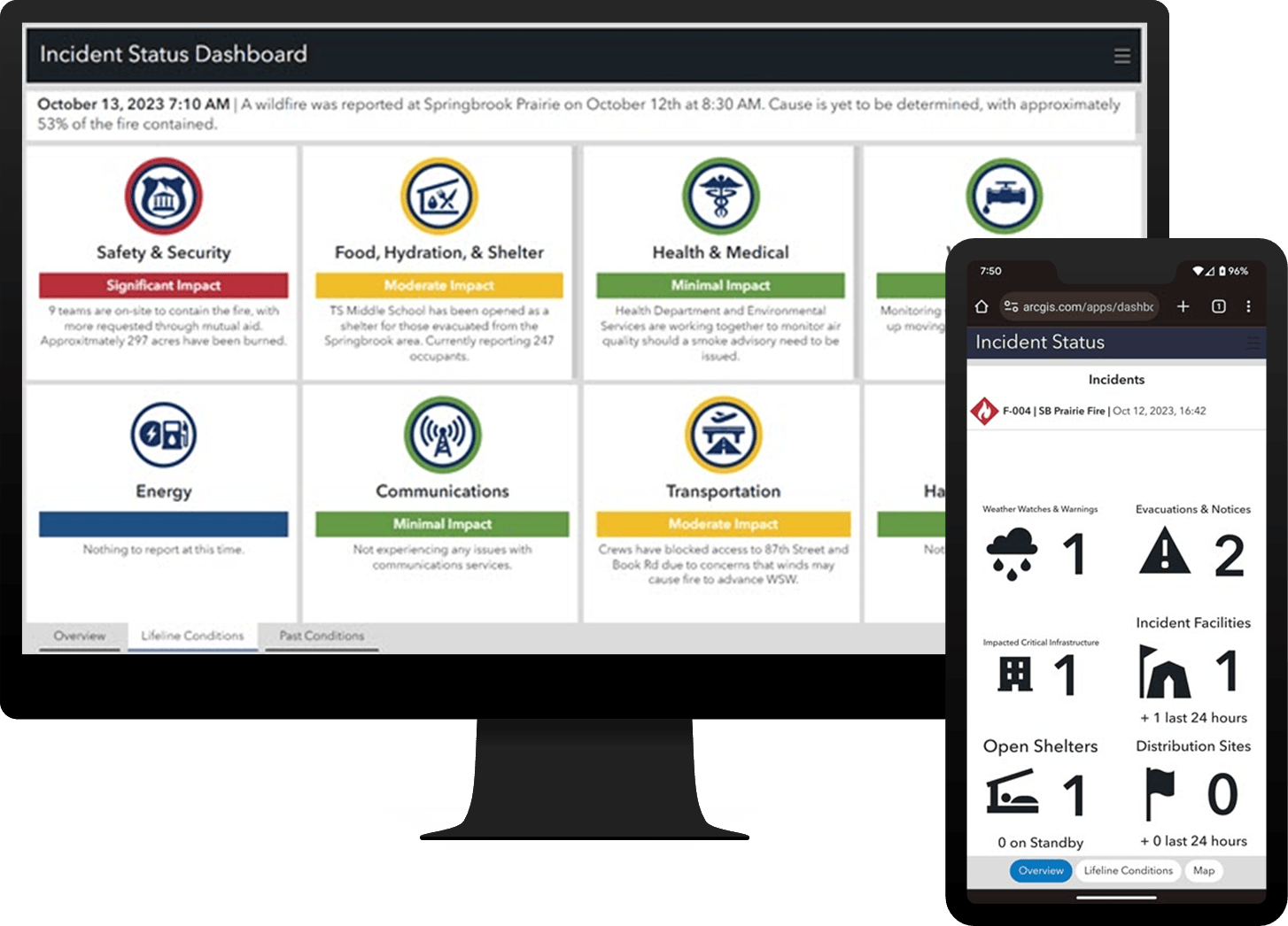
Brief key stakeholders
For effective decision-making, key stakeholders need to know the extent of the emergency and the status of response activities, as well as about any disruptions to critical services and plans to restore them. The Incident Status Dashboard app can be used to provide all this information, ensuring clear communication at all command levels and facilitating effective decision-making at the executive level.

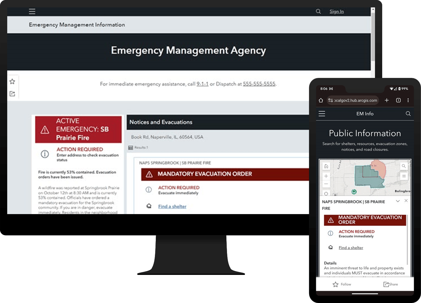
Share emergency information
The public also need access to emergency information, whether it’s before, during, or after an incident. Current status? Emergency resources? Evacuation zones? Road closures? The Emergency Management Information site serves as a platform to communicate necessary emergency information to the public. Residents can then use this information to evaluate their personal risk and make an informed decision about when to take action.

There’s no such thing as too much help during an emergency. Be sure to check out the latest version of Emergency Management Operations to see all the ways the solution can lend a hand.
Resources
For more information about the Emergency Management Operations solution, check out the following resources:
- Learn how deploy, configure and use to the solution.
- View a demo video.
- Chat with us on Esri Community.
- Learn more about ArcGIS Solutions.


Article Discussion: