ArcGIS Solutions helps you make the most of your GIS by providing purpose-driven, industry-specific configurations of ArcGIS.
As demand for renewable energy grows, acquiring the right amount of land for a renewable project is becoming more complex. To meet the acreage requirement, companies are finding they need to acquire more tracts of land, especially for large utility–scale sites. Aware of the highly competitive nature of the industry, solar and wind renewable energy companies, must work quickly to cultivate positive relationships with landowners, identify suitable sites, and secure land agreements.
Land acquisition campaigns require a lot of coordination. Tracking landowner interactions and agreements, managing input from subject matter experts, and monitoring the acquisition process require true collaboration among all parties.
Introducing Renewables Land Acquisition, a new solution from ArcGIS Solutions that simplifies and accelerates the land acquisition process for new renewable energy production site. Here’s how it can help:
Streamline the land acquisition process
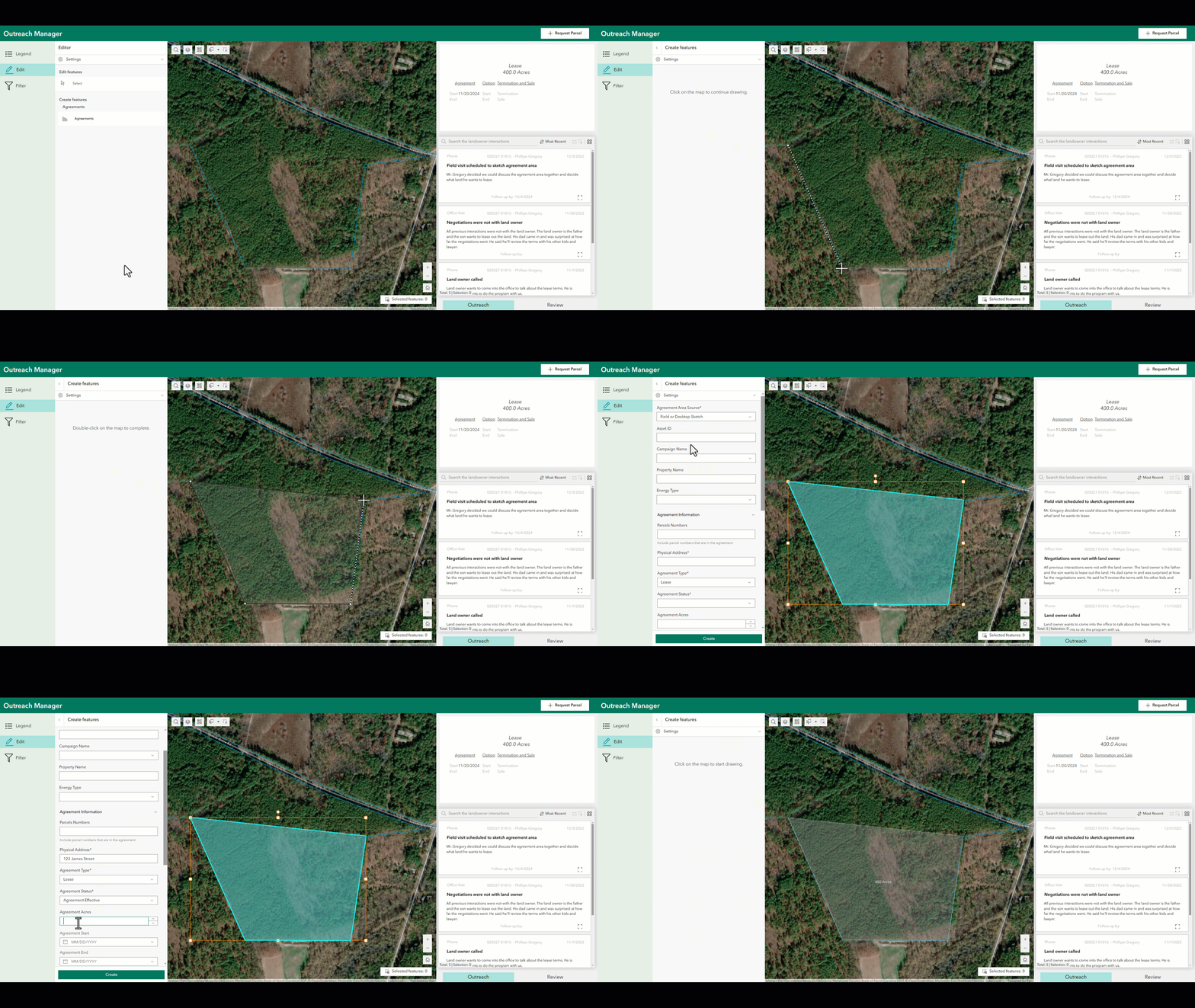
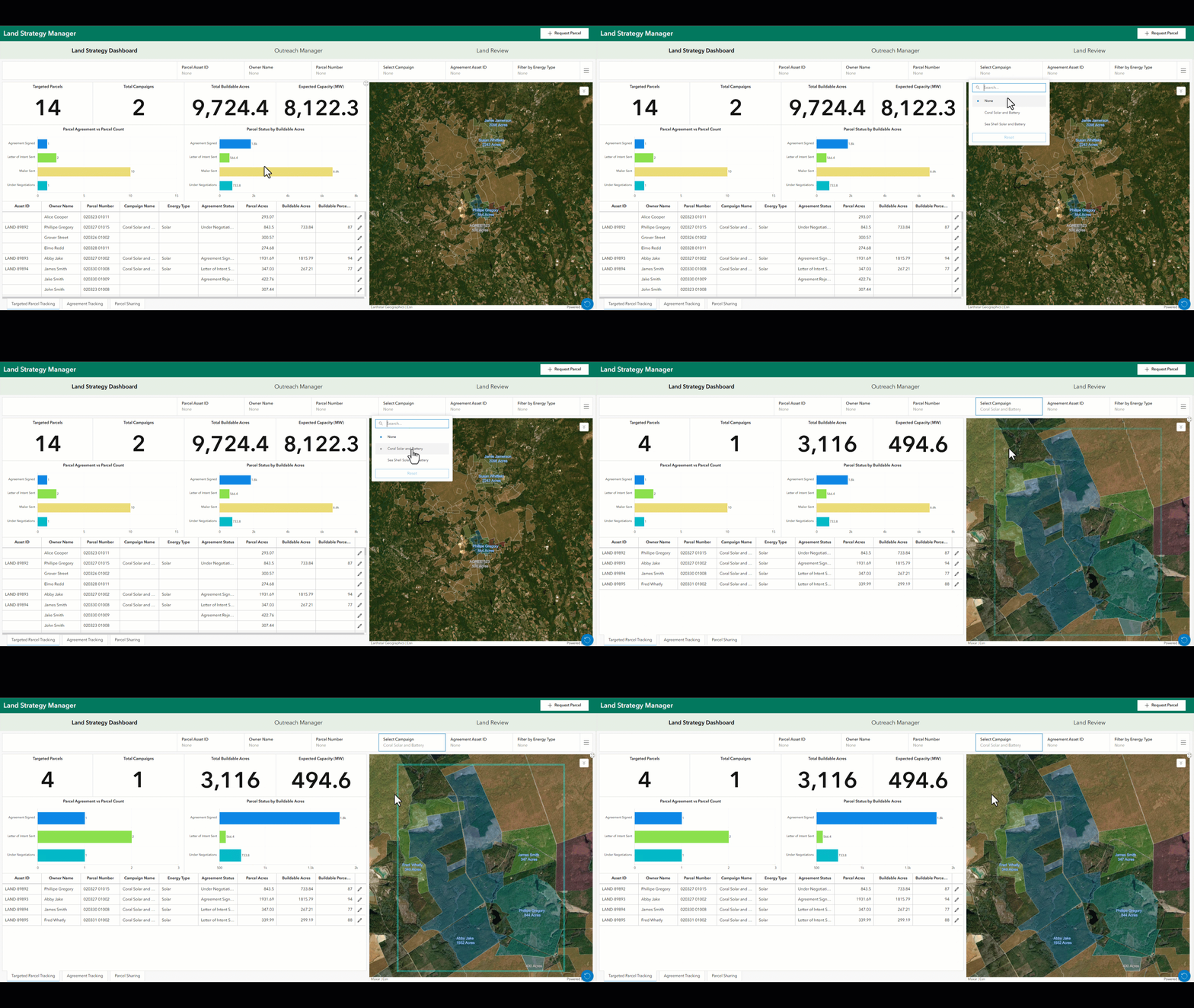
The Renewables Land Acquisition solution includes apps to help you manage parcel information, track landowner interactions, and log agreements. Your land strategy team can efficiently request and update parcel data, ensuring that all communication and agreements are well-documented and easily accessible to everyone. The solution also includes tools to help you monitor campaign progress, identify potential bottlenecks, and quickly address challenges.
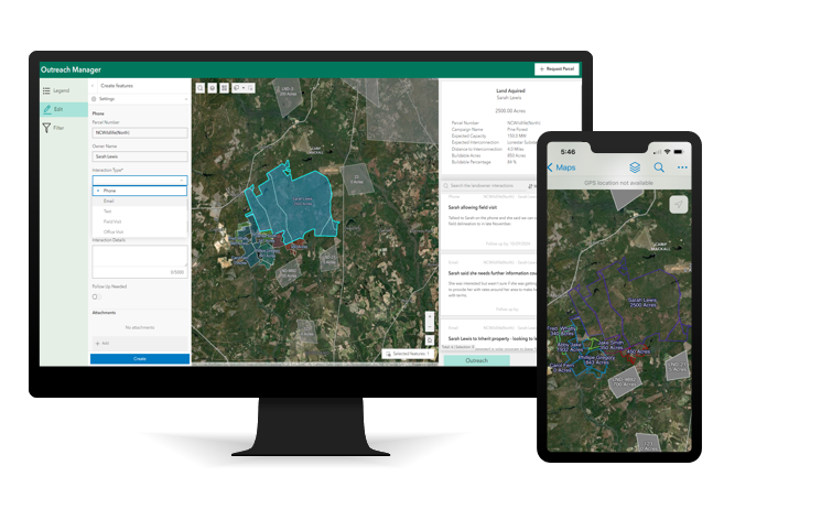
With this solution, land agents can add and update information directly from the field using mobile devices. This capability ensures that all data is current and accurate, allowing for real-time collaboration and decision-making. Land agents can sketch agreements, capture landowner interactions, and update parcel information on the go, significantly enhancing the efficiency and responsiveness of the land acquisition process.
Enhance team collaboration
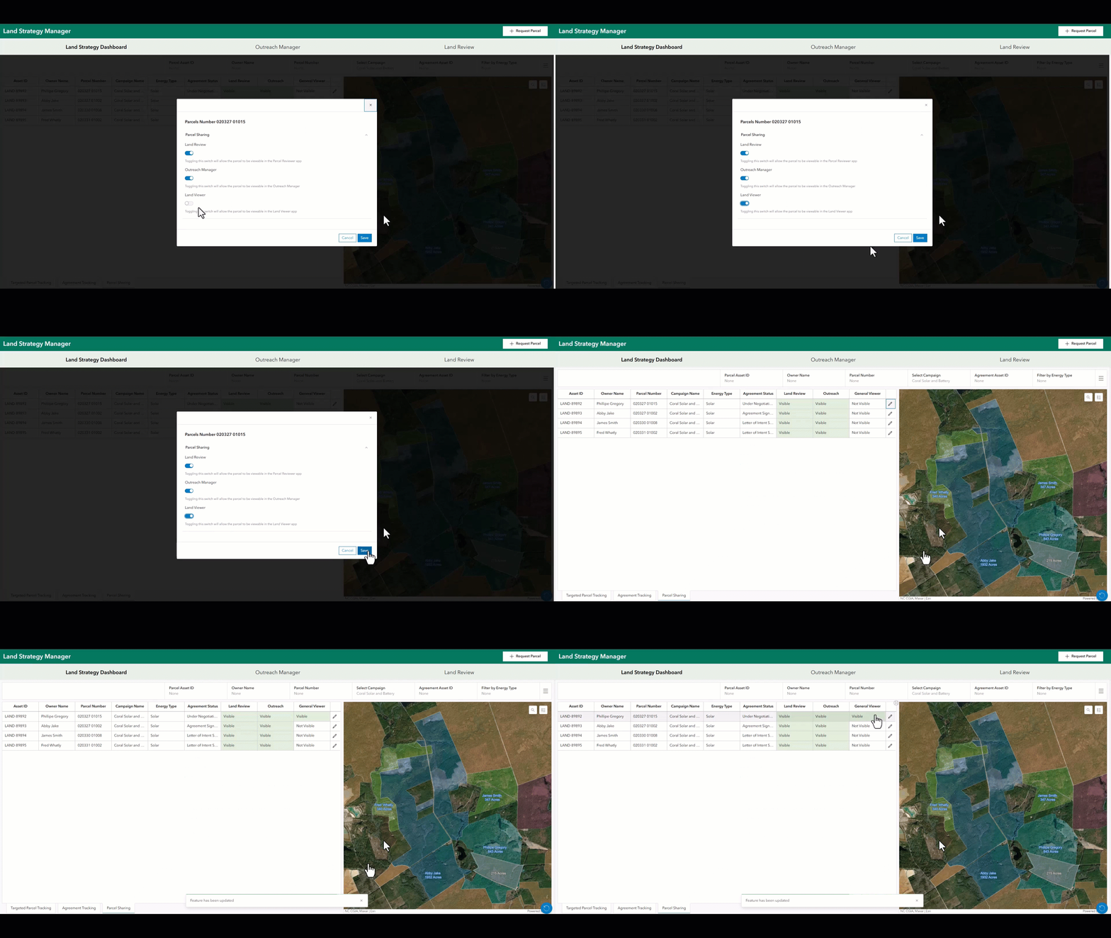
The solution’s unified, map-based system enhances collaboration by connecting all stakeholders involved in the process of land acquisition. Land agents in the field, subject matter experts, and origination leads can effortlessly share and access parcel information, track landowner interactions, and manage agreements. This platform ensures that everyone is working with the most up-to-date data, facilitating informed decision-making and efficient project management.
Make informed site-acquisition decisions
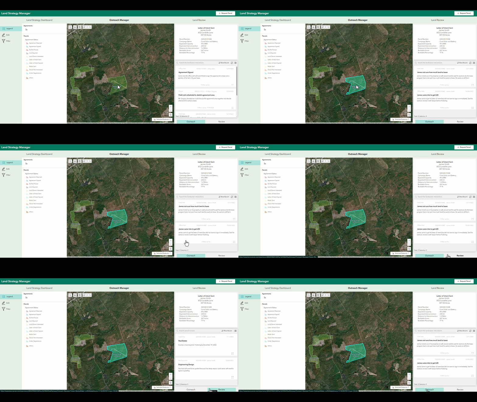
Renewables Land Acquisition ensures that all your land acquisition deals are based on accurate, up-to-date information. Easy access and insight into landowner interactions and land reviews help companies identify the parcels most suitable for development and negotiate more effectively to secure them. Ultimately, the solution helps renewable energy companies optimize their land acquisition strategies and achieve their project goals efficiently.
Innovative solutions for an innovative industry
Renewables Land Acquisition is ArcGIS Solutions’ second renewables-specific solution. It joins Solar Site Data Management, released earlier this year, in our growing collection of solutions tailored specifically for the renewable energy industry.
Learn more
For more information about the Renewables Land Acquisition solution, check out the following resources:
- Learn how to deploy, configure, and use the solution.
- View a demo video.
- Discover the Solar Site Data Management solution:
- Deploy, configure, and use the solution.
- Check out the release blog.
- Learn more about ArcGIS Solutions.

Commenting is not enabled for this article.