Roads are the most important public assets local governments maintain. They enable the supply of goods and services and connect residents to workplaces, schools, and hospitals. Properly maintained roads increase a community’s standard of living, save lives, prevent injuries or property damage, and improve traffic flow.
Road condition is greatly affected by a local governments ability to perform timely maintenance and upgrades. Over time, weather, climate, and traffic cause road pavement to degrade. When roads are in poor condition, they constrain a community’s economic vitality, put lives at risk, and increase the cost of operating a vehicle. As a result, road maintenance organizations routinely inspect road quality conditions and conduct routine maintenance or repairs. These routine inspection programs reduce capital costs and identify safety issues before an incident occurs.
The Roadway Management solution delivers a set of capabilities that help local governments inventory public roads and their characteristics, conduct routine pavement condition assessments, and streamline inspection and maintenance activities.
Improve road data management
Before an organization can effectively manage and assess the quality of their roadway assets, agencies must create an accurate inventory of the location and characteristics essential to the care and maintenance of those assets. To help organizations effectively manage and assess the quality of their roadway assets, a series of apps can be used to create an accurate inventory of the location and characteristics of roads, guardrails, pavement markings, traffic calming devices, and pavement condition survey units.
The Roadway Data Management ArcGIS Pro project can be used by mapping technicians to load existing GIS records into the solution’s feature layers and create new record information while being guided through a series of tasks.

After record information is loaded, the Roadway Management Center app can be used to update and manage inventories on the web. The Roadway Management Center can also be used to by operations and maintenance staff to monitor asset conditions and pavement assessment results, triage requests for service, and create work assignments.
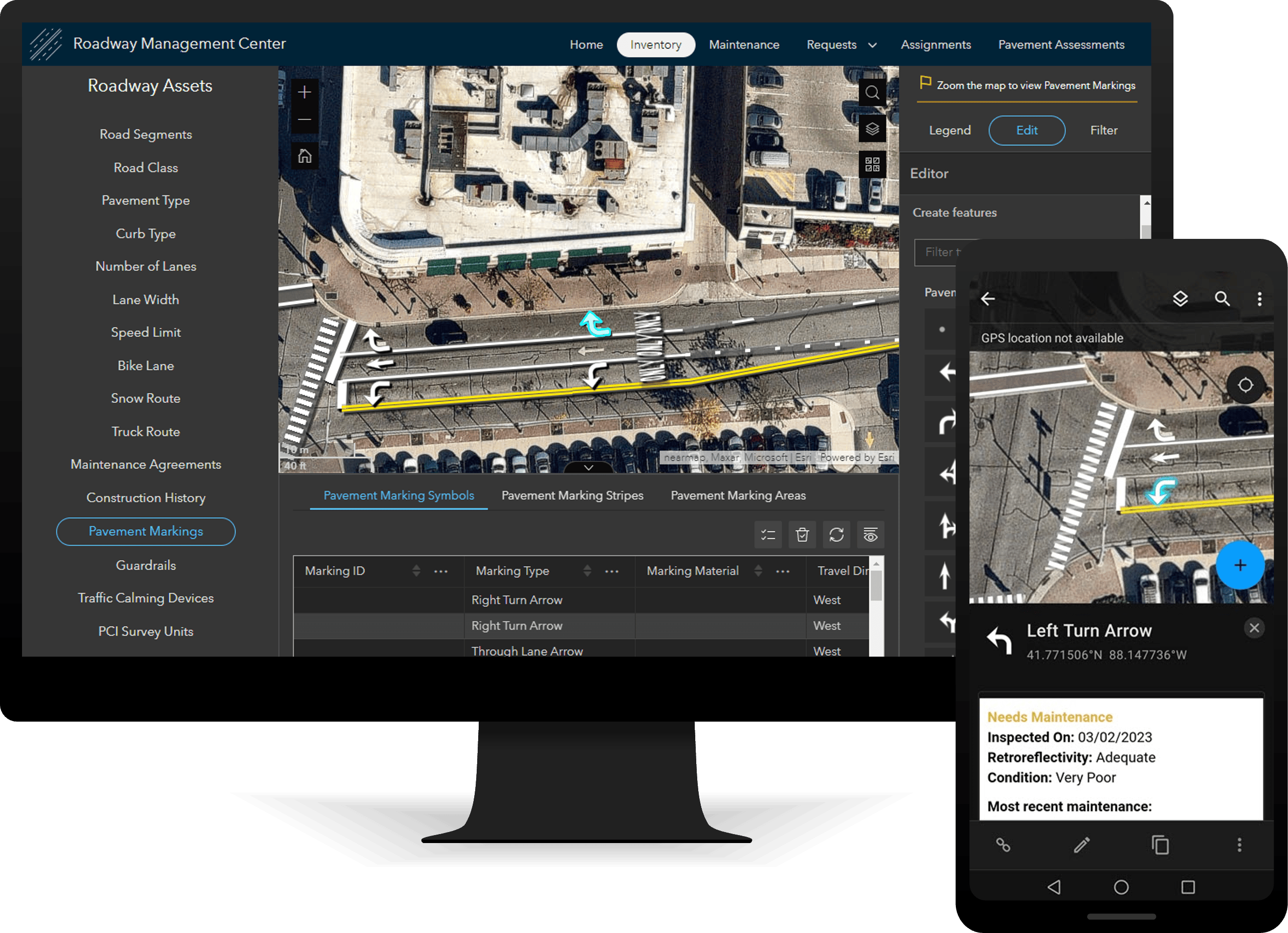
Operations and maintenance staff can also access roadway asset information in the field by using the Roadway Field Map. This map enables mobile workers to manage roadway asset inventories and to record inspection and maintenance activities.
Streamline inspection and maintenance activities
Operations and maintenance staff are constantly monitoring and reporting on the status of roadway assets and addressing issues as they arise. As supervisors triage service requests and schedule routine maintenance, they delegate field assignments to mobile workers to ensure that work activity is addressed in a timely manner.
Field staff often encounter issues on the roadway while traveling from one assignment location to the next. Roadway issues such as debris in the roadway, potholes, and guardrail damage can be reported at speed by passengers within work vehicles using the Road Reporting ArcGIS QuickCapture project.
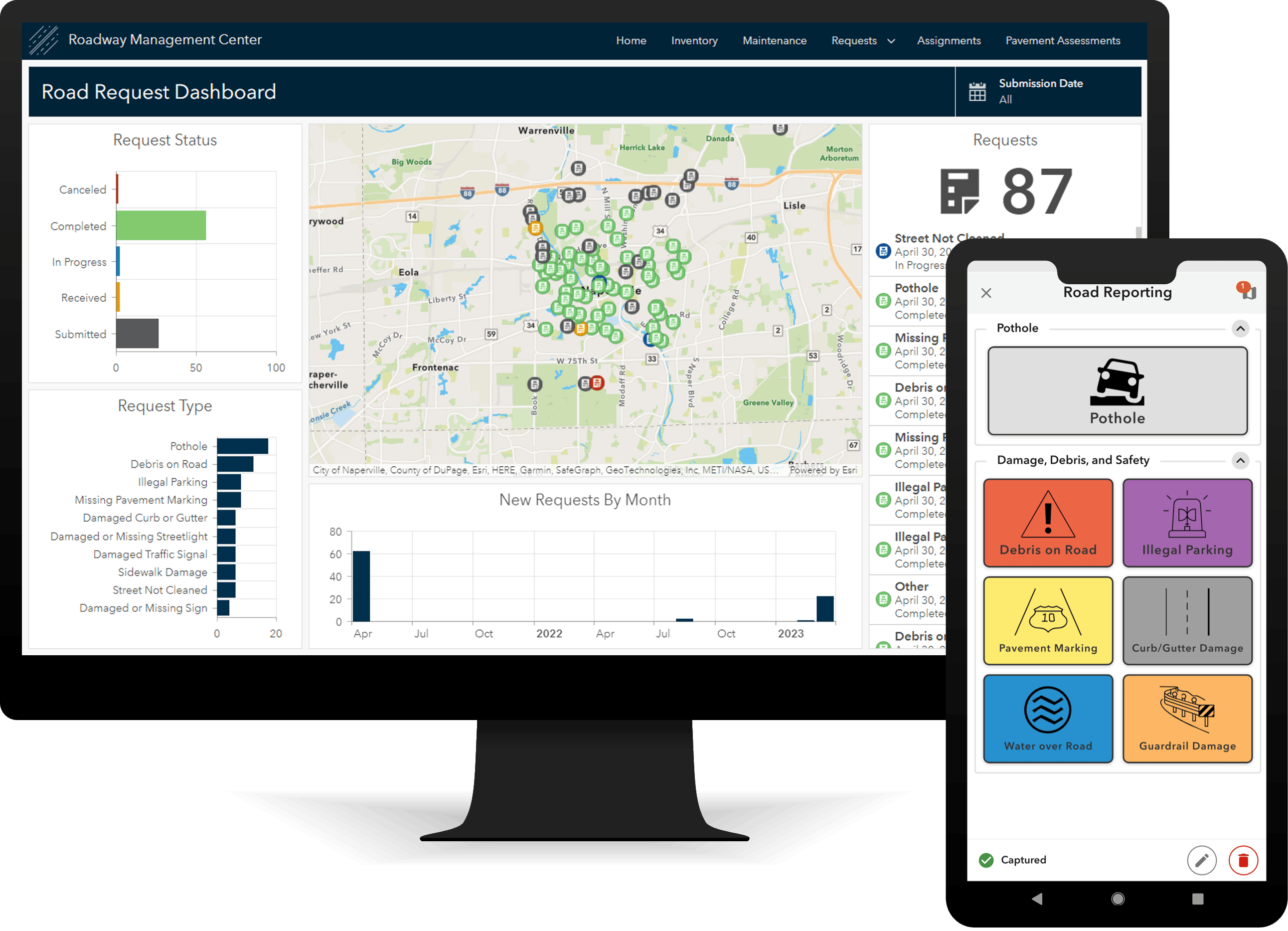
As issues are reported, maintenance supervisors can use the Roadway Management Center to triage both internal and external requests for service.
To help organize work activity for mobile workers, the Road Assignments ArcGIS Workforce project can be used by operations and maintenance staff to address routine maintenance needs and service requests.

Effectively assess pavement condition
Road maintenance organizations conduct routine pavement condition inspections to determine the right treatments on the right roads at the right time.
The Roadway Management solution provides the Rapid Pavement Assessments ArcGIS QuickCapture project, which enables operations and maintenance staff to assess pavement quality at speed while traveling as a passenger in a work vehicle.
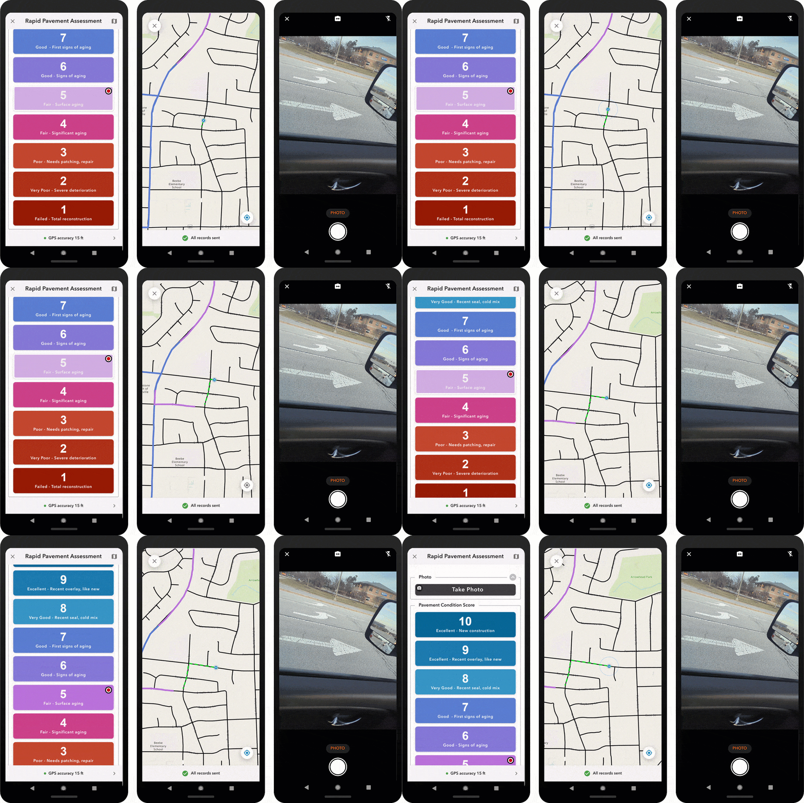
Operations and maintenance staff, who are most familiar with the roads and their conditions throughout the community, can help contribute to pavement monitoring programs by conducting these windshield-type of pavement assessments. Results from these assessments can then help provide a high-level view of the overall condition of the road network.
The Roadway Management solution also enables organizations to conduct a pavement condition index survey. A pavement condition index (PCI) is a statistical measure of pavement condition and is often used to help agencies select pavement preservation and rehabilitation strategies in their pavement management systems.
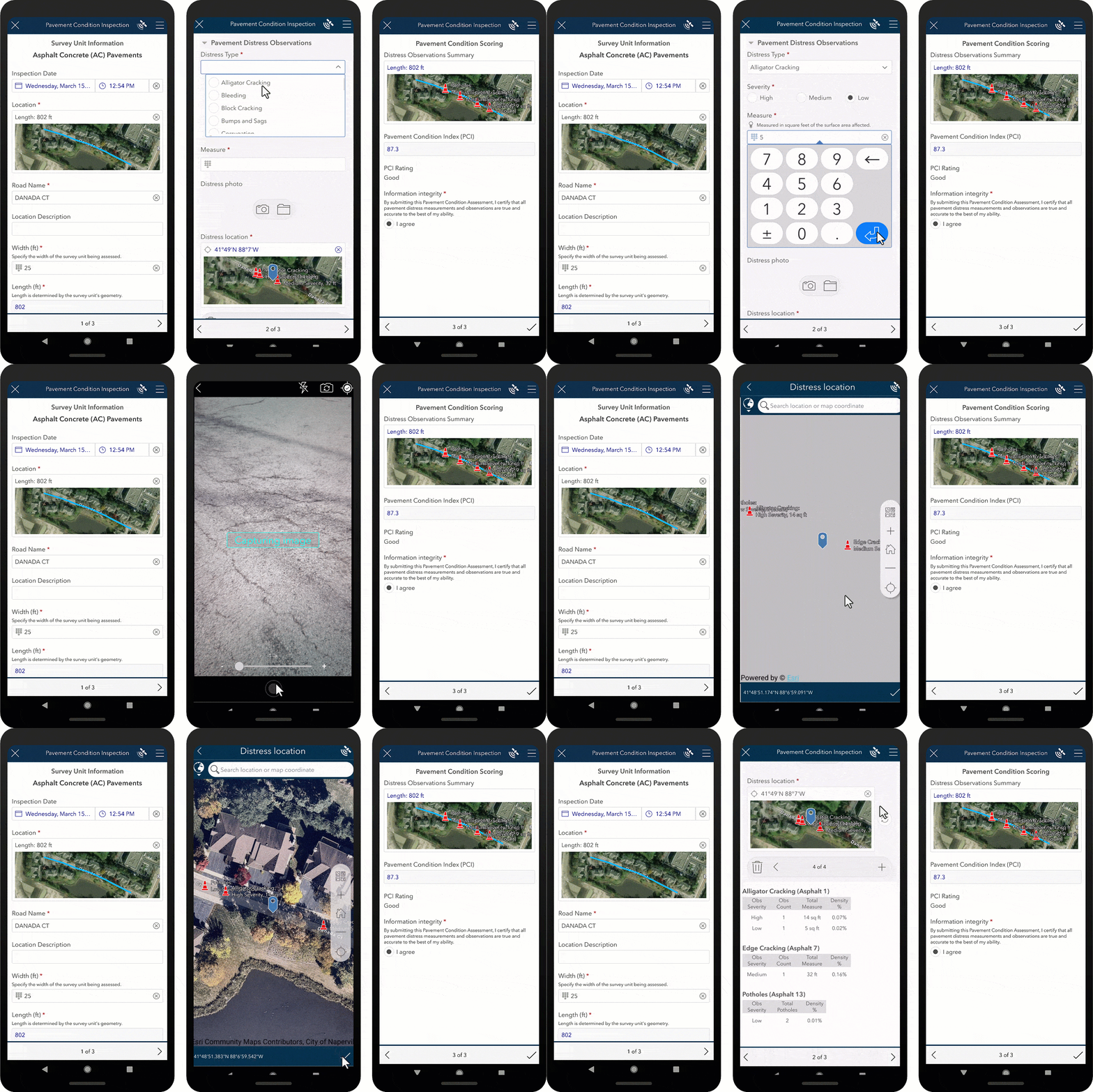
Pavement inspection professionals can conduct condition inspections on asphalt concrete (AC) pavements using the Pavement Condition Inspections ArcGIS Survey123 form. These inspections cover a predefined section of a road or survey unit and result in a pavement condition index (PCI).
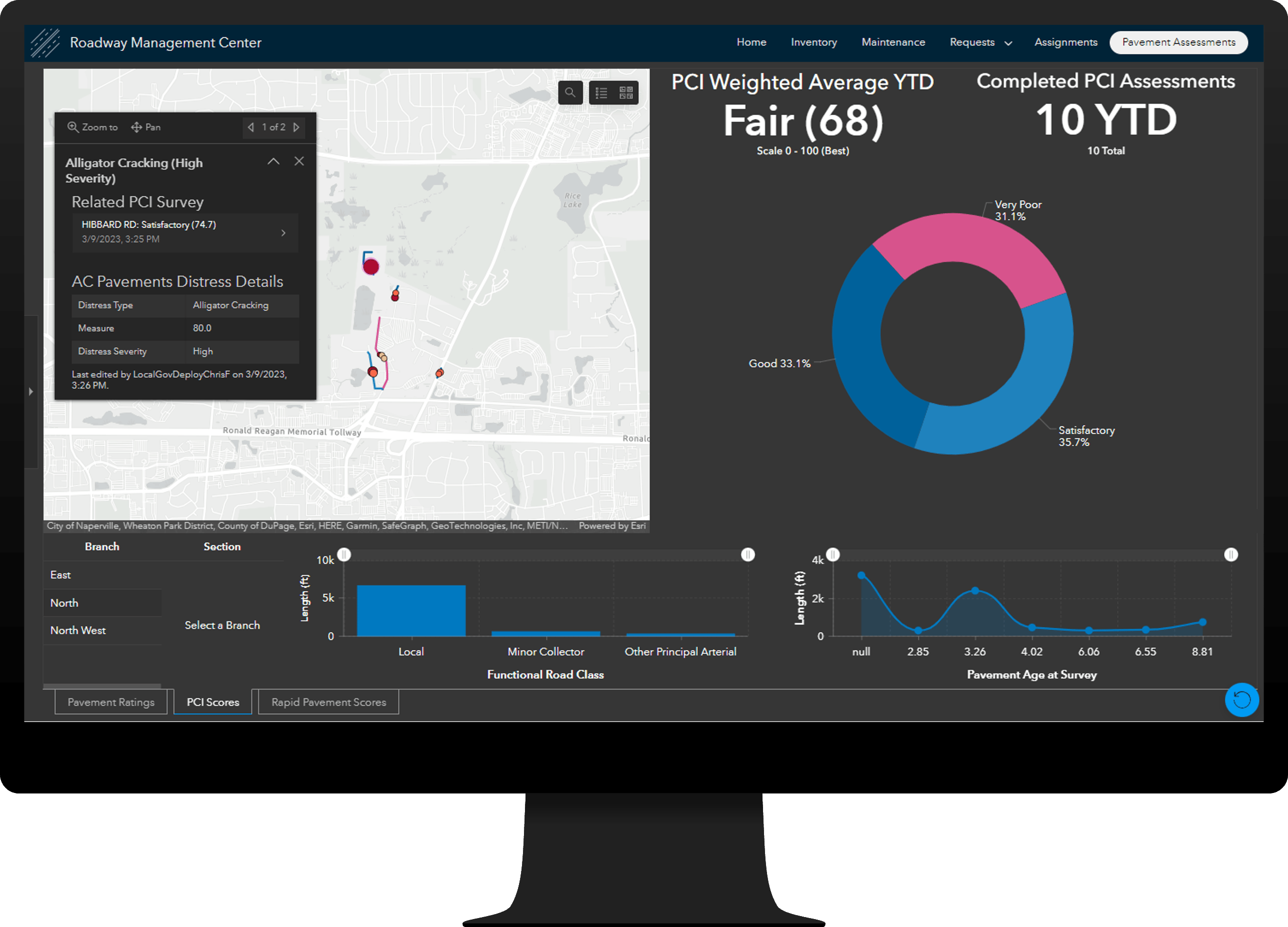
As pavement assessments are completed, the Pavement Assessments ArcGIS Dashboards app can be used by operations managers and directors to review current and historical pavement ratings, PCI results, and rapid pavement assessment results.
Increase transparency and public trust
Increasing transparency and acknowledging the quality of roads throughout the community is crucial to building public trust. Sharing pavement ratings with the public achieves this, and transportation and public works agencies can do so by providing a single website destination that offers 24-hour access to their organization.
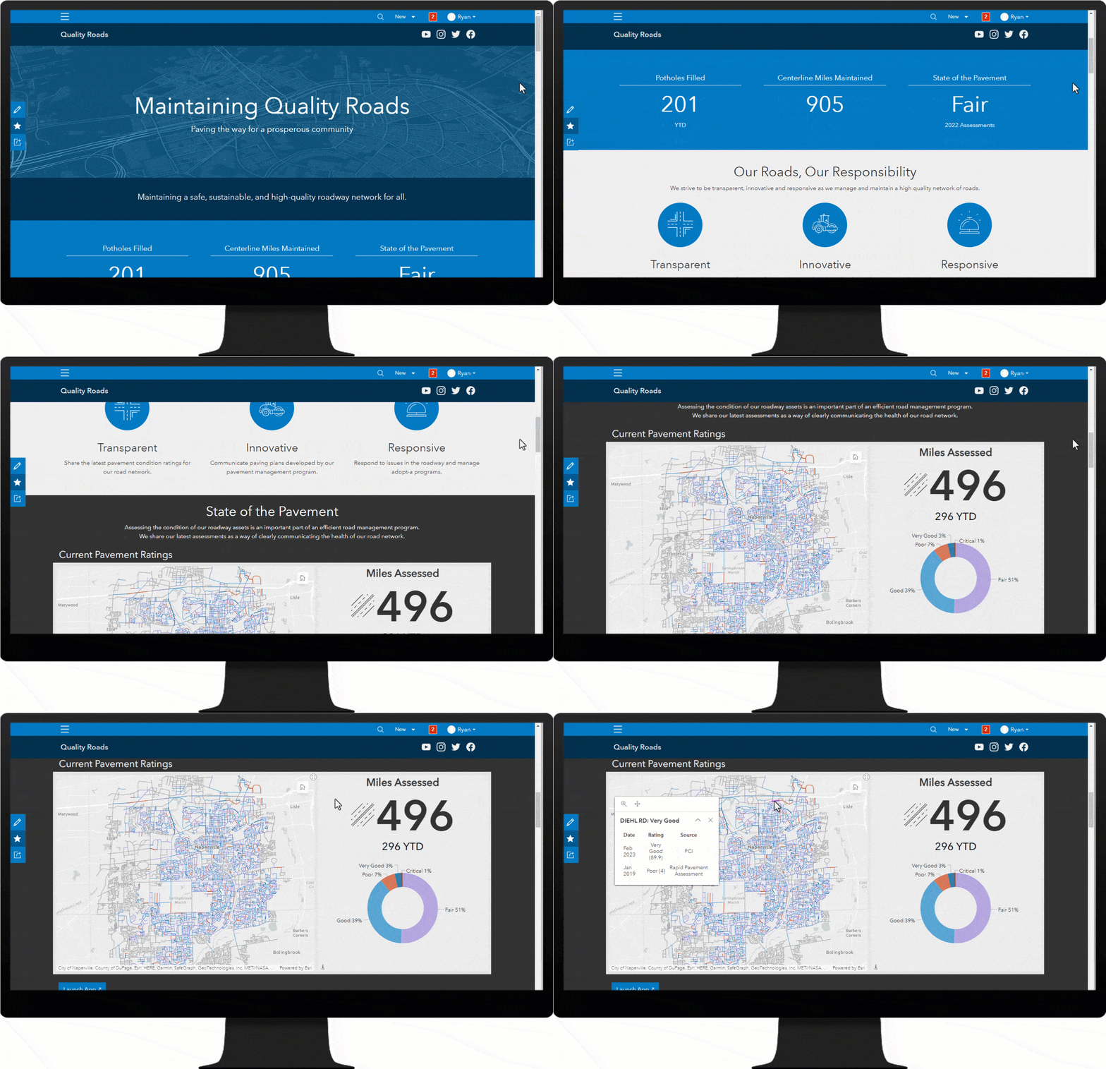
The Quality Roads Hub site can be used by transportation and public works agencies to share pavement condition ratings and paving plans. The State of the Pavement section features the Current Pavement Ratings app, an ArcGIS Dashboards app that can be used by the public to view current and historical pavement ratings.
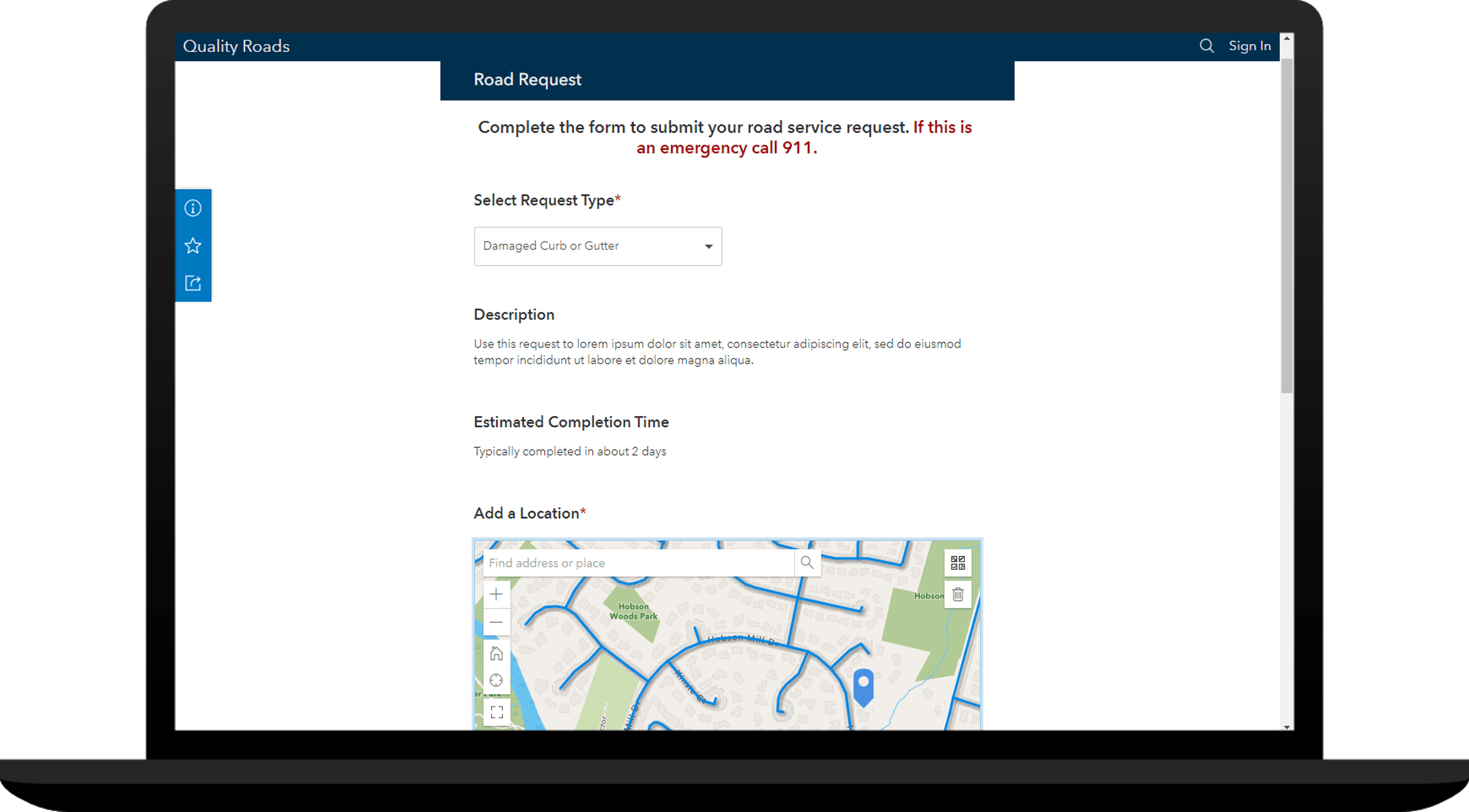
Additionally, the Responsive Roadway section provides access to the Road Request form, a digital survey form that helps agencies solicit road related requests for service from the public. This form can be customized to meet the specific needs of an organization, including updating terms of service for different road issue types and setting location-based restrictions for reporting road requests.
Additional resources
We are happy to share this release with you. Below, you can find additional resources you may find useful.
- Watch the Roadway Management video to learn more
- Deploy the Roadway Management solution
- Learn how to configure and use Roadway Management
- For questions and feedback, chat with us on Esri Community or contract Esri Support Services


Article Discussion: