Parks improve quality of life, protect natural resources, and enhance local economies. Unfortunately, park agencies are increasingly burdened with overuse and many times the first agency to receive funding cuts during an economic downturn. As a result, they are continuously balancing park asset maintenance needs with available funding.
The first and most critical step park agencies must take to prioritize asset needs is to create a park asset inventory. A park agency cannot plan park improvements, maintain existing assets, and ensure guest safety unless they know what assets they have, where they are, and what condition they are in.
The Park Infrastructure Management solution delivers a set of capabilities that help parks and conservation agencies inventory park assets, understand asset condition, and communicate changing asset conditions that impact park services.
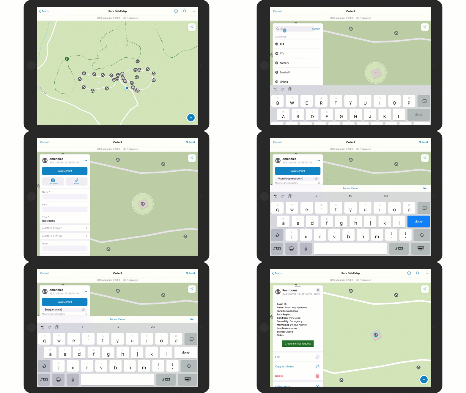
Inventory and assess park assets in the field
In many cases, a field assessment of existing park assets may be the most efficient way to develop a park asset inventory. The information collected in the field can then be augmented with other descriptive information that helps park staff or the general public view park information easily. The Park Field Map can be used by park rangers to inventory, inspect, and maintain park assets in the field.
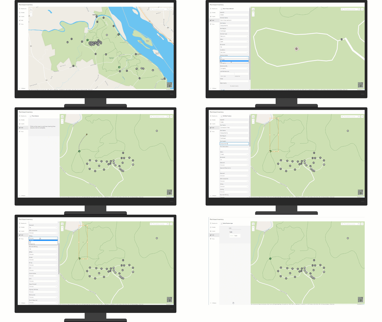
Develop park asset inventory
Existing park assets collected by park rangers in the field can be reviewed and information added to help park staff and the general public find information about a park. New park assets can also be added to a park asset inventory using imagery and record documents. The Park Asset Inventory app can be used by mapping technicians to create new park assets and review park assets collected by park rangers in the field.
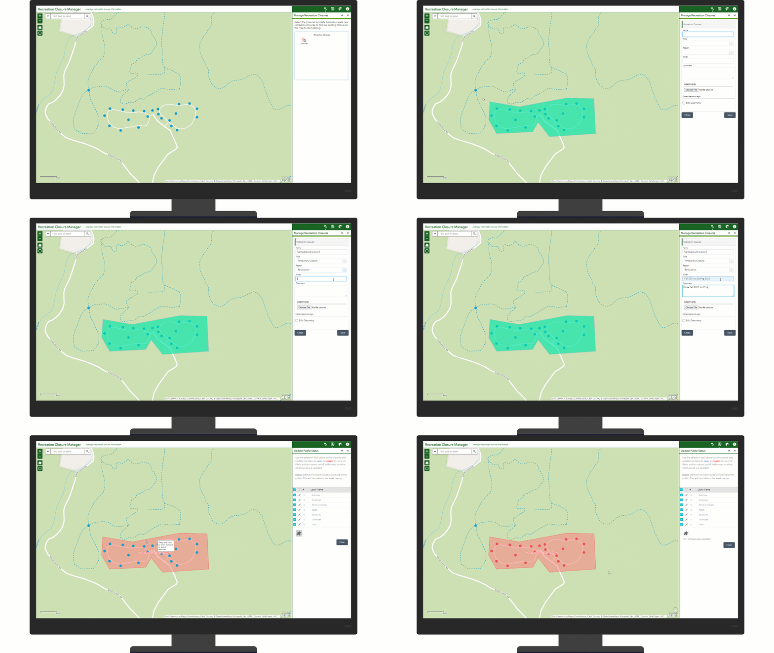
Update recreation closure information
Communicating the status of recreation opportunities helps visitors plan trips and reduces congestion and overuse of resources. The Recreation Closure Manager app can be used by public information staff to create and update recreation closures. This app is shared between the Park Infrastructure Management solution and the Recreation Outreach solutions. Recreation closures created with the Recreation Closure Manager app will be displayed in the recreation locators (Park Locator, Trail Locator, Water Resource Locator, Wildlife Resource Locator) included with the Recreation Outreach solution.
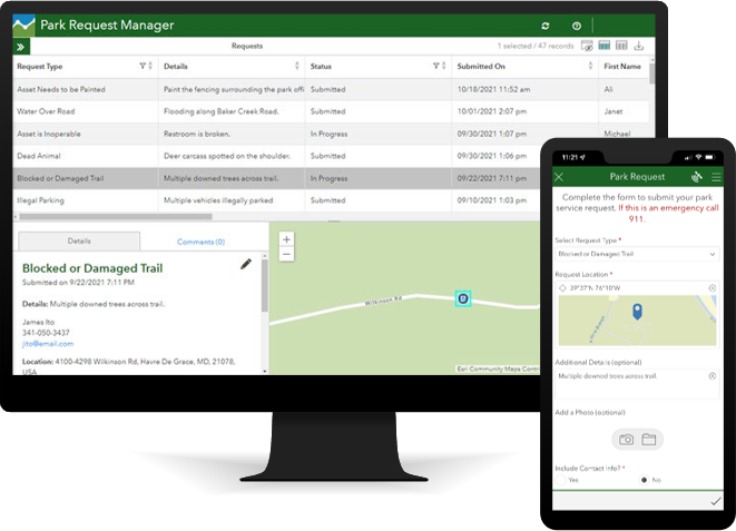
Respond to requests for service
Soliciting requests for service from the general public as well as park staff is an important component of park operations. The Park Infrastructure Management solution includes two forms to submit park service requests, one form for internal staff such as park rangers and one form for the general public. As park service requests are submitted, park operations staff can use the Park Request Manager to triage submitted problem reports and update the status of each report.
Finally, the Park Request Dashboard can be used by park operations staff to monitor the status of park service requests.
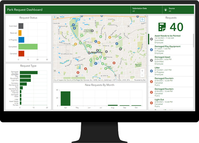
The Park Request form, Park Request Manager, and Park Request Dashboard are shared between the Park Infrastructure Management solution and the Recreation Outreach solution.
Additional resources
Learn more about the Park Infrastructure Management solution and how you can quickly deploy it on the ArcGIS Solution site. For questions and feedback, chat with us on Esri Community or contact Esri Support Services.
Note, the November 2021 ArcGIS Solutions release also includes a newly enhanced Recreation Outreach solution. It complements the Park Infrastructure Management solution and helps you engage the public about their recreation experiences and promote recreation opportunities to the public. Organizations will get the most value when using the Park Infrastructure Management solution in conjunction with the Recreation Outreach solution.

Article Discussion: