Local assessors have a statutory responsibility to discover, list, and value property at current market conditions. These values determine how much an owner must pay in property taxes to local governments.
Turbulent housing markets cause typically stable property values to rise or fall dramatically. Subsequently, concerned property owners question their property assessments and tax bills.
Public engagement is an essential part of the property valuation process. However, complex assessment systems can make it difficult for local governments to share information easily with the public. At the same time, listing aggregators have brought property information and home valuation data directly to consumers, transforming expectations and driving demand for modern, simple, and engaging access to property assessment information.
The enhanced Equitable Property Value solution delivers a set of capabilities that allow local governments to share authoritative property information in a map-based application, modernize customer service, and promote fair and equitable property values.
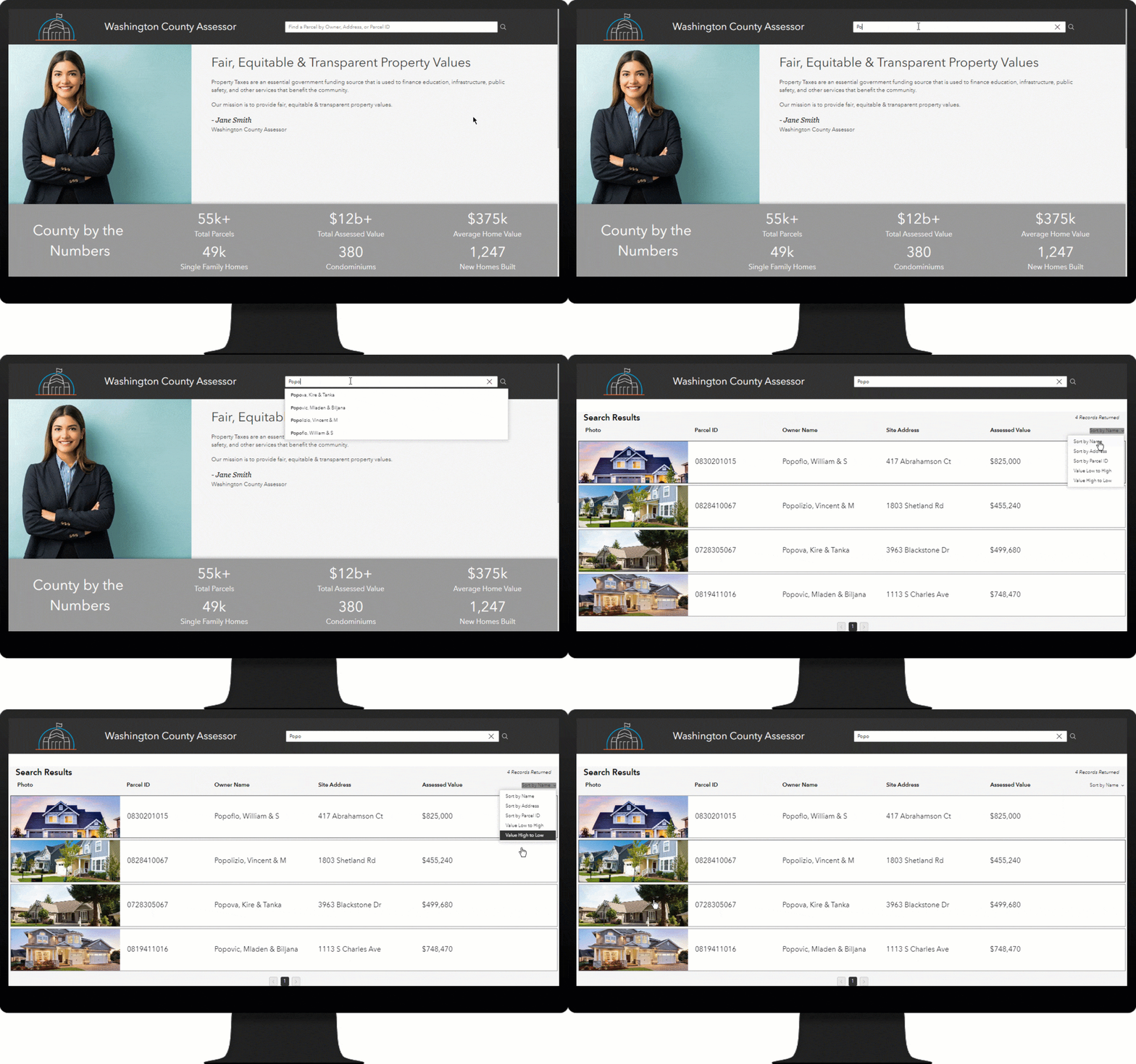
Simplified search functionality
The newly simplified search function allows a property owner or the public to quickly find a parcel and understand property information. The user can search for a parcel by owner name, parcel address, or parcel ID. From the search results, the user can select a parcel to see more detailed information.

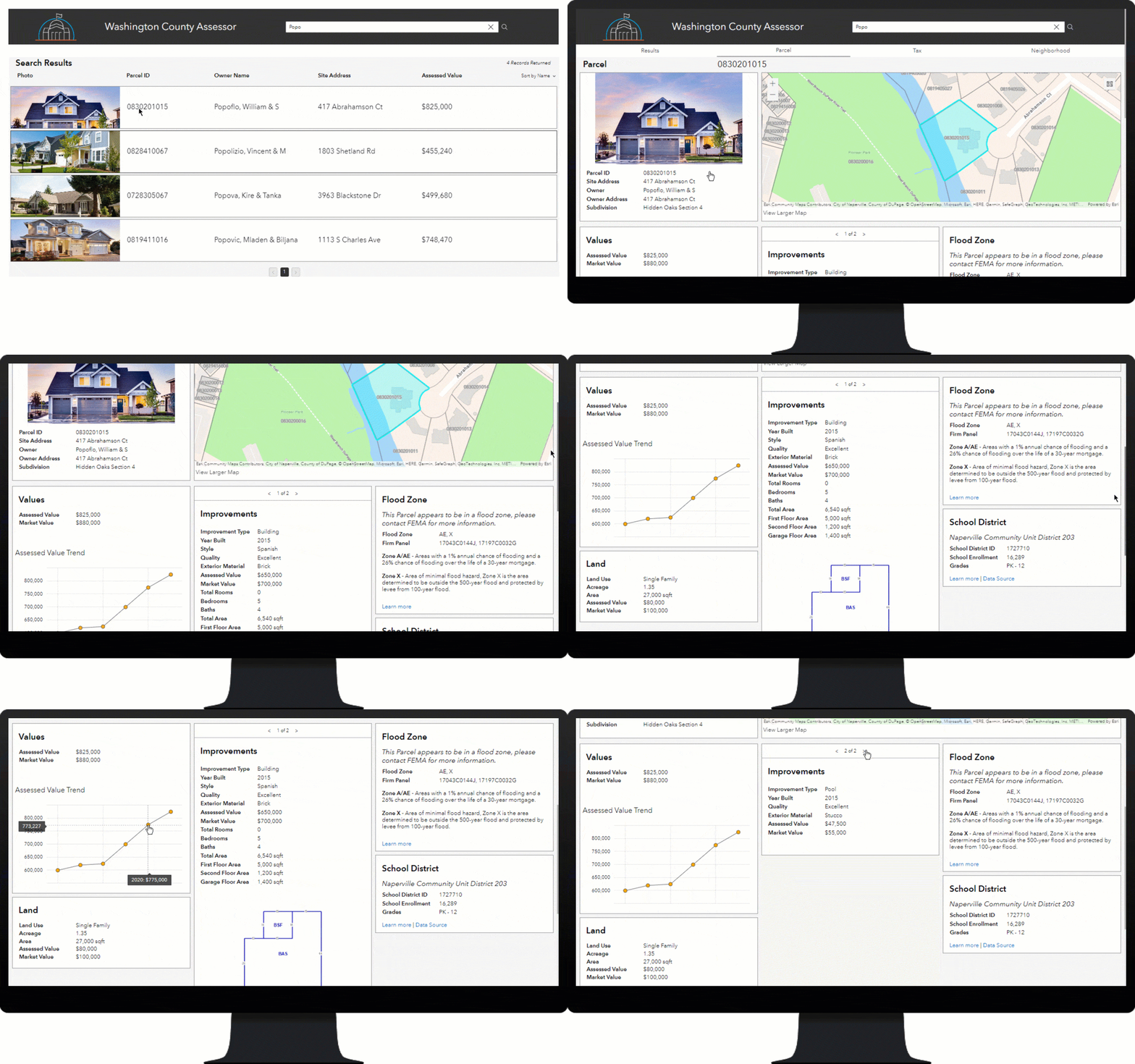
Consolidated parcel information
Information available on the new Parcel page provides access to authoritative property information that is typically found in a local government computer-aided mass appraisal (CAMA) and tax receivables database. This responsive app includes an interactive map and provides consumers with a detailed view of the property data, including owner information, value history, land details, and improvement details.
Flood risk can negatively impact property value and increase the cost of insurance coverage. Using the authoritative floodplain boundary information (DFIRM panels) available in the app, land development companies, real estate professionals, and the general public can access details about the relationship between a selected parcel and the floodplain, which in turn supports decision-making that occurs during land development and the home-buying processes.
School district assignments can have a major influence on families when determining home value. School district performance levels, teacher-to-child ratios, demographic diversity, and other factors oftentimes are key in choosing a location. Using authoritative data from the National Center for Education Statics, the application provides the appropriate school district assignment along with a link to the NCES District Demographic Dashboard for the selected parcel.

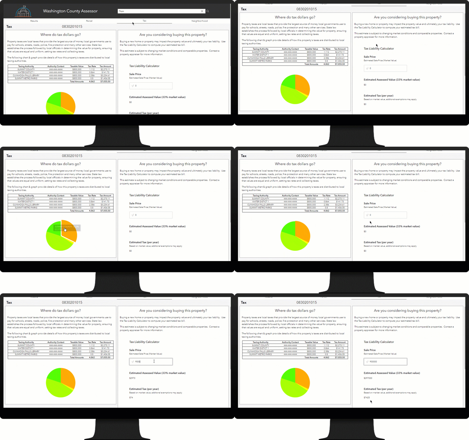
Enhanced tax parcel details
Confusion over how property tax dollars are distributed between local government agencies is not uncommon. The app’s new Tax page helps clear this confusion by guiding the public’s understanding of how the property taxes for a selected parcel are distributed. The app provides a detailed breakdown of the parcel’s tax distribution in a chart and graph. Sharing this information delivers transparency to the allocation of funding that is provided to services such as schools, public safety, and transportation.
The Tax page also includes a tax liability calculator, which makes it easy for a user to quickly estimate the taxes based on a purchase price.

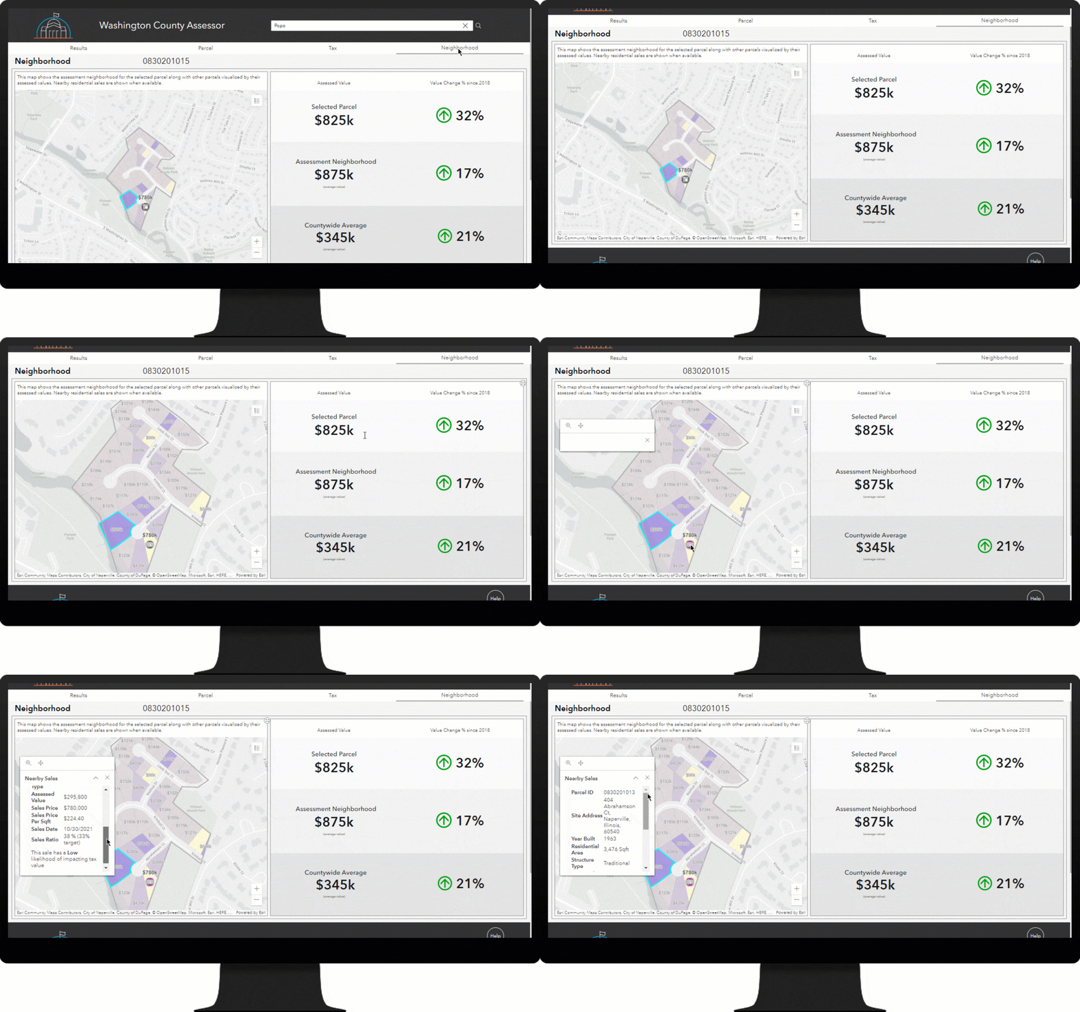
New neighborhood value analytics
The new Neighborhood page provides a user with information on how a selected parcel compares with other parcels in the assessment neighborhood and across the county. The user can see the selected parcel’s assessed value and value trend, along with the average values and trends. The page includes a map showing other properties within the assessment neighborhood.
When recent sales information is available, the user can explore it by clicking the sales on the map. This information allows users to gain insight into a specific sale and how it may affect property values.

Additional resources
Learn more about the Equitable Property Value solution and how you can quickly deploy it. For questions and feedback, chat with us on Esri Community or contact Esri Support Services.

Article Discussion: