ArcGIS Solutions helps you make the most of your GIS by providing purpose-driven, industry-specific configurations of ArcGIS.
Despite all the buildup to an election—ads, endorsements, debates, and (of course) social media posts—voter turnout in the United States tends to be low, typically coming in at around 60 percent in a presidential election year and much lower otherwise. Why? Eligible voters shy away from the polls for a number of reasons—confusion about registration deadlines and uncertainty about how, when, and where to cast a ballot, to name a few.
ArcGIS Solutions’ Election Outreach solution is designed to help state and local governments improve voter engagement and get people to the polls. It includes several maps and apps that can be configured with authoritative election information pertinent to a community. Together with Election Management and Election Results, Election Outreach helps organizations in nearly all aspects of the election process.
Ready for change
Pope County, Minnesota, has witnessed countless elections in its more than 150-year history, and its commitment to providing its residents with a transparent election process has never been stronger. Therefore, when county team members determined that traditional methods of finding polling places were not the best source for accurate locations, they immediately turned to Pro-West & Associates, a Walker, Minnesota-based GIS consulting firm that has been an Esri partner for more than 30 years.
Pope County’s main concern was that it lacked a routine process for managing election-related spatial data. Its existing maps consisted of traditional layers that weren’t updated consistently and often showed outdated voting precincts and polling locations. The state’s authoritative poll place finder wasn’t a solution either; the tabular system relies on third-party consumer mapping applications, which also tend to be inaccurate, especially for rural areas. One notable inaccuracy for Pope County was the rural countryside township hall, used as a polling place, that was displayed nearly two miles away from its actual location. So, whenever the team found that county maps were outdated, they would download new GIS data from the state, create polling place data, and manually update the information in-house, a labor-intensive process that they knew could be improved upon.
Pro-West has been a proponent of ArcGIS Solutions’ election solutions since the first one debuted in 2016 and frequently deploys one or more of these solutions for their clients. It didn’t take long for their solution engineers to determine that ArcGIS Solutions’ Election Outreach was perfect for Pope County.
Knowledge is power
Pro-West configured the Election Outreach solution to meet the county’s specific needs. The result? Pope County’s Promoting Transparent Elections ArcGIS Hub site, a single-destination website where county residents can find accurate election information all in one place.

Visitors to the site are greeted by an interactive map that allows them to find their elected representatives—from county commissioners to members of Congress—simply by typing in their residential address or clicking their location on the map. To ensure that this experience worked to the county’s specifications, Pro-West built the map with ArcGIS Experience Builder and embedded it into the Hub site template provided with the solution.
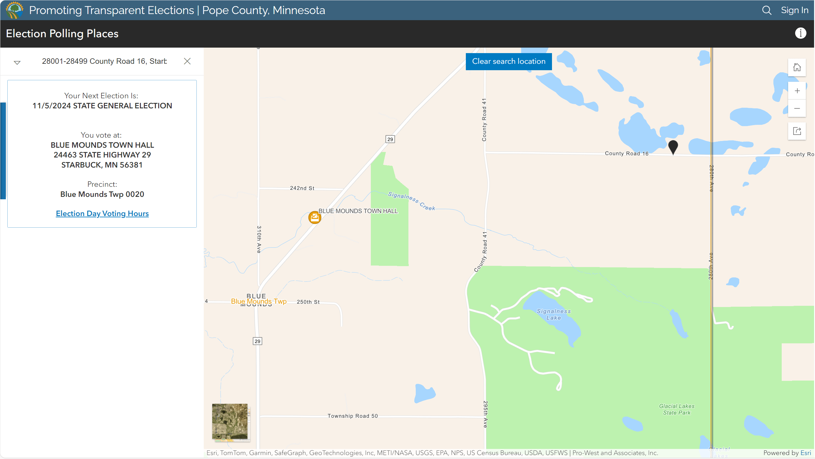
Another click takes visitors to the easy-to-use Election Polling Places app. Residents can use this app to get important election day information about their precinct, including their assigned polling place locations.

For the people
According to Stephanie Rust, Auditor-Treasurer of Pope County, the county’s Promoting Transparent Elections Hub site has helped voters stay informed about important deadlines and has increased overall awareness around elections. In addition to providing accurate polling location information, the site includes a list of key election dates, answers to frequently asked questions, and access to election results both for current and past elections. Residents looking for a more active role can even submit a request to become an election day volunteer.
The GIS-based solutions we have implemented at the county have allowed us to improve the accuracy of information we provide to voters in Pope County and the ease with which they can access that information.
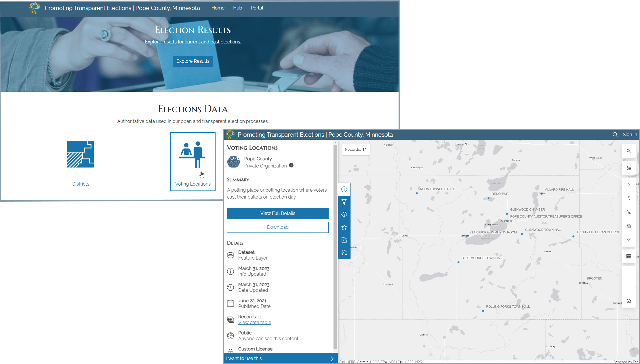
The county’s Hub site also provides open access to the authoritative data that the county uses in its election processes. This means that anyone can view or even download and use the county’s district, voting location, and voting precinct data and maps.

A clean sweep
With the November 2024 general election just weeks away, election transparency has never been more important. But thanks to Pope County, Pro-West, and ArcGIS Solutions’ Election Outreach solution, Pope County residents can head to the polls confident that they have all the election information they need.
Now that’s democracy at its finest.
Learn more
For more information about the Election Outreach solution, check out the following resources:
- Deploy, configure, and use the solution.
- View a demo video.
- Discover related solutions:
- Learn more about ArcGIS Solutions.


Commenting is not enabled for this article.