The Operations Management solution is now available to deploy with ArcGIS.
The first release of Operations Management includes a collection of maps and apps which serve as a set of tools to help states National Guard and Air National Guard.
Other branches of the military, as well as organizations that manage events and missions, could also gain from using this solution.
With this solution you can do the following:
- Capture real-time event and mission development
- Add multiple survey entries within the same interface
- Collect and review status and field reports submitted from all levels of support
- Edit or delete map entries
- Generate event and mission reports in a variety of formats
- Upload unit’s Area of Responsibility and include in analysis
- Add external and internal data sources on the fly
- Submit field reports with image attachments
- And much more…
Manage and Collect all Aspects of an Event or Mission
The Operations Management solution leverages Survey123 forms, Web AppBuilder and Dashboards to provide a dynamic method for input and editing of events, missions, status reports, and field reports.
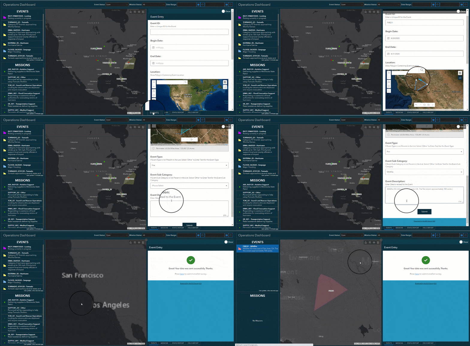
A user can easily begin submitting an event by using the Operations Dashboard by selecting the Event Entry report. This form allows for the input of details related to an event. By using the included operational weather and extreme event layers as a reference, you can begin filling in common attributes of an event. Details like Event ID, Event Type, Unit Assignment, Location, etc. can all be input in this survey. The short video below shows how quickly personnel can complete the report and submit information regarding the event. All steps can be completed by using a web browser or by using the Survey123 field app on a mobile device.
Operations Dashboard

Situational Awareness at all times and at all levels
The Operations Management solution empowers organizations to capture all details of an event or mission from beginning to end.
The solution contains four separate Survey123 reports that can be submitted from any connected device and by any member participating in Operations. These entry forms include: Event, Mission, Status and Field report. Immediately after submission, the information included in reports will appear on the solution Dashboards, Web Maps and Apps.
This immediate interaction between the Survey123 forms and Web Apps allows for rapid dissemination and intelligent decision making.
The Operations Dashboard provides the Mission or Event Manager a dedicated interface to submit events, missions, status and field reports. The Operations Manager app gives the organization the freedom to isolate events, generate reports, modify or move feature layers and find specific information within seconds.
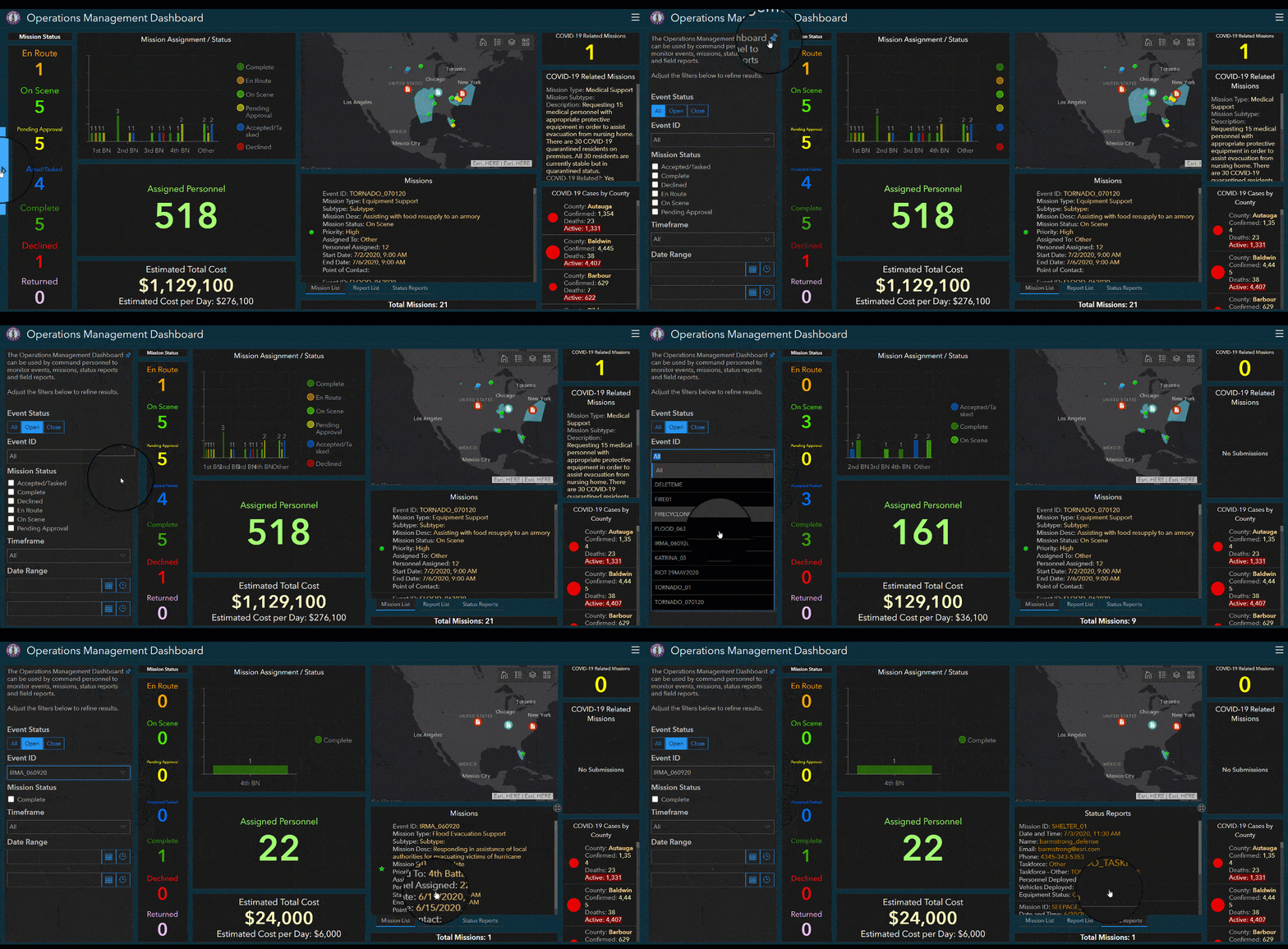
Finally, the Operations Management Dashboard pulls all submitted data and neatly displays it in charts, graphs and allows for quick selection and filtering. The organization’s leadership will remain informed and aware of current and historical events and missions.
The short video below demonstrates how quickly personnel can filter the Operations Management Dashboard and get specific details related to a mission.
Operations Management Dashboard

I’m excited to share this new solution and its capabilities with you. Please reach out and let us know if you have any questions about this solution. Be sure to provide us with your feedback on GeoNet.
Wait!
Before we go our separate ways, let me give you three tips on how to get started.
Easy to Deploy
Deploying this solution is extremely easy by simply using the ArcGIS Solution App.
Easy to Configure
Operations Management is ready to use immediately after deployment, but you may need to do small changes to reflect a naming convention applicable to your organization. Check out our documentation to learn how.
Easy to Use
As easy as it is to deploy to your own ArcGIS Online or Portal environment, you can first test the solution here, via our Try-it-Live site.
Additional Resources
Learn more about the Operations Management solution and how you can quickly deploy the solution from the ArcGIS Solution site.

Article Discussion: