ArcGIS Solutions helps you make the most of your GIS by providing purpose-driven, industry-specific configurations of ArcGIS.
You’re asked to justify the value of your GIS program, or it will be cut. Can you do it? An employee leaves, and you want to hire a replacement, but your director asks you to prove the need. Do you know how to quantify the value of the vacant position? Through the grapevine, you hear that folks are not happy with the customer service your program provides. How can you address an issue if you aren’t aware of it? For a GIS program manager, just thinking about these situations is scary. But these questions aren’t intended to be scare tactics; they are actual situations that happened to real people. If they happen to you, are you ready with your answers?
The long-term success of your GIS program depends on how well you can demonstrate that your work aligns with program goals and your organization’s overall business objectives. Providing quantifiable data showcases the direct positive impact that GIS has on business outcomes and clearly communicates to executives the value of GIS. But if you lack a broad understanding of how GIS contributes to business outcomes and can’t provide this information, you risk losing executive support.
So again, are you ready with your answers? If you hesitated even a little bit, then you’ll be happy to learn that our new GIS Request Management solution has capabilities that can help you bridge the divide.
Enrich organizational engagement
Maybe your CIO or IT director is thinking about consolidating IT services and service providers and transferring the systems to a larger IT organization. Or perhaps your organization is undergoing deep budget cuts, and executives see GIS as fractured or redundant. As a GIS manager, you’re at a crossroads. Either you come out of your technical comfort zone and quickly learn to think strategically about outcomes and business value, or you risk losing employees, funding, or even your entire program.
How can the GIS Request Management solution help? The solution includes several pre- or partially configured apps that help drive increased participation and collaboration in your organization:
- A hub where you can share key GIS program information with internal stakeholders, increase GIS knowledge in your organization, and proactively deliver relevant GIS services
- A digital form for internal stakeholders to request ArcGIS accounts, which you can then use to grant them access to existing GIS maps, apps, and data
- A digital form for internal stakeholders to request GIS services, which allows you to capture relevant information and begin the GIS service delivery process
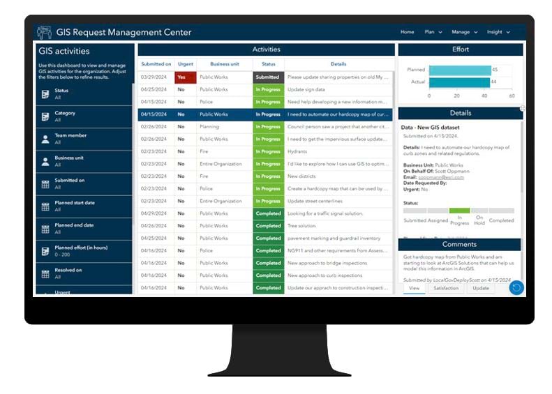
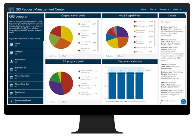
- A dashboard for you to monitor and manage GIS requests efficiently
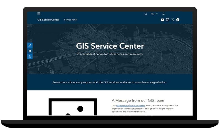

Streamline GIS service delivery
Perhaps you have developed a geospatial strategy or roadmap that has established a vision and path to organizational success, but you aren’t sure how to implement it. GIS Request Management includes apps that can help you organize your GIS activities and ensure that these activities are aligned with your GIS strategy or roadmap:
- A digital form for staff to record additional GIS activity, allowing you to catalog required GIS work and incorporate it into your GIS service delivery process
- An app to manage ArcGIS account requests, allowing you to provision access to GIS maps, apps, and data efficiently
- A series of apps to manage and quickly resolve GIS requests and related activities, which helps maintain organizational confidence in GIS services
- An app for you to monitor GIS service delivery to ensure that GIS resources are allocated effectively and that GIS requests and related activities are aligned with your GIS strategy
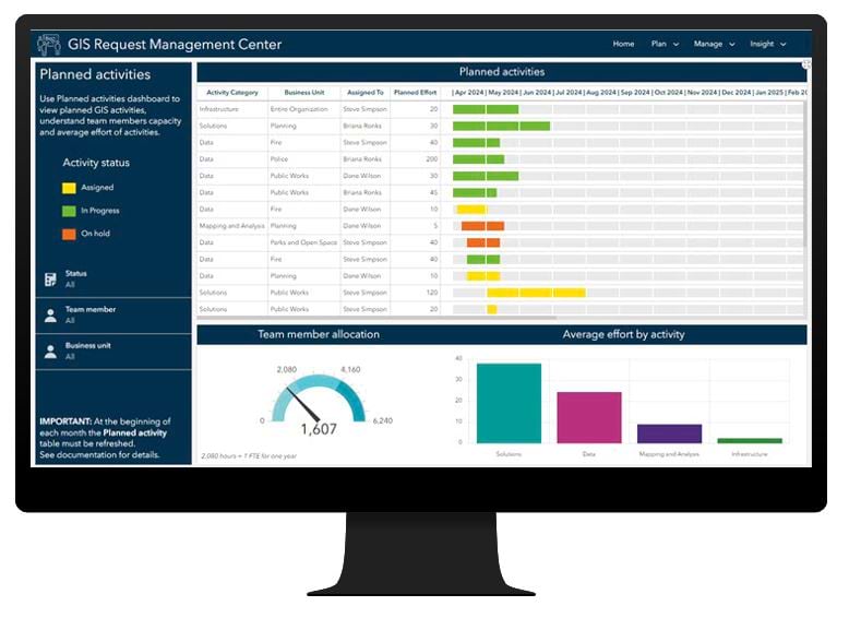
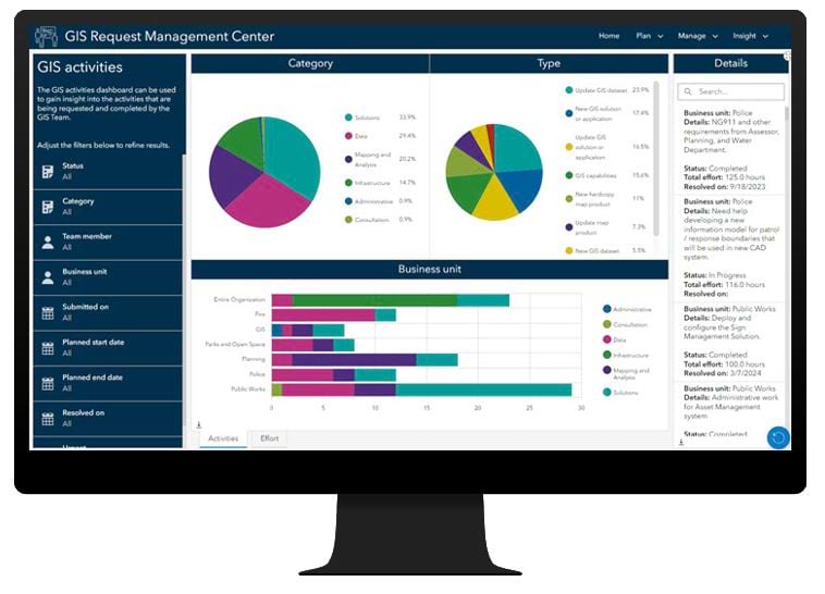
Improve GIS program performance
Lastly, don’t underestimate your role as a customer service provider. What if your team missed a critical deadline and now your team is no longer trusted? How can you be sure that you are doing a good job promoting your services and managing service delivery if you don’t know how your customers feel about the services you provide? GIS Request Management includes apps that help you collect this critical information, allowing you to adjust and adapt your services when necessary:
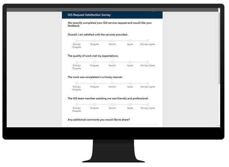
- A digital form to capture satisfied internal stakeholders are with how you resolve GIS requests for service and related activities
- An app to monitor GIS service delivery, allowing you to ensure that GIS requests and related activities are aligned with customer needs and your organization’s business strategies
Promote program sustainability
Managing a GIS program is hard work, but it’s also necessary. Fortunately, the GIS Request Management solution can help you with some of your managerial needs. Check out the following links to learn more about how the solution can help you solicit requests for service, manage the delivery of GIS services, and promote the value of GIS to internal stakeholders.
Learn more
For more information about the GIS Request Management solution, check out the following resources:
- Learn how to deploy, configure, and use the solution.
- View a demo video.
- Read The Path to Geospatial Excellence.
- Visit the ArcGIS Well-Architected Framework and Architecture Center.
- Learn more about ArcGIS Solutions.


Article Discussion: