ArcGIS Pro 2.0, Esri’s next-generation desktop GIS, has been released and is available from My Esri. Now is the perfect time to upgrade to ArcGIS Pro.
ArcGIS Pro 2.0 brings more of your highly requested workflows to the table, features new innovations not available in any other desktop GIS, and is more tightly integrated with the rest of the ArcGIS platform.
Highly Requested Workflows

Your favorite workflows are now easier and more powerful in ArcGIS Pro 2.0. You can now perform more complete workflows solely in ArcGIS Pro, such as map creation and data management.
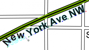
- Create more effective and meaningful maps with annotation and grids.
- Getting started with new ArcGIS Pro projects has vastly improved with Favorites.
- Modify your topology properties directly in ArcGIS Pro.
- Enhanced traverse tool improves your COGO workflows.
- Highly requested context menu options for importing and exporting data included in the Catalog pane.
Unique Innovations

ArcGIS Pro 2.0 features unique innovations that cannot be found in any other desktop GIS.
- Easily explore your 3D landscapes with the new innovative 3D navigation controls and sync the views of your 3D and 2D maps.
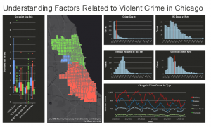
- Your layouts are more useful and powerful than ever with embeddable dynamic interactive charts.
- Improvements to 3D drawing including feature drawing by camera distance and enhanced lighting of 3D objects make your 3D visualizations even better.
- Analytics Improvements with fill missing values tools and enhanced spacetime cubes.
- Get more done with new geoprocessing tools only available in ArcGIS Pro.
ArcGIS Platform Integration
ArcGIS Pro 2.0 works better with the rest of the ArcGIS platform, including ArcGIS Online, ArcGIS Enterprise, and Esri’s vast library of ready-to-use apps. Your cross-platform workflows are now easier and more powerful than ever.
- Enhancements for editing and interacting with the geodatabase in the ArcGIS Pro 2.0 SDK.
- Consume native OGC Web Feature Service (WFS) Services directly in ArcGIS Pro.
- Sync with feature layers that reference data registered in Portal for ArcGIS 10.5.1.
- Vertical coordinate systems are included when sharing web scenes and web scene layers.
- Continue to work in ArcGIS Pro while packaging operations complete in the background.
Get the full details on what’s new in ArcGIS Pro 2.0.


Article Discussion: