The Q4 2021 release of ArcGIS Aviation Charting and ArcGIS Aviation Airports includes many new and exciting features and enhancements to support you in your charting and design practices. In this blog post, you will learn more about these updates.
ArcGIS Aviation Charting adds more tools in ArcGIS Pro
ArcGIS Pro 2.9 marks a major release for the ArcGIS Aviation Charting extension! While we have been incrementally releasing features in ArcGIS Pro, we are excited to share that you can now use ArcGIS Pro to automate your Enroute and Visual chart production workflows. The ArcGIS Aviation Charting documentation has been overhauled to provide you with information to quickly become productive after migrating from ArcMap to ArcGIS Pro.
Evaluating obstacles using ArcGIS Aviation Airports
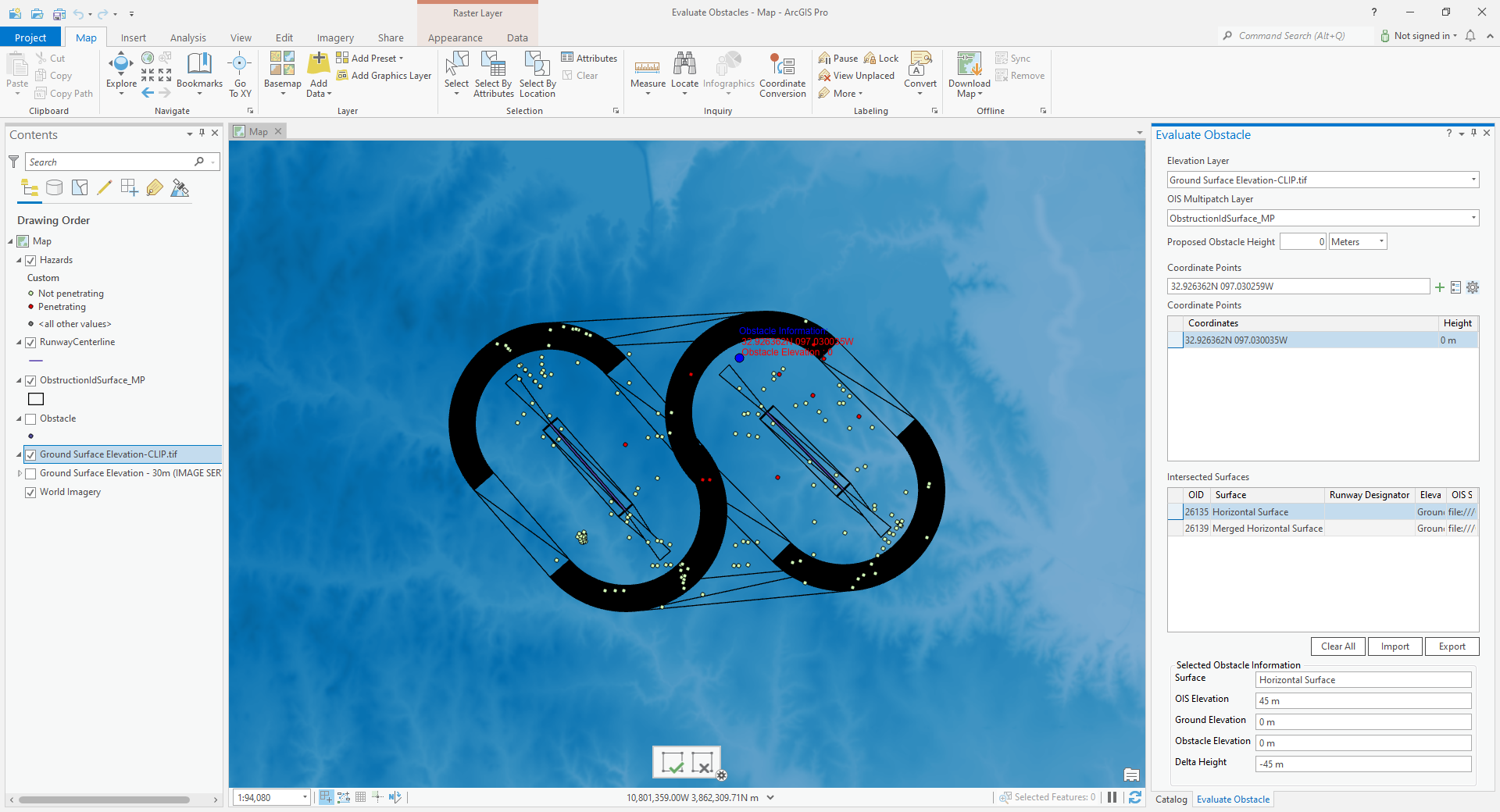
Obstacle analysis is a common exercise for determining the location of potential hazards in and around an airfield. The new Evaluate Obstacle tool allows you to efficiently find potential flight hazards against authoritative obstacle data. You can also place temporary, proposed obstacles as part of your analysis. Proposed obstacles can be exported and shared with other members of your organization, or with external stakeholders.

New and updated surround elements
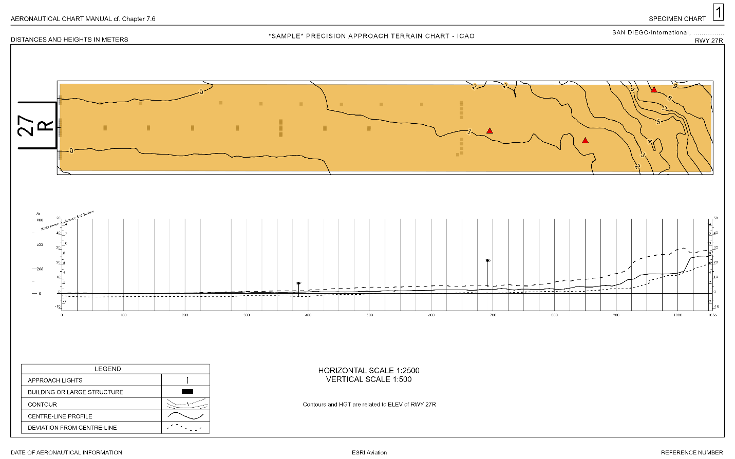
There have been several updates to the chart surround elements. A vertical scale bar has been added to ArcGIS Aviation Charting and ArcGIS Aviation Airports that allows you to show the vertical extent of features above the ground on a chart. The Terrain and Obstacle Profile element has been updated in ArcGIS Aviation Airports to show or omit obstacles that are in the shadow of another obstacle. You can use both elements together to create a terrain chart in ArcGIS Pro.

Enhanced support for AIXM 5.1
AIXM 5.1 is the standard for data exchange in the aviation domain. ArcGIS Aviation Charting features continued support for the AIXM 5.1 standard at this release. The Export AIXM 5.1 Message tool allows you to export data from your Aeronautical Information System (AIS) and share it with others as an AIXM 5.1 message file. The ArcGIS Aviation Charting documentation has been updated with advanced workflows for configuring the Import AIXM 5.1 Message tool to better support your AIXM data.
The FAA 13A Runway Protection Surfaces tool
ArcGIS Aviation Airports contains a suite of tools to generate obstruction identification surfaces across numerous specifications from aviation authorities like the FAA and ICAO. The FAA 13A Runway Protection Surfaces tool has been added to the Obstruction Identification Surfaces toolset. This tool creates runway protection surfaces based on standards in the FAA Advisory Circular 150/5300-13A. It can be customized to fit your needs using the CustomizeOIS.exe tool in the ArcGIS Aviation Product Files package (download the package on My Esri).
ArcGIS 2.9 is an exciting release for the ArcGIS Aviation extensions! If you have questions about any of the content added at this release, please reach out to us on Esri Community. We hope you enjoy these new capabilities– Happy Charting! ✈


Article Discussion: