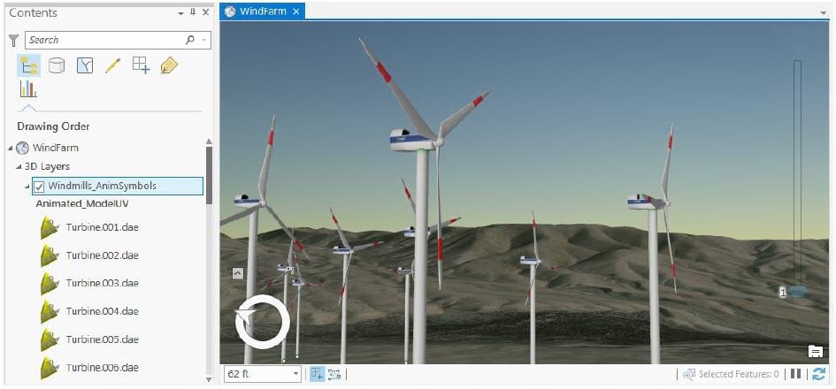
The ArcGIS Pro Map Exploration Team has recently released a new Animated Symbols sample add-in for ArcGIS Pro aimed at helping users develop realistic animated symbols for in-place features that show movement. The Animated Symbols add-in provides a set of tools which automate the process of creating animated 3D symbols along with a stop-motion animation ready for export to a video. Also provided with the add-in is a dataset with sample 3D models which users can try out including wind turbines, cranes, flags and train signals.
The new add-in, with supporting sample dataset and user guide are available on ArcGIS.com. You can also view a brief, introductory video on YouTube.

Developed with the ArcGIS Pro SDK, the add-in illustrates how users can create a powerful set of tools for building a complete animation-building workflow with Pro’s Map Exploration API and other APIs.
With its provided sample models, the add-in makes it easy to develop a wind turbine visualization as illustrated in the screenshot above. It also creates a corresponding animation showing the turbine propeller blades in motion, which users can then export to the many video formats for sharing the visualization. As discussed in the add-in’s user guide, it combines several data processing and configuration procedures which:
- Create a new feature class (and layer) to contain the animated wind turbines
- Convert each feature in the Windmills layer into a set of features, one for each symbol state
- Define a unique-value renderer for the layer, where each model is bound to a feature value
- Define the range properties for the layer, so each symbol state can be stepped through in sequence using the Range Slider
- Generate an animation for the scene, and add keyframes that step the symbols through their ordered sequence – thereby creating the illusion of movement
To learn more about getting started with 3D data in Pro, see the ArcGIS Pro resources page, and Esri’s Learn GIS lessons like Explore 3D data. For resources on developing Pro add-ins, visit the ArcGIS Pro SDK resources page.


Commenting is not enabled for this article.