Pipeline and Gas Utility Customers Will Get the Ability to Personalize Updated Point Symbols
Maps present data in a geographic context to enable pipeline and gas utility staff to better perform many tasks and workflows.
In the office and out in the field, staff rely on clearly designed and differentiated symbols to visually grasp the meaning of authoritative content on print and online maps. Generally, the more intuitive the symbol, the quicker the viewers can understand what they’re seeing on the map.
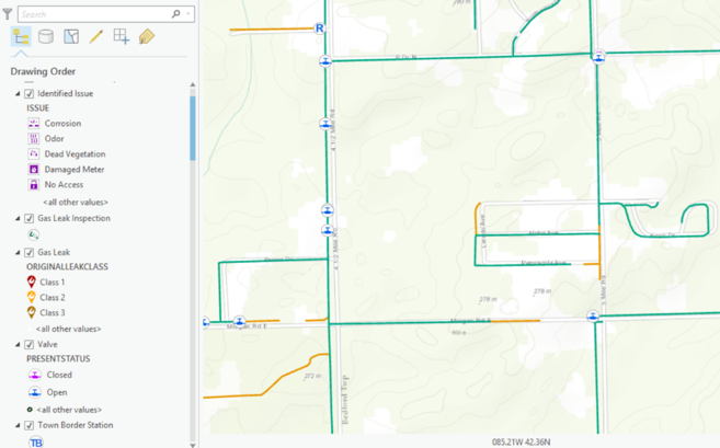
Point symbols in the ArcGIS platform have been around for many years. With the many recent ArcGIS platform advances that allow mapmakers to create more progressive maps, Esri launched an initiative to design a new collection of pipeline and gas utility point symbols that keep pace with these advances.
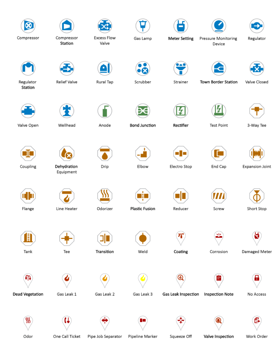
These new point symbols, which are intended to be more attractive and intuitive, will be available to ArcGIS Pro users. This will give users the flexibility to personalize these symbols to best fit the look and feel of any scenario. Moreover, these symbols were specifically created for an international audience. They do not rely on any English terms or abbreviations. Color and container shapes are used to categorize the symbols. The ArcGIS Pro 1.2 style file with these symbols is available for download at esri-styles.maps.arcgis.com/home/item.html?id=6ef5483a02334f1889fb207fe6e743ea.
Here is a preview of the new symbols:
To download a PDF of the new symbols, go to esri-styles.maps.arcgis.com/home/item.html?id=969ea0c28e3845c780812e668f2091cd.
We look forward to your feedback as we seek to refine these point symbols in the future.
Send Us Your Feedback
The release of this collection of symbols complements the portfolio of ArcGIS for Gas Utilities maps, apps, and services. As we work to develop additions to this portfolio, your feedback will help ensure that we are building solutions that will be useful to you. So send us your comments! Keep an eye out for new ArcGIS for Gas Utilities solutions, and let us know how you are leveraging them in your utility or pipeline.


Article Discussion: