First blog of the year comes as an announcement of the new capabilities available in the ArcGIS Pro 3.1 release.
As a quick preview, here is a rundown of some of the key geodatabase enhancements:
- Multiselect operations in the Domains view
- Ability to apply domains during feature class creation
- Toggle the ability to see only objects owned by the connected database user
- Allow Multipatches to register with the Geodatabase
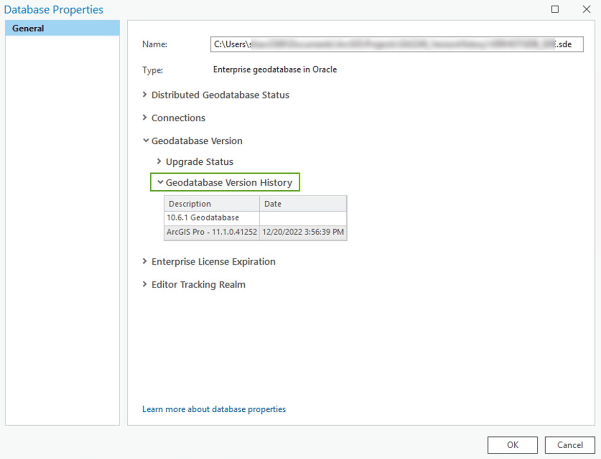
- The Database Properties dialog box now displays the geodatabase version history
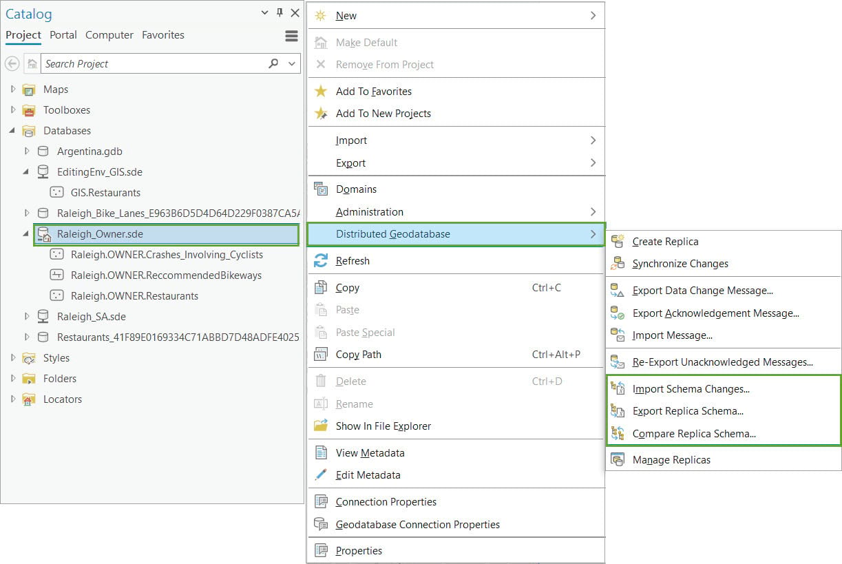
- Much anticipated geodatabase replication equivalency items
Got you curious? Let’s go into the details.
Multiselect operations in the Domains view
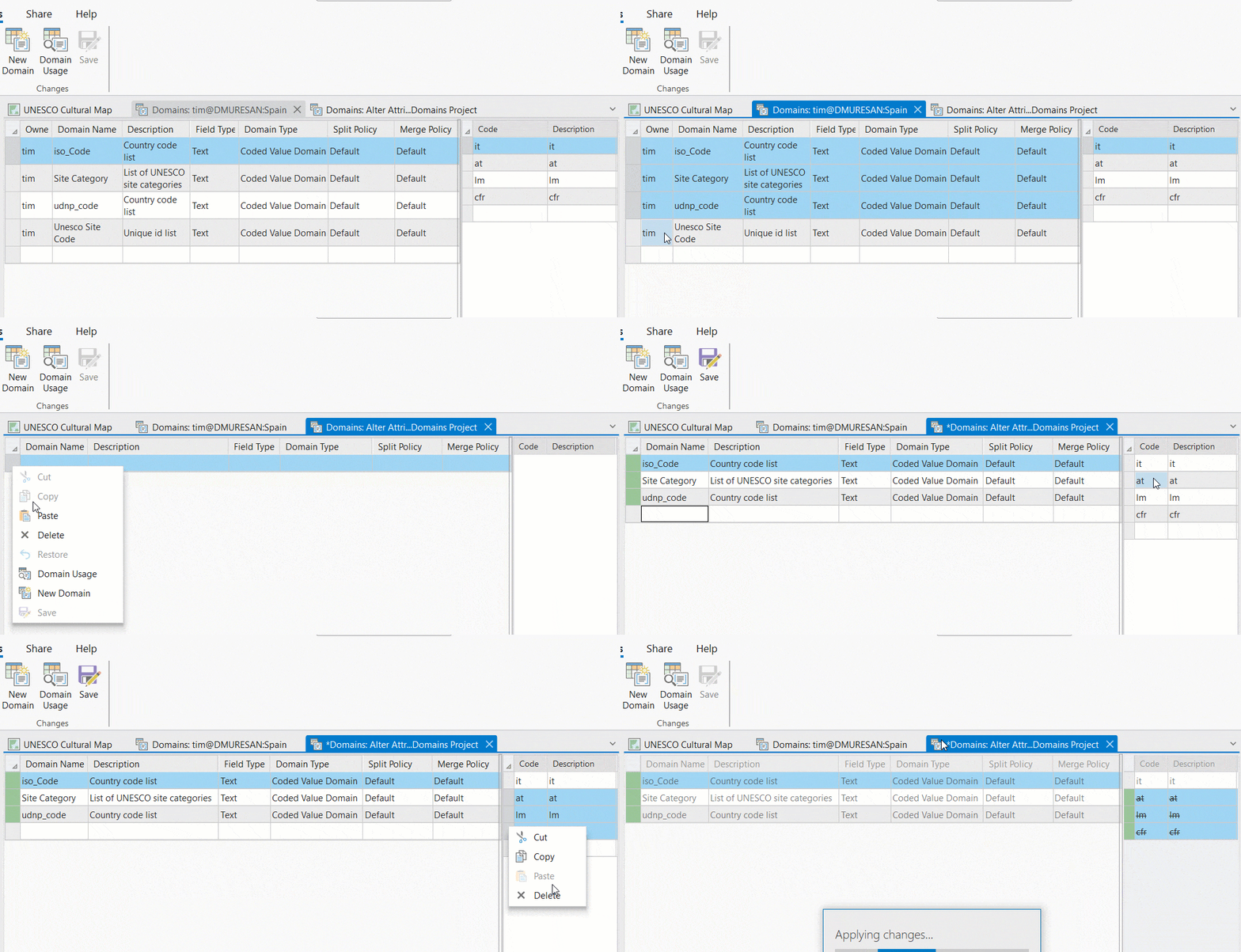
You can now select multiple rows in the Domains view to perform key data modeling operations such as cutting, copying, pasting, and deleting domains and domain values within the same view or between different views. One key benefit of this is that it allows you to move multiple domains from one geodatabase to another more efficiently. This capability was requested on the ArcGIS Pro Ideas page and is now available for you to use.
Ability to apply domains during feature class creation
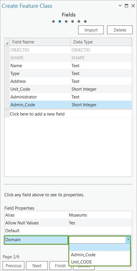
Building on the previous idea, we have added the ability to apply existing attribute domains when creating a new feature class using the Create Feature Class wizard. This tool enhancement is intended to streamline the creation process by allowing you to set up both the fields and attribute domains of a new feature class in a single step, saving you time and effort.
Toggle the ability to see only objects owned by the connected database user
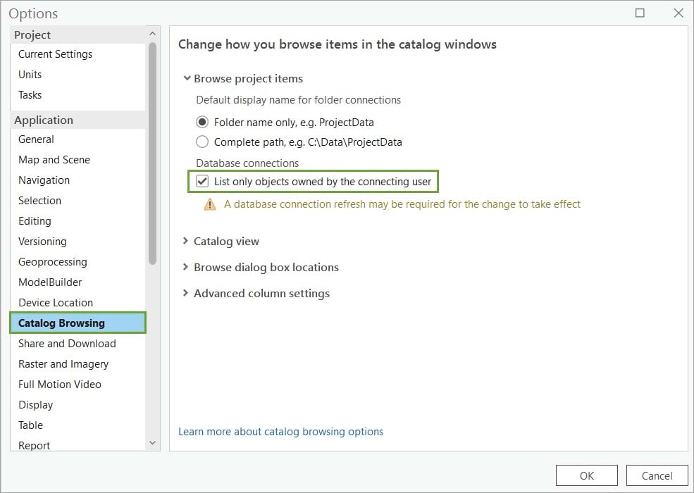
To offer a similar user experience with ArcCatalog, we added the List only objects owned by the connecting user option on the project Options page. By selecting this option, you can save time by avoiding the need to browse through a large number of items and only see the ones that you own. This is especially useful when connecting to a highly populated enterprise geodatabase.
Allow Multipatches to register with the geodatabase
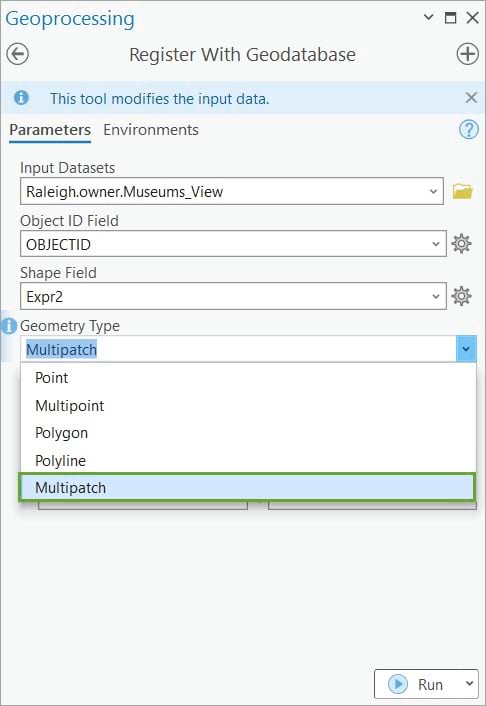
We have also added support for the multipatch geometry type to the Register with Geodatabase geoprocessing tool. This enhancement allows you to choose multipatch as the geometry type when registering feature classes, tables, views, and raster layers that were created in the database using third-party tools. This provides greater flexibility and compatibility when working with spatial data.
The Database Properties dialog box now displays the geodatabase version history
To improve common geodatabase management tasks, we added the Geodatabase Version History section that provides a summary of all the geodatabase upgrades, including the dates and versions, for your reference.
Geodatabase replication equivalency items
To improve the user experience when working with replicas we added geoprocessing tools to work with schema chances, a new tab on the Manage Replicas pane allows you to view and manage feature service replicas, and the ability to manage replicas at the feature class level. Check out my follow up blog on this topic.
With each software release, we strive to improve the user experience, enhance software performance, and facilitate a smooth transition from ArcMap to ArcGIS Pro by regularly porting over key functionality. We also take into account your ideas and feedback, and many of the improvements we make are based on your considerations. We would like to thank you for your contributions and encourage you to continue to share your thoughts on the Data Management Ideas page.
Photo by Hello I’m Nik on Unsplash


Commenting is not enabled for this article.