The lastest release of ArcGIS Maritime includes new tools and enhancements that allow you to create better charts and do more with your maritime data.
Manage S-57 Products in ArcGIS Pro
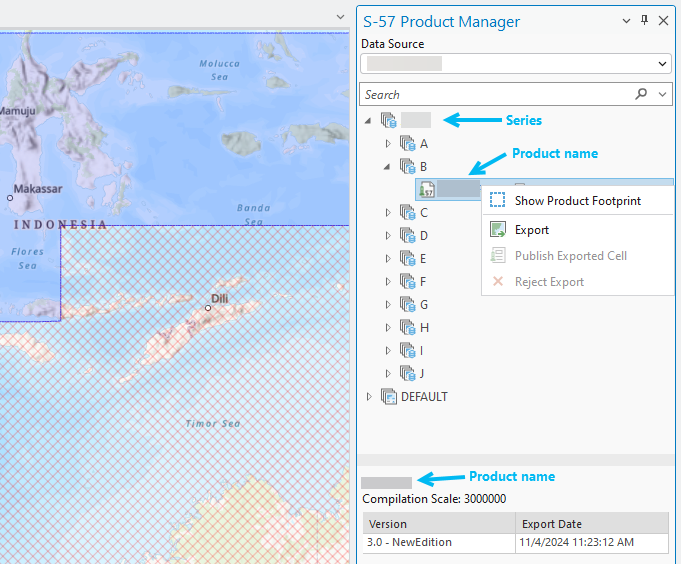
Perhaps most notable is the brand-new S-57 Product Manager tool, which allows you to more efficiently manage, publish, and export S-57 products in ArcGIS Pro. While exporting products was already possible, you can now export from the S-57 Product Manager pane, where you can view and organize the products in a database. This new tool is included on the Maritime S-57 tab of the ArcGIS Pro ribbon, in the S-57 Editing group.

Learn more about the S-57 Product Manager
Edit existing light sectors
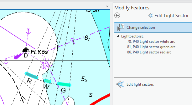
In ArcGIS Pro 3.3, you could generate light sectors for your chart products. With ArcGIS Pro 3.4, you can also edit existing light sectors with the Edit Light Sector tool. This tool allows you to shorten or lengthen light sector limit lines and adjust the placement of the color arc so to draw attention to light sectors and reduce conflicts with other chart elements.

Learn more about how you can edit light sectors
Scale band refinements
The S-57 Set Scale Band tool group on the Maritime S-57 tab has also been expanded—a new Append Filter tool makes it possible to revise an existing scale band filter, add a filter to an existing query, and add layers to a filter. You now can also enable or disable conflation.

Learn more about filtering maritime data by scale band
ArcGIS Maritime server
On the server side, ArcGIS Maritime server offers new capabilities with the release of ArcGIS Enterprise 11.4. This includes enhanced custom symbology for wrecks, fairways, navigation lines, and recommended tracks. Additional Lua properties for feature objects are also available with this release, including properties for feature and dataset compilation scales. Labeling for features is also improved—using the rotateWithFeature Lua property now provides a way to rotate text to align with features. These are just a few of the new things you can do.
To learn more about Maritime server enhancements at 11.4, including updated symbology files, check out What’s new for ArcGIS Maritime server or visit the What’s new in ArcGIS Pro documentation for the latest in ArcGIS Pro 3.4. For more information, visit the ArcGIS Maritime page or and post your questions in the ArcGIS Maritime board in Esri Community.

Article Discussion: