
🌟 Join Us at the 2024 Esri User Conference! 🌟
Are you ready to dive into the exciting world of GIS? Look no further! The 2024 Esri User Conference is just around the corner, and you won’t want to miss it. From July 15 to July 19, we’re bringing together experts, industry leaders, and GIS enthusiasts from around the globe for an unforgettable event.
Here is what we will cover in this blog:
- Previous technical workshops
- Plenary session
- Expo
- Tuesday schedule
- Wednesday schedule
- Thursday schedule
Previous technical workshops
 Take a trip down memory lane by revisiting last year’s sessions on the UC2023 channel. It will set the stage for an even more enriching experience at this year’s conference.

Plenary session
Kick off the conference by attending the plenary session to get a sneak peek into the latest advancements in GIS technology and discover how it’s shaping our world.

Expo
Come meet the cool people behind Esri’s innovations by joining us at the expo during the showcase hours! The Geodatabase team will be at the ArcGIS Enterprise area to chat, answer questions, and share their insights.

Expo hours:
Tue, July 16: 09:00 a.m. – 06:00 p.m.
Wed, July 17: 09:00 a.m. – 06:00 p.m.
Thu, July 18: 09:00 a.m. – 04:00 p.m.
And now, the spatial data management itinerary. Whether you’re a seasoned GIS professional or just dipping your toes into the geospatial world, our curated itinerary awaits you! Dive into the fascinating realm of geodatabases, database functionalities, workflows, and data management best practices.
Each session comes packed with a full set of supporting materials:
- 📚 Blogs: Get insights, tips, and real-world examples.
- 🎥 Videos: Visualize concepts and learn as you go.
- 📖 Tutorials: Step-by-step guides to master key skills.
- 🗺️ Story Maps: Explore narratives through maps.
- 🌐 Geodatabase Resources Hub: One-stop-shop for all things geodatabase.
Tip: You can use these materials as a reference before the conference or as a follow-up resource.

Geodatabase: An Overview
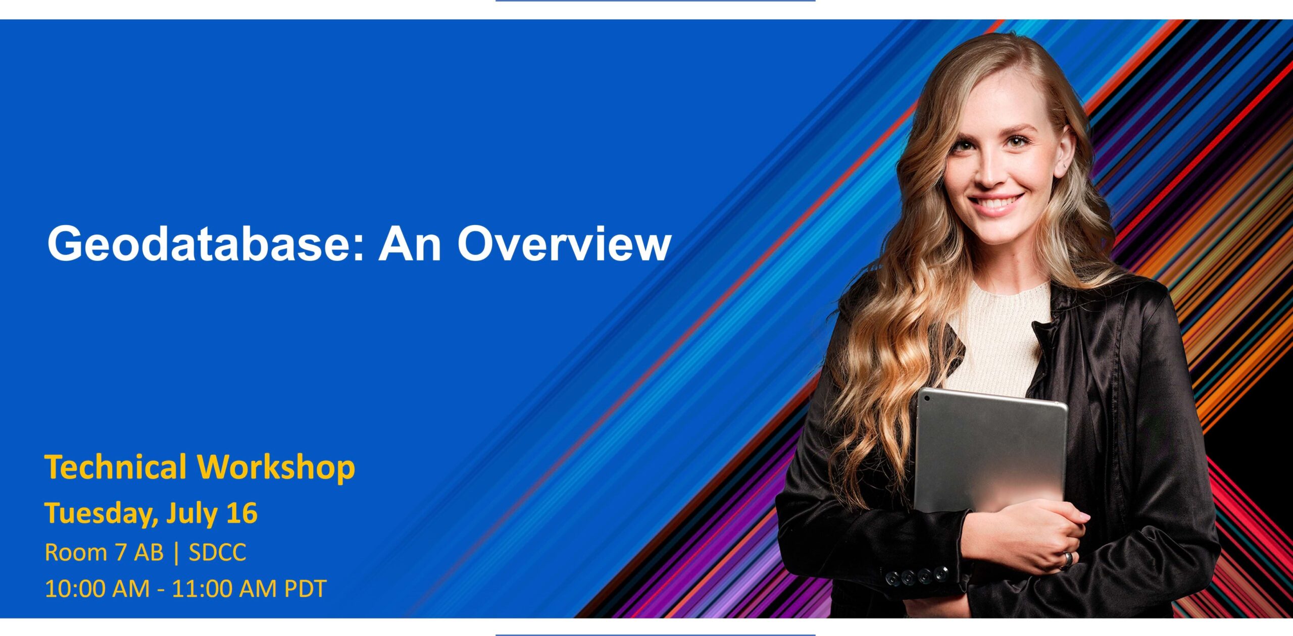
Enhance your data with spatial and relational integrity rules, data validation, business logic, and advanced behavior. This presentation explores various aspects of the geodatabase information model that provides a data storage and data management framework for ArcGIS. See how to apply geodatabase features to your own data and workflows.
Speakers: Mihail Kaburis, Sean Woodward
Supporting materials:
- Getting Started with the Geodatabase – web course on Esri Academy
- Build a geodatabase to support Salzburg tourism – tutorial
- Look at Mobile Geodatabases go! – An introduction – blog
- Apply subtypes and domains to Vienna hiking trails – tutorial
- Assess urban tree health using contingent values – tutorial
- Improve campsite data quality using a relationship class – tutorial
- Improve data quality with Attribute Rules – tutorial
- Use geodatabase topology for ecomobility – tutorial
- Maintain data accountability with editor tracking – blog article
- Create your own geoprocessing tool to download attachments – blog article
Enterprise Geodatabases: An Overview
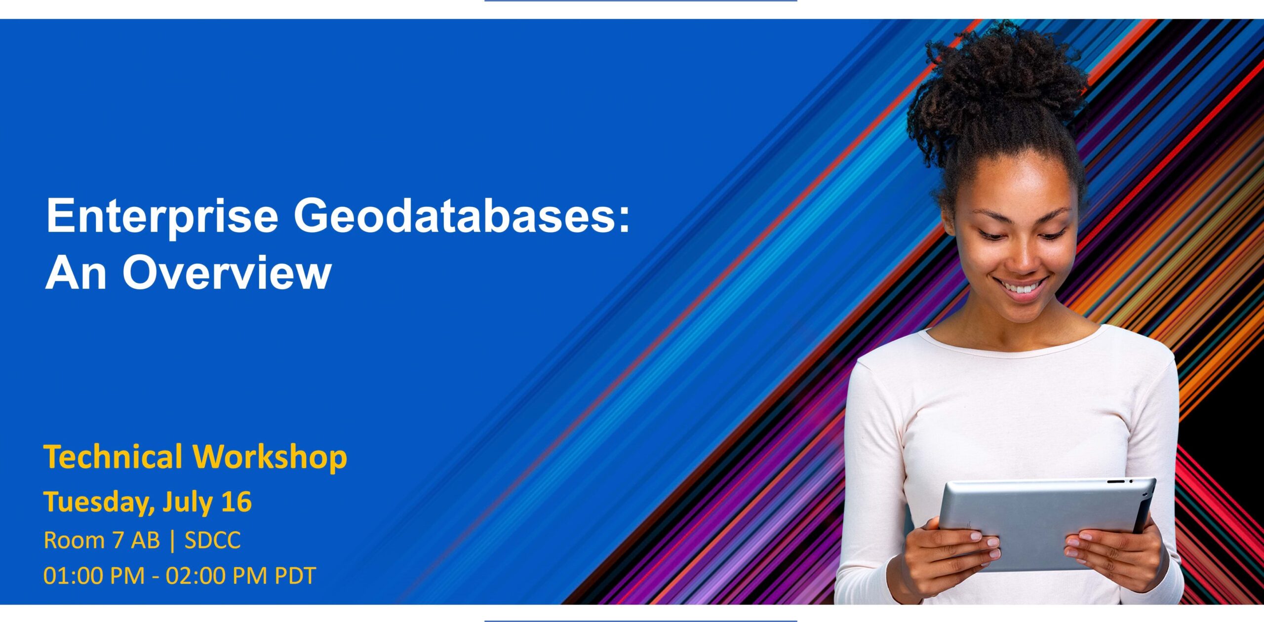
Interested in learning about enterprise geodatabases and how to leverage them for your organization? Presenters provide an in-depth overview of multiuser enterprise geodatabases. Discover the basics of creating an enterprise geodatabase, loading and securing data, editing, and performing essential administration tasks.
Speakers: Dakota Lowery, Morgan Robinson
Supporting materials:
- Deploying and Maintaining a Multiuser Geodatabase – instructor led course on Esri Academy
- Deploy an enterprise geodatabase for real estate – tutorial
- Publish data from an enterprise geodatabase – tutorial
- Transfer ownership of enterprise geodatabase domains – blog article
- Restoring SQL Server databases with a new name – blog article
- Create an on-premises PostGIS only geodatabase in PostgreSQL – blog article
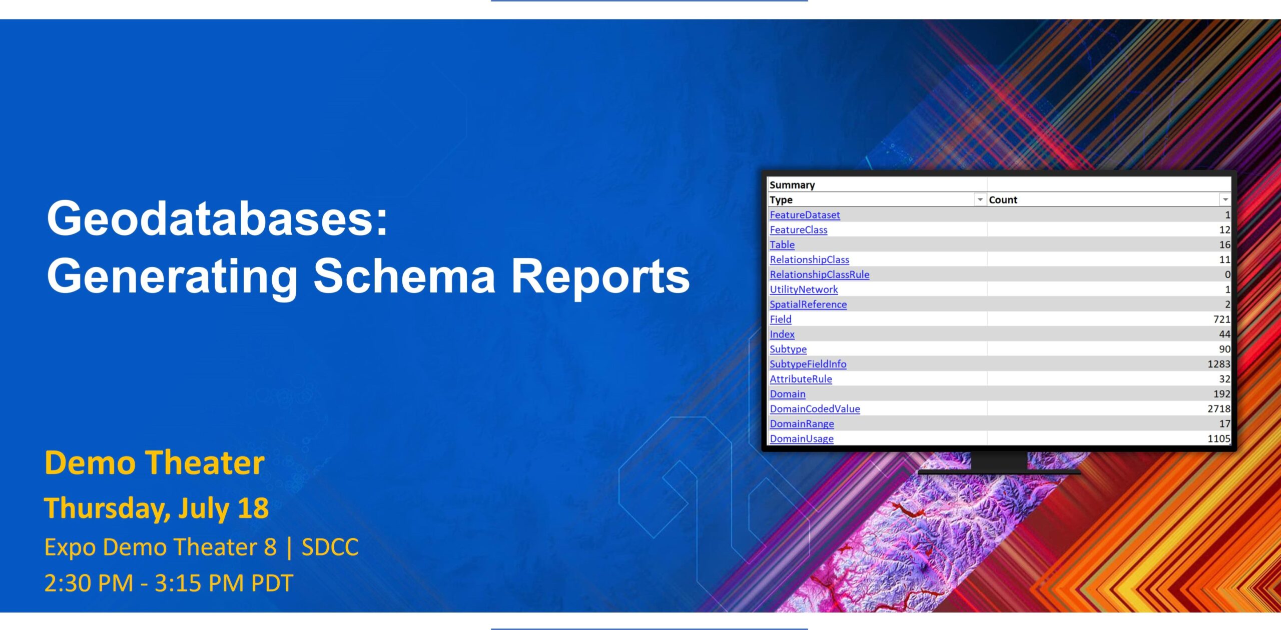
Geodatabases: Generating Schema Reports
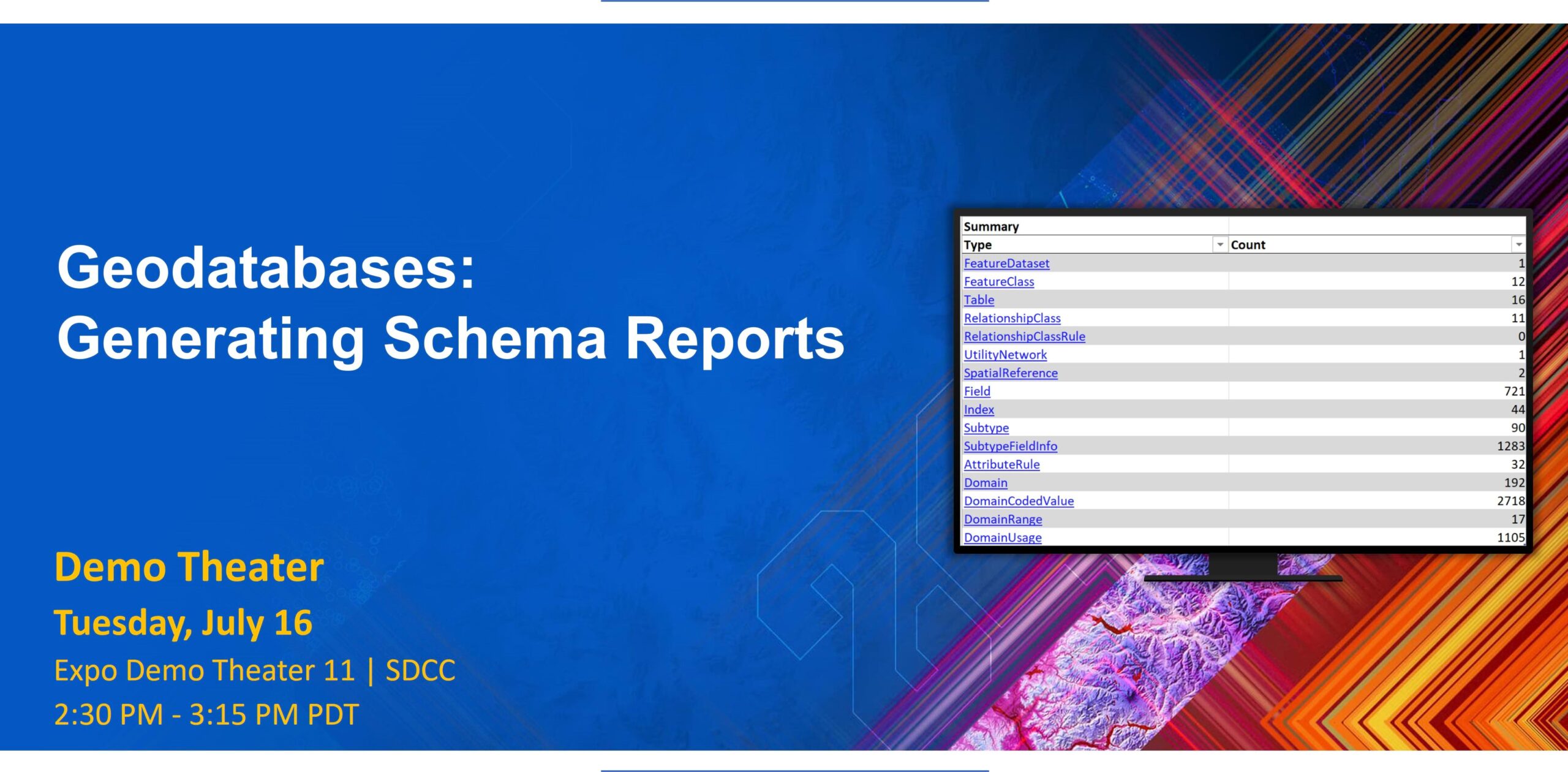
Want to know how you can analyze, refine, and document your geodatabase design using the Generate Schema Report tool? This presentation demonstrates both the tool’s ability to provide a comprehensive overview of the geodatabase structure and its usefulness as a data modeling tool in identifying areas for improvement in your geodatabase design. Learn tips and trick when working with a schema report and see some future enhancements to data design.
Speakers: Jonathan Murphy, Sean Woodward
Supporting materials:
- Geodatabase schema reports – An introduction – blog article
- Generate a schema report in ArcGIS Pro – video
ArcGIS Data Pipelines: From Cloud Data Stores to ArcGIS Online

Do you store data in Amazon S3, Microsoft Azure Blob Storage, Google BigQuery, or Snowflake? Learn how ArcGIS Data Pipelines, a new data preparation application, helps bring cloud data into ArcGIS Online as hosted feature layers. This presentation guides you through the process of connecting to a cloud dataset, preparing the data using a suite of data engineering tools, and writing the data as hosted feature layers.
Speaker: Max Payson
Supporting materials:
- ArcGIS Data Pipelines – An Overview
- Introducing Data Pipelines in ArcGIS Online (beta release) – blog article
- Introduction to ArcGIS Data Pipelines – webinar
- ArcGIS Data Pipelines is Now Available – blog article
- ArcGIS Data Pipelines at the Dev Summit 2024 – blog article
- What’s New in ArcGIS Data Pipelines – blog article
- Join the ArcGIS Data Pipelines Community!
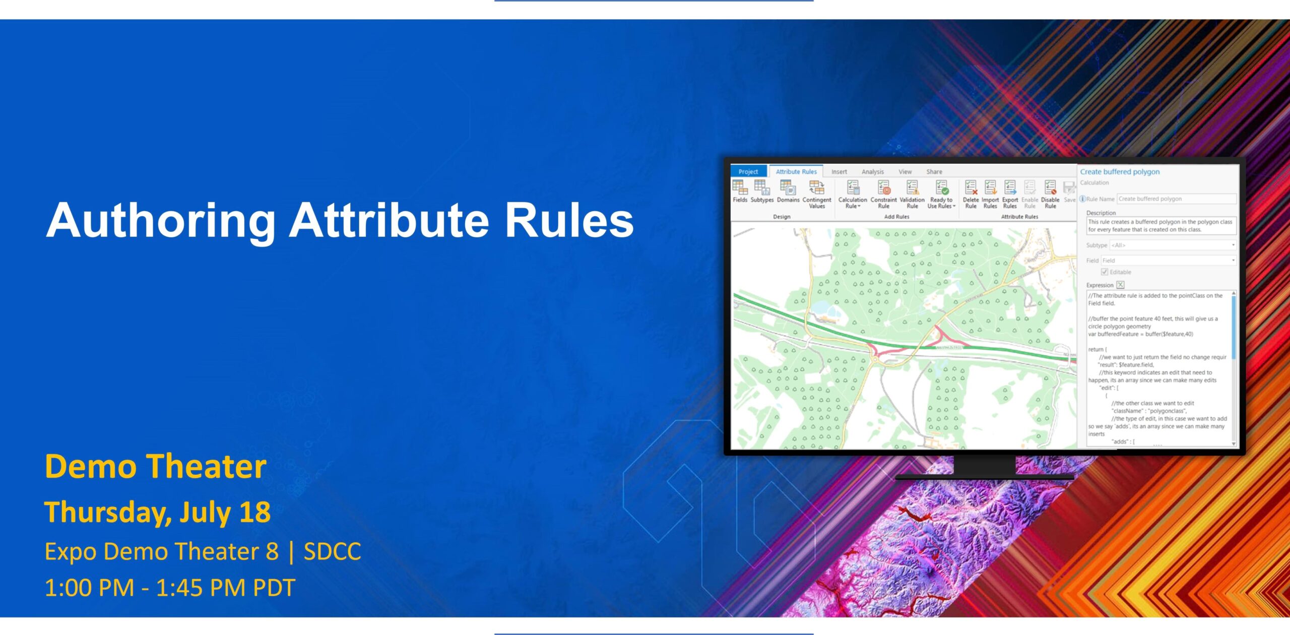
Authoring Attribute Rules
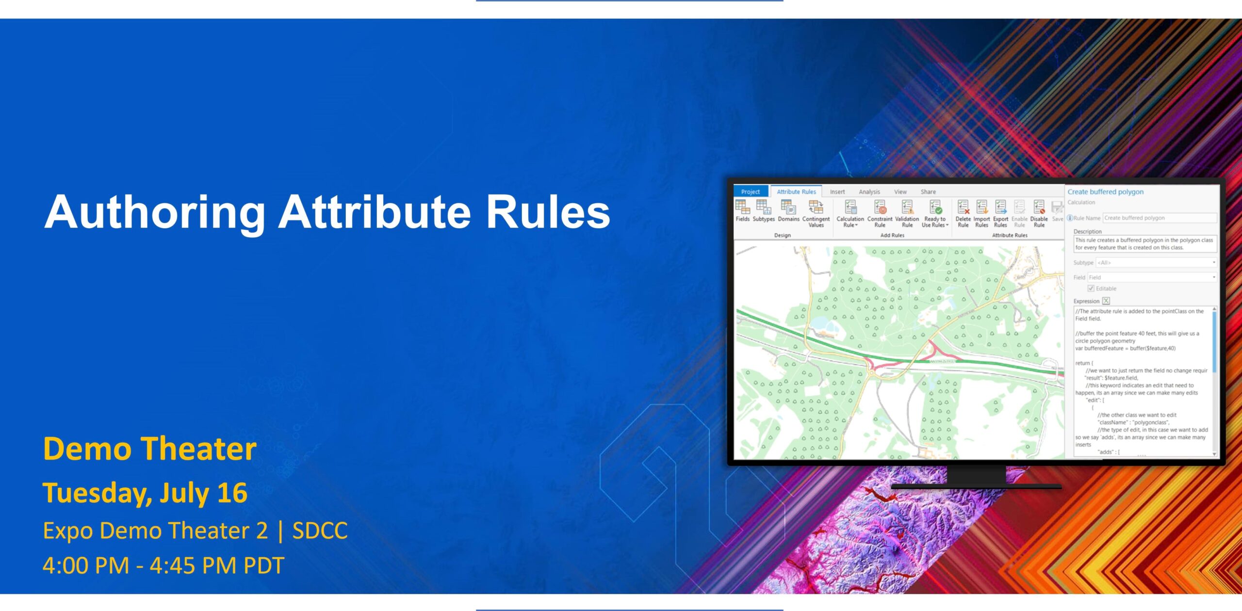
Want to enhance your editing experience and improve your data quality? Find out how authoring different types of attribute rules is beneficial for you. This presentation covers the basics of creating simple attribute rules, using the ArcGIS Arcade function reference, and gradually introducing more complex Arcade expressions to develop more comprehensive attribute rules.
Speaker: Christopher Curtis
Supporting materials:
- Attribute rules page – Geodatabase Resources Hub
- Attribute rules page – Esri Community

Multiuser Editing Against Feature Services

Want to learn more about multiuser editing in enterprise geodatabases? This presentation covers branch versioning and nonversioned archiving. Gain an understanding of the different data registration types for feature services and how to identify which registration type is applicable for your desired use case. Learn how to set up data for short and long transactional editing, share it with the organization, and use some common editing workflows.
Speakers: Melissa Jarman, Diana Muresan
Supporting materials:
- Versioning page – Geodatabase Resources Hub
- Data Management page – Esri Community
ArcGIS Data Pipelines: An Introduction

Did you know that you can create, run, and schedule data preparation workflows with a drag-and-drop user interface that does not require any coding? ArcGIS Data Pipelines, a new app in ArcGIS Online, supports connecting to a variety of data sources; applying tools to blend, build, and integrate datasets; and publishing hosted layers that can be used across your ArcGIS organization. This presentation introduces the app and its key features, preparing you to streamline your data integration and preparation workflows.
Speakers: Duncan Mackey, Max Payson, Bethany Scott
Supporting materials:
- ArcGIS Data Pipelines – An Overview
- Introducing Data Pipelines in ArcGIS Online (beta release) – blog article
- Introduction to ArcGIS Data Pipelines – webinar
- ArcGIS Data Pipelines is Now Available – blog article
- ArcGIS Data Pipelines at the Dev Summit 2024 – blog article
- What’s New in ArcGIS Data Pipelines – blog article
- Join the ArcGIS Data Pipelines Community!
ArcGIS: Distributing Data with Feature Service Sync

Do you work with distributed data or are you interested in learning more about it? Presenters share the various ways that data can be distributed when using ArcGIS, how to distribute data using the feature service sync capability, and how to synchronize data using ArcGIS Field Maps and ArcGIS Pro.
Speakers: Gary MacDougall, Gaurav Maske
Supporting materials:
- Feature service sync workflows page – Geodatabase Resources Hub
- Prepare feature services for offline use – help documentation
- Work with offline maps and branch versioned data – help documentation
- Offline maps and traditional versioned data – help documentation
- Create replica – developer documentation
- Synchronize Replica – developer documentation
- ArcGIS Enterprise page – Esri community
Enterprise Geodatabases: Demonstrating Branch Versioning Workflows
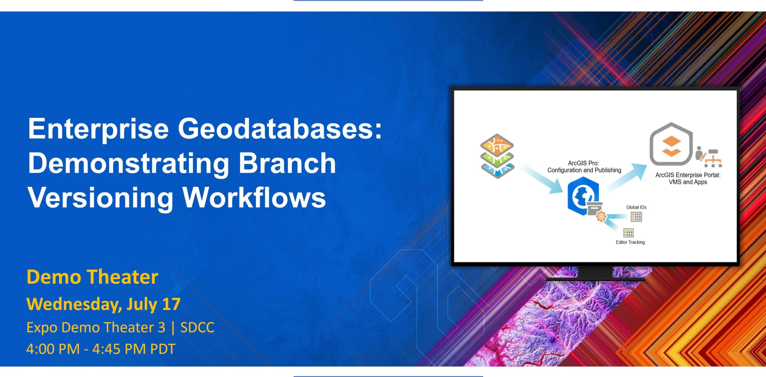
Join us to explore management workflows related to branch versioning with ArcGIS Pro, ArcGIS Enterprise, and the REST application programming interface (API). The workflows that are demonstrated include, but are not limited to, creating and deleting versions, editing named versions, changing version ownership, reconciling versions, and posting versions. In addition, learn how to perform additional workflows through the REST API that are not available through ArcGIS Pro.
Speaker: Robert Krisher
Supporting materials:
- Versioning page – Geodatabase Resources Hub
- Data Management page – Esri Community

Multiuser Editing Against Feature Services

Want to learn more about multiuser editing in enterprise geodatabases? This presentation covers branch versioning and nonversioned archiving. Gain an understanding of the different data registration types for feature services and how to identify which registration type is applicable for your desired use case. Learn how to set up data for short and long transactional editing, share it with the organization, and use some common editing workflows.
Speakers: Melissa Jarman, Diana Muresan
Supporting materials:
- Versioning page – Geodatabase Resources Hub
- Data Management page – Esri Community
ArcGIS Enterprise: Data Storage Strategies

Data is an integral part of ArcGIS, providing the foundation for your mapping, analysis, and decision-making workflows. Where you store your data impacts how you access, edit, validate, secure, and scale it. This presentation highlights the storage options that are available to you in ArcGIS, from ArcGIS Data Store and enterprise geodatabases to cloud storage and cloud data warehouses. Get a high-level understanding of the data storage landscape in ArcGIS Enterprise and how you can leverage these different storage options in your own organization.
Speakers: Nana Dei, Sarah Hanson
Supporting materials:
- The ArcGIS Architecture Center – help documentation
- ArcGIS Architecture Center: About reference architectures – help documentation
- Data in ArcGIS: User managed and ArcGIS managed – Esri technical paper
- Content management techniques for your ArcGIS Enterprise portal – Esri technical paper
- ArcGIS Enterprise and cloud migration – Esri technical paper
- ArcGIS Enterprise: Data Stores – ArcGIS Enterprise documentation
- Portal for ArcGIS: Data and publishing in ArcGIS Enterprise – ArcGIS Enterprise documentation
- ArcGIS clients and DBMS upgrade considerations – blog article
Authoring Attribute Rules
Want to enhance your editing experience and improve your data quality? Find out how authoring different types of attribute rules is beneficial for you. This presentation covers the basics of creating simple attribute rules, using the ArcGIS Arcade function reference, and gradually introducing more complex Arcade expressions to develop more comprehensive attribute rules.
Speaker: Christopher Curtis
Supporting materials:
- Attribute rules page – Geodatabase Resources Hub
- Attribute rules page – Esri Community
Geodatabases: Generating Schema Reports
Want to know how you can analyze, refine, and document your geodatabase design using the Generate Schema Report tool? This presentation demonstrates both the tool’s ability to provide a comprehensive overview of the geodatabase structure and its usefulness as a data modeling tool in identifying areas for improvement in your geodatabase design. Learn tips and trick when working with a schema report and see some future enhancements to data design.
Speakers: Jonathan Murphy, Sean Woodward
Supporting materials:
- Geodatabase schema reports – An introduction – blog article
- Generate a schema report in ArcGIS Pro – video
ArcGIS Enterprise: Integrating Cloud-Native Services

Connect to the cloud services that you need through ArcGIS Enterprise. This presentation explores cloud native storage like AWS S3, Azure Storage, and Google Cloud Storage as well as cloud databases like AWS Aurora, Azure SQL, and Google Cloud SQL. Get an in-depth look at these integration options and how they can benefit you. Presenters also share practical examples to help you get started.
Speakers: Sarah Hanson, Chris Pawlyszyn
Supporting materials:
- ArcGIS Enterprise in the cloud: Cloud options for ArcGIS
- ArcGIS Architecture Center: Cloud services and providers
- An introduction to query layers – blog article
- Leverage Cloud Data Warehouses with ArcGIS Pro and ArcGIS Enterprise – blog article
- ArcGIS Enterprise page on Esri Community
Enterprise Geodatabases: Performance Troubleshooting
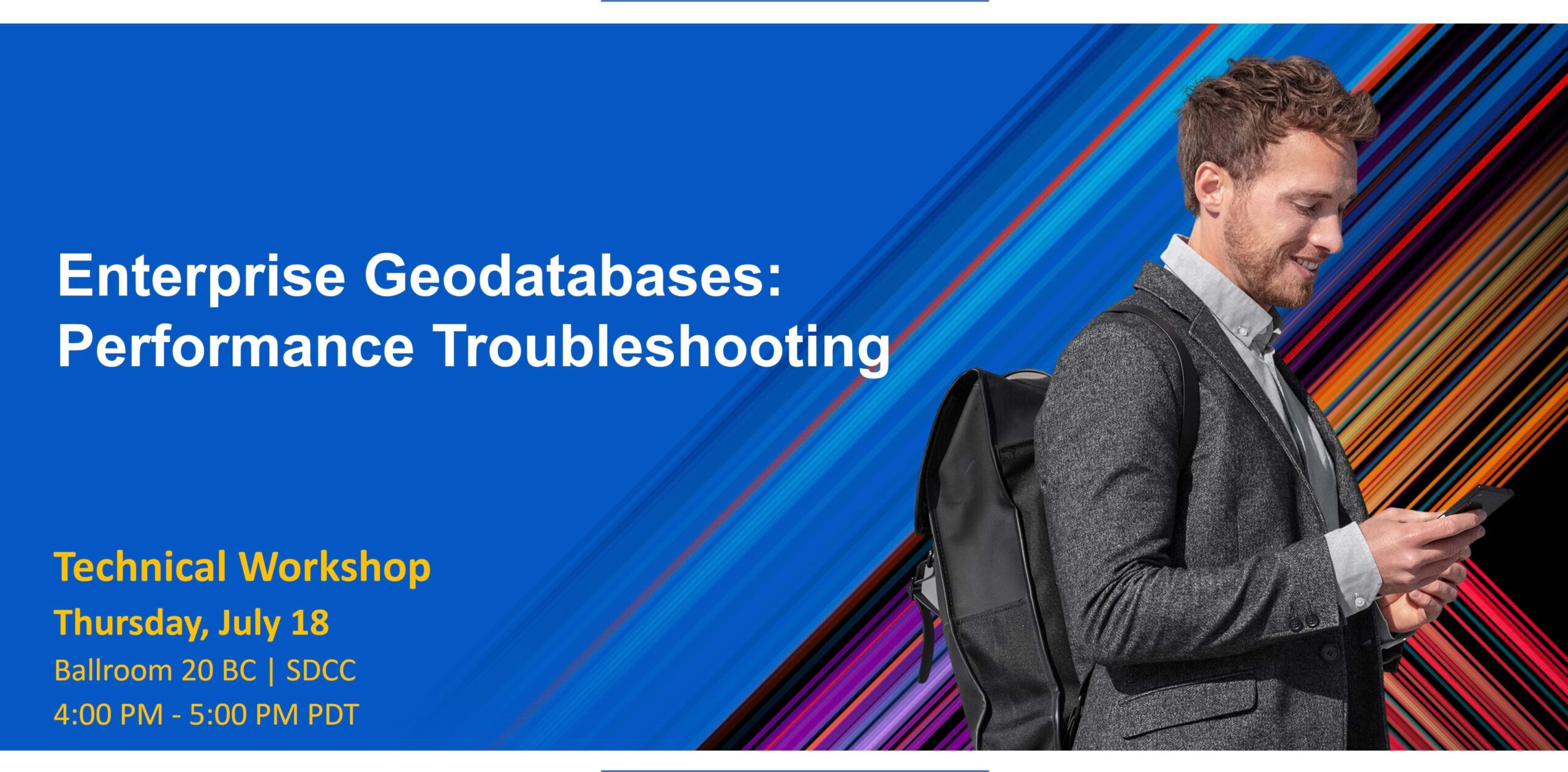
Performance-related issues with enterprise geodatabases, maps, or feature services? In this presentation, explore real-world scenarios and discover troubleshooting techniques and tools that you can use for your own organization.
Speakers: Raymond Bunn, Nana Dei, Jim McAbee
Supporting materials:
>Click here to access database related materials
- The ArcGIS Architecture – help documentation
- What is the EGDBHealth Report? – blog article
- Troubleshooting Performance Issues in ArcGIS Pro – blog article
- ArcGIS Pro: Diagnostic Monitor – ArcGIS Pro documentation
- Diagnose ArcSDE connection and performance with SDEINTERCEPT – Esri technical paper
- ArcGIS clients and DBMS upgrade considerations – blog article
>Click here to access services related materials
- Configure Service Instance Settings – help documentation
- Optimizing ArcSOC Availability and Utilization – blog article
- ArcGIS Enterprise Analysis with System Log Parser’s Optimized Analysis Type – blog article
- Monitoring web service requests using Fiddler – technical support blog
- Troubleshoot map service performance with server logs – ArcGIS Enterprise documentation
- ArcGIS Enterprise Systems and Network Transport Time – Esri technical paper
- Utility Network Properties Extractor – blog article
ArcGIS: Distributing Data with Feature Service Sync

Do you work with distributed data or are you interested in learning more about it? Presenters share the various ways that data can be distributed when using ArcGIS, how to distribute data using the feature service sync capability, and how to synchronize data using ArcGIS Field Maps and ArcGIS Pro.
Speakers: Gary MacDougall, Gaurav Maske
Supporting materials:
- Feature service sync workflows page – Geodatabase Resources Hub
- Prepare feature services for offline use – help documentation
- Work with offline maps and branch versioned data – help documentation
- Offline maps and traditional versioned data – help documentation
- Create replica – developer documentation
- Synchronize Replica – developer documentation
- ArcGIS Enterprise page – Esri community
We look forward to seeing you in San Diego!


Commenting is not enabled for this article.