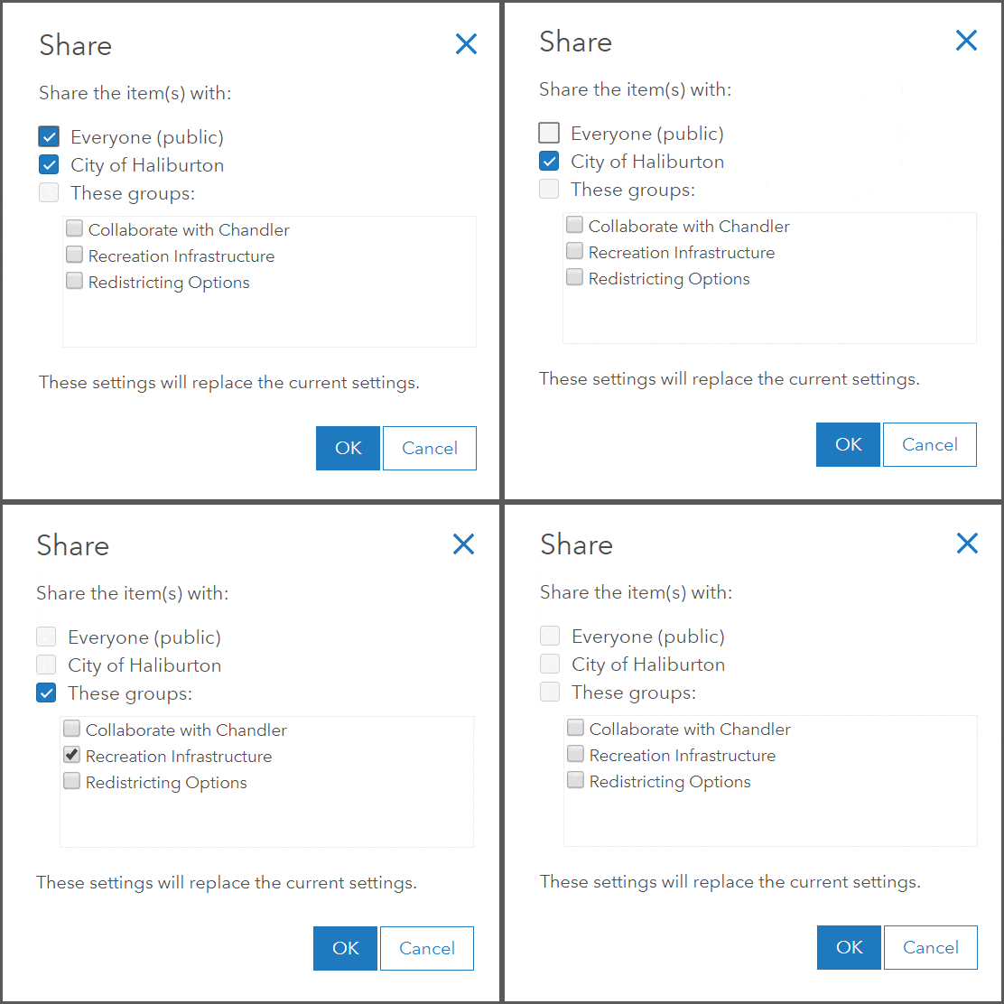
ArcGIS has a powerful sharing model that enables its members to easily share content items such as maps, apps, scenes and files with their desired audience. Whether the audience is the entire 7.6 billion people in the world, or a few members of your company, ArcGIS Online has the infrastructure and security to get your mapping content to the right people quickly. The sharing settings of an item control both the findability and security of items in ArcGIS Online. This article will describe some common sharing scenarios and the security and findability impacts of each scenario.

Items Shared with Everyone (public)
Scenario: The City of Haliburton wants to create an application that allows its citizens to search for public beach locations and find out the water quality and lifeguarding schedule. This application and the data will be hosted in ArcGIS Online, but will also be displayed on the City’s public website and should be searchable by search engines so the public can easily find this information.
Security:
As a public app, viewers can access the web application anonymously. The users just need to be able to find the URL to access the content. To ensure the public can access all components of the web application, the supporting items, such as the layer and web map must also be shared with everyone.
Findability:
As public items, the URLs and item descriptions are provided to the Google index for inclusion in searches. Items that are shared with everyone are also added to the ArcGIS Online search index, allowing users to search and discover public items within ArcGIS Online. Before sharing items with the public, ensure that viewers can identify your items in search results by including complete item information.
Items Shared with Your Organization
Scenario: The GIS Manager for the City of Haliburton manages and owns key datasets that GIS Analysts use in their day-to-day work, such as the recreation infrastructure layer, property parcels, water infrastructure, and tree inspection layers. This data should be accessible to all members of the City of Haliburton organization but not the public as some data is editable and confidential. The GIS Manager also wants the analysts to easily find data that has been created and shared within the organization as the central spatial data repository for the city.
Security:
Items that need to be accessed by organization members and not the public should be shared with the organization. This sharing setting will require visitors to log in to the organization with their ArcGIS Online username and password to search and access content.
Findability:
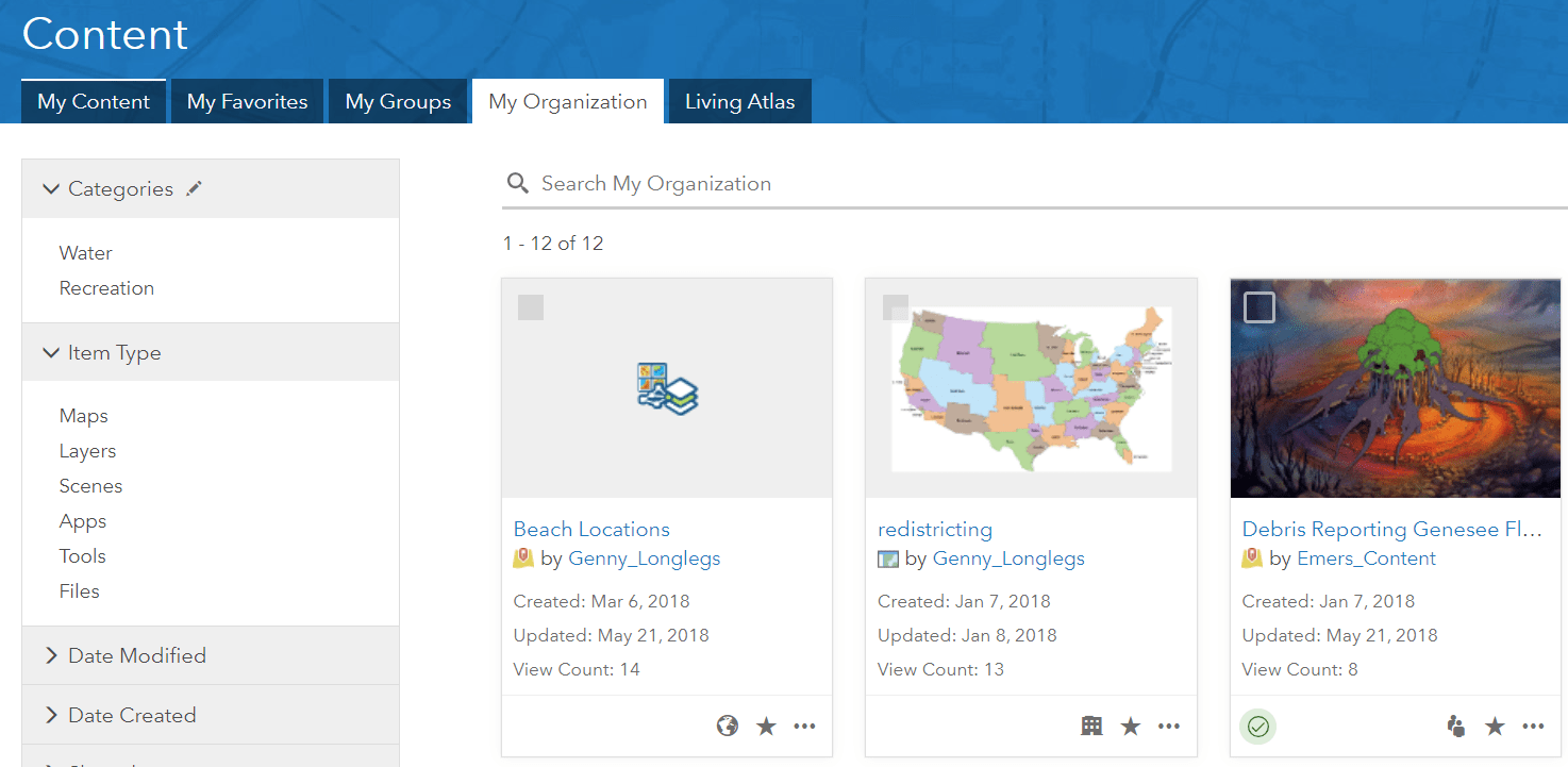
Items shared with the organization can only be searched for and browsed to by members of the organization. Other members of ArcGIS Online will not be able to find such content in a search and outside member attempting to navigate directly to the item will be prompted for a login. Content that is shared with the organization can be found in the My Organization tab of the content page, along with other organization content that the user has access to (example: content that is shared with everyone but originates from the organization). This creates an easy location to find content that has been created by organization.
Note: Some custom roles may not include privileges to view content shared with the organization. This can be helpful for temporary contractors within an organization, as outlined in this article.

Items Shared with a Group
Scenario: The GIS Analyst has created a proposal for re-zoning some land in the City of Haliburton. The re-zoning is in the planning stages, so the maps and data need to be reviewed by a team of stakeholders but shouldn’t be available to other members of the organization or public at this stage. The team of stakeholders include the City Manager, GIS manager and Business Manager who will be viewing the shared content.
Security:
Items that need to be accessed by specific people should be shared with a group. Creating a group, adding the specific members usernames, and sharing the content to the organization provides secure access to the items for group members. Once a group member has provided their username and password by logging in to ArcGIS Online, they will be able to access the content that has been shared with the group.
Findability:
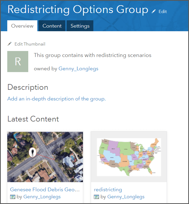
Items shared with members through group sharing can only be searched for and browsed to by members who are members of the group. Other organization members will not be able to find this content in a search and will be prompted for a login if an unauthorized member attempts to navigate directly to the item. Content that is shared with a specific group can also be found on the group page or on the My Groups tab on the content page. Tip. Consider where the best place is for your users to discover the shared content, as different stakeholders may have different familiarity with ArcGIS Online. If members accessing the shared content use the content page often, this may be the easiest way to find content they have access to. If the member is generally unfamiliar with ArcGIS Online, consider providing the URL to the item and the user’s username and password. Even though the security is set up through group sharing, the desired user experience may be simple navigation to a link and authentication.
Note: Members can join and share content with groups within the organization and in other organizations in ArcGIS Online. Read this blog for more information about cross-organization sharing.

Private Items
Scenario: The GIS Analyst who created the Public Beach application iterated through a few versions of the application, data structure and web styles before creating the production-ready application. The final application was shared with the public, but the initial content created for the project will remain if other applications with an earlier iteration are needed. No other user in the organization really needs to know about this content, but the analyst isn’t ready to delete the work yet.
Security:
Items that are works in progress, tests, reference data, or ideas don’t need to be shared with anyone. They can stay as private content, meaning only the owner and members with administrative content management privileges can see this content. A username and password is required to access this content.
Findability:
Private items can be found in the search by the content owner. It can also be found in the My Content tab of the content page. If there are items that don’t have a security reason to not be shared, there is a strong case to have users keep those items as private so test items aren’t easily searchable and findable by users who don’t need to access the items.
Tip: Content managers and Administrators should recommend a private content review time for users in the organization. This way users can find private content that may not be used any longer and remove the content from ArcGIS Online if it isn’t needed.

Sharing with Multiple Audiences
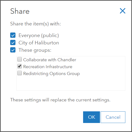
As noted in the sections above, the ArcGIS Online sharing settings control the security and findability of items. You can select multiple sharing settings to take advantage of the security and findability of different sharing settings.
Scenario and Sharing settings:
The GIS Manager for the City of Haliburton wants to organize all the city’s recreation applications, so the recreation content managers of the ArcGIS Online organization can easily find them grouped together. The applications need to have the sharing setting of everyone, this will ensure that public users can anonymously access the applications that are posted on the city’s website. The applications can also be shared with the recreation managers apps group, so that all the members of the recreation managers group can find the applications on their content page on the My Groups tab. As the members of the recreation managers group can access all the supporting items for the applications because they are shared publicly, only desired content (applications) needs to be shared with the group to create an easy navigation experience.
So go ahead and decide who you want to share your geospatial content with, and set up the correct sharing settings to take advantage of the wealth of organization members, ArcGIS Online members, and the public who can view and collaborate with your content.


Commenting is not enabled for this article.