If you’ve taken the time to build a nice web map with clear symbology, great pop-ups, and a nicely labeled legend, chances are you want to share it! ArcGIS Online makes it easy to share your web maps in any type of website including blogs, news outlets, or organizational websites. You can control many different elements of the viewing experience, such as the width and height, zoom control, location search, and the ability to view a larger version of the map.
Select desired options in a few clicks
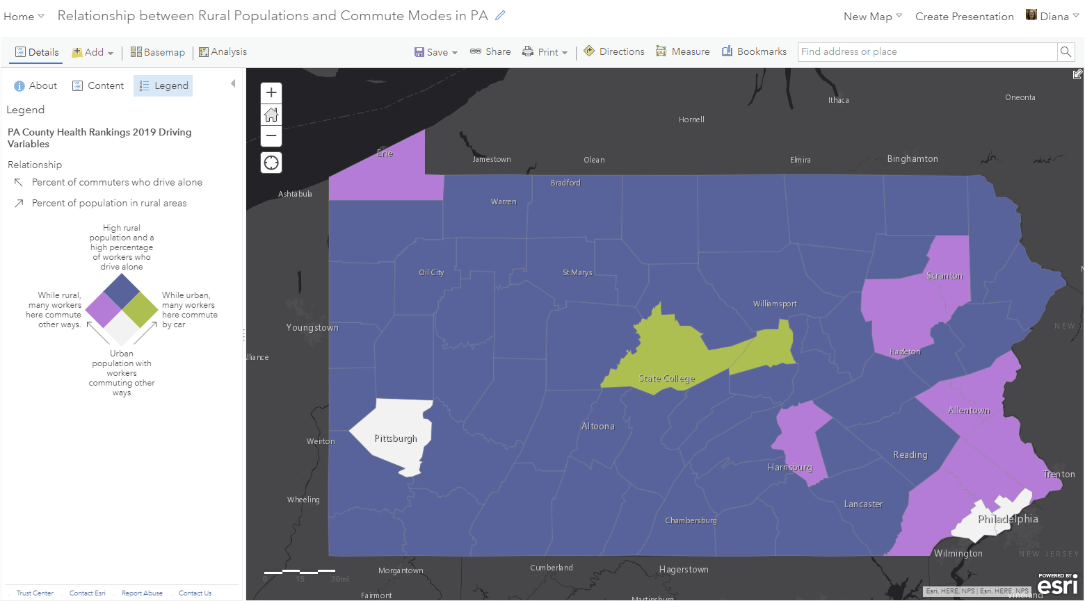
Once your map is shared publicly, it only takes a matter of clicks to get customized HTML supporting your choices for the different elements of the viewing experience. For example, here’s a web map I created that shows the relationship between rural populations and commute modes in Pennsylvania.

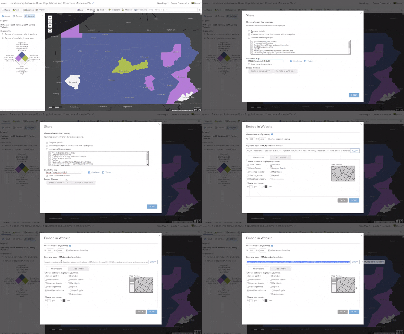
I’ll simply click Share -> Embed in Website -> and select my desired elements of the map. I don’t want to display the scale bar, but I do want to display the legend that I spent time crafting. The scalebar is now removed from the map preview on the right and a legend panel is added. The map preview helps give a sense of how the display options will look in the web map. Once I’ve selected or deselected the options I want, I just click the big Copy button next to the HTML code.

Insert copied HTML into website code
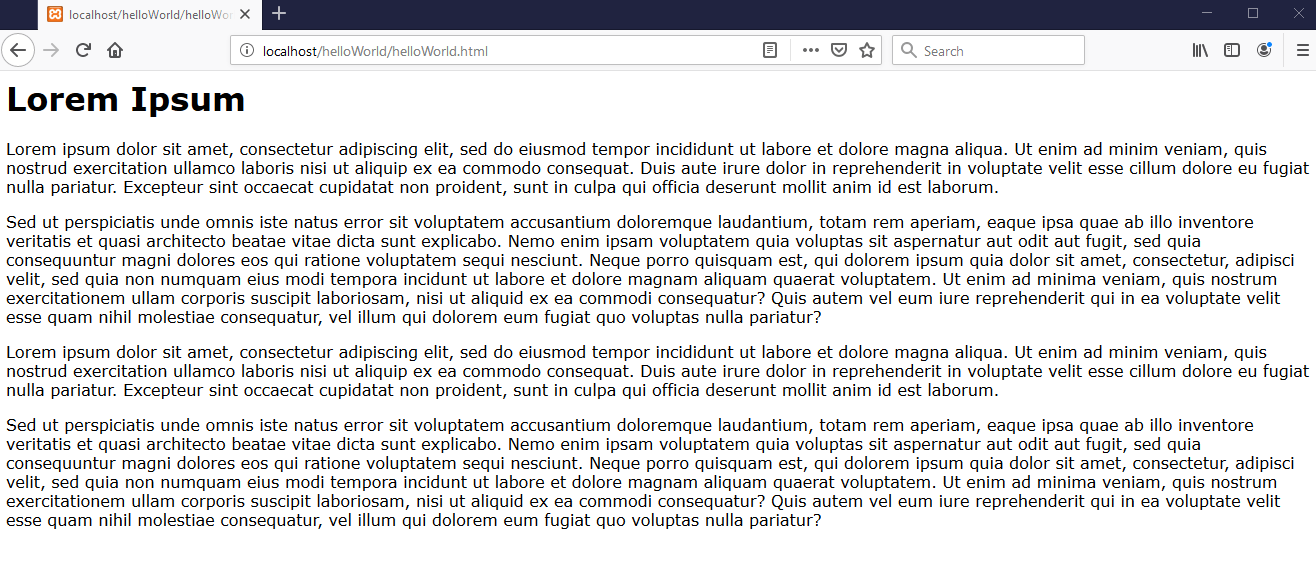
Now that I’ve copied the HTML code, I can pass this on to my organization’s webmaster, or insert it into my organization’s website myself. For example, imagine my organization has a website that looks something like this:

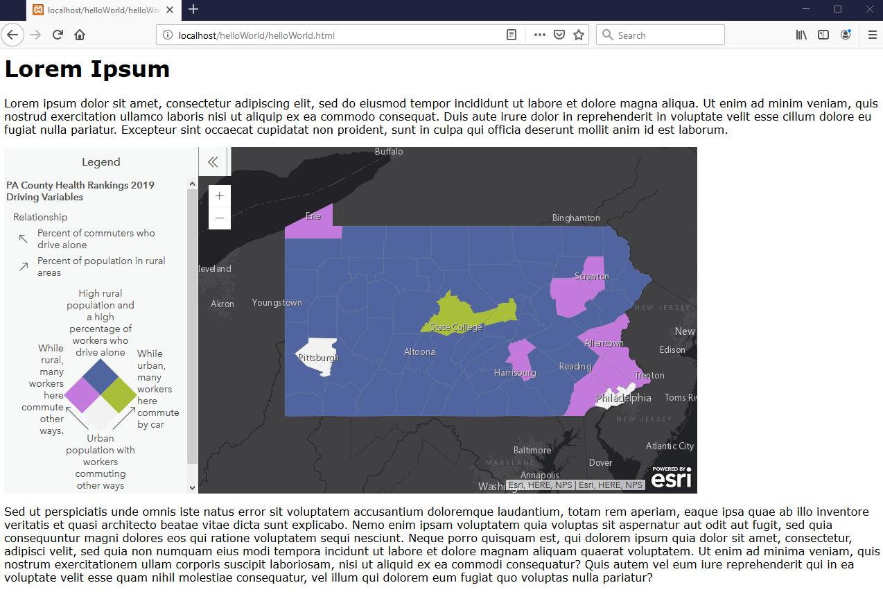
In the website builder environment, I simply paste the HTML I just copied into the place in my blog post where I want the map to appear. I played around with the size dimensions and found that 1000 x 800 works for this site. I’ll save and preview to make sure that it’s appearing as expected: a web map without a scalebar but with the expandable legend, just the way I want!

Anyone who views this website will be able to interact with this web map by zooming in and out, panning around, clicking on a county to reveal the pop-up, and expanding or collapsing the legend. There are many other available options for letting your viewers interact with your map including a search capability, a basemap selector, and a link to view a larger version of the map (helpful when size is an issue, particularly for sites designed for mobile devices). For more information on embedding web maps, see the official help doc on embedding items.
In addition to organizational websites, other ways to share your web maps with the world are through story maps, configurable apps, or dashboards – all of which are easy to build in ArcGIS Online.

Commenting is not enabled for this article.