Each year many of us make New Year’s resolutions to change or do something different: exercise more, lose weight, be healthier, travel, achieve new goals, or grow individually. A New Year’s resolution is defined in many ways:
A New Year’s resolution is a tradition, most common in the Western World but also found in the Eastern World, in which a person resolves to continue good practices, change an undesired trait or behavior, accomplish a personal goal, or otherwise improve their behavior at the beginning of a calendar year. (Wikipedia)
A promise that you make to yourself to start doing something good or stop doing something bad on the first day of the year. (Cambridge Dictionary)
The things you promise yourself you will do over the year, but quit after the first 2 weeks. (Urban Dictionary)
Regardless of how you define it, here’s 10 suggestions for your ArcGIS Online 2023 resolutions.
4. Improve your profile and profile gallery
5. Take your map craft to the next level
8. Get the most out of Living Atlas
10. Be a part of your community

Evolve your brand
An organization’s brand is an easily identifiable visual symbol or graphic style that is reflected in your home page, hubs, item thumbnails, user or organization profiles, and apps. A brand provides immediate recognition of your organization and helps others understand the value and the veracity of your content and what you do.

If you verify and register your organization, your public content that you’ve badged as authoritative will also display the authoritative badge when discovered via search, adding more confidence in your work.
- Create a thumbnail style and brand (ArcGIS Blog)
- Organization verification (Help)

Improve your Home page
The home page is the landing page of your organization’s website and serves as a gateway for your user community. Configuring a modern and professional-looking home is not only a best practice, but also a reflection on your organization and the communities you serve.
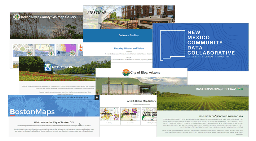
The home page provides helpful resources and content for organization members once they sign in. Your home can also serve as a public destination, showcasing maps, apps and other content to a broad audience.
- Create a great home page for your organization (ArcGIS Blog)
- Configure your home page navigation bar and galleries (ArcGIS Blog)
- Configure home page (Help)
- Best practices for creating an organization home page (Help)

Create a Hub (or two, or three)
ArcGIS Hub Basic is included with ArcGIS Online so there’s no reason not to create a custom-crafted destination for any audience. Whether it’s for other members of your organization, a destination for transparency and opening content to others, a theme-focused gallery, or for general public information, a Hub is an ideal choice to take you beyond your Home page.
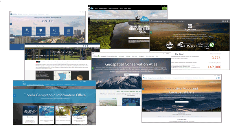
ArcGIS Hub Premium includes additional features and capabilities that make it a true community engagement platform, organizing people, data, and tools through information-driven initiatives. If you’ve not done so already, make it your resolution to explore ArcGIS Hub.
ArcGIS Enterprise users can implement Enterprise Sites to provide focused destinations for portal members.
- Try Hub Basic (Tutorial)
- Build an ArcGIS Hub (Tutorial)
- Get started with ArcGIS Hub Premium (Tutorial)
- Tips and time savers for ArcGIS Hub and Enterprise Sites (ArcGIS Blog)

Improve your user profile and profile gallery
It’s frustrating to search for content, find something that might be of interest, click the user profile to identify the source, and see…nothing, leaving you wondering whether this is from an authoritative source or a student in a MOOC. With the right profile it’s easy for anyone to understand it’s from a trusted source, and sheds a good light on all your work.
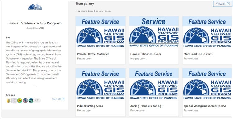
Besides individual profiles, you can set up organizational profiles for your top-tier shared content. Your profile not only tells the online world who you or your organization are, but can also include contact information and a customizable gallery of your items.
- Create a great profile (ArcGIS Blog)
- Customize your profile item gallery (ArcGIS Blog)
- Manage profile and settings (Help)
- Brand yourself with the user profile page (ArcGIS Blog)

Take your map craft to the next level
There are lots of ways to take your map craft to the next level. Smart mapping delivers interactive data exploration and mapping capabilities, and helps you uncover patterns and stories inside your data. Smart mapping is data-driven, so helps you to quickly create beautiful and informative maps.
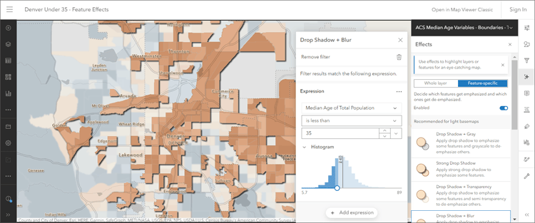
Use effects and blending to make expressive maps, apply focus to certain aspectes of your data, and really make your maps pop with meaning.
- Styles quick reference (Help)
- Smart mapping (Esri website)
- Smart mapping styles in Map Viewer (StoryMaps Collection)
- Feature-specific effects (ArcGIS Blog)
- Use effects (Help)
- Use blend modes (Help)

Make your pop-ups pop
Layer pop-ups are an essential and important part of crafting the complete map information experience. Pop-ups can transform an otherwise dull list of attributes into a far more meaningful display of intuitive and engaging information for your audience. While it’s easy to craft good pop-ups, they are often are overlooked. But with a little knowledge and tradecraft, it’s easy to push your pop-ups to the next level, turning attributes into enlightenment.
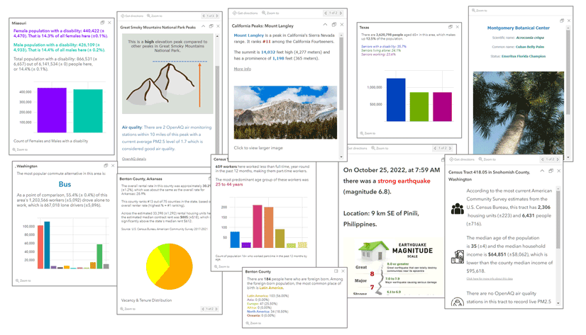
Pop-ups can include configured fields, formatted text (and HTML), images, charts, and information from related tables. Use Arcade to do even more with your pop-ups.
- Configure pop-ups (Help)
- Pop-ups: the essentials (ArcGIS Blog)
- Enhance your pop-ups using ArcGIS Arcade and Living Atlas (ArcGIS Blog)

Do your housekeeping
Do you have a lot of items named using “junk” or “test?” Time to clean those up and get rid of them. And while you’re at it, improve the thumbnails and item descriptions for all your essential content, especially when shared with others in your organization or publicly.
Review your content and cull out the lemons. Remember you can categorize your items and also mark them as authoritative or deprecated. Organize your content for easy discovery using folders.
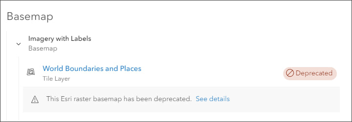
Scan your map item pages for any deprecated operational layers or basemaps that need to be replaced. An easy way to divide and conquer this task is to sort by date, then check the older content first.
Administrators can also view and report status and run reports on all items in the organization, showing the view count, date last viewed, and other details which can help identify content that that needs housekeeping. Another good idea is to launch the Security Advisor found at the ArcGIS Trust Center (see button in the upper right) to check your organization for any privacy or security concerns.
- Best practices for sharing (Help)
- Manage content (Help)
- Move items (Help)
- Content categories (Help)

Get the most out of Living Atlas
ArcGIS Living Atlas of the World is the foremost collection of curated geographic information from around the globe. It includes authoritative ready-to-use maps, apps, and data layers from the global GIS user community that support your work. Visit the Living Atlas website where you can learn about what’s new, sign in and browse content to begin your work, view the blog, and explore a gallery of useful and interesting apps.

Living Atlas can help you learn how to make awesome maps and pop-ups. Just open a map or layer, and explorer how it’s been crafted. Tired of the same old basemaps? Try creating a custom basemap gallery to leverage even more Living Atlas basemaps, or use the Vector Tile Style Editor to start with a Living Atlas basemap and create your own unique look and feel.
To leverage even more of Living Atlas, you can submit your own content to be listed among the very best available. Share your organization’s data or services through the Community Maps Program, enriching the wider GIS community. Your contributed data will be hosted in maps and layers in ArcGIS Online for free as part of Living Atlas. Help improve basemaps with your latest imagery or elevation data, and provide feedback and edit features.
- Living Atlas news, updates, and techniques
- Living Atlas blog articles
- Living Atlas apps
- Community Maps Program
- Esri Maps for Public Policy

Learn something new
There’s always something to learn, whether it’s a new workflow, a better technique, or just a bit of tradecraft you can apply to your work. There are many opportunities to learn something new to add value to you and your organization. Here’s a few resources for learning:
- ArcGIS Online tutorial and series gallery
Expand your skills by exploring an ArcGIS Online focused tutorial or series. - Esri Academy
Whether you’re looking for instructor-led training, web courses, learning plans, or other formats, you’ll find lots of learning opportunities (both free and fee-based) via the Esri Academy. - ArcGIS Online Blog
Lots of blog articles that cover newly added capabilities, techniques, and tutorials. Want to learn even more? Search the greater ArcGIS Blog to expand your ArcGIS horizons.

Be a part of your community
You’re a part of a greater community of ArcGIS Online users. The Esri Community site provides forums for learning, asking questions, submitting ideas and more. Visit the ArcGIS Online community to participate.

Also check out the Living Atlas community for news, updates, and information on basemaps and other content.

Commenting is not enabled for this article.