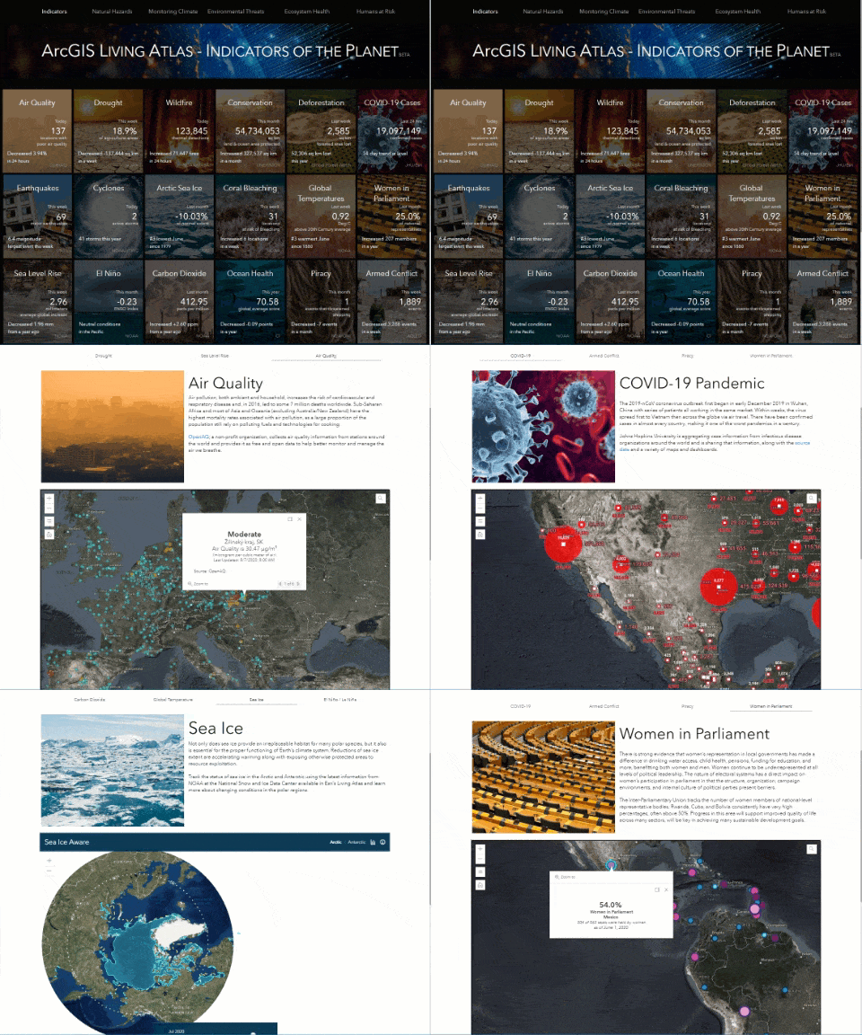
Last month, we introduced the ArcGIS Living Atlas Indicators of the Planet (Beta): a website that showcases authoritative information for 18 themes of interest for tracking the state of the planet. These planet indicators provide a quick snapshot of the status of each theme and provide customized pages with further information about each theme. Particularly, Indicators of the Planet provides relevant information on a variety of topics from places undergoing a decrease in air quality to identifying places with rising COVID-19 cases. For example, we can track growth in protected areas or check how we’re faring in electing women to parliamentary positions. Most importantly, all themes display the latest information available, which is possible with automated near-real time updates by Live Feeds.

Live Feeds
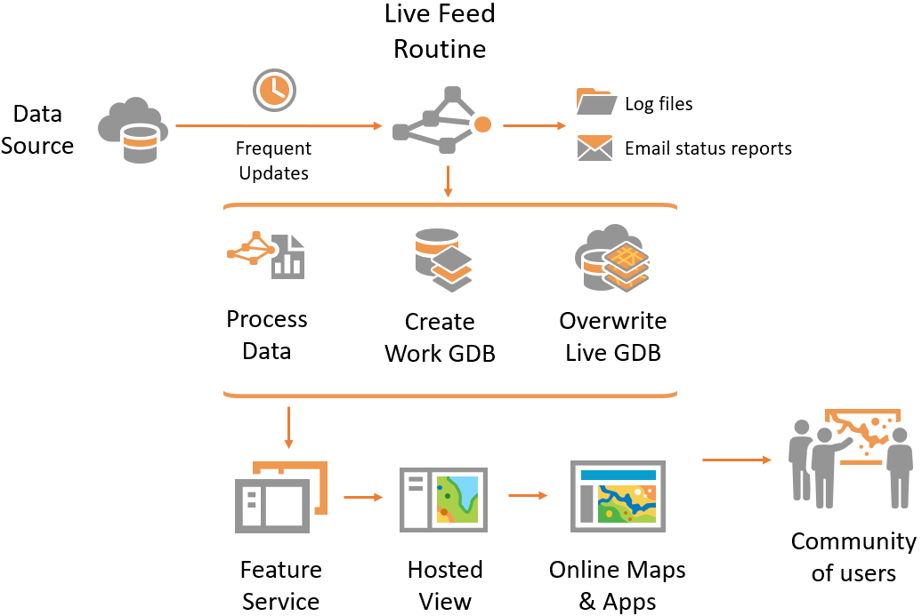
Live Feeds are dynamic layers that display the most recent information from an online source. Live Feed layers in Living Atlas enable us to display near-real time information such as tracking hurricanes, wildfires, forecasting river discharge, and more. Live Feeds layers are kept up-to-date by a script routine.

A Live Feed routine checks for updates, downloads and geoprocesses data, and overwrites online layers. For example, the Live Feed routines powering Living Atlas Indicators of the Planet update the information behind each GeoCard and also their corresponding map layers.

There is a set of tools and online resources available for the creation and implementation of Live Feed layers on ArcGIS Online.
Live Feeds Methodology, Tools, and Resources
ArcGIS Online includes materials for the assimilation, development, and implementation of Live Feeds. From online lessons to technical documents. These online resources can take you promptly from beginner to expert.
- Live Feeds group: ArcGIS Online group with examples of Live Feed layers in Living Atlas.
- Learning Materials on Learn ArcGIS:
- Schedule Automated Near Real-Time Data Updates: learn how to set up a simple Live Feed routine from an online data source.
- Update Real-Time Data with Python: learn how to script and deploy a Live Feed routine.
- Aggregated Live Feed (ALF) community group:
- ALF methodologies document.
- ALFlib python module.
- Overwrite Feature Service script: script that can be used for the automation of updates from the command line.
- ArcGIS API for Python: online documentation for developers.
Additionally, you can explore the different courses we offer in our Esri training website.
Summary
Live Feeds are dynamic layers in ArcGIS Online that show the most recent information available such as earthquakes, hurricanes, or river discharge. These layers are updated by Live Feed routines that automate the process of overwriting the information in near-real time without service interruptions. Live Feeds power the updates behind ArcGIS Living Atlas Indicators of the Planet.
More Information?
Join GeoNet and ask a question to our community of experts.

Article Discussion: