The June 2024 update is closing the gap on related record support by introducing the ability to view and edit related records in the attribute table. Yes, you read that correctly. When working with related data in Map Viewer, you can explore and work with related records in the attribute table.
In this blog we’ll walk through the new related record viewing experience in the attribute table, review performance enhancements, and discuss what’s coming in future updates. There are many more exciting additions to the table, so make sure to check out the new add/edit record and field calculation experiences.
Related Records in Map Viewer
When you add related data to Map Viewer, you have two options for viewing it: through the pop-up and now through the attribute table.
Viewing related records in the table
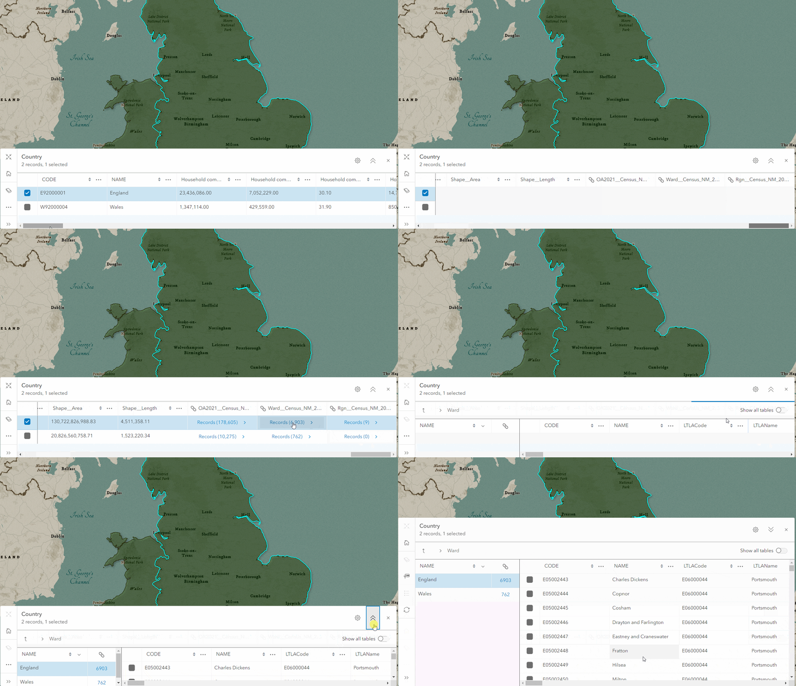
Let’s look at the related record table experience using the England and Wales household composition layer from the Living Atlas. This feature service has 8 layers representing different geographic areas of varying sizes. Several layers have a one-to-many relationship to the others. For example, the country layer has may related regions.
In Map Viewer, opening the country layer’s attribute table and scrolling to the end we see a column for each related layer denoted with the relationship name. Each relationship column cell contains “Records (#)”, where the number represents the number of related records for that feature. In our example, we see that England has 6,903 related wards. Clicking on a record’s cell opens the table of the ward layer, filtered to display the 6,903 wards located in England.

Navigation
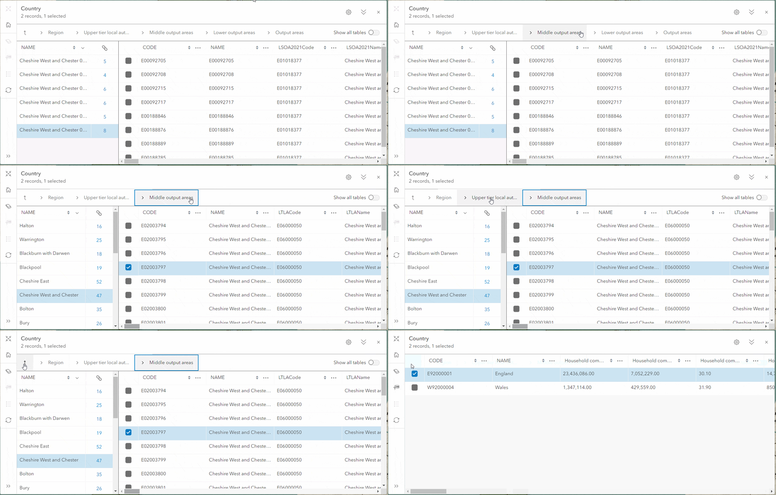
When navigating through multiple levels of a relationship tree, it’s important to track the steps you’ve taken and to have the ability to return to a previous table. The breadcrumbs header was added to facilitate this process. Clicking a table name allows navigating back to it, while clicking the Exit related records button jumps back to the original table.

Comparing values
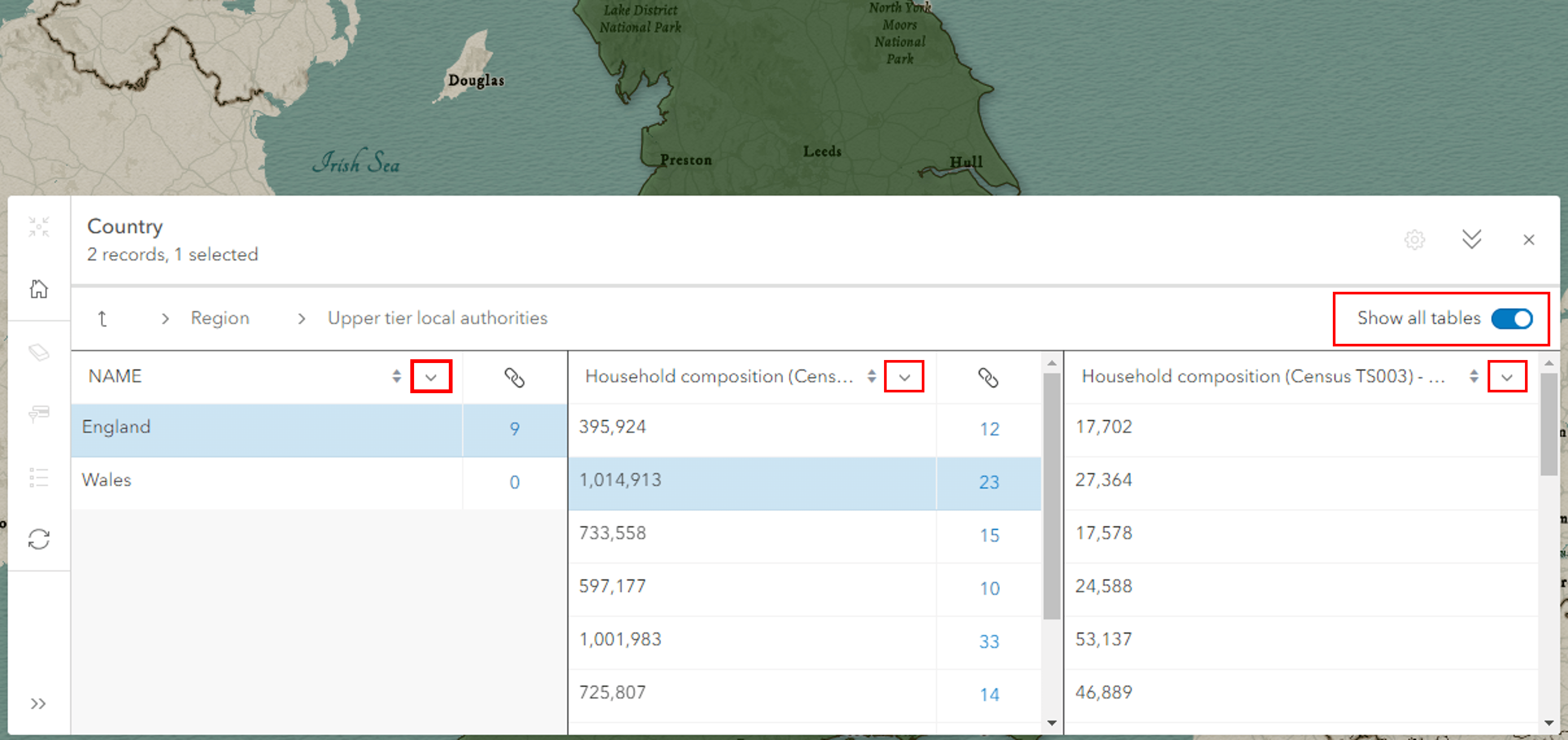
You’ll notice that as you drill into related records, only two tables are shown at a time. This gives you more space for viewing the attributes of related records. However, if you want to compare values between all open tables, simply turn on Show all tables and use the column menu to change the visible field.

Pop-up to table
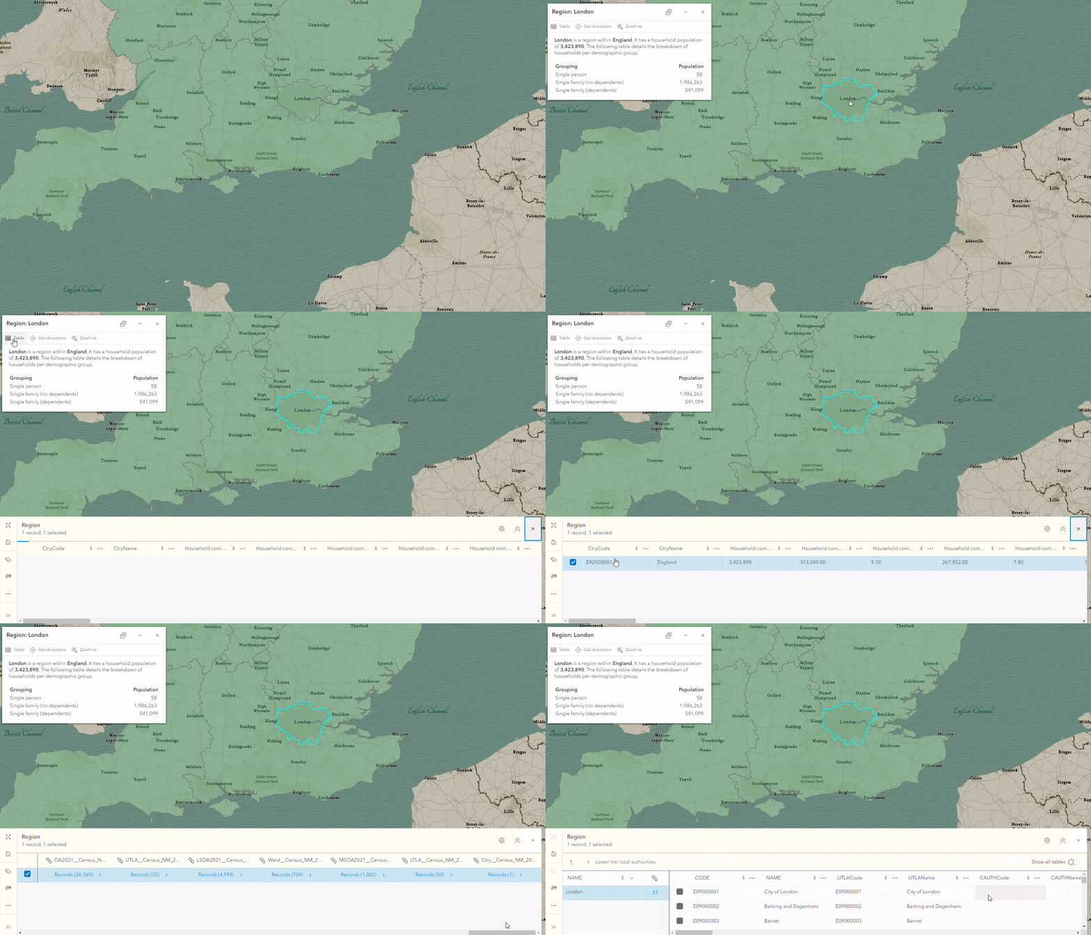
The layer pop-up now includes an action to view the feature’s attributes in the table. This is particularly useful if you want to view the related records for a specific feature. No more tiresome scrolling or temporary filters! Simply select a feature of interest in the map and click the Table button in the pop-up action bar.

Table performance
In the coming weeks, while exploring big data in the Map Viewer, performance improvements made to the attribute table should become apparent. This includes snappier load times and responsiveness when loading feature-dense, column-rich, and datasets heavy with related records. Furthermore, you should see a progress indicator signifying data retrieval is in progress.
Final thoughts
We know that related record support in the table is crucial for many of your workflows. To ensure availability across your applications we built the functionality into the ArcGIS Maps SDK for JavaScript FeatureTable widget. To summarize, Map Viewer, or any other application making use of the FeatureTable widget, can now work with related records. We’re very excited about this and hope you are too.
Now for more exciting news. Let’s talk future updates. You can look forward to a refreshed related record experience on the item details page and support for viewing and managing attachments through the table. Until then, enjoy working with your related records in Map Viewer.

Commenting is not enabled for this article.