This blog article was originally published on April 7, 2019, and has been updated.
A group is a collection of items usually related to a specific topic or area of interest. Groups are an effective way to gather content together and enable others to easily find and use the items. To really make content in your group resonate, you can go beyond just having a shared group and create a better presentation of group content using a curated gallery of items or a group-based ArcGIS Instant App.
Configuring a group gallery is an inherent capability of groups. Group apps are designed to work with the items you add to a group, and offer different ways to present those items beyond the standard capabilities of the group alone.
Here are several ways you can effectively present content in a group.
Configure a curated group gallery
A great way to showcase the best layers, maps, or apps in your groups is to highlight specific group content. By default, the content gallery for a group displays the most recently added items under the group description. Group owners, group managers, and members with administrative privileges to manage content in groups can curate a gallery of featured group content instead of showing recently added items.
For more information, see Use a curated gallery to feature group content.
Use an Instant App
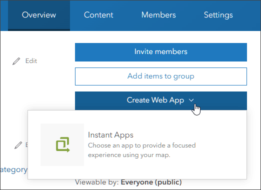
ArcGIS Instant Apps that use groups can be found in several ways, but the easiest is to go to the group item Overview tab, click Create Web App, then choose Instant Apps.

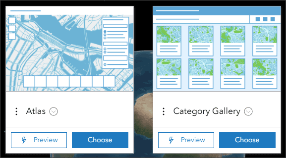
The Instant Apps home page will open, showing the available apps for group content at the top. These are Atlas and Category Gallery.

Category Gallery
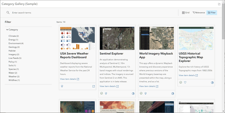
Category Gallery offers users a way to explore the content using search or filters, including categories defined at the group or organization levels. The key value that this app provides is the ability to leverage categorized content from a group. This example shows the app opened with filter and categories displayed.

Category Gallery key features
- Enables viewers to search by category, as well as item type, date created, date modified, date shared, status, and tags.
- Specify map viewing options, including search, legend, scalebar, home button, measurement tools, basemap toggle, and sharing.
- Choose the details displayed on content items, including item type, owner name, date created, date modified, view count, link to item page, and full summary.
- Provide a title, and optionally customize the contents of the header via HTML.
For more information, see:
- Explore content with Category Gallery (Blog)
- Category Gallery item details
- Category Gallery (Help)
- Categorize content (Help)
Atlas
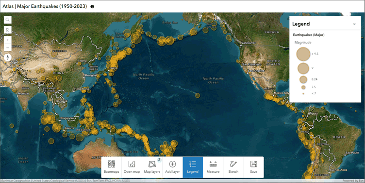
Atlas provides viewers with tools to explore layers in a group with essential mapping and data exploration capabilities. You can add a group of content for your audience to explore with measurement tools and the option to view in 2D or 3D. The app can be configured to allow viewers to add layers, adjust transparency, view data as a table, export a map as an image or PDF, or save the map to their ArcGIS account.

Atlas key features
- Choose basemaps and open maps to explore them.
- Add layers and view more about them in the side panel.
- Toggle between 2D and 3D.
- Use simple markup tools to highlight places on the map.
- Save your work by exporting to a PDF, generating a screenshot, or (if enabled) sign in to save map to your content.
For more information, see:
-
- Introducing Atlas (Blog)
- Atlas item details
- Atlas (Help)
More information
Group galleries and group based gallery apps enable you to present a specific collection of content in a meaningful way to your audience, whether it be the public, organizations you are working and sharing with, or specific users within your organization. Group galleries and gallery apps are designed to work with the items you add to a group, and offer different ways to present those items beyond the standard capabilities of the group alone.
For more information, see


Commenting is not enabled for this article.