As a GIS or image analyst, having a strong system to store and process your images is important. This is especially true when your collections need to be shared with other organizations, users, or internal stakeholders. Whether you’re using imagery to provide context through visualization or conducting analyses ranging from simple hillshade calculations to complex feature extraction and suitability assessments, ArcGIS Online offers the ideal solution. This SaaS-based platform allows you to host, manage, analyze, and visualize your imagery seamlessly, without the hassle of deploying and maintaining on-premises infrastructure.
We’re excited to announce that imagery hosting and analysis in ArcGIS Online are now more accessible than ever! Previously, these capabilities were only available through the ArcGIS Image for ArcGIS Online extension. Now, with recent updates, Creator user types and higher can host imagery, and Professional user types and higher can perform image analysis—without needing any additional extensions.
What This Means for Users
Simplified Access to Image Hosting
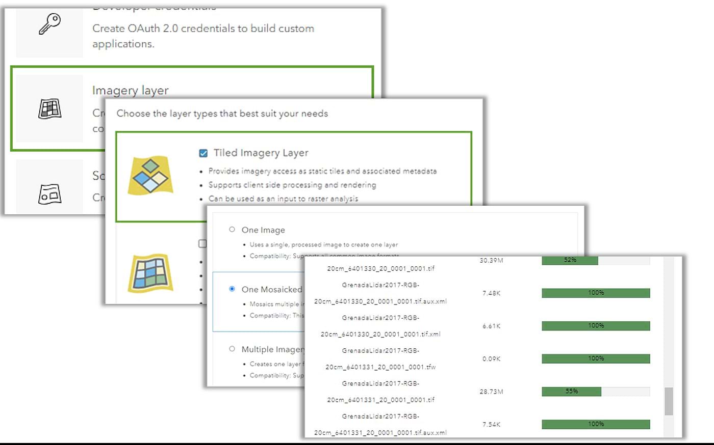
If you’re a Creator user type or higher, you now have the ability to host imagery directly in ArcGIS Online. This feature was previously reserved for those with the ArcGIS Image for ArcGIS Online user type extension, limiting access to a smaller subset of users. By integrating this capability into the Creator user type, we’re empowering more users to upload, store, and share imagery as part of their GIS projects.
Whether you’re working with satellite images, drone-captured data, or other forms of raster data, the ability to host imagery in ArcGIS Online opens up new possibilities for collaboration and data management. You can easily share your hosted imagery with colleagues, integrate it into web maps, or use it as a base layer for further analysis.
Access to Advanced Image Analysis
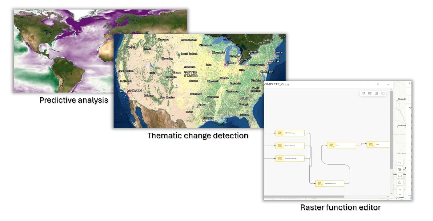
For those with Professional user types or higher, the benefits are equally exciting. In addition to hosting, you now have access to a suite of image analysis tools directly within ArcGIS Online, without the need for additional extensions. This includes capabilities like performing classification, extracting features, and conducting change detection, all within the familiar ArcGIS Online environment.
By making these powerful analysis tools more widely available, we’re enabling a broader group of professionals to extract valuable insights from their imagery data. Whether you’re in environmental monitoring, urban planning, or resource management, the ability to perform sophisticated image analysis can dramatically enhance your work.
Why It Matters
This update makes it easier to use imagery in GIS. It makes these tools easier to use and lets more people use these powerful tools. Whether you’re managing satellite data, drone imagery, or other raster data, these new capabilities will enhance your ability to collaborate, analyze, and make data-driven decisions. It’s about democratizing access to tools that can drive more informed decision-making, foster collaboration, and unlock new insights from spatial data.
Moreover, this change aligns with the growing need for organizations to work with imagery data. As the availability of high-resolution satellite imagery, drone data, and other forms of raster data continues to increase, so does the need for accessible tools to manage and analyze this data. With these updates, more users in our community can now fully participate in the imagery workflow, from hosting to advanced analysis.
Getting Started
If you are a Creator or higher user type, you can create and host imagery layers, and as a Professional or higher user type, (in addition to hosting), you can perform advanced image processing and analysis directly from within ArcGIS Online. These features are now live in your ArcGIS Online account. Dive in and start exploring the expanded possibilities for your projects today!
We’re thrilled to see how our user community will leverage these new tools to push the boundaries of what’s possible within your GIS. Whether you’re sharing pictures for a local project or doing research for a global initiative, we think these updates will make your work more powerful and effective.
Learn more about ArcGIS user types and how they’ll help you align team roles, connect your organization, streamline administration, and scale as your needs grow.
Looking Ahead
As we continue to develop and expand our imagery capabilities, our focus remains on making our technology as accessible and useful as possible. We’re excited to see how our users will use these updates. We’re also looking forward to more new ideas that will help the global imagery and GIS community. Be sure to visit the web to learn more about integrating imagery and remote sensing with GIS.


Article Discussion: