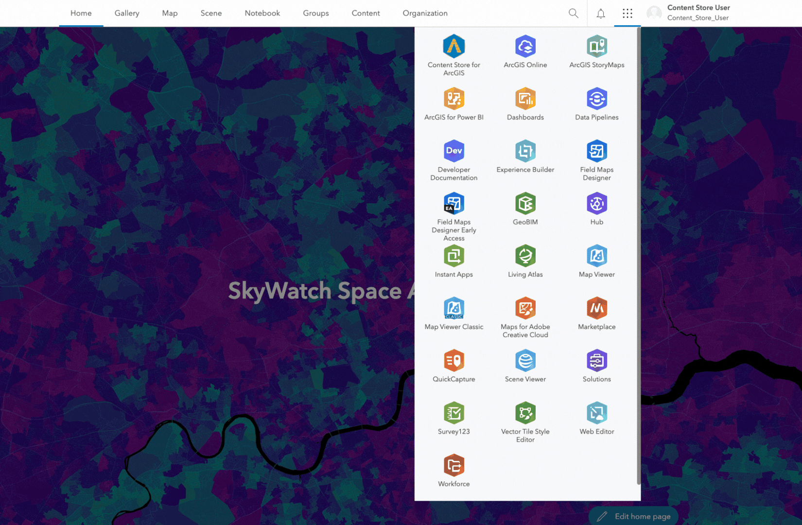
Introducing Content Store for ArcGIS
Imagine you’re a city planner tasked with mapping out a new development project. You need a current, high-spatial resolution satellite image to understand the surrounding terrain, identify potential issues, and present a clear, detailed plan to the city council and the public. Commercial satellite imagery can provide the level of detail required, but you’ve found the process of finding and purchasing it to be challenging. In the past, you’ve spent a significant amount of time navigating through multiple provider portals. And, each has its own set of requirements and pricing structures. Coordinating and negotiating contracts with different imagery providers can be a lengthy process, which certainly hinders real-time insights. There’s also a risk that the imagery you buy may not meet the needs of the project. All of this can delay your project and increase costs.
But what if there was a simpler way? Enter Content Store for ArcGIS, a new way for ArcGIS users to discover, purchase, and integrate premium commercial satellite imagery with their projects.
Discover and Purchase Commercial Satellite Imagery in ArcGIS.
Say goodbye to the days of juggling multiple provider portals and navigating cumbersome procurement processes for purchasing imagery. Content Store for ArcGIS brings together a wide range of current, high-quality commercial satellite imagery from multiple providers, all in one place. This consolidated data is then made available through ArcGIS, streamlining the procurement process. Featuring imagery from Esri’s cornerstone Esri Partner Network (EPN) partner, Maxar, as well as other leading commercial data providers, this ArcGIS app was created jointly by Esri and SkyWatch, a trusted ArcGIS partner and the world’s leading geospatial data platform. Now, you can swiftly find and purchase the imagery you need for any area of interest, streamlining your workflow, and saving you time.
Content Store for ArcGIS is now available in ArcGIS Online and coming soon to ArcGIS Enterprise. It allows you to enrich your GIS with premium commercial satellite imagery with the detailed visual context and valuable insights only high-resolution imagery can provide. It also ensures you have access to the highest quality imagery tailored to your specific needs, offering significant benefits whether you’re an individual user or you want to provide easy access to imagery for your entire organization.
Streamline Your Imagery Search
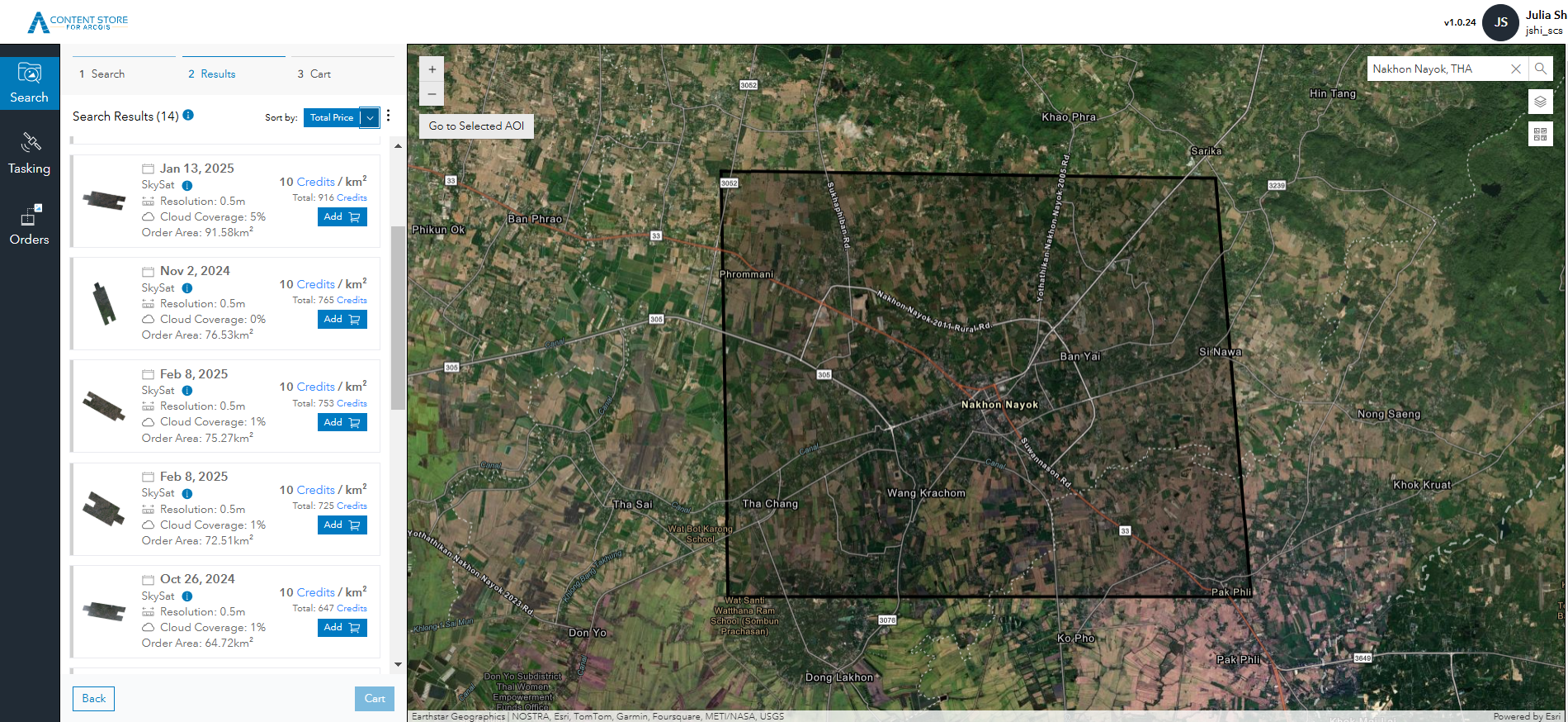
Content Store for ArcGIS provides a centralized solution that simplifies the process of searching for imagery from multiple sources. One of the key features is the ability to use your ArcGIS content to define your area of interest precisely. This ensures that you are searching within the exact geographic boundaries relevant to your project. Additionally, you can filter search results by spatial resolution, capture date, cloud cover, and price. These capabilities help users find the most relevant and accurate imagery faster, enhancing the quality and relevancy of your work.
A Simple Purchasing Process
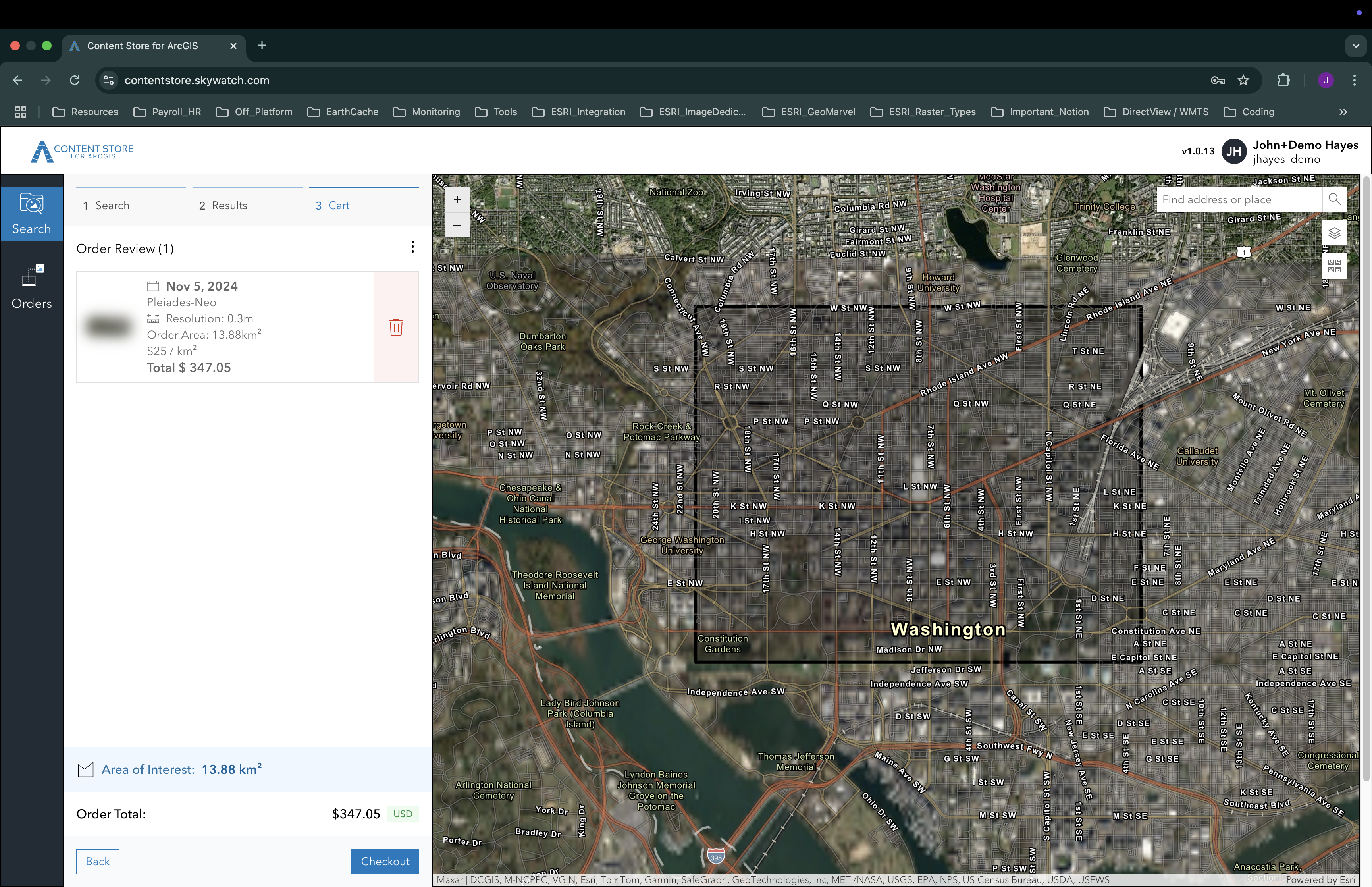
Finding and purchasing the right imagery for your project has never been easier. Once you identify the imagery you need, you can sign in using your existing ArcGIS Online credentials and proceed with the purchase. Whether you choose to pay with a credit card or use Content Store for ArcGIS data credits provided by your organization’s administrator or data procurement manager, the process is quick and straightforward. This ensures you get the imagery you need to optimize your projects.
For data procurement managers, the process is equally seamless. They can simply sign in with their own ArcGIS Online credentials and purchase imagery for the whole organization. They’ll have the flexibility of paying on demand with a credit card, or they can purchase prepaid Content Store for ArcGIS data credits, which can then be allocated to you and other users. This streamlined approach eliminates the usual procurement delays, allowing you and other ArcGIS users to create maps, visualizations, and other resources more efficiently, ultimately helping everyone make informed decisions.
Feel Confident About Your Imagery Investments
A significant consideration in purchasing commercial imagery is ensuring that it meets your specific needs. Content Store for ArcGIS addresses this by providing a low-barrier, low-commitment solution. You can test and vet small amounts of data before making a larger investment, ensuring that the imagery is exactly what you need. This allows you to focus on purchasing only the imagery for the precise areas you require, maximizing the value of your investment. By investing a relatively small amount upfront, you can achieve a higher return on investment (ROI) and minimize the risk of ordering imagery that doesn’t serve your purpose.
Use Purchased Imagery to Complement Other Geospatial Data
Integrating commercial satellite imagery with data from ArcGIS Living Atlas and other public sources adds substantial value to your geospatial analysis. While open imagery provides a broad and accessible foundation to your GIS, commercial imagery often offers higher resolution, more frequent updates, and supports specialized requirements for the area of interest or analysis. This ensures a more comprehensive and accurate geospatial dataset. By using both, you can enhance your insights and decision-making processes, so your projects are based on the most reliable and up-to-date information available.
Flexible Use Cases to Help You Maximize Your Imagery Investment
Once you have the imagery you need, it’s ready for a wide range of applications. You can preview it on a map, download it to your local environment, or publish it as a layer to your ArcGIS Online organization. This seamless integration sets the stage for powerful sharing and analysis within the comprehensive ArcGIS imagery system.
Visualize and Analyze Your Imagery or Use it for GeoAI
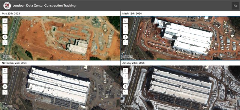
You can use ArcGIS tools to visualize and analyze the imagery you purchase, depending on your ArcGIS user type. Or, you can use ArcGIS GeoAI capabilities to automate extracting insights from your imagery. For example, a conservationist can leverage satellite imagery to monitor deforestation and generate True Orthos to share findings with environmental agencies and the community, raising awareness and driving action. This helps you make informed decisions and communicate your insights effectively.
Share Your Imagery and Analyzed Results in the Context of a Map
With the imagery you purchase through the Content Store for ArcGIS, you can create and share web maps and apps—either with your organization or with the public. For example, a city planner can create a web map of a proposed development area and share it as a web app with city council members and the public to gather feedback and support. This facilitates group decision-making and enhances awareness of the project.
Stay Tuned for More Data and More Access Options
Future releases of ArcGIS will expand the availability of Content Store for ArcGIS to additional user environments. We will also introduce new types of imagery from more Esri partners, as well as additional content for use in ArcGIS. Whether you’re a city planner, environmental specialist, or business analyst, ArcGIS will empower you to easily access commercial satellite imagery to make more informed decisions. Get ready to jumpstart your geospatial projects with this enhanced imagery! Visit the ArcGIS Marketplace to start enabling seamless imagery purchases for your organization.
More Opportunities to Learn and Share with Others
- Check out Content Store for ArcGIS in this live recorded demo.
- Find technical information on how to set up Content Store for ArcGIS.
- See what Jack Dangermond said about Content Store for ArcGIS in this clip from Esri FedGIS 2025 plenary presentation.
- See how Content Store for ArcGIS can enable seamless access to imagery purchases for your organization in this video
- Watch and share this short video
- …and don’t forget to read about what else is new in ArcGIS Online for February 2025!


Article Discussion: