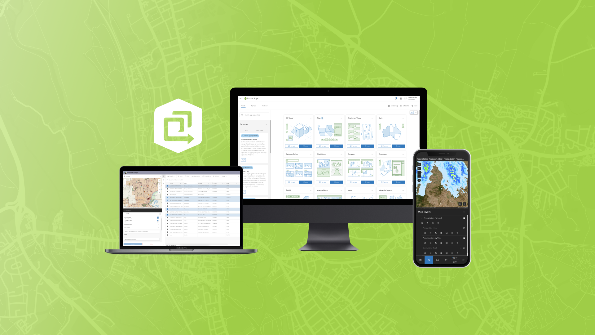
The February 2025 ArcGIS Online update introduces new features and key updates throughout the site. The same applies for ArcGIS Instant Apps, as we have rolled out several updates and new features to our existing apps, further improved choosing and managing your apps on the Instant Apps home page, and addressed various bugs and enhancements to help stabilize and improve your experience across the site. See the highlights below.
Instant Apps home page updates
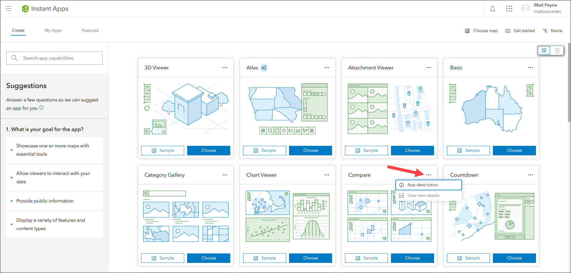
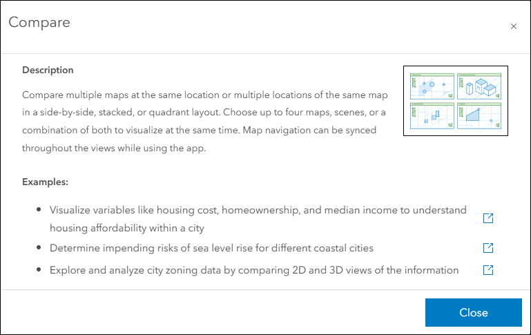
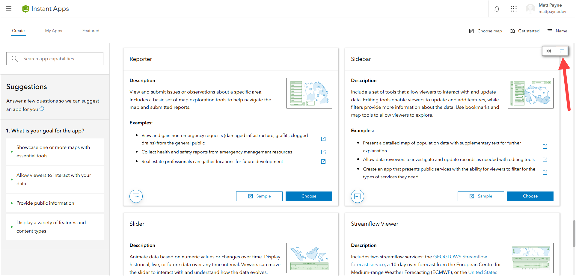
The Instant Apps home page offers a centralized place to browse, choose, create, and manage ArcGIS Instant Apps. We have redesigned the user interface to give you a cleaner and more efficient experience when using the site. Each app template on the Create tab has a brand new thumbnail illustration that gives a high level glance at what that template can offer. To quickly see details about what each template does, click the ellipses icon located in the top right of each card and choose App description. Included with every template are three live sample apps associated with each example to provide a deeper look into what that template can achieve.
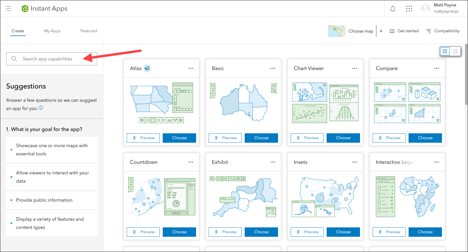
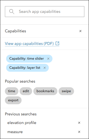
Use the search box now located in the left side panel to search for app capabilities, tools, and settings. For example, to find which templates offer a time slider and the ability to use a layer list, search for “time slider” and “layer list”. The search box supports multi term selection to help further refine your results. Unsure what to search for? Utilize the new popular search terms located in the Search panel to get started discovering apps containing popular and useful tools.
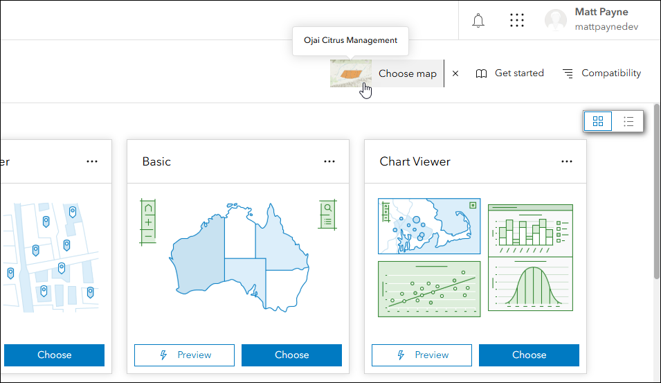
Choosing a map in the Instant Apps home page is a very useful way to get started towards creating an app. Use the Choose map button in the header to pick a map for the first time, or to change to a different map. Use the toggle at the top of the resulting window to choose a web scene or group, as well. The Instant Apps home page reads your map, scene, or group and filters the template choices based on which ones are compatible with what you chose.
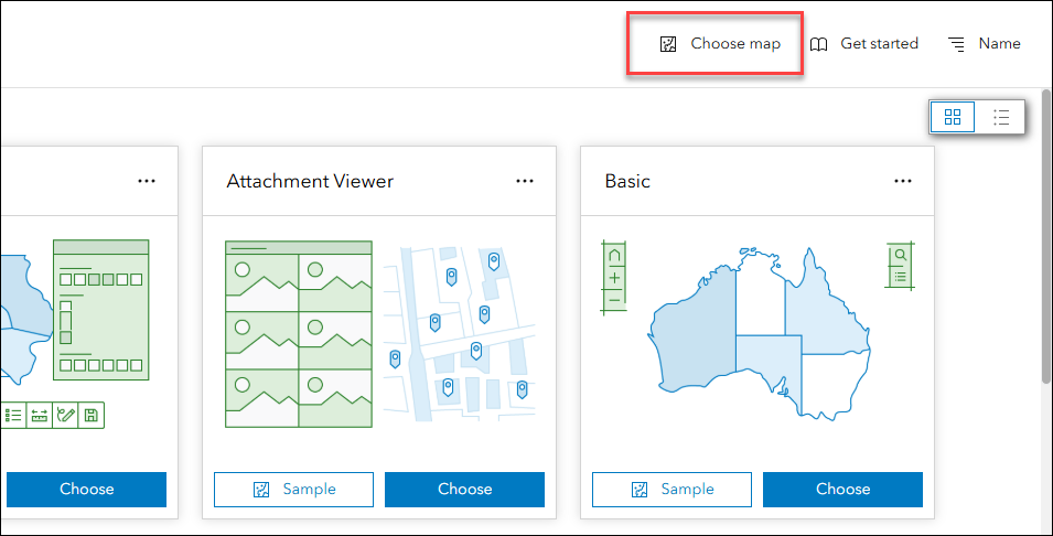
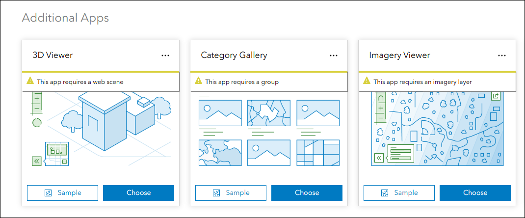
Note that if you came to the Instant Apps home page from Map Viewer, your map is already selected in the Instant Apps home page and is noted in the header with it’s thumbnail and title in the hover tip. All templates that are compatible with your map are listed first. Templates that are not are listed under the Additional Apps section below with messages noting the reasons for incompatibility.
To access a more detailed view of available templates with all information up front, toggle to Details view in the upper right.
The My Apps tab is a space to manage your existing apps created using Instant Apps. Toggle to this tab from the left side of the header of the Instant Apps home page.
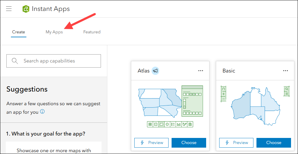
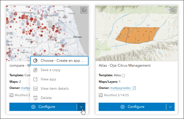
Use the Configure button at the bottom of app cards to edit and republish updates to any of your apps. Access the drop-down menu on the Configure split button to find other useful operations such as instantly saving a copy of your app.
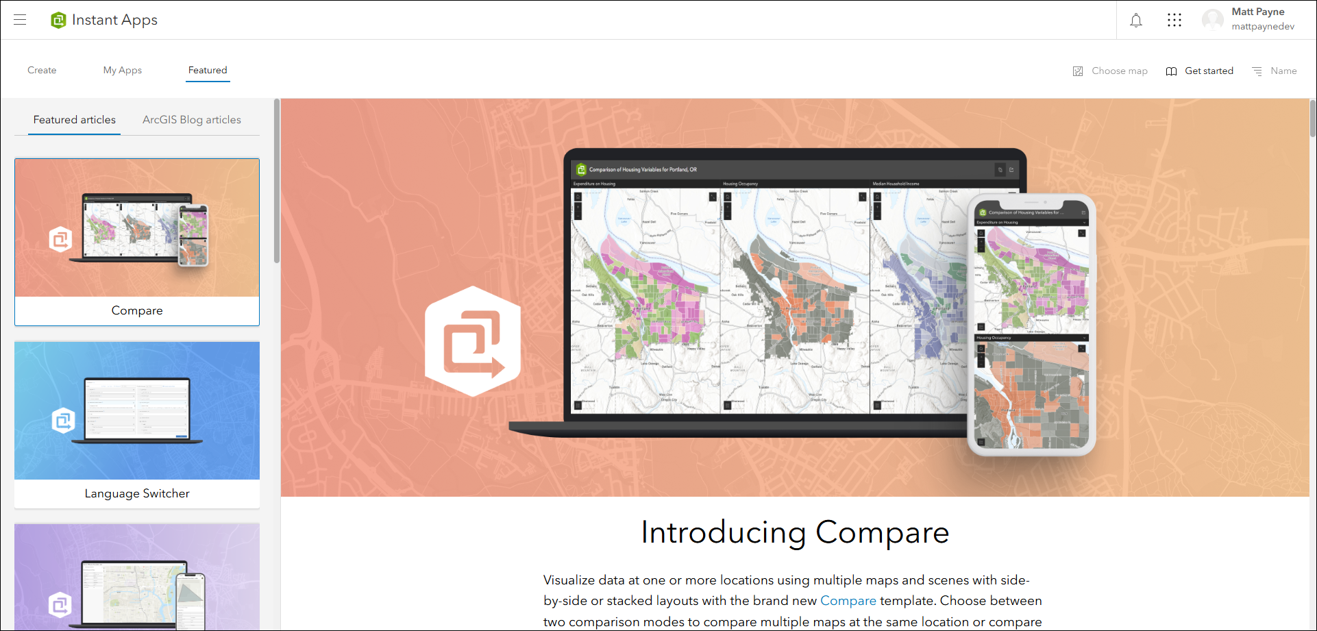
Access the Featured tab to discover new and useful information about Instant Apps. We update this page with each release to highlight a template, tool, or workflow.
Atlas updates
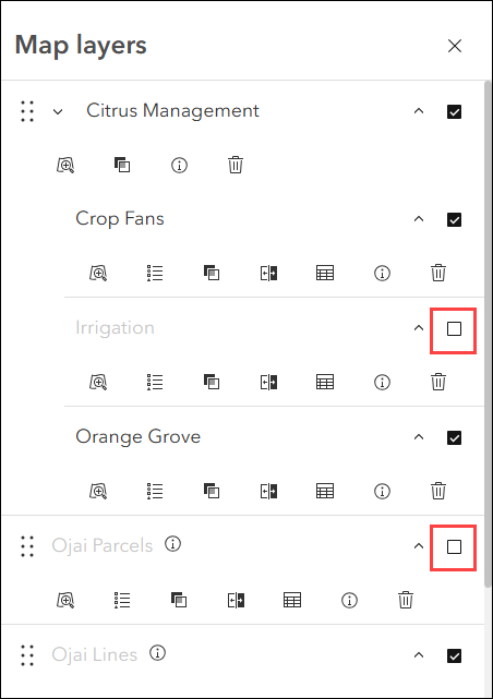
Atlas provides viewers with tools to explore maps and layers with light weight mapping and data exploration capabilities. Viewers can open a map and add individual layers to it. They can utilize measurement tools, generate an elevation profile, toggle the view between 2D and 3D, use a swipe tool and adjust transparency on layers, and view data as a table. A few exciting updates have been made to the Map layers panel making it easier to use on smaller screens and explore layers and their tools.
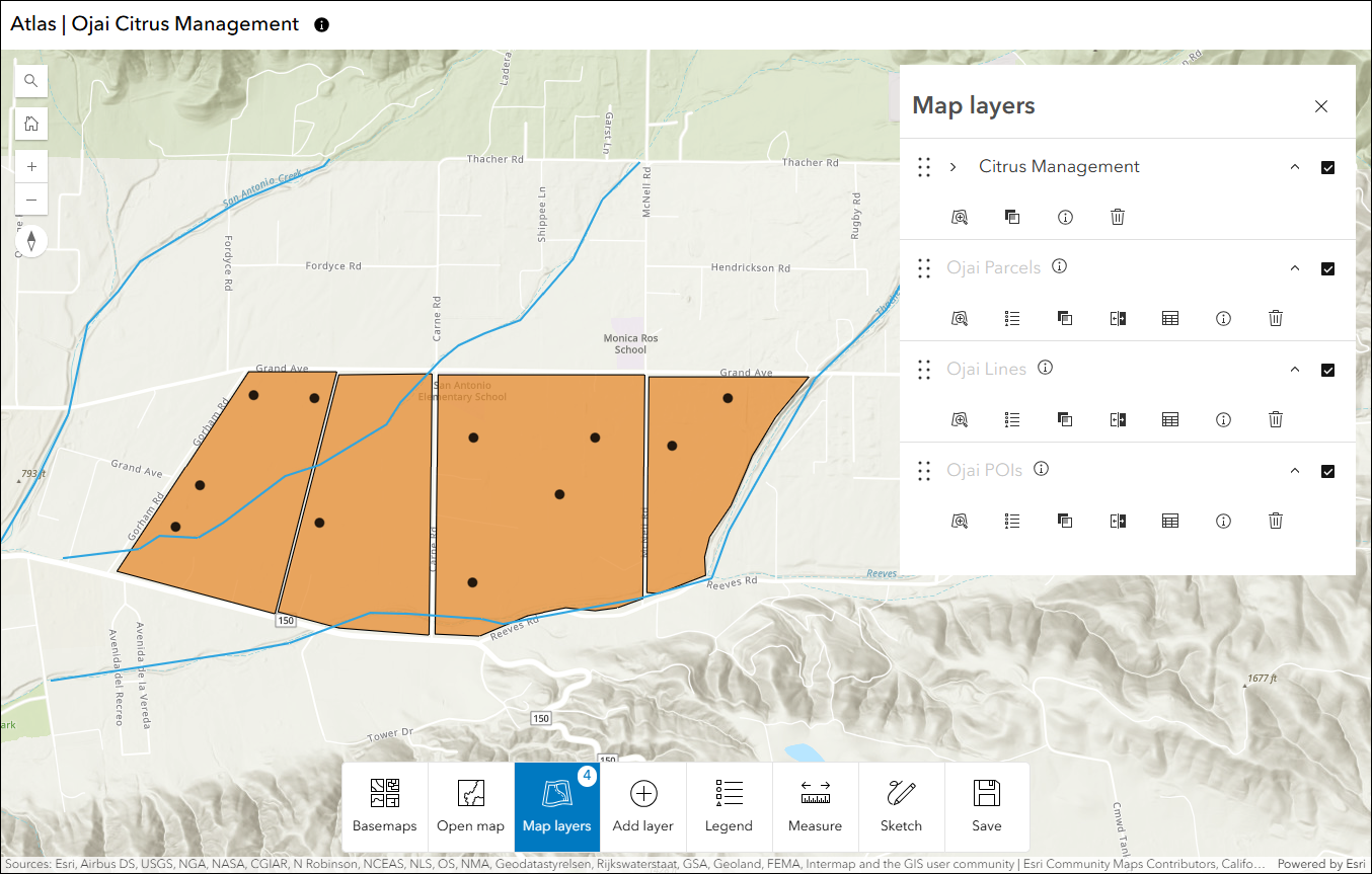
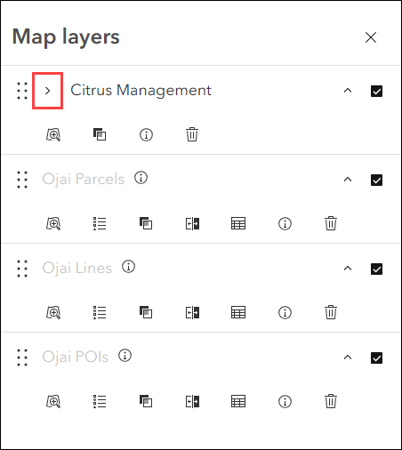
Group layers are organized together and conveniently indented in the list making them easily distinguishable from other layers. They can be expanded or collapsed with a click.
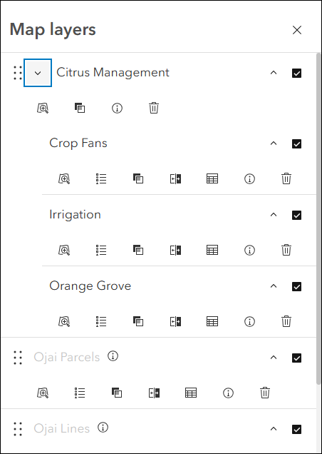
When the map’s zoom level is outside of a layer’s visible range, the layer name will appear grayed out with a new hover tip icon that provides the app viewer with context. Once the layer is visible in the map, the icon will disappear and the layer name will no longer be grayed out.
Toggling layers in the Map layers panel on and off is now controlled by a single checkbox next to each layer in the list.
Manager updates
Review and edit data from multiple maps and layers using the Manager app template. For example, review problems and feedback with new public transit stations that were collected using crowdsourcing. Use the app configuration to choose each map used in the project that you want included for review. A browser in the configuration lets you search and find any map you have access to so that there’s no need to rely on having everything contained inside a single group.
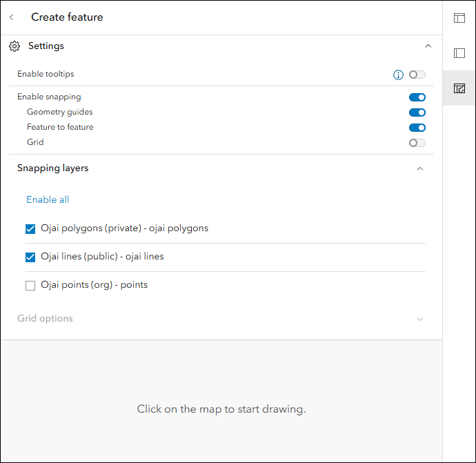
Utilize the new snapping tool options when creating new features or editing the geometry of existing features. Enable snapping from the Settings drop-down in the app when editing and decide which layers will participate and which types of snapping are allowed.
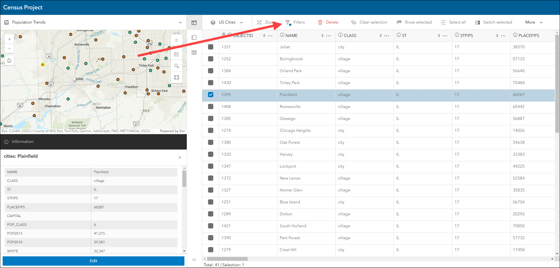
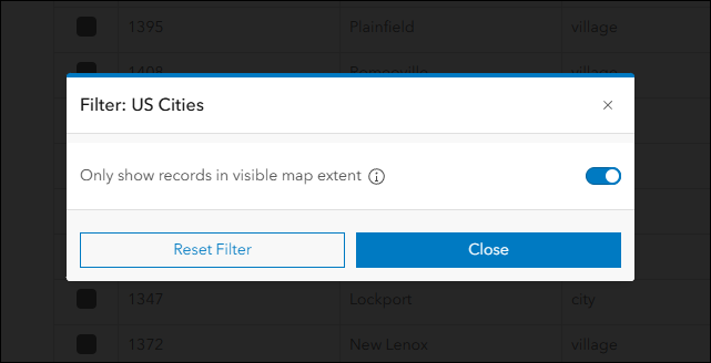
Take advantage of the new option to filter the table by map extent to get a focused, condensed list of table records based on what you see in the map. In both Split view and Table view layouts, click Filters in the top table header to access this new setting. Note that while editing a feature in the map, this setting will not be respected.
Reporter updates
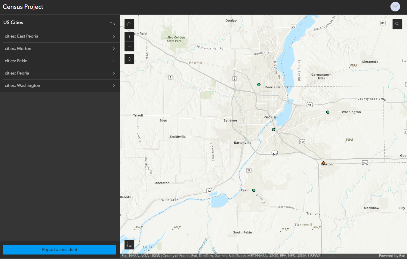
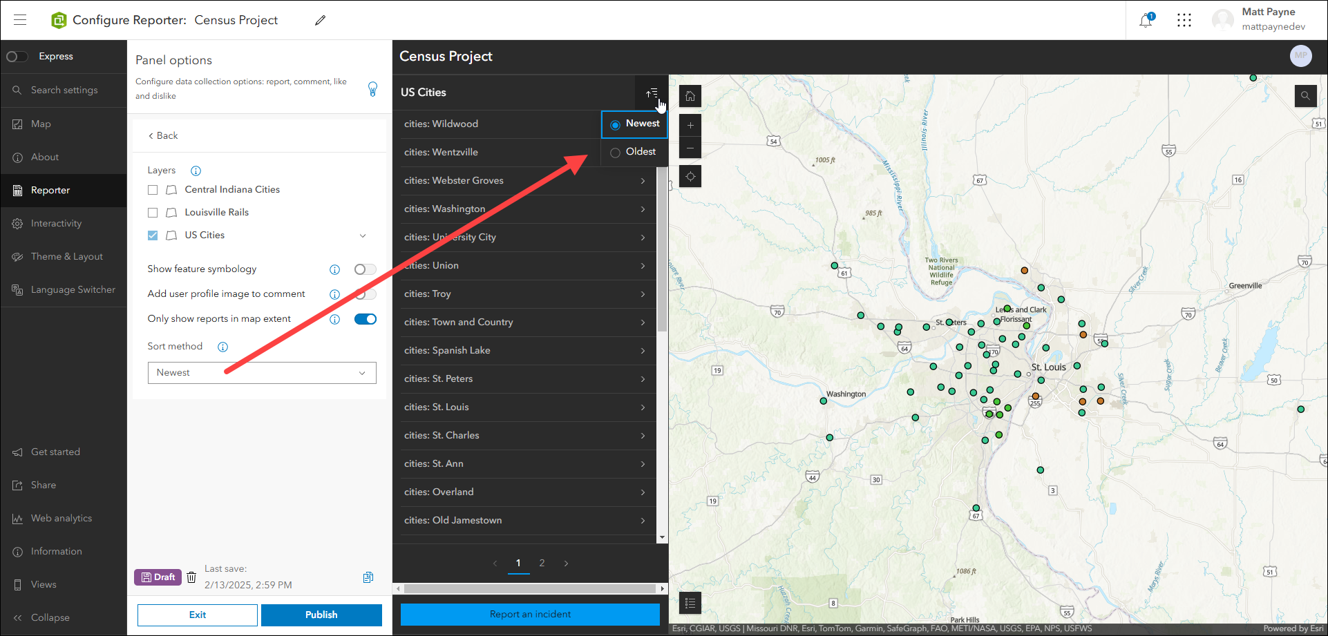
View and submit issues or observations in an area using the Reporter app template. This app lets users create a report that displays on the map. They can also view existing reports and use basic map exploration tools to navigate the map. App creators now have the option to configure their apps to filter reports by map extent. When enabled, the app will display a focused list of reported incidents based on what you see in the map as you pan and zoom.
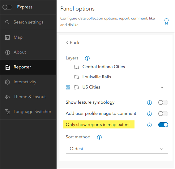
App creators also have a new option to determine the default sort method for reports in the panel. This controls how reports are sorted by default, and app viewers can still modify this as needed when using the app.
For further details about what’s new, check out our What’s New in Reporter (February 2025) blog.
Screenshot and Export tool updates
The Screenshot tool has been retired with the February 2025 update. It has been replaced with the Export tool, which has full functional equivalency of Screenshot plus more. Your existing apps that contain the Screenshot tool will automatically include Export in its place with no configuration needed on your part.
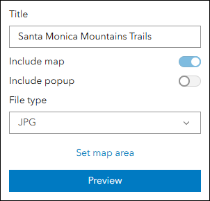
Utilize Export in your apps as the primary tool to create images or screenshots of the map. Including an Export tool in your app is a great way to allow app viewers to capture and share what they see. Recently, we’ve expanded the file type choices to include PDF, JPG, and PNG. When exporting your map, the tool includes a drop-down menu to choose the desired file type. If your app uses a custom image for the app logo, this will also be included in the export. The Export tool can be added to most apps by enabling it in the app configuration on the Interactivity settings > Share tab.
Deprecation Notice for ArcGIS Configurable Apps
As of the June 2023 update of ArcGIS Online, a deprecation notice has been issued for ArcGIS Configurable Apps. Deprecation does not impact the availability, functionality, and Product Lifecycle Support phase of ArcGIS Configurable Apps.
ArcGIS Configurable Apps continues to be available until it is officially retired, but will not receive new features or other enhancements. Before retirement, users are still able to create apps using ArcGIS Configurable Apps templates and existing apps will continue to work.
Retirement of Configurable Apps is expected to happen in the Q1 2026 release. Please take a look at our detailed announcement blog: Deprecation Notice for ArcGIS Configurable Apps.
More information
For more information please reference our documentation page where you can find details about getting started with creating and sharing ArcGIS Instant Apps.

Article Discussion: