Need to gather some simple information and put it on a map?
The GeoForm is a configurable web mapping application template for form-based data editing of a Feature Service through the web browser. This application allows users to enter data through a form instead of a map’s pop-up, while leveraging the power of the Web Map and editable Feature Services. It can be deployed right from ArcGIS Online using the “Create Map App” workflow or by developers by downloading the code from GitHub.
Since the release as an Early Adopter template in July, we’ve improved the GeoForm by listening to your feedback, user testing the app, and adding some nifty features. We’ve fixed nearly 100 GitHub issues, consisting of feature requests, user experience enhancements, and pesky bugs.
Some of the added features and highlights include:
- Date-time picker
- Field format type support
- Ability to change how fields are displayed
- Additional BootSwatch styles to choose from (Bootstrap themes)
- Basic offline editing support
- Additional coordinate entry types
- Localized template to different languages
- Subtype and range domain fields support
- Full screen button to the map
- UI/UX improvements (based on usability and user feedback)
- Lots of bug fixes
The Future
We still have a lot to do. Here’s our planned roadmap of enhancements:
- A view to browse entries via a map or listing
- More attachment options
- Improved mobile pop-up
- Various bug fixes and user interface enhancements
Other features we are considering:
- Author-viewer mode to edit existing submissions
- Multiple layer support
- Line and polygon features
- A group of sample feature services for data collection
Try It Out
It’s now a part of the standard Esri Templates group, so you can start building your very own GeoForm right away.
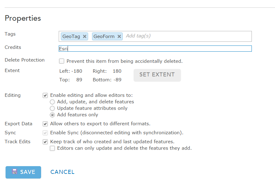
1. Create an an editable feature service, add features only is recommended. Add this layer to your web map.
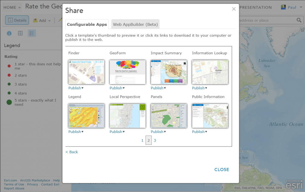
2. Share your web map as a web mapping application
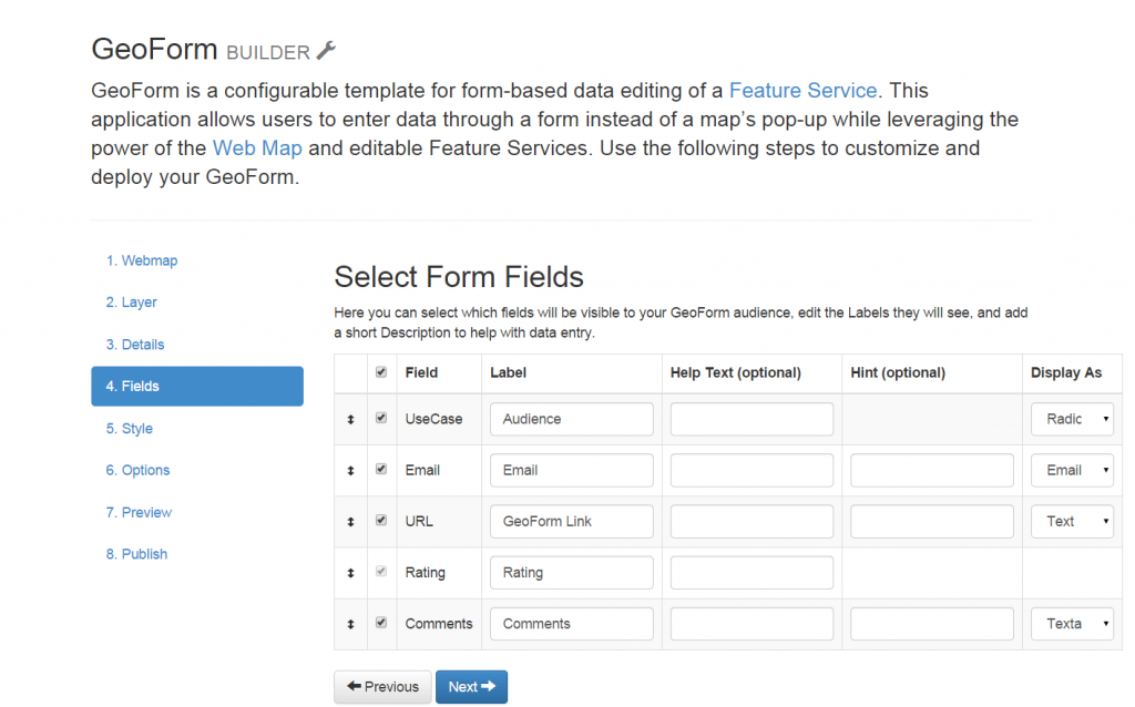
3. Use the GeoForm Builder to configure and share your new application
We have heard organizations talk about using this app for a variety of scenarios:
- Mapping the location of an organization’s members
- Crowdsourcing disaster related information from the Public
- Recording search and rescue incident information and location
- Teaching students about wildlife monitoring
- Gathering customer feedback for cellular service areas
- Sharing a story of kindness
Here’s a sample we put together letting you rate the GeoForm.
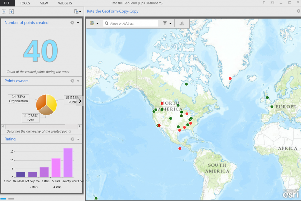
We will be monitoring your feedback using the Operations Dashboard.
Also, do you need to create a quick feature service to test this out? Try Option 2 in this blog: How to create a hosted feature service.
Help Us Help You
Please send us your feedback via the GeoForm, GitHub, or on the ArcGIS item to help make this template even better. If you’re a developer, we’d like to see your customizations, as well.
Thanks for reading and we look forward to your feedback.


Commenting is not enabled for this article.