We are very excited to share that notebook web tools are now available in the June 2024 update of ArcGIS Online.
Think of a notebook web tool as a means of running the Python code in an ArcGIS Notebook via a simple web tool with a few input parameters. This web tool can then be consumed in client applications such as the Map Viewer, ArcGIS Experience Builder, or other web apps. With this functionality, users can run complex Python workflows without ever seeing any code!
Use Cases for Notebook Web Tools
- Custom map print service: you can author a notebook that uses arcpy.mp to automate map layout and design, then publish it as a web tool. Users can zoom to a location in a web map or web app, then run this web tool to produce a PDF map of that location with all required map elements (e.g. title, legend, scale bar, north arrow, etc.)
- Printing report templates: you can create a notebook that automatically configures and updates a Survey123 survey based on new input data. You can then publish this notebook as a web tool and expose that web tool as an Experience Builder widget that prints a custom report template generated by data from the survey.
- Data cleaning and updates: you can author a data cleaning notebook that ingests an input feature layer and removes missing values, formats attribute names, and recalculates its spatial extent. You can share this notebook as a web tool to your colleagues who are not familiar with Python or data engineering so they can use it to clean and prepare their feature layers.
Notebook web tools can be published by notebook authors who have the Publish web tools privilege. When the notebook web tool is shared, it can be consumed by other members of your organization who have the Run web tools privilege.
Notebook web tool tutorial
Check out the Notebook web tool tutorial for a complete tutorial on how to author and publish a web tool from scratch. The web tool created in this scenario allows you to identify electric vehicle (EV) charging stations along a route.

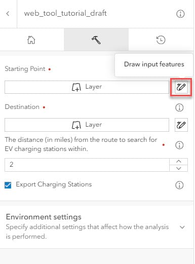
Example of the notebook web tool user interface in the Map Viewer.
Behind the scenes, there is a bunch of Python code that pulls in data, then performs the network analysis and spatial queries within the notebook. However, all the web tool user needs to do is pick the start and end point of the route and the search distance from it. Give the workflow a try with your own locations!


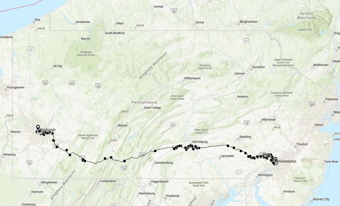
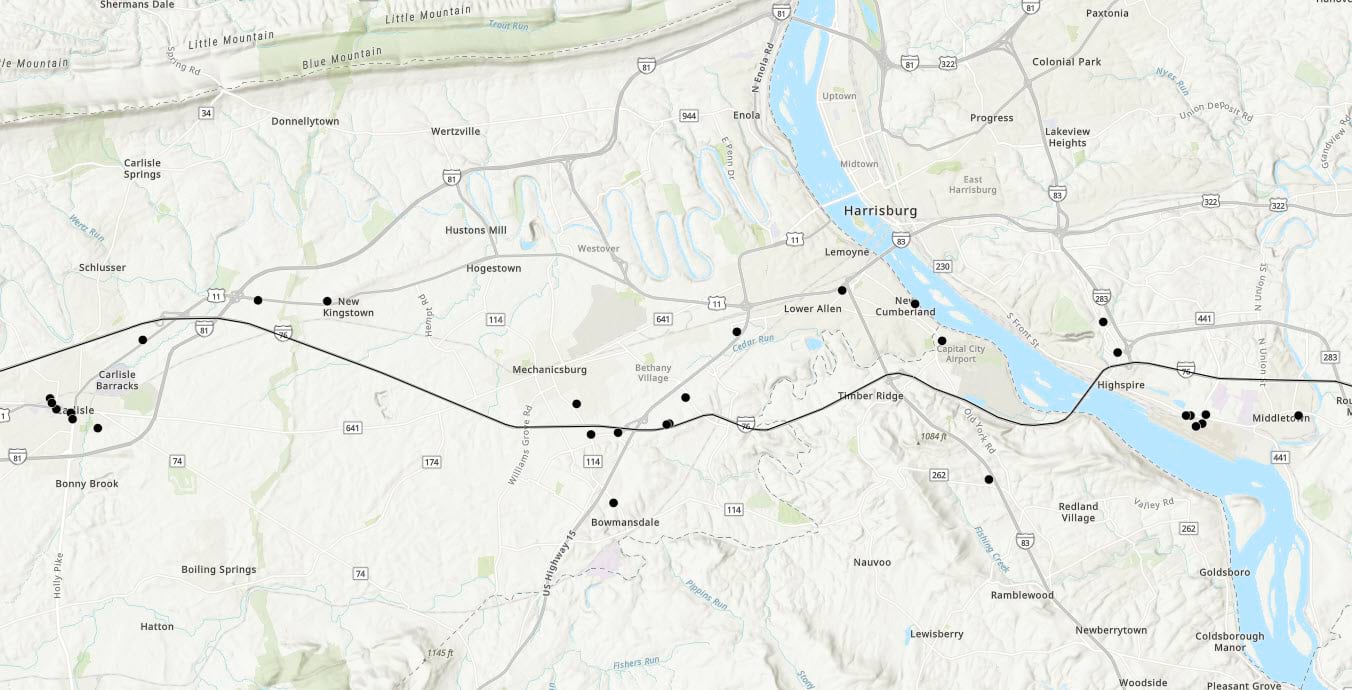
Outputs of the notebook web tool showing the route between Philadelphia and Pittsburgh, Pennsylvania with EV charging stations along the route.
Join the Esri Community
Whether you want to talk specifically about notebook web tools, or about ArcGIS Notebooks in Online, Enterprise, or Pro in general, please join the ArcGIS Notebooks community . Ask questions, share ideas, and get help from your fellow notebook users. You can also visit the ArcGIS Notebooks product page for product level information and quick links to resources.
If you are interested in learning about other exciting updates in ArcGIS Online, please read the What’s New in ArcGIS Online (June 2024) blog.

Article Discussion: