For the past few years, we have encouraged ArcGIS Online administrators to update the basemap gallery for their organization to use Esri’s vector basemaps, which most have long since done. One of the benefits of using the vector basemaps is their localization. The set of vector basemaps shown in the basemap gallery varies based on the region and language settings of the organization and user.
As described in this earlier blog article, if the organization region setting is a specific country, such as the United States, the user may see a custom set of basemaps that have been curated for that country. This may include additional country-specific basemaps or custom basemaps with different treatments of disputed boundaries and place names.
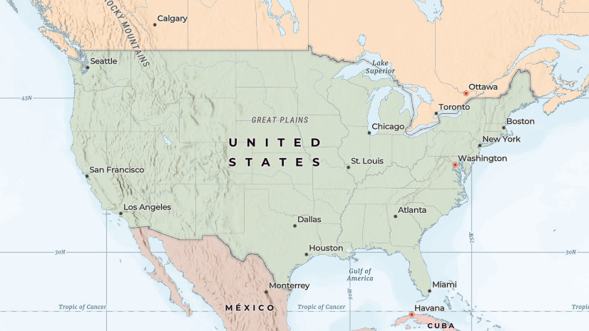
With the latest update of the Esri vector basemaps this week, we have published a new set of custom basemaps for the United States. These basemaps include updated place names recently defined by the U.S. Government, as well as updated treatments of several disputed boundaries and places previously defined by the U.S. State Department.
Accessing Custom Basemaps
If you would like to use the new set of custom basemaps for United States in your work, you should first verify that the region setting for your organization (or public account) is set to United States. When signed in to ArcGIS.com, you can click your name and My settings to confirm if your region is set to United States. If not, you can coordinate with the organization administrator to update the organization defaults like below.

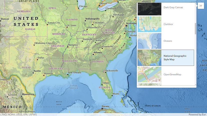
When this is done, you can open the Map Viewer, select the Basemap tool on the toolbar and you should be able to scroll down and see a curated set of country-specific basemaps, including the USGS National Map and others.

If you see these country-specific basemaps, you can select one of the over 25 vector basemap styles that Esri offers (e.g. Topographic, Navigation, Outdoor, etc.) and you will be using one of the new custom basemaps for the United States. If you save a new web map, it will save this basemap layer in your map.
Note: if you are not signed in to ArcGIS.com, the default Topographic map and basemap gallery you see will be based on the country location of your IP address.
Existing Web Maps and Apps
Your previously saved web maps and web apps will continue to use the basemap layer that was saved in the web map when it was last updated. If you’d like to use the new basemaps for the United States, you will need to update the web map(s). To do this, you can open the web map in Map Viewer, select the desired basemap style from the basemap gallery, and save the web map. This will replace the basemap layer item referenced in the web map, and it will inherit any future updates made to this basemap layer.
Custom Basemap Gallery
If you would like to use some but not all the Esri default basemaps for the United States region, or would like to use your own curated set of basemaps, you can create a custom basemap gallery for your organization. You can add selected web maps from the options below, or your own organization.
- United States Vector Basemaps: new set of custom basemaps for the United States (alternative WGS84 versions)
- ArcGIS Online Vector Basemaps: existing set of vector basemaps for World region in English language
- ArcGIS Living Atlas of the World: comprehensive set of basemaps including many creative styles
ArcGIS Pro
If you are using ArcGIS Pro while signed in with your ArcGIS Online account, then the basemap gallery that appears in ArcGIS Pro will be the same as what you would see in Map Viewer in ArcGIS Online, based on your organization’s settings. If you are using ArcGIS Pro while signed in to your ArcGIS Enterprise portal, then the basemap gallery that appears will be the same as what you see in Map Viewer in your Enterprise portal.
ArcGIS Enterprise
If you are using an ArcGIS Enterprise portal, then basemap gallery will be based on your portal language settings and will not include the custom basemaps for the United States or other regions, as regions are not supported in Enterprise. However, ArcGIS Enterprise organization administrators can customize basemaps used in the ArcGIS Enterprise portal. Enterprise users that have access to ArcGIS Online can create web maps that reference the United States vector tile layer items hosted in ArcGIS Online for use in the basemap gallery. More details on this option are available in this ArcGIS Enterprise blog article.
Conclusion
As described above, ArcGIS Online includes a wide variety of basemap styles and options that are designed to support a diverse set of use cases and user communities. We would encourage you to configure your ArcGIS organization to offer the most appropriate set of basemaps for your content creators and end users.

Commenting is not enabled for this article.