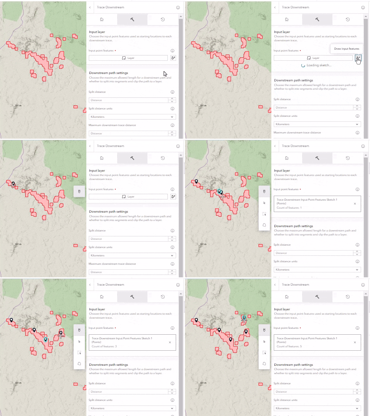
Drawing sketch layers is a quick way to add a small number of features to a web map in Map Viewer. Sketch layers can be points, lines, or polygons, and are supported as feature inputs for analysis.
The February 2024 release of ArcGIS Online includes support for drawing sketch layers from the analysis pane for select analysis tools and raster functions. This enhancement allows you to create sketch layers for your analysis without exiting the analysis pane.

Drawing sketch layers is supported for input parameters that require geometry but no other attributes (for example, it’s not supported for inputs that calculate summary statistics). When drawing sketch layers is supported, the Draw input features button will appear next to the button to select a layer.

Example
You want to analyze mining sites in the Amazon rainforest to determine how pollutants will flow through a water network. The mining sites are available as a polygon layer. You can draw points to use as an input to the Trace Downstream tool.
Data attribution
The mine_locations hosted feature layer is based on a dataset produced by the Amazon Mining Watch project. It was imported from its original GEOJSON format.


Article Discussion: