ArcGIS Mission is an Esri solution to event management when command and control of a situation are paramount. Mission establishes a constant flow of information between command post operations personnel and responders in the field through personnel tracking, and communications between all members of a mission. As operations evolve, mission members receive real-time updates, mission-relevant taskings, and have the ability to submit critical intelligence from the field. This constant information flow provides decision makers with the most up-to-date information they need to assure resources are where they need to be when they need to be there. All mission data is logged and securely stored in an organization’s portal environment where it can be used for analysis efforts, after action review, or any other organizational need.
Let’s look at some of the new enhancements and features of ArcGIS Mission 11
Integration with Esri Applications increases Productivity
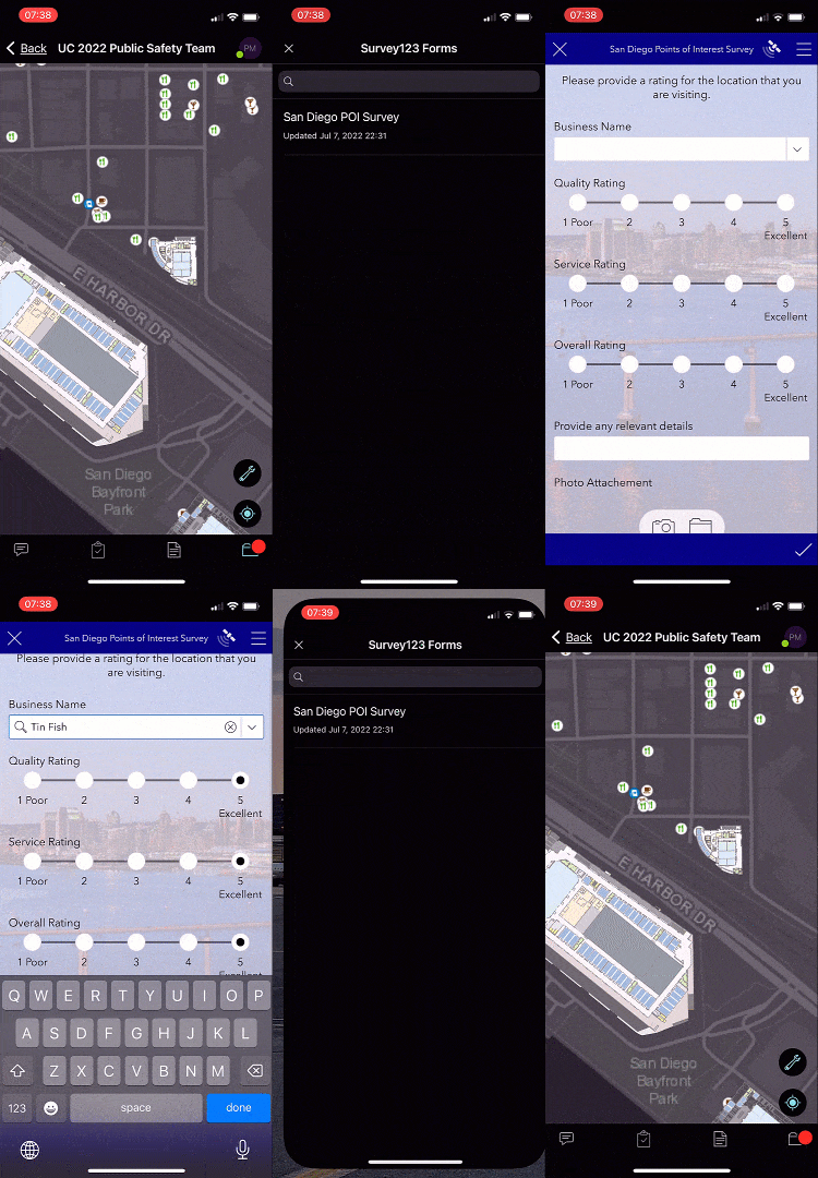
ArcGIS Mission has inclusive tools to capture field intelligence, such as customizable reports which can be created and deployed natively. Many organizations however, still rely heavily on tools such as Survey 123 and custom web applications to accomplish organizational goals. With the release of ArcGIS Mission 11 organizations can now integrate their Survey 123 and custom web applications into any Mission which greatly extends the capabilities of the system.
These apps can now be accessed on Mission Manager and Mission Responder from what was previously known as “Additional Materials” and is now “Materials”. We’ve redesigned Manager and Responder so that these materials can be accessed directly from an active mission map. Once selected, the user will now see any documents and images associated with the mission as well as added surveys or web apps. Selecting a survey or web app will open that item, allow the user to perform the desired functions, and upon completion of the task the user will be returned to the mission environment. This seamless integration makes two apps function as one.

Dark Mode Introduced to Lower User’s Profile
Trying to keep a concealed profile during a low-light operation is a difficult task when a bright screen is accessed. ArcGIS Mission now provides a way to accomplish both with a newly designed “Dark Mode” experience. This experience which has been enabled on both Mission Manager and Responder, provides the ability to easily enable a preferred mode or one that works best for the operating environment with a simple button toggle on Manager or settings adjustment in Responder.
Feature media is demonstrated in Dark Mode
Deep Linking – Why it matters for Mission Responders
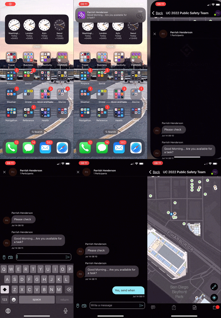
Sometimes, mission events require immediate attention; the faster, the better. Previously notifications from the Mission Responder app would appear as a banner notification on a device. Tapping the notification would simply open the Responder app, but then force the user to navigate to the event through a manual process. Through deep linking, the process is simplified where tapping on the notification will now take the user directly into the message or report that generated it, within the app. This streamlines the process providing a more streamlined experience for field responders.

View submitted reports in Mission Responder
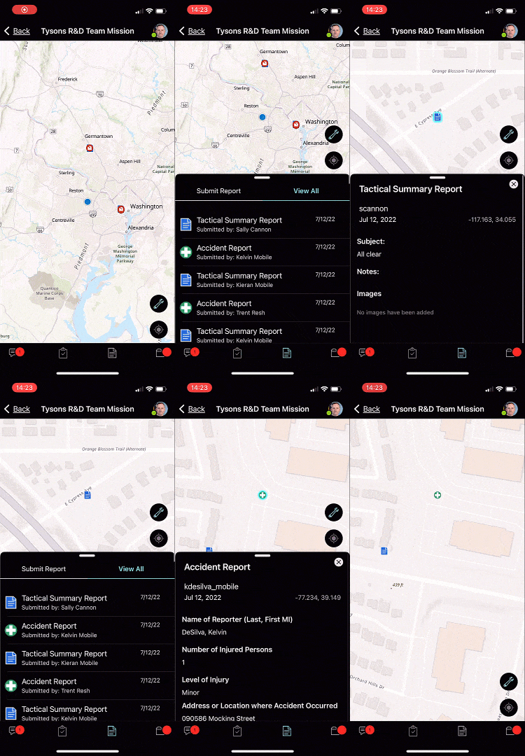
In previous versions of the Mission Responder app, users could only open submitted reports by selecting them on the mission map. This made it easy to maintain their awareness of the mission area they were operating in but difficult for viewing reports submitted elsewhere in the mission space. In the latest version of Mission Responder, a Reports List is now an integrated part of the Reports tool. The Reports List allows all responders the ability to see all submitted reports during a mission in a scrollable list view. Each report, once selected, is zoomed to on the map and opened so that responders can view it’s details. This is helpful when trying to find a report or learn more about a specific mission event.

Dynamic map editing during an active mission
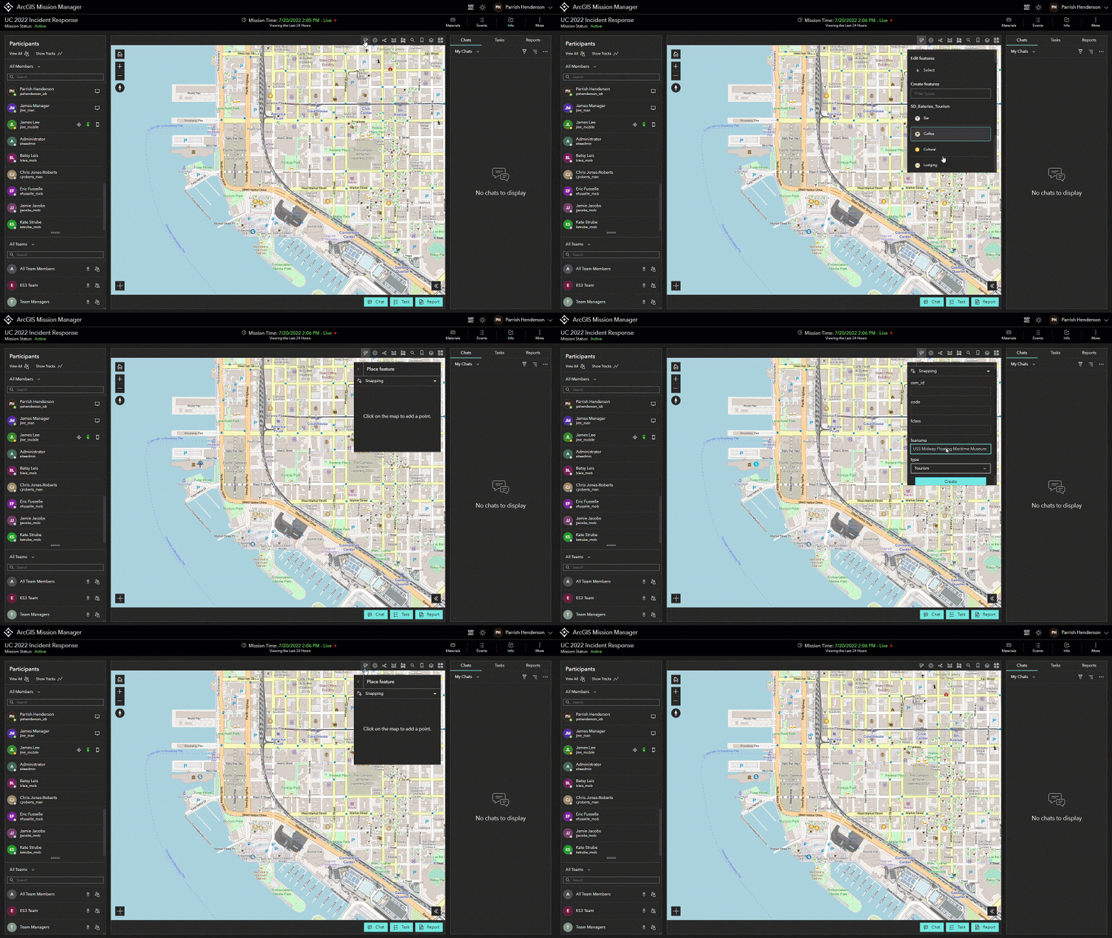
The ability to add features and web layers to enhance a mission’s map makes it simple to customize any mission without having to pause the mission or have an open web map on an additional tab or screen. In previous versions, it was not possible to edit map features directly from within the mission analyst workspace but all of that has changed. With the addition of map editing tools in the mission analyst view, features can now be directly edited during an active mission. This includes editing positions, text and number fields, adding data, or deleting data, which gives users more control over their missions.

Other Enhancements and Features in this release include:
- Considerable changes made to provide the user with a more streamlined experience in both Manager and Responder.
- Improved information management within Mission Server which improves performance.
- Report template editing from existing reports in the portal.
- The addition of multiple pre-loaded report schemas.
- Expanded library of Mission Style Icons.
Stay Informed and Involved
ArcGIS Mission has an established community of users that continues to grow. The feedback and ideas from this community are used to help drive future innovations of the product making it better with every release. We encourage you to become part of the conversation and submit any feedback you may have by visiting the Esri Community to learn more.
To learn more about ArcGIS Mission and add it to your organization’s ArcGIS Enterprise deployment, get in touch with an Esri representative. Also, get the latest news about ArcGIS Mission.


Article Discussion: