Have you ever experienced challenges when accessing rich content from ArcGIS when using your Android Tactical or Team Awareness Kit (ATAK) mobile device? The ATAK Plugin to ArcGIS extends these capabilities and can be accessed via the TAK.gov website.

ATAK’s mobile client users can now receive, process, and handle foundational raster and vector content provided by ArcGIS. When connected, users can browse supported services or access protected content using built-in security authentication. This content can also be cached for offline use.

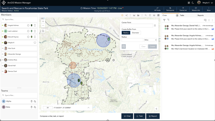
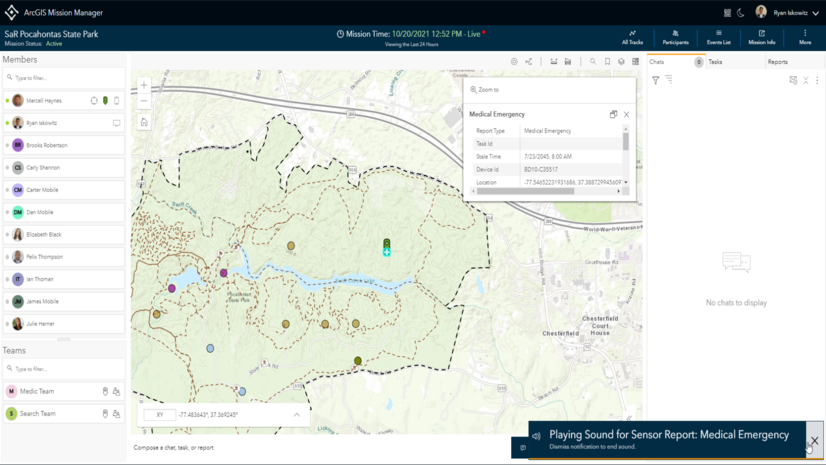
Additionally, the ATAK Plugin to ArcGIS enables users to stream their location from an ATAK device back to ArcGIS. This feature enables an ATAK user’s location to be visualized in applications like ArcGIS Dashboard, or when actively participating in team activities in ArcGIS Mission.

ArcGIS Mission is a relatively new product that enables analysts, mobile teams, and executives to quickly establish command and control by organizing and managing teams and resources, whether working on planned events or dealing with unplanned circumstances.

To gain access to the ATAK Plugin, please visit Tak.gov and for information on ArcGIS Mission please click here.


Article Discussion: