October 24, 2020 is the deadline of the U.S water debt in which Mexico still has to release about 300 million cubic meters of water to the Rio Grande. The U.S. water debt is part of the 1944 treaty about the water utilization of the Rio Grande, Colorado and Tijuana Rivers. The situation has sparked tensions south of the border with the Mexican government struggling to meet its international commitments. The drought-impacted farmers in Chihuahua have revolted.
At a National level, Mexico benefits from the 1944 treaty from transfers from the Colorado River to the western part of the country in exchange for releases from the Rio Conchos in the State of Chihuahua into the Rio Grande, favoring communities in Texas. Regionally, farmers in Chihuahua are discontent, especially during dry spells. Likewise, Texan farmers are uneased by the delays with water releases to the Rio Grande.
The current situation between the U.S. and Mexico is an example of the challenges about sharing water resources in transboundary basins. The ArcGIS platform already provides fundamental tools for spatial analysis to overcome these challenges. What’s more interesting in the past years is that near-real time layers in ArcGIS Living Atlas of the World can support hydro projects in innovative ways.
Water Conflicts and Droughts
Three items in Living Atlas can help us better understand water conflicts:
- The Standardized Precipitation Index (SPI) Recent Conditions layer shows areas under persistent dry conditions.
- The Armed Conflict Location Event Data (ACLED) shows the location of reported conflicts mainly in the Global South.
- The Esri Hydro Reference Overlay provides general context of the main hydrologic features at different scales.
The combination of these three layers highlights areas in the world experiencing water scarcity and also areas in which these dry conditions have resulted in protests or conflicts, such as the recent events in Northern Mexico.
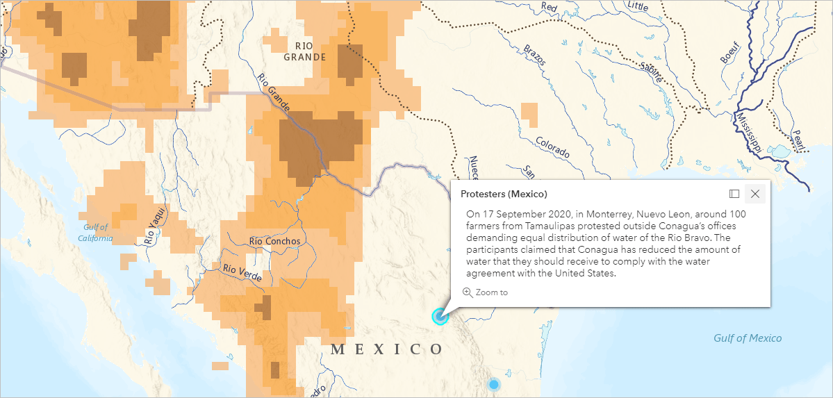
The SPI layer shows that large parts of the Rio Grande watershed, especially the area corresponding to the Rio Conchos tributary in Mexico are experiencing extremely dry conditions. The ACLED layer shows in near-real time ongoing protests due the distribution of water in Northern Mexico.
Water Conflicts in the World
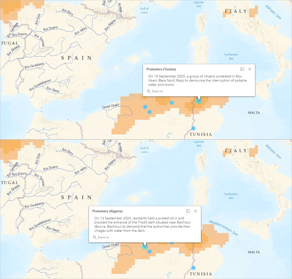
At the same, other regions around the world are experiencing different types of water conflicts. Water conflicts are not only caused by droughts but also due challenges in water supply, insufficient responses from authorities to changing conditions, or lack of required infrastructure.
In Algeria, people demanded that authorities provide a solution to their current water crisis. In Tunisia, people denounced water supply interruptions.
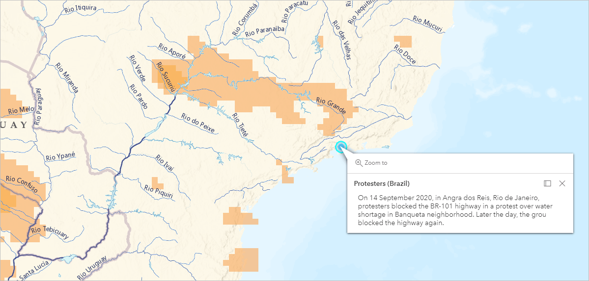
Water shortages in neighborhoods in Rio de Janeiro provoked protests and roadblocks.
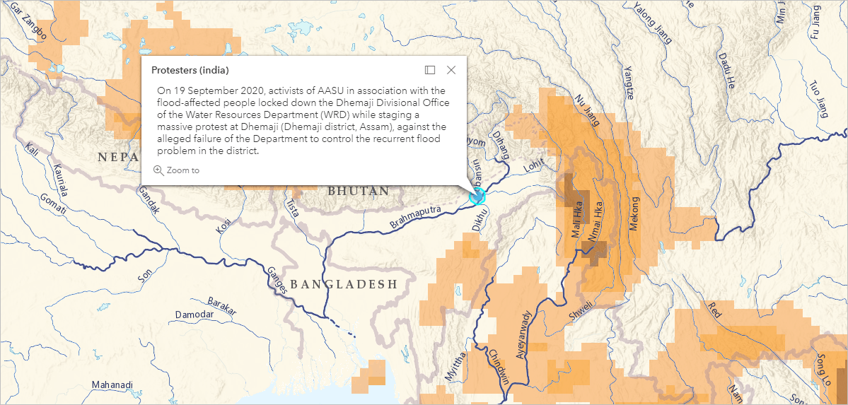
In contrast, people in Northeast India are demanding better flood control measures. Excess of water and floods can also lead to water conflicts.
Forecast of River Discharge
Another relevant water-related item in Living Atlas is the GEOGloWS ECMWF Streamflow System (6 Day Forecast) that estimate river discharge at a global scale. The forecast of river discharge can power a more localized analysis of variation in flows, by identifying low or high flows.
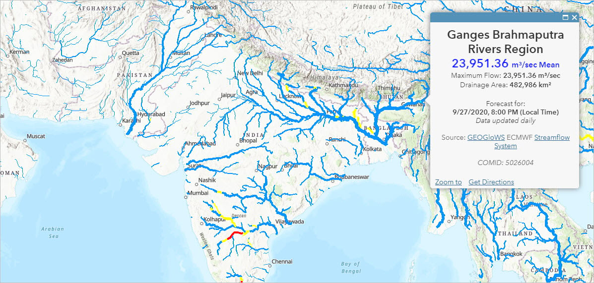
Note: The blog ArcGIS Living Atlas of the World Layers for Water Resources has a complete list of water-related items in Living Atlas.
Summary
Living Atlas provides a collection of layers suitable for water resources projects. Near-real time layers known as Live Feeds display the most recent information available such as (1) dry conditions from precipitation indices, (2) recent water conflicts, or (3) river discharge forecasts. Information from different sources can then be combined into a single map (e.g. Water, Droughts, and Armed Conflicts map). The integrated approach allows us improve water management practices, shifting from scenarios of water stress and competition to scenarios of water security and cooperation.
More Information?
Join GeoNet and ask questions to the Living Atlas community of experts.

Article Discussion: