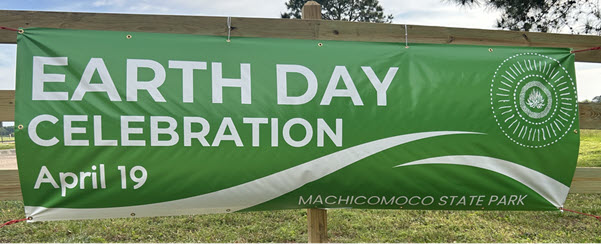
Last weekend, in celebration of Earth Day, I went camping with my family at Machicomoco State Park in Virginia. On Saturday, April 19, we participated in the Earth Day Celebration, where tribes and local organizations showcased their efforts in environmental preservation. I was particularly thrilled to see a strong emphasis on water resources, which I found especially meaningful.
The full list of participating tribes and organizations is available at the event’s website.
I had the chance to speak with nearly all the tribes and organizations at the event. Next, I’d like to showcase a few that stood out to me, particularly for their focus on water resources.
Friends of Dragon Run
One of my favorite organizations at the event was the Friends of Dragon Run (FODR), a group dedicated to preserving a 203-acre swampland within the Dragon Run Watershed. They emphasized the vital role of protecting the entire catchment to ensure the health of the swampland. I found their section on ‘Swamp Sightings’ especially engaging, as it showcased iNaturalist observations in the area. This inspired me to create a Dragon Watershed web map using layers from Living Atlas, including the Watershed Boundary Dataset (WBD), National Hydrography Dataset (NHD), and iNaturalist Observations.

The Dragon Run Watershed web map above is presented using an app built with the ArcGIS Instant Apps Basic template.
Moreover, FODR volunteers also shared details about their upcoming activities, including opportunities to kayak in the Dragon Run during spring and summer— which sounds incredibly fun!
Chickahominy Indian Tribe
The Chickahominy Indian Tribe showcased an overview of the diverse environmental programs across Virginia. Their display focused on water quality and the challenges caused by pollution. One highlight was their creative educational model, which demonstrates how pollution from various parts of a watershed ultimately impacts rivers and wetlands.
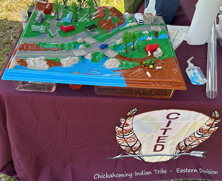
The Trace Downstream service in ArcGIS Online allows us to follow the pollution from its source to downstream tributaries, rivers, and wetlands, offering an overview of the impacted water resources.
Upper Mattaponi Indian Tribe
The Upper Mattaponi Indian Tribe shared their great work in monitoring wetlands, with a focus on sampling, water quality, fisheries, and their expanding GIS program.

They also shared details about their exciting Annual Pow Wow event.
Other Remarkable Organizations
The event was organized by the incredible Friends of Machicomoco. During the event, I also had a chance to connect with people from the Chesapeake Bay National Estuarine Research Reserve Virginia, the Virginia Department of Conservation and Recreation, the Pamunkey Indian Tribe, and several other groups.
Final Thoughts
Happy Earth Day! The event at Machicomoco State Park was the highlight of my camping weekend. I truly enjoyed learning from tribes and local organizations about their conservation efforts, particularly their focus on water resources. It was inspiring to see how the geographic approach and GIS supports their initiatives.
Get Involved
Explore local environmental organizations and apply your GIS skills to make a positive impact.

Article Discussion: