In collaboration with the US Geological Survey (USGS), Esri recently updated the online USGS historical topographic map collection with over 1,700 new maps.
Esri also added new features and functionality to the USGS Historical Topographic Map Explorer app, which allows users to explore the map collection. You can now use the app to create an ArcGIS Online web map of the topographic maps you want to work with!
USGS Historical Topographic Map Collection
Esri’s USGS topographic map collection now contains 177,061 historical quadrangle maps dating from 1882 to 2006. Previously available only as printed lithographic copies, high-resolution images of these maps are freely available online and can be downloaded as georeferenced TIFFs for use in web maps, geographic information systems (GIS), and other applications. In this update, 1,227 new maps were added to the collection and 530 maps were replaced with better-quality images. Going forward, Esri will be updating the map collection regularly to keep pace with work by the USGS staff who are continuing to scan their historical maps.
The historical maps are part of the USGS Historical Topographic Map Collection―a project that was launched in 2011. The collection includes all scales and all editions of the topographic maps published by the USGS since the inception of the topographic mapping program in 1879. The maps have scales ranging from 1:10,000 to 1:250,000. Some scales have broad coverage across the United States, while others may have only a few maps.
The USGS scanned each map as is to capture the content and condition of each map sheet. All maps were georeferenced, and metadata was captured as part of the process. Using ArcGIS, the scanned maps were made into an image service that can be viewed on the web and allows users to download individual scanned images.
USGS Historical Topographic Map Explorer App
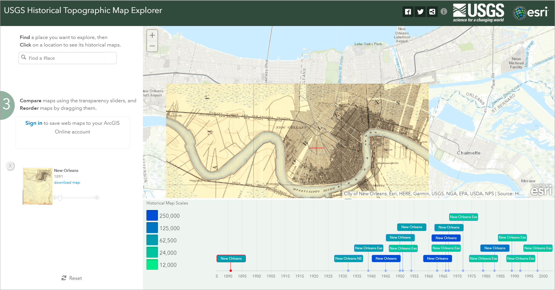
The USGS Historical Topographic Map Explorer app brings these maps to life through an interface that guides users through three steps for exploring the map collection:
- Find a location of interest.
- View the maps.
- Compare the maps.
Finding the maps of interest is simple. Users can see a footprint of the map in the map view before they decide to add it to the display, and thumbnails of the maps are shown in pop-ups on the timeline. The timeline also helps users find maps because they can zoom and pan, and maps at select scales can be turned on or off using the legend boxes to the left of the timeline. Once maps have been added to the display, users can reorder them by dragging them. They can also download them as zipped GeoTIFF images. Users can also share the current state of the app through a hyperlink or social media. This ArcWatch article guides you through using each of these steps: https://www.esri.com/esri-news/arcwatch/1014/envisioning-the-past.
Updates to the App
We recently updated the USGS Historical Topographic Map Explorer app. The simple yet useful functionality remains as before, but users can now save a web map once they have signed into their ArcGIS Online account.
Once signed in, users can create a web map with the current map view and any maps they have selected.
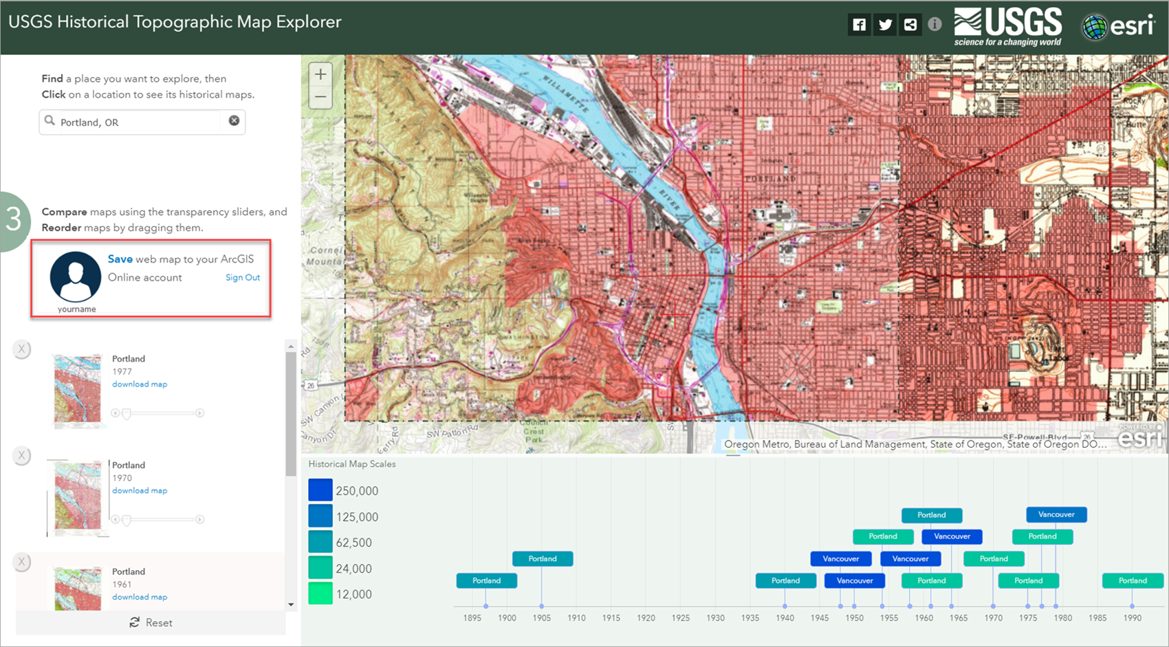
The title of the web map will be the same as the top map in the side panel of the app. All historical maps that were selected in the app will appear in the Contents of the web map with the earliest at the top and the latest at the bottom. Turning the historical maps on and off or setting transparency on the layers allows users to compare the historical maps over time.
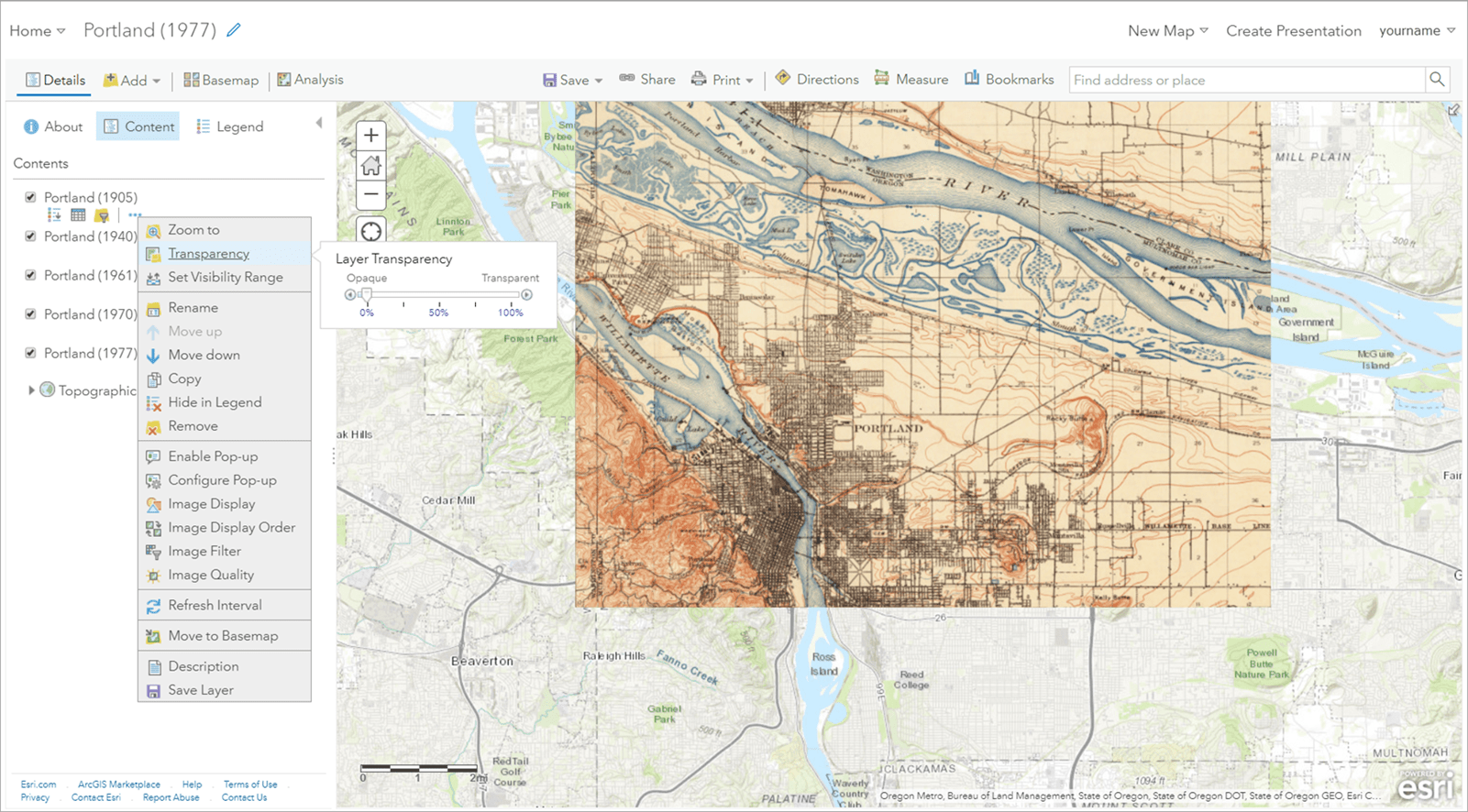
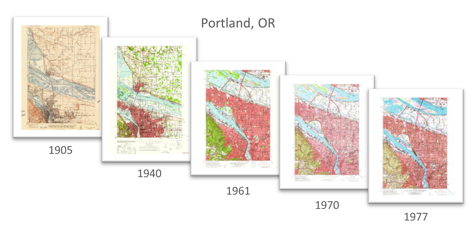
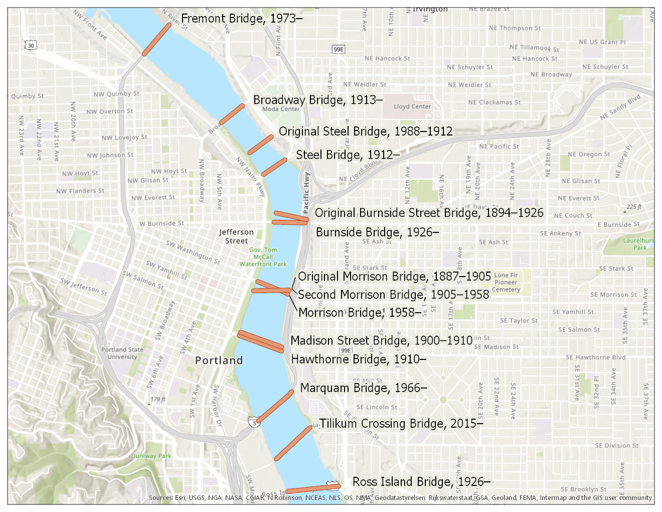
The web map can also be opened in ArcGIS Desktop (Pro or ArcMap) and used for exploration or data capture. For example, the five historical maps of Portland, OR, shown at the beginning of this blog post were used to digitize the city’s bridges over the Willamette River.
Other enhancements to the USGS Historical Topographic Map Explorer app include that users can now reset the app using a link at the bottom of the side panel. This will reposition the map at the initial location (New Orleans, LA) and remove maps from the side panel.

Users can also find out more about the USGS map collection and the app by clicking on the information button at the upper right.

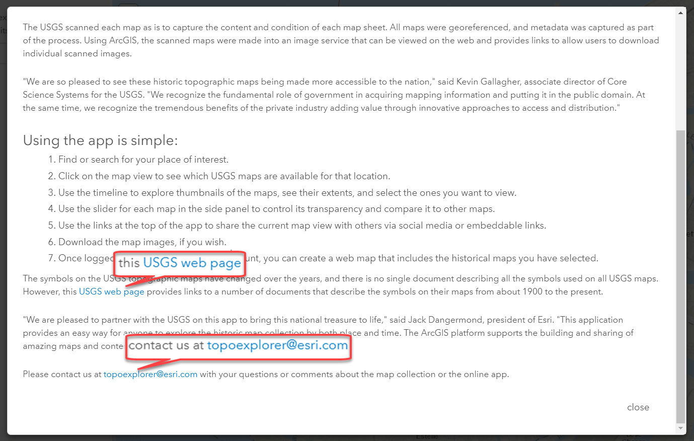
This opens a pop up with information about the maps and app. It also includes a useful link to a USGS web page that provides access to documents with keys to the symbols on historic and current USGS topographic maps. The pop up also has a link to send Esri questions or comments about the map collection or the app.
We have shared the updated USGS Historical Topographic Map Explorer app on GitHub, so users can download it and configure it to work with their own map collections. You can also learn more on ArcGIS Online about the USGS Historical Topographic Map Explorer and the image service of the map collection.
Resources
- To learn more about the maps and the app, see this blog post.
- For step-by-step instructions on using the app, see this ArcWatch tip.
- A forthcoming ArcWatch tip will provide the same kind of instructions for using the new functions and features of the updated app.

Commenting is not enabled for this article.