Many weeks ago I saw an achingly beautiful bit of AI-generated terrain art shared by Esri’s glorious instagram account. Initially I was a bit intimidated by the robots; it was so charming and tactile and wondrous and dreamlike and sinuous. But also…inspiring.

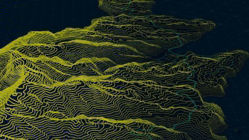
I wondered if I could take a crack at re-creating this aesthetic in ArcGIS Pro, with actual for realzies honest to goodness geographic data. Here is my attempt, using NASA SRTM elevation data of the Mount Hood / Columbia River area of the American Pacific Northwest…
0:00 Dazzling intro
0:34 DEM elevation download, thanks NASA!
0:50 Blur the DEM for smooth generalized contours with Raster Functions
1:20 Create contours from a DEM using Spatial Analyst
2:02 Ferris Bueller style summary of the hack
2:16 Hack that turns 2D elevation polygons into isometric 3D-looking things
3:34 Color thievery
4:11 A crisp edge highlight
5:18 Isolating the shading into a separate layer with delicious blend mode
8:15 Poster paper texture from Living Atlas
9:58 Pepper gets a scratch
…
Here are some exports from this Pro-ification of AI-inspired topo art using real geographic data. I use them as my desktop background because it’s a fun way to start the morning.


Here are some without the cartoonizing outlines. I sort of like these better…


I hope you give this a try and apply your own riffs and styles. It’s a beautiful world we live in and the source of unlimited inspiration. Thanks for reading!
Love, John

Article Discussion: