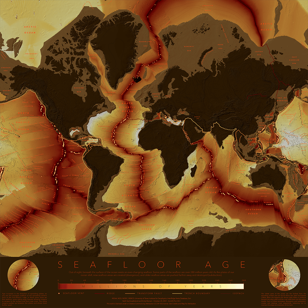
Did you know that parts of the sea floor are over 180 million years old? Did you know the areas where we have hydrothermal vents are some of the youngest or newest places of the seafloor? Do you know where the oldest place in the ocean is? This map helps us understand this and more.

I originally had the idea for this map after I read through the “Data report: Strategic Environmental management Plan for deep seabed mineral exploitation in the Atlantic Basin”. The report is a wealth of knowledge that lists important geographic data sets that describe the features and characteristics of the seafloor.
This map is a compilation of five different layers that can help you visualize and understand the different areas of the seafloor:
You can find these resources in the following “Seafloor” group in ArcGIS Online as well in as well as in the ArcGIS Living Atlas of the World.
Special thanks to cartographer Emily Meriam for help on this project and bringing together these layers in such a compelling way. This information would not be nearly as eye-catching without the artistic representation provided by Emily.
Download the poster: https://arcg.is/1iH9DS


Article Discussion: