World Imagery Firefly is the style of basemap you might use if you were installing a top secret command center, or if you were designing the dashboard of an orbiting space module—when you need the context, texture, and awesomeness of rich imagery, but all that full-blown color just gets in the way.
Why Firefly?
If you aren’t familiar with World Imagery Firefly, it’s the basemap component of Firefly Cartography. World Imagery Firefly provides the powerful clarity and context of Earth imagery with a more muted palette, so that thematic data is more readily, and accurately, showcased. Designed to be used in conjunction with Firefly symbology (available as a style for ArcGIS Pro and as point symbols in ArcGIS Online), it works well in low-light environments, adds a dramatic aesthetic, and looks pretty cool. True color is progressively feathered in at closer scales so that at the neighborhood level, you’re seeing full color. Stop reading this blog post and go check it out! HINT: If you are still seeing the old imagery, you might need to clear your browser cache.
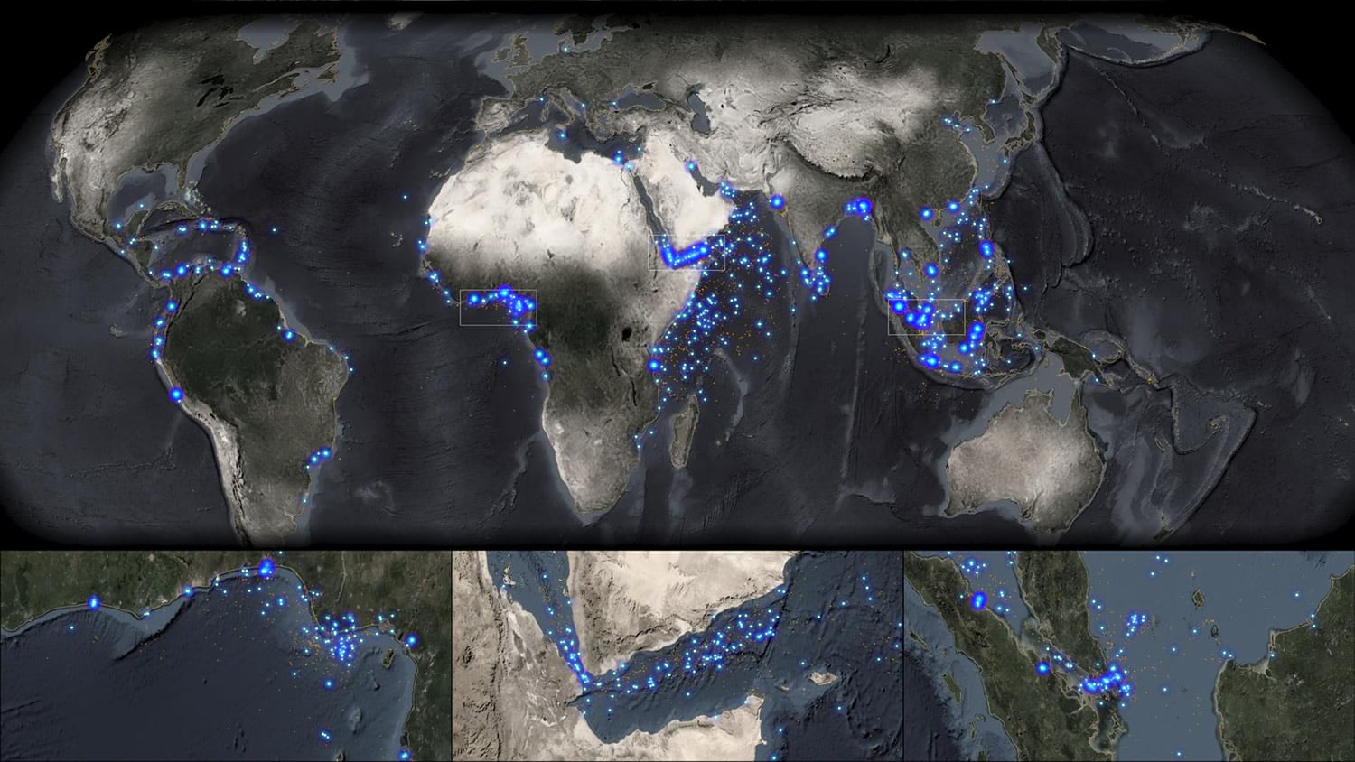
Here’s an example of Firefly imagery and Firefly symbology, showing incidents of modern piracy…
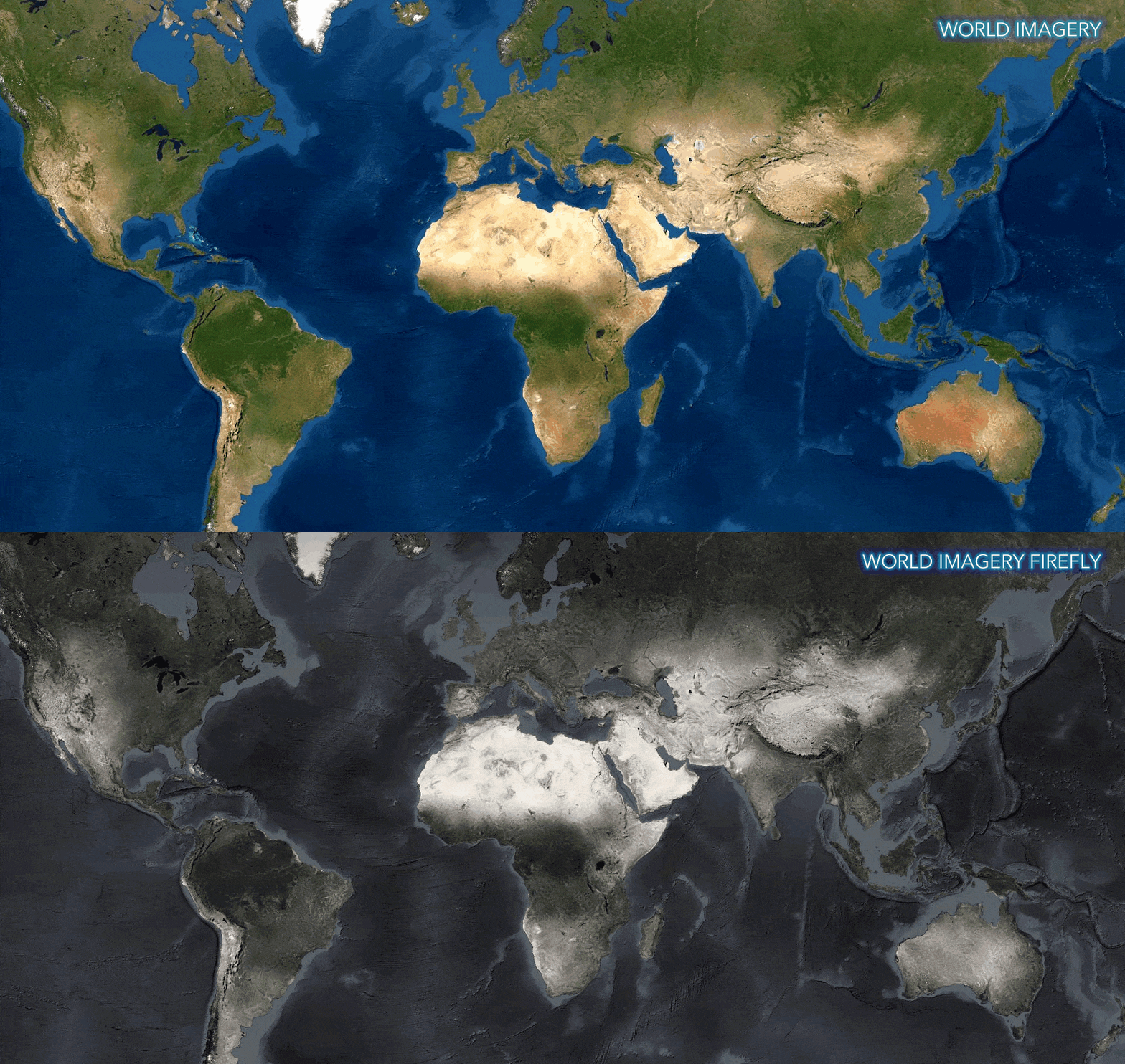
Here’s a comparison between World Imagery and World Imagery Firefly. The desaturation, and utility for thematic mapping, becomes apparent:
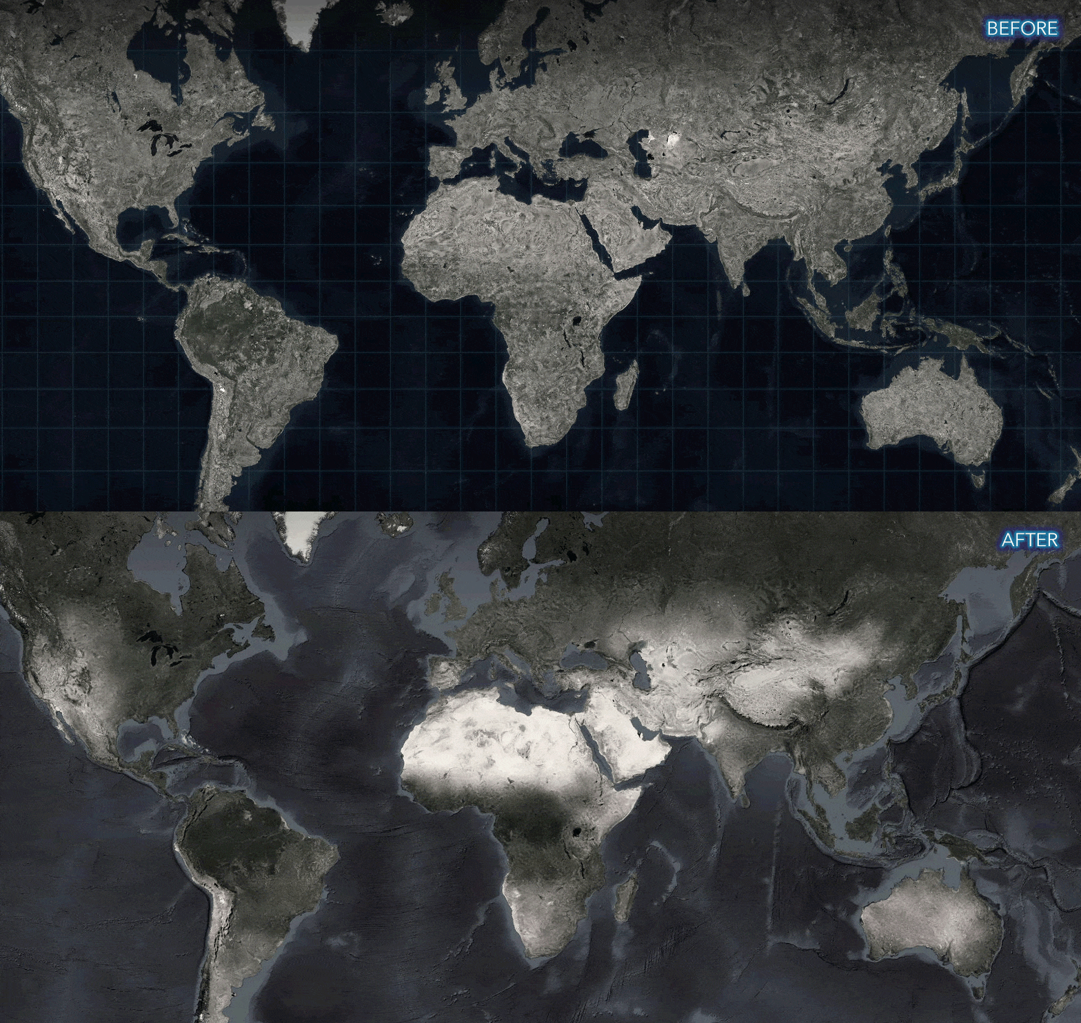
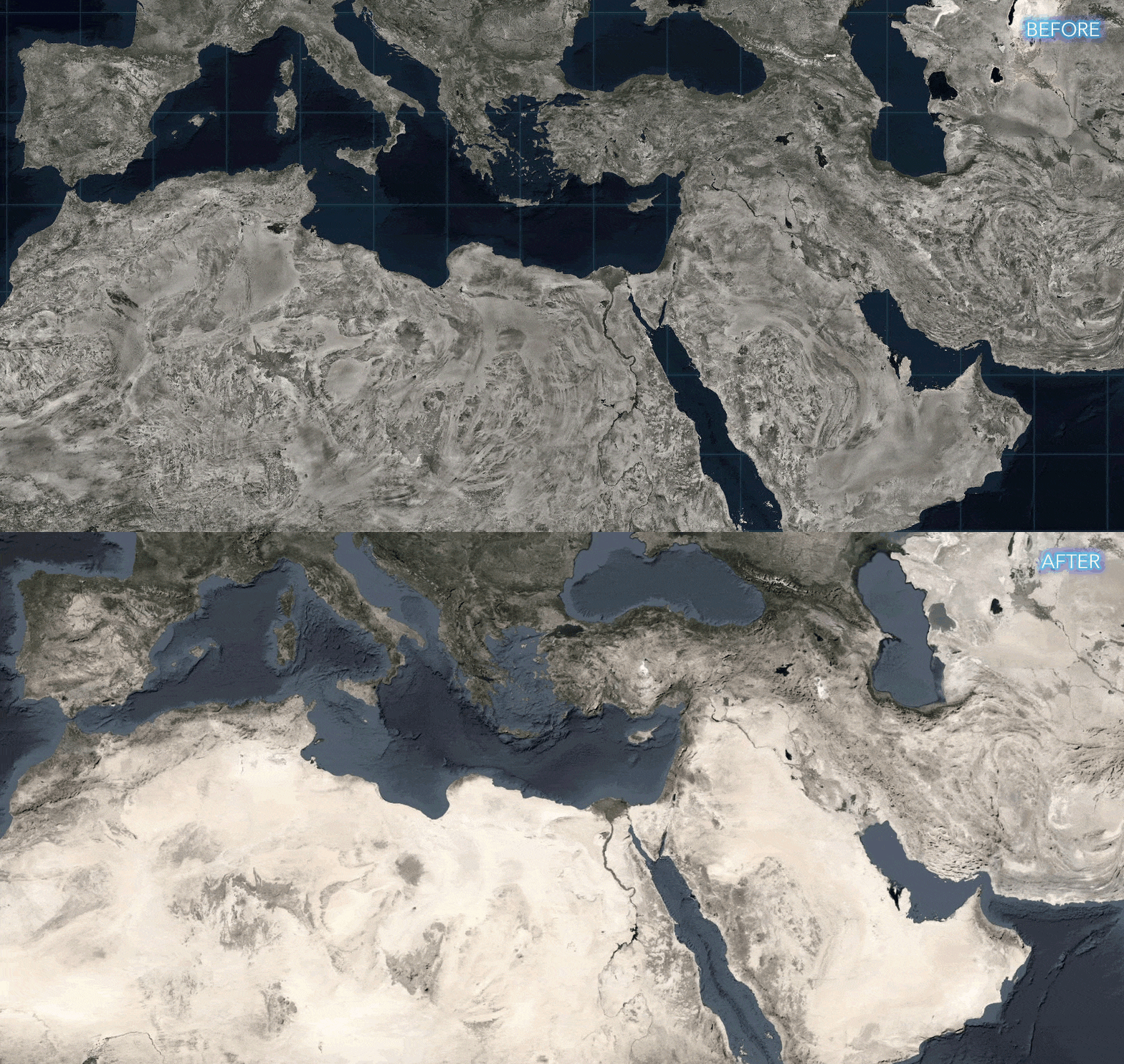
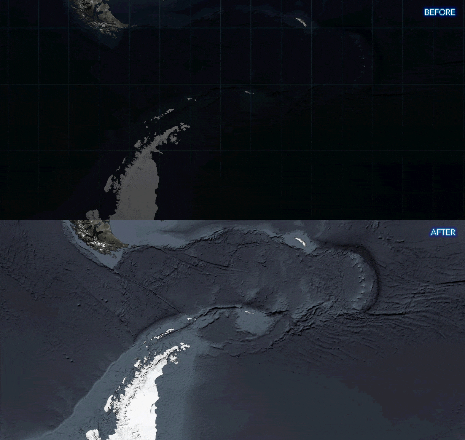
Here’s a comparison between the previous version of World Imagery Firefly, and the updated version:
What’s New?
We’ve been working to improve Firefly, based on the uses we’ve seen in the wild. Here’s a rundown.
Since its initial launch, the Firefly basemap has frequently been used in nautical and oceanic applications. We boosted the visibility of the bathymetric component, to bolster its value in those applications.
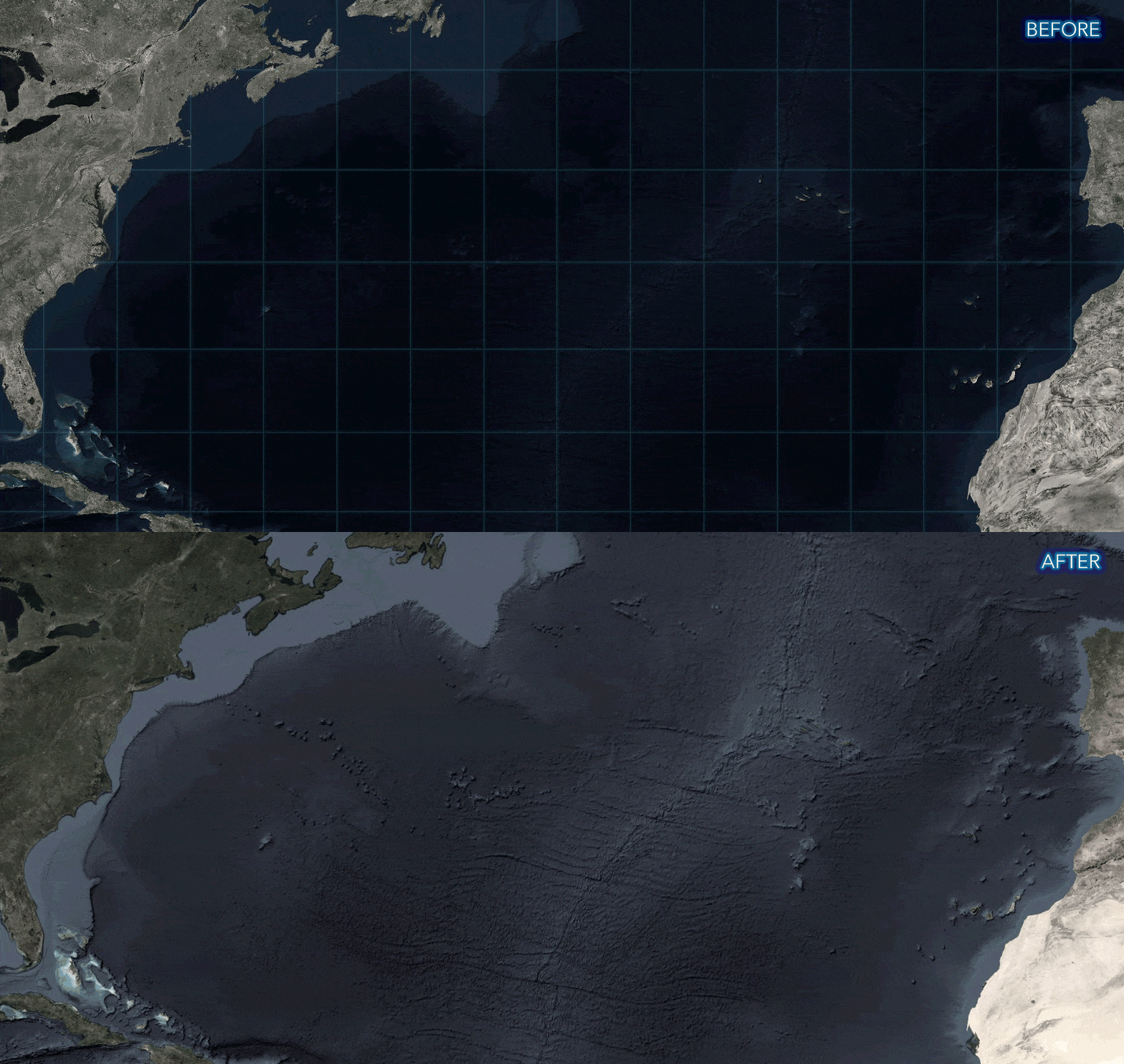
The initial version of Firefly had a graticule in oceanic areas. While this helped distinguish it from its World Imagery cousin, it wasn’t always a welcome addition in some cartographic settings. This baked-in graticule has been removed, but is still accessible as an independent overlay available in the Living Atlas.
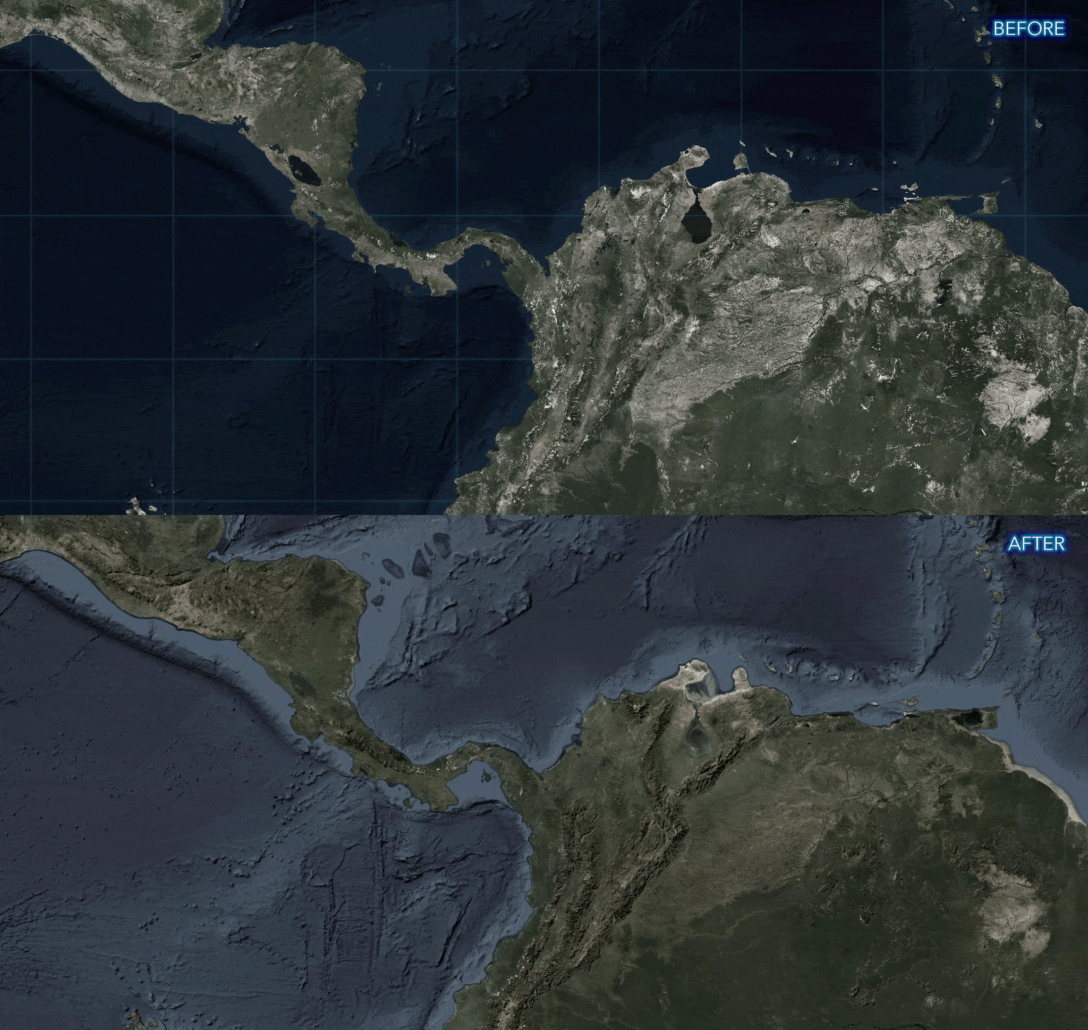
The updated version of Firefly has a bumpification effect. Bumpification applies a topographic texture to imagery at broad scales to convey the tactile surface of the earth that isn’t necessarily apparent in imagery alone.
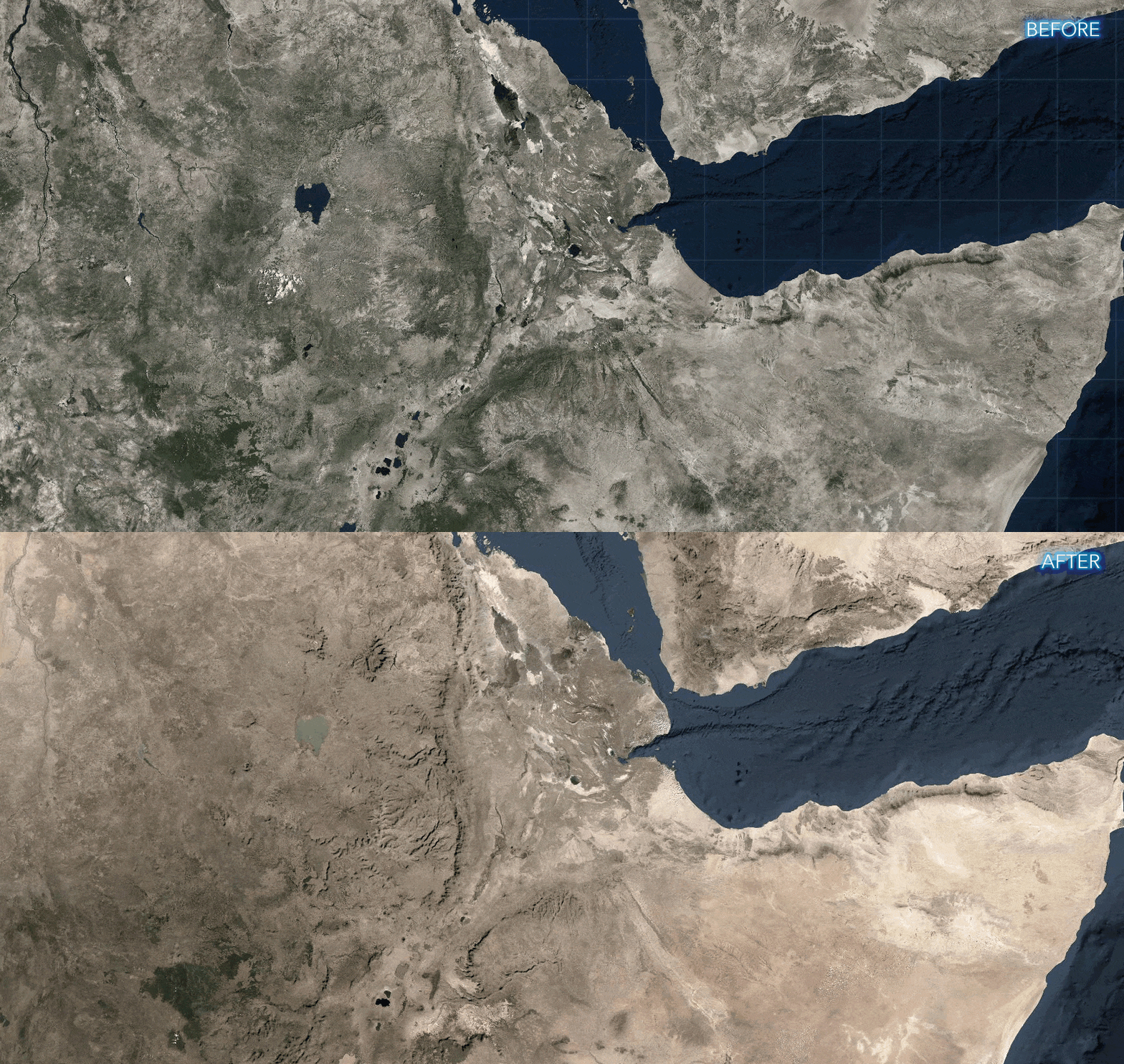
The imagery in the previous version of Firefly included a fair amount of texture and complexity. This new version leverages TerraColor NextGen imagery, which provides a more natural perspective of global landcover.
The previous version of Firefly had a vignette, darkening the poles. This newest version still has the vignette, which is an important aesthetic of Firefly cartography, but it is greatly reduced to better accommodate near-polar applications.
So there you have it! Our old friend, with a new but familiar look. We hope you consider it for your Hollywood set design—er, thematic mapping adventures!
Special thanks to Jim Mason for his ingenuity and efforts to get this out the door.
Happy Firefly Mapping! Robert Waterman and John Nelson


Article Discussion: