Article written in collaboration with CAL FIRE’s Tiffany Meyer and Kim Wallin
California faces a great deal of wildfire risk on an annual basis, which wildly impacts the population, housing, and ecosystems within the state. Understanding where fires have occurred, when they occurred, and their size can help communities and organizations plan and mitigate against future fire risks. To help the GIS community easily access this valuable information, The California Department of Forestry and Fire Protection (CAL FIRE) has made their authoritative historical fire perimeters readily available within ArcGIS Living Atlas of the World as a set of ready-to-use spatial content. This makes it easy to quickly find and use the most authoritative California wildfire perimeters data, directly within your ArcGIS maps.
CAL FIRE Wildfire Perimeters
CAL FIRE’s Fire and Resource Assessment Program (FRAP) annually maintains and distributes a historical wildland fire perimeter dataset from across public and private lands in California. The GIS data is developed with the cooperation of the United States Forest Service Region 5, the Bureau of Land Management, National Park Service and the United States Fish and Wildlife Service and is released in the spring with added data from the previous calendar year. The data covers fires back to 1878, and includes the fire perimeter boundary, acreage burned, containment information, and more.
Data collection methods have improved over time, with accuracy, precision and timeliness. Fixed winged sensors can now capture perimeter locations and growth in near real time. New sources such as the Fire Integrated Real-Time Intelligence System Program (FIRIS) and the Wildfire Forecast & Threat Intelligence Integration Center (WFTIIC) have also be added to improve the perimeter boundaries.
Accessing CAL FIRE data in ArcGIS
CAL FIRE collects data internally and from various agencies and formats the data into a standardized schema. Each Spring, CAL FIRE updates their Living Atlas content with the newest perimeters to provide a long-standing atlas to explore patterns of fire history. CAL FIRE offers California Fire Perimeters as a ready-to-use layer within ArcGIS Living Atlas of the World. These ready-to-use options within Living Atlas offer meaningful symbology, pre-configured popups, and an easy to use application experience.
California Historical Fire Perimeters layer
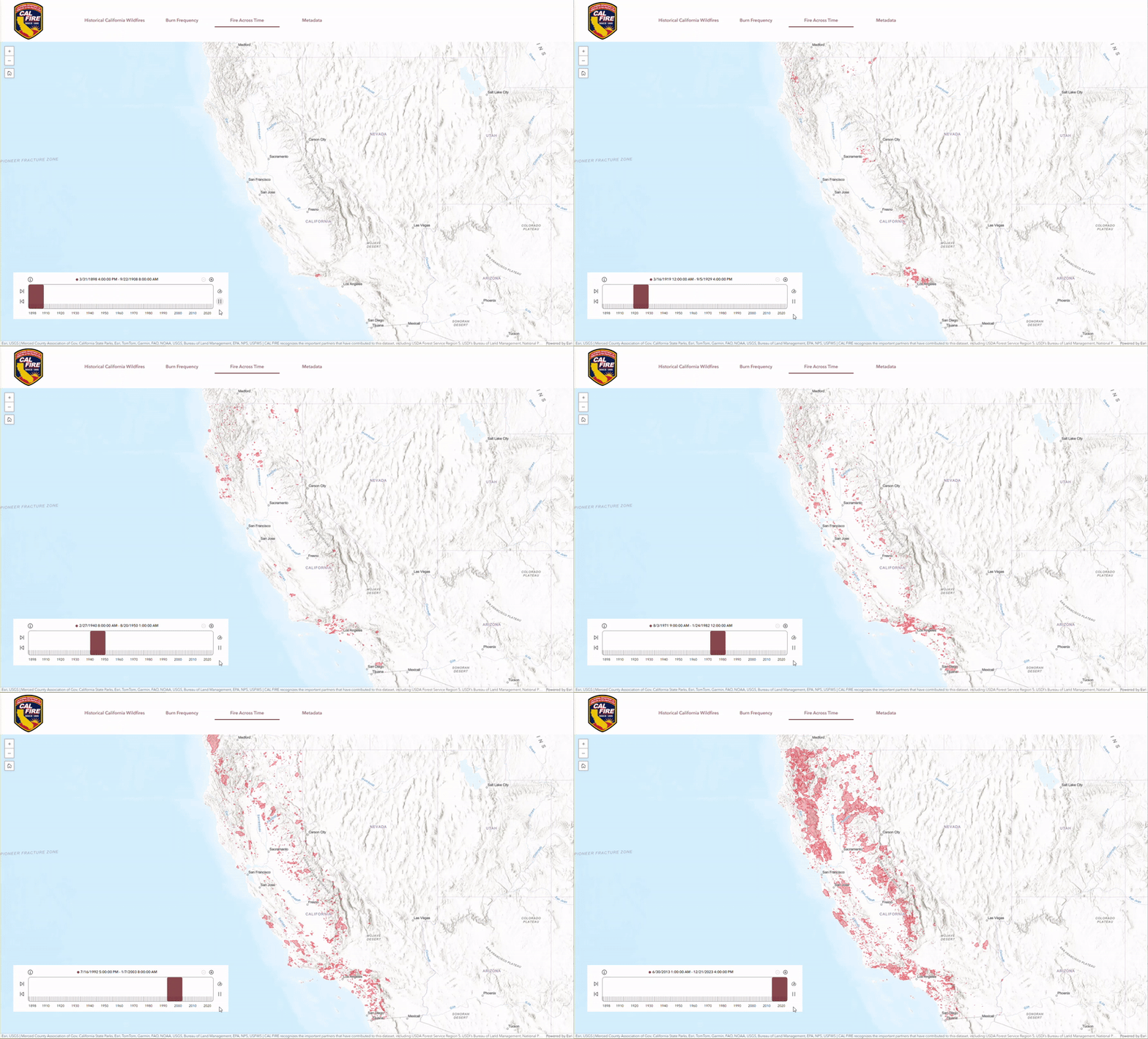
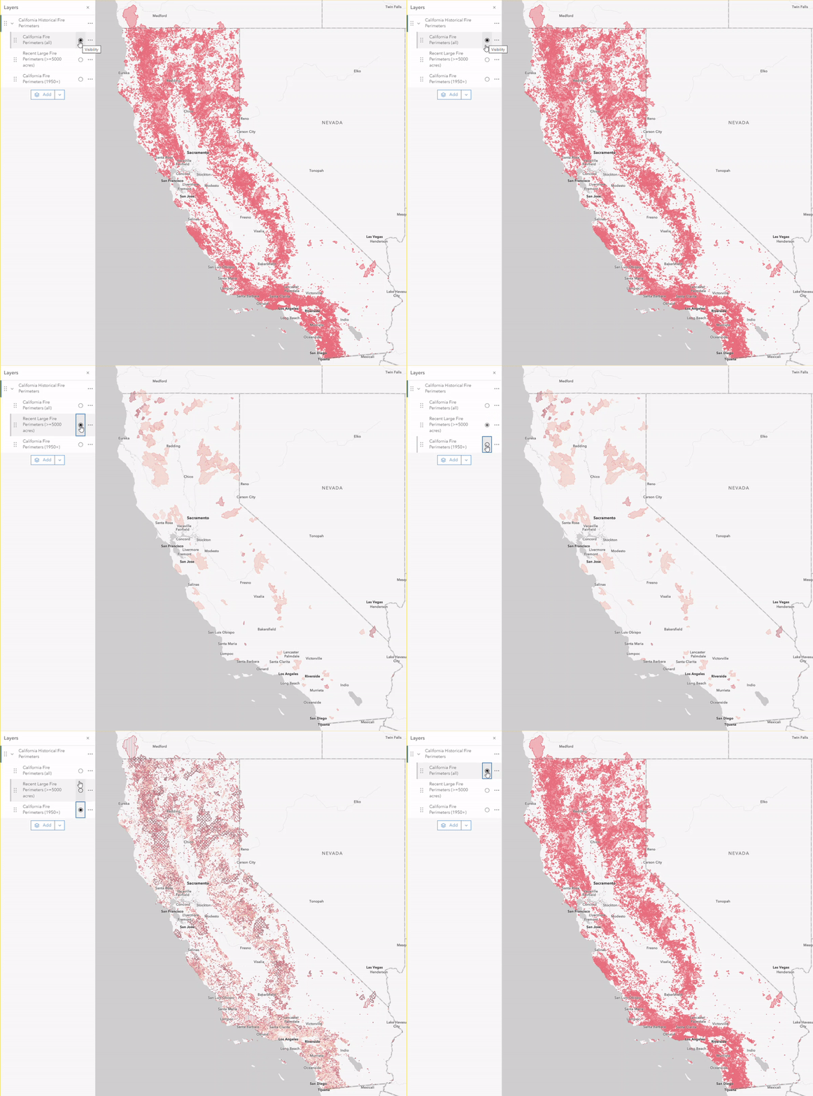
For example, the California Historical Fire Perimeters layer contains three sublayers to help you easily visualize all fires over time, the recent fire perimeters over 5000 acres within the past 5 years, or fire perimeters by decade. The layer also contains easy-to-read alias names for each data attribute and meaningful labels at appropriate scales to help you utilize this layer within your own mapping and analysis projects. For the recent fires sublayer, there is also a scale-dependent label that helps visualize where the most recent fires occured and how many acres burned.
California Historical Wildland Fire Perimeters Experience App
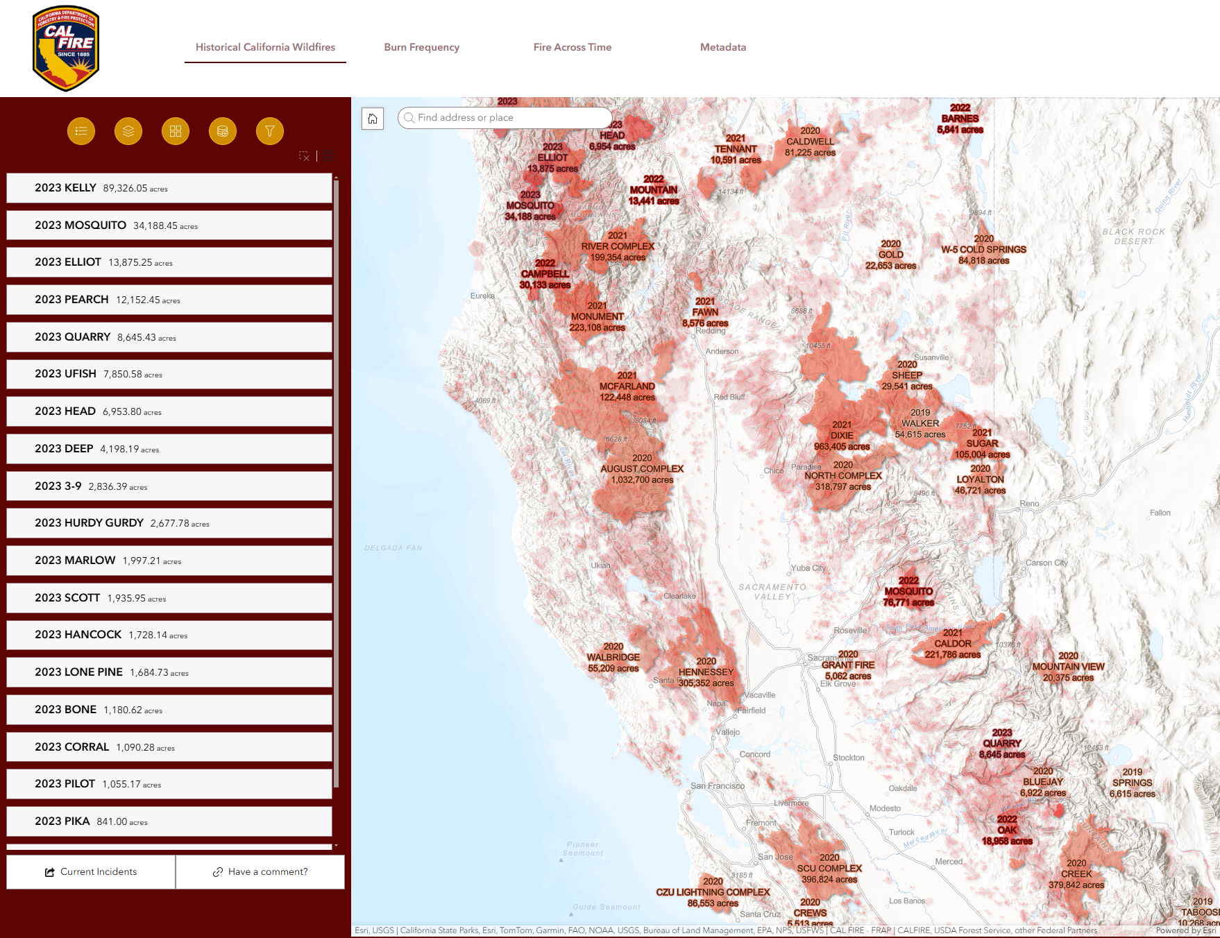
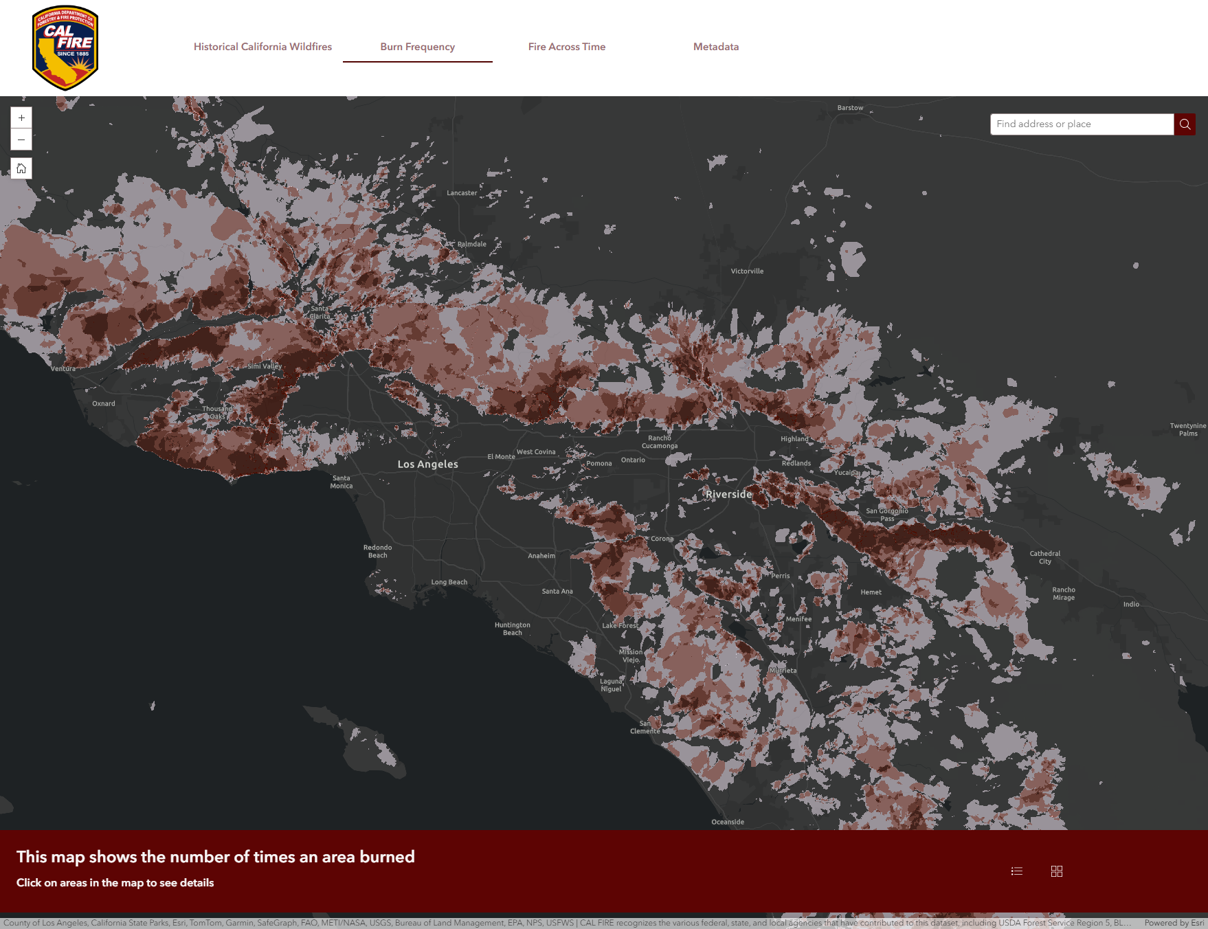
This app provides a user friendly experience to interact with CAL FIRE’s historical fire perimeter dataset. Users can add their own data, filter, or explore the perimeters against several other authoritative layers. The app utilizes a time enabled layer for users to view the perimeters across time and show cases a burn frequency analysis produced annually in hand with the perimeter dataset. Learn more about the agencies involved, the cause of an indicent, how often an area has burned, or overlay incidents with vegetation types. This app provides a comprehensive experience to explore patterns over time, and ask spatial questions about fire history.
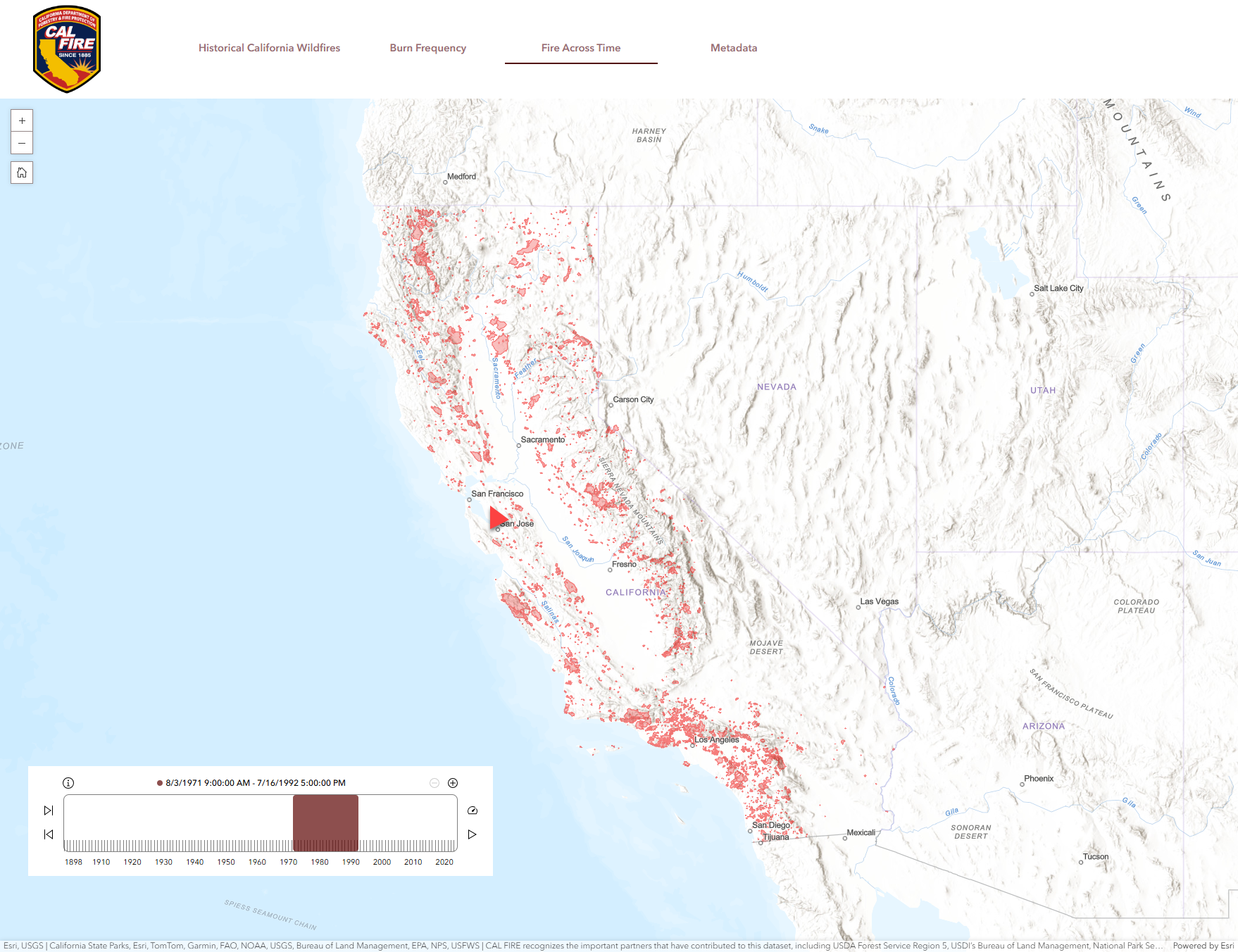
The app also contains detailed metadata about the update process, version updates, and collection criteria.
To find the underlying CAL FIRE layer within ArcGIS, visit ArcGIS Living Atlas of the World.
Examples of CAL FIRE data in Action
The fire perimeter data can be utilized by many audiences such as GIS professionals, emergency response organizations, state and local government planners, universities/researchers, among many others. The following use cases are examples of how this data is being used by planning agencies:
Fire Severity Models
These models assess the ecological impact of fires, and the extent of damage to vegetation, soil and ecosystems. The historical fire perimeter dataset is used to identify when and where a fire has occurred, as well as the ecological area. This is critical information for planning and building the USDA Forest Service Monitoring Trends in Burn Severity (MTBS) program, as well as their Burn Area Reflectance Classification (BARC) soil burn severity map products. The burn severity maps are a crucial tool for assessing post-fire conditions and target areas in need of emergency rehabilitation to prevent potentially catastrophic flooding, landslides and soil erosion, as well as prioritizing areas in need of post-fire restoration and reforestation.
Fire Ecology
Research lead by Caden P. Chamberlain strives to understand wildfire effects on yellow pine mixed conifer ecosystems of the Sierra Nevada forests by evaluating how the fire severity and times burned of the region’s fire history meet ecological targets. To read the full article, visit the following: When do contemporary wildfires restore forest structures in the Sierra Nevada? | Fire Ecology | Full Text (springeropen.com).
Burn Probability
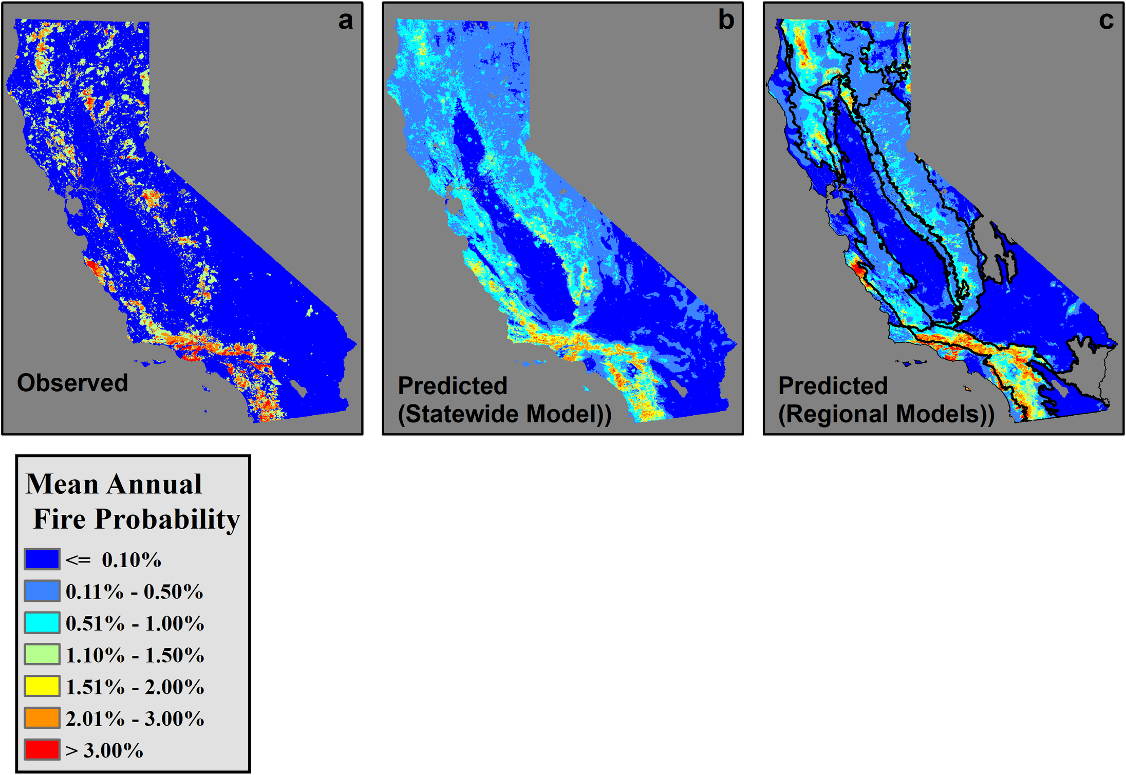
This research article uses land use, human activity, fuel dryness/availability, and historical fire perimeters as response variables to gauge how often things burn. It helps identify the burn probability which becomes an input to the carbon calculator. The study uses the CAL FIRE data to document the importance of previous burn events and time variables on fire behavior.
Fuel Treatment Effectiveness Tracker
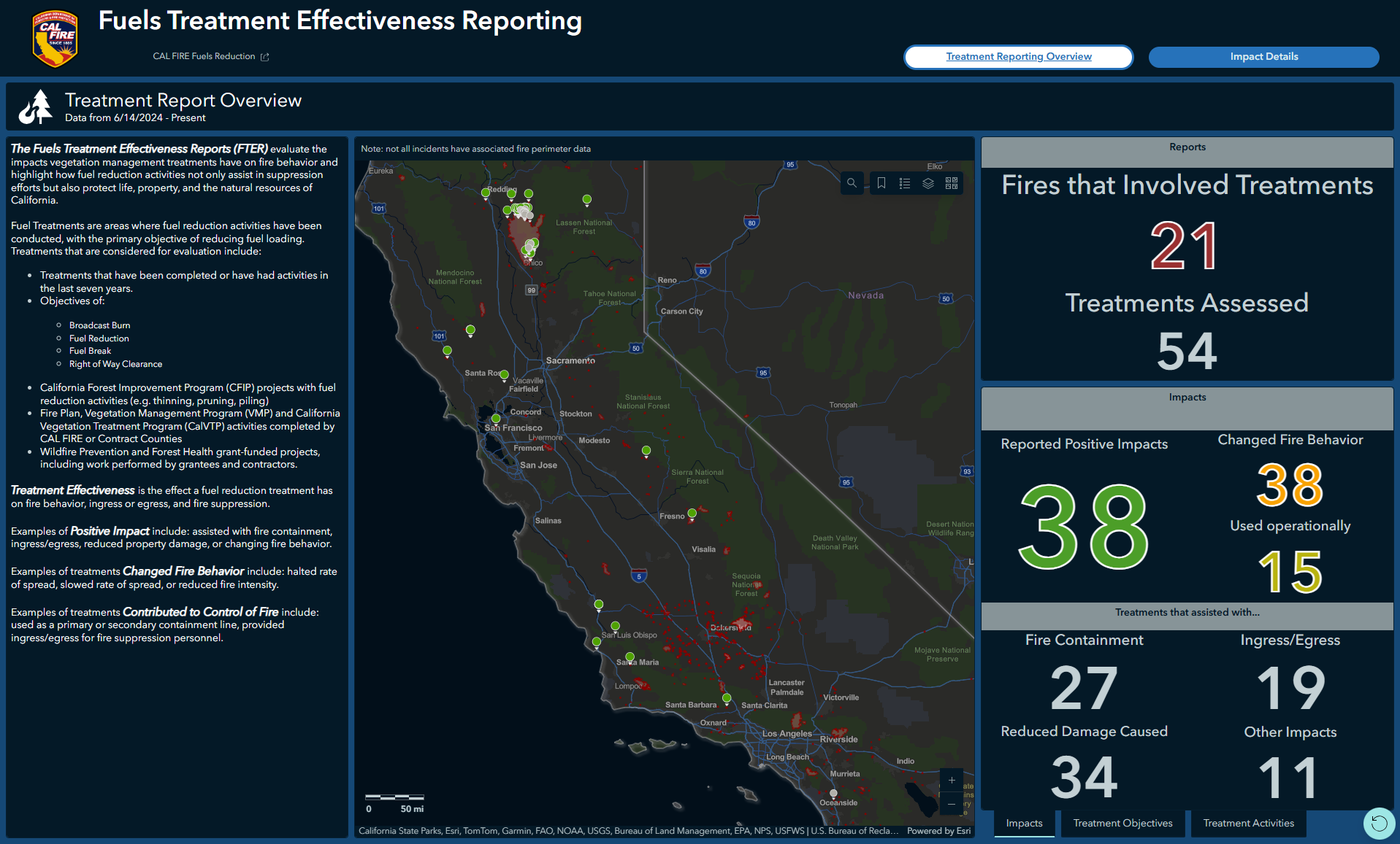
The Fuels Treatment Effectiveness Reports (FTER) Dashboard provides a look at how CAL FIRE is evaluating the impacts vegetation management treatments have on fire behavior and highlight how fuel reduction activities not only assist in suppression efforts but also protect life, property, and the natural resources of California.
More about CAL FIRE and FRAP
The California Department of Forestry and Fire Protection (CAL FIRE) is committed to serving and safeguarding California’s people and property through fire prevention, protection and stewardship of the state’s privately owned wildlands. CAL FIRE focuses on wildfire prevention through pre-fire engineering, vegetation management, fire planning, education and law enforcement.
CAL FIRE’s Fire and Resource Assessment Program (FRAP) assesses the amount and extent of California’s forests and rangelands and analyzes their conditions to guide management and policies. FRAP maintains and stewards the historical wildland fire perimeters to support the goals of the program.
Resources and Notes about the Perimeters
Although the dataset represents the most complete digital record of fire perimeters in California, it is still incomplete, and users should be cautious when drawing conclusions based on the data.
CAL FIRE (including contract counties) submit perimeters ≥10 acres in timber, ≥50 acres in brush, or ≥300 acres in grass, and/or ≥3 impacted residential or commercial structures, and/or caused ≥1 fatality. All cooperating agencies submit perimeters ≥10 acres.
Other links and resources:
Please help improve this dataset by filling out this survey with feedback:
Article Discussion: