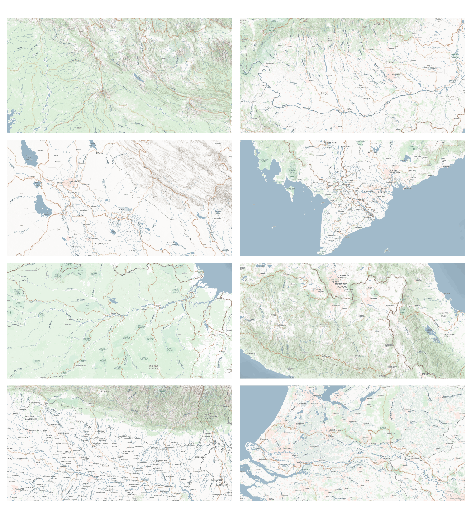
We are happy to announce the beta release of the Environment Basemap, a new basemap of the world designed to support environment, landscape, natural resources, hydrologic and physical geography content.
This web map consists of four vector tile layers that provide unique capabilities for customization, high-resolution display and offline use in mobile devices. Surface water features (rivers, lakes, streams, and canals) with labels and global watershed boundaries are two of the individual layers in the map, allowing you to adjust the drawing order to ensure your layers are not obscured, but are instead accentuated.

The Environment basemap builds on the success of the Hydro Reference Overlay, while also providing flexibility that our user community asked for, such as:
- The ability to turn on and off watershed features.
- The ability to pull out surface water features into a single layer that could be dropped into other maps.
In addition, the map utilizes the most up-to-date base data that all the Esri basemaps are built with. At this release, you can access the webmap using a link or through a search, but in the fall release of ArcGIS Online, the Environment map will be one basemap option available throughout the ArcGIS platform.
Separate Layers

The four vector tile layers that create the map are:
- Environment Detail and Label – A vector tile reference layer for the world with administrative boundaries and labels; populated places with names; ocean names; topographic features; and rail, road, park, school, and hospital labels.
- Environment Surface Water and Label – A vector tile surface water layer for the world with rivers, lakes, streams, and canals with respective labels.
- Environment Watersheds – A vector tile watersheds boundaries.
- Environment Base – A vector tile base layer for the world with vegetation, parks, farming areas, open space, indigenous lands, military bases, bathymetry, large scale contours, elevation values, airports, zoos, golf courses, cemeteries, hospitals, schools, urban areas, and building footprints.
Designed for Environment Content
The components and symbology of each individual layer were designed to produce a neutral backdrop for other environmental layers.

In the image above, you see many layers that work well with the Environment basemap. Please review A Living Atlas of the Environment StoryMap for more examples.
De-emphasize Human Landscape
This basemap de-emphasizes human landscape features such as administrative boundaries and city names, and instead the topographic labels, forests, and parks are displayed more prominently. The map does include boundaries and labels for populated places, landform names, roads, rail, parks, schools, and hospital names, however many of these base features are understated and only appear at large scales, allowing the physical characteristics of the earth to take the spotlight.

The neutral gray-blue color of surface water features was chosen to allow for other water related content to be drawn on the map without visual conflict. The stream labels are placed so that when other stream features are drawn over top of the basemap the stream names will be visible. For example, the GEOGLOWS layer from Living Atlas is a 10-day river streamflow forecast that displays a linear network of stream lines. The Environment basemap rivers, as seen in the image below, provide the necessary context while allowing the streamflow forecast data to feature more prominently.

The Environment Base layer is a streamlined selection of base data. Features in the base include vegetation, parks, farming areas, open space, indigenous lands, military bases, bathymetry, large scale contours, and elevation values. There are minimal human features shown, only airports, zoos, golf courses, cemeteries, hospitals, schools, urban areas, and building footprints.
Global Watershed Boundaries
While human boundaries are normally how we delineate landscapes, a more natural and useful way is through watershed boundaries, especially for physical geography related content. Watersheds encompass the true essence of location and flow. The watersheds for this map were styled with an earth tone palette and get increasingly detailed as you zoom in. Normally these are polygon boundaries but for visualization purposes, the coastlines were removed so that their complex geometry wouldn’t take prominence from other map content.
Because the water features are a separate layer, you may see some label conflicts on the map intermittently. The basemap was designed so that the Environment Detail and Label act as the reference layer, and the Surface Water and Watershed Boundaries are in the base section. You may need to move them around to get the look and feel you want for your map, but fortunately having four separate layers allows for flexibility and customization that many have asked for over the years.
We hope that you find the Environment Basemap to be useful, and we would love to hear any feedback you may have. Please take this very short survey to help us understand how the map is being used and how we could improve it in future releases, including the next release in October 2024.


Article Discussion: