ArcGIS IPS is an indoor positioning system that enables real-time indoor asset inspections, location sharing, and wayfinding. It visualizes your blue dot location on an indoor map and helps enhance asset management, safety and security, and occupant and visitor experiences.
This release introduces enhancements to ArcGIS IPS configurations in ArcGIS Pro, support for offline workflows and 3D visualization, enhancements to the ArcGIS IPS Setup app, and more.
Enhancements to ArcGIS IPS Configurations in ArcGIS Pro
Indoor Positioning Configuration
A new set of configuration options has been added to the Indoor Positioning map properties for IPS-aware maps. You can now manage key features of the IPS engine, including path-snapping, position smoothing, fallback to system GNSS, and Apple IPS support (if available in your indoor environment).
The Indoor Positioning Configuration options become available once you make a map IPS-aware by selecting an existing Indoor Positioning Data Service for the Indoor Positioning Data Source property.
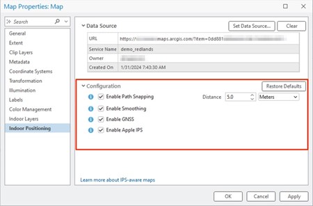
Path-snapping: If your map contains pathways features configured for IPS usage, you can now simply enable path-snapping via the configurations pane and also specify a snapping distance. During position estimations, the blue dot will be snapped to the closest pathway feature within the set threshold distance.
Smoothing: When this option is turned on, it helps smoothen sudden and unexpected position changes to the blue dot.
GNSS: Enabling this property allows the blue dot to automatically switch to GNSS when this source of position is more reliable than IPS, e.g. when leaving the building and transitioning to the outdoor environment.
Apple IPS: I f this configuration is enabled and an Apple IPS deployment is available for your facility, ArcGIS IPS will consider it as an additional source for positioning and consider it while calculating your indoor position.
Support for Fully Disconnected Workflows
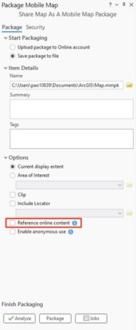
IPS-aware maps can now be packaged into a Mobile Map Package (MMPK) for offline use. The MMPK includes both the indoor map and indoor positioning data, allowing devices without internet access to continue utilizing indoor positioning capabilities. To create IPS-aware MMPKs, use the “Share Map as a Mobile Map Package” tool and uncheck the option “Reference online content”. This update is also part of the ArcGIS Maps SDK for Native Apps release (see bottom of the blog).
Indoor Positioning Data Updates
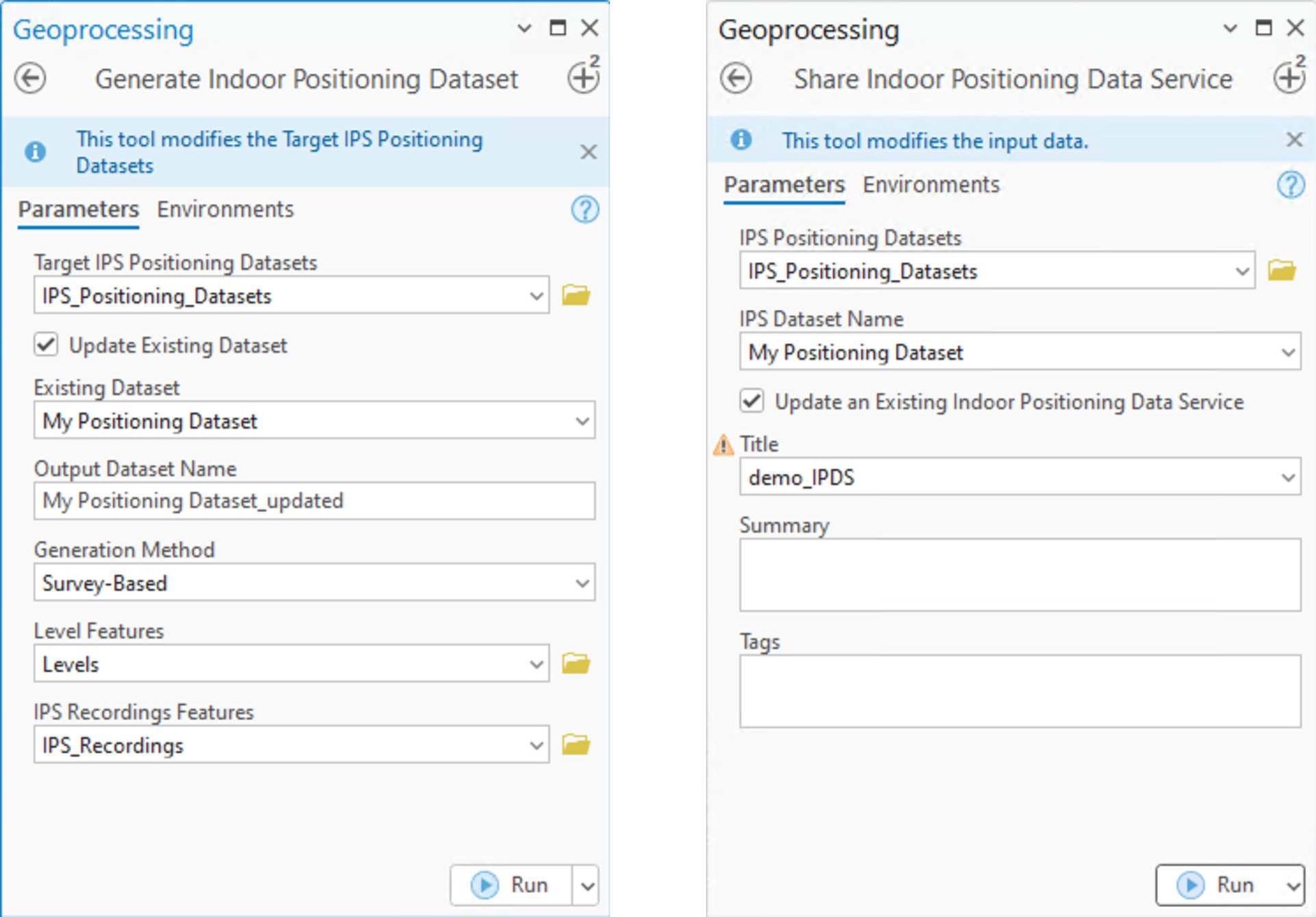
You can now update an existing Indoor Positioning Dataset or Data Service without reconfiguring IPS-awareness. Previously, updates required creating new datasets and services, which also meant updating all web maps linked to the previous Indoor Positioning Data Service. At ArcGIS Pro 3.4, the Generate Indoor Positioning Dataset and Share Indoor Positioning Data Service tools have a new option to update existing positioning data. Simply turn the Update Existing Dataset checkbox on and select the existing item that you want to update with new data.
3D Visualization Support
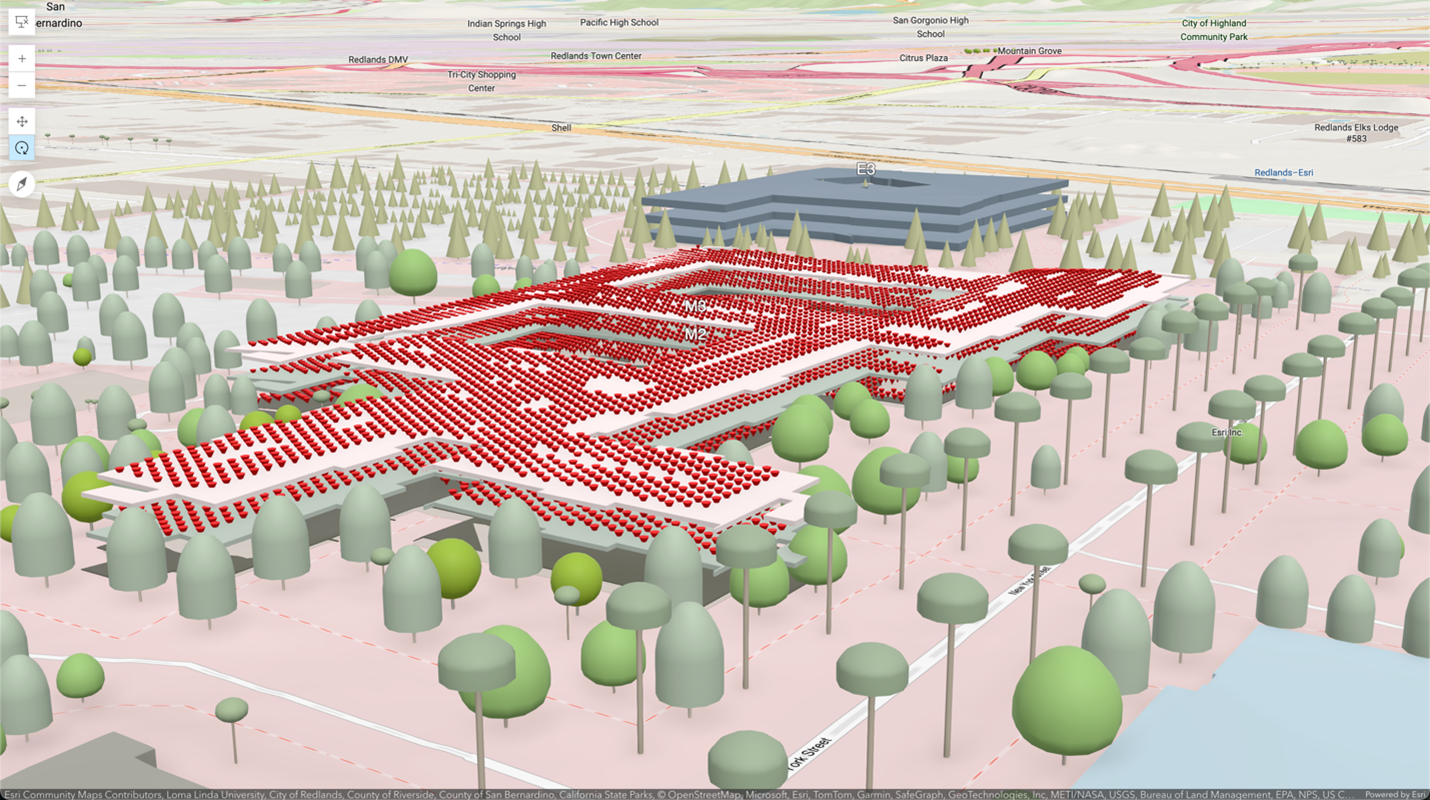
Indoor Positioning Datasets are now supported in 3D scenes to provide an enhanced visualization experience for indoor positioning data.
Updates to ArcGIS IPS Setup App
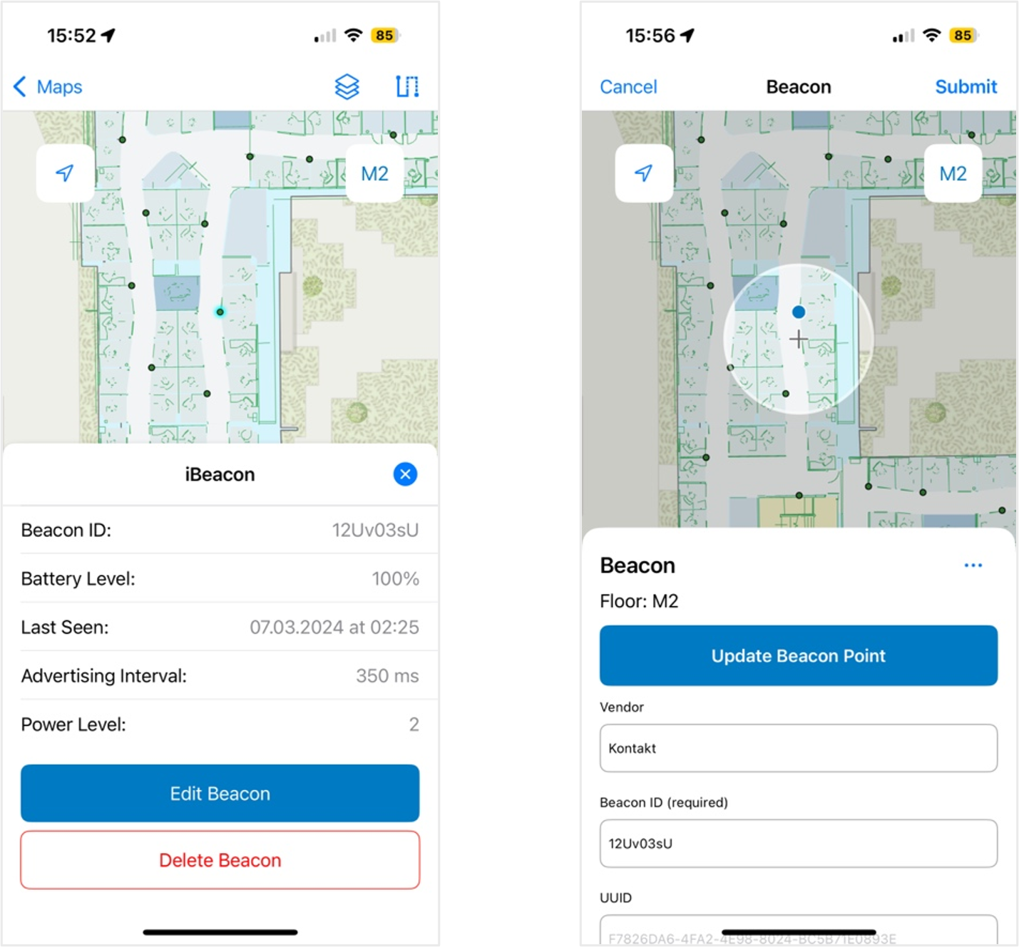
Beacon deployment and maintenance features
Indoor positioning systems typically require some kind of hardware. The majority rely on Bluetooth Low Energy (BLE) beacon signals as input for indoor position estimations. Sometimes, Wi-Fi signals are used in place of BLE.
To capitalize on the benefits of the survey-less indoor positioning data generation method, beacon positions inside the facility must be defined and precisely marked on an indoor map. Aside from the existing option to create and edit features via the ArcGIS Field Maps app’s functionalities, you can now use the ArcGIS IPS Setup app to annotate beacon features through specially tailored workflows. This allows users to quickly deploy and m aintain information about their indoor positioning system infrastructure.
This functionality provides the basis for future capabilities such as automatic health (battery) monitoring of IPS networks.
Map Settings
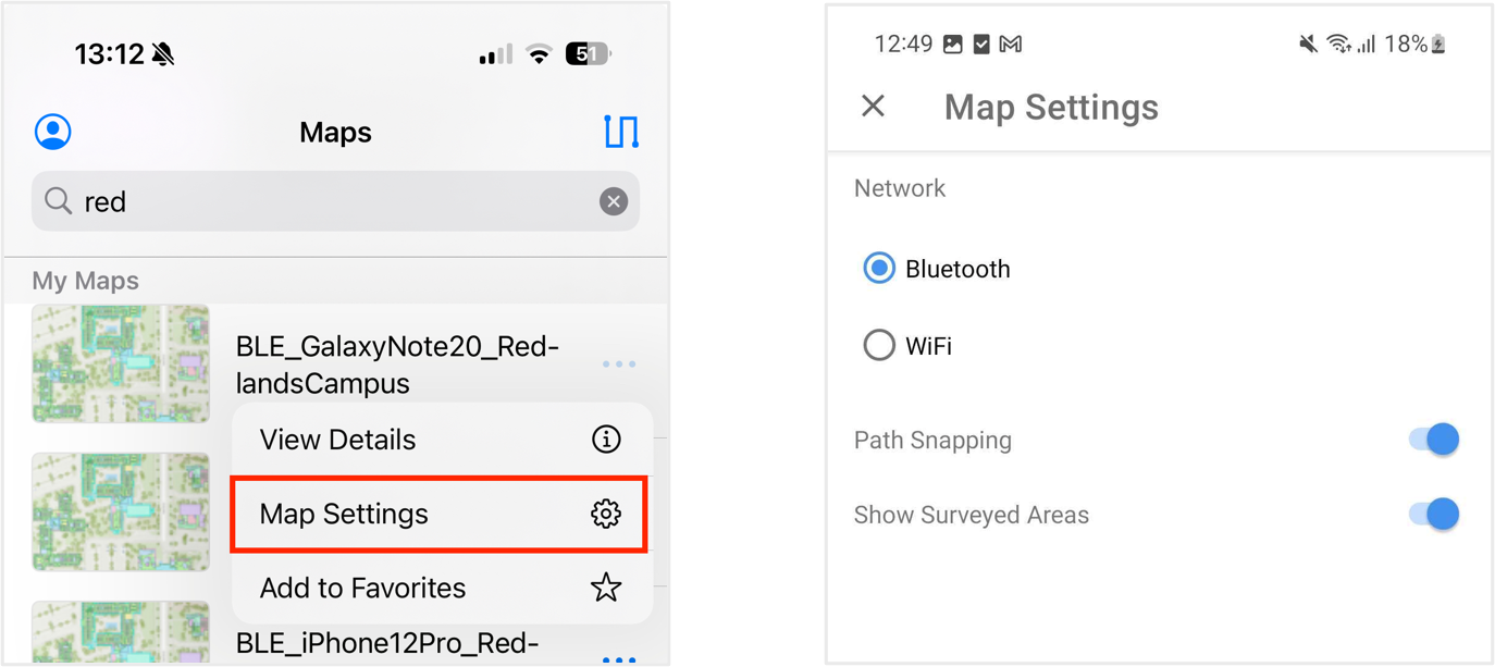
ArcGIS IPS performance configurations used to be handled at the app level within the user profile. The introduction of map settings now allows path-snapping, and network configuration (more specifically – survey radio type on Android; and beacon UUID definition on iOS devices) to be defined at the map level allowing more flexibility during IPS enablement and testing. While IPS configurations can be defined in the indoor positioning map property, IPS Setup users will be able overwrite or customize them in map settings for specific conditions testing.
New icons for Survey, Recordings, and Layers
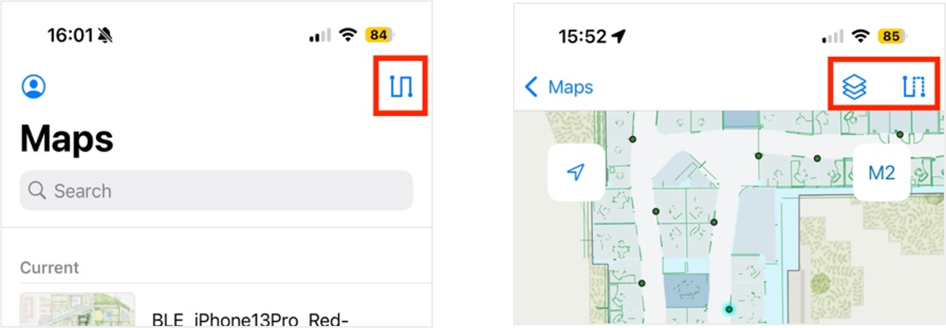
The ArcGIS IPS Setup app has further been enhanced with updates to the user interface, such as replacing the existing Recordings created list icon and introducing a brand-new Survey icon. In addition, a new map layer filter now allows you to customize the visualization of the IPS map layers.
ArcGIS Maps SDKs for Native Apps
Indoor Positioning Configuration
The IndoorPositioningDefinition, which stores information needed to create an IndoorsLocationDataSource (ILDS), now has a new configuration property. It is populated when an indoor positioning configuration is shared with the map and is used by ILDS automatically, without any additional programming. You can change the configuration for ILDS at any time from within an application.
Support for Fully Disconnected Offline Workflows
MapsSDK can now consume a MMPK that contains both the indoor map and indoor positioning data. Using such an MMPK allows applications to work completely offline and still get the blue dot indoors.
Beacon Scanner
At this release, we have introduced a new module called BeaconScanner in MapsSDK 200.6, which can be used to pick up radio signals from any surrounding beacons. The BeaconScanner can be used to set up and maintain an IPS deployment, and the information from it can be used to update the IPS_Beacons feature class.
At this initial release, information from the BeaconScanner includes parsing battery level of detected beacons and is supported for Kontakt.io beacons .
Errors and warnings
The behavior of errors and warnings has been updated slightly. Now, errors are only triggered during the startup phase of ILDS, the main reason being missing or incomplete IPS data.
Warnings can occur while ILDS is running. They indicate a possible degradation in the quality of the calculated indoor position. A warning is issued once at the end of a position calculation cycle, and then the warning property will be reset to null once ILDS is running smoothly. The same warning will not be triggered again in subsequent calculation cycles.
For more information, please visit the ArcGIS IPS product page. Ask questions and stay up to date by joining our Esri Community place.



Commenting is not enabled for this article.