Effective asset management is essential for organizations to control the life cycle of assets, ensuring a balance between performance, risk, and expenditure to meet organizational goals. Geographic information system (GIS) technology significantly enhances asset management by providing a spatial context for data, enabling organizations to visualize, analyze, and manage assets more effectively. GIS facilitates better decision-making by offering insights into assets’ condition, location, and performance, leading to optimized maintenance strategies, improved operational efficiency, and enhanced long-term planning. Through GIS, organizations can streamline asset management processes, ensure data quality, and achieve regulatory compliance, ultimately maximizing the value and lifespan of their assets.
Water and wastewater utilities manage assets that are horizontal as well as assets that are vertical. Horizontal assets include water pipes, valves, meters, fire hydrants, sewer pipes, maintenance holes, and reclaimed water pipes. Vertical assets include equipment and facilities at water and wastewater treatment plants, pump stations, dams, water storage tanks, and support facilities.
The water industry began using ArcGIS for horizontal asset management decades ago. GIS was initially used to store asset information and visualize this information on a map. Over time, utilities have advanced their use of GIS to effectively monitor the condition, location, and performance of horizontal assets, leading to better decision-making and long-term planning. The use of GIS for horizontal asset management has become a standard practice, providing valuable insights and tools for managing complex horizontal infrastructure networks.
A System for Vertical Asset Management
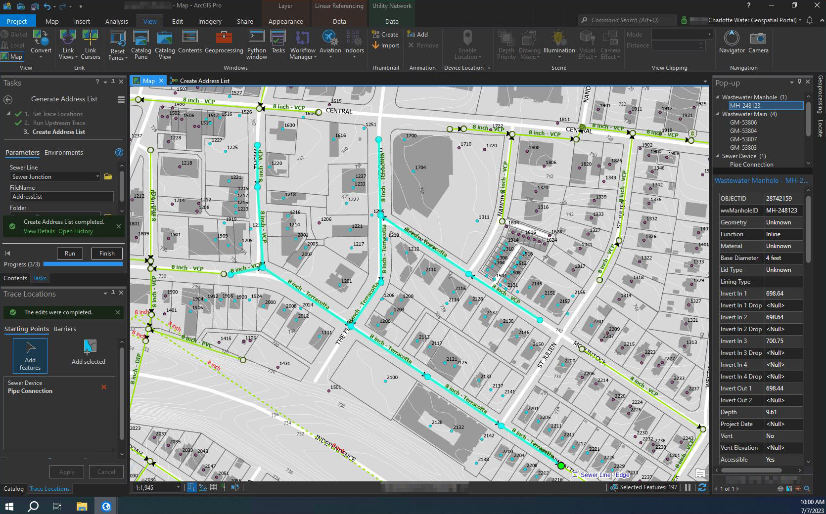
Challenges related to a changing workforce, aging infrastructure, extreme weather, regulatory requirements, and lack of resources are pushing utilities to be more innovative. Utilities that are already using ArcGIS technology understand its powerful capabilities and are applying what they know to advance their asset management strategy. Modern network management solutions have enabled them to digitally transform how they manage their horizontal assets and transition to more holistic asset management that includes vertical assets. This often incorporates a shift from hierarchical asset management strategies previously used for vertical assets, to comprehensive mapping of real-world physical assets in GIS. Technological capabilities provided by GIS-based solutions include the ability to map asset groups and asset types, resulting in a strong foundation for vertical asset management.
Extending the Benefits of GIS into Your Facilities
ArcGIS has proved to be indispensable in enhancing operational effectiveness and facilitating informed decision-making processes. Its capabilities have evolved and expanded, offering a comprehensive view of infrastructure that encompasses both vertical and horizontal assets. Utilities streamline facility management by leveraging GIS solutions for establishing a robust system of record, expediting facility mapping, enabling 2D and 3D visualization, aiding in maintenance planning, fostering collaboration, and integrating with various business systems. This empowers organizations to make data-driven decisions, enhance operational efficiency, and ensure the longevity and optimal performance of their facilities.
- System of Record—A GIS-based authoritative system of record plays a crucial role in supporting vertical asset management. It serves as a central repository for all spatial data related to assets and ensures data quality. The system of record is the foundation for expanding GIS within facilities. It is the first step in streamlining asset management processes, improving decision-making, and enhancing operational efficiency.
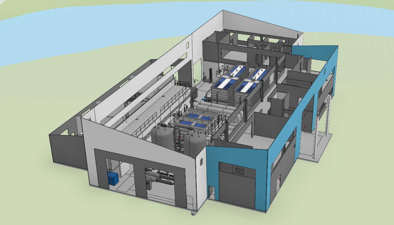
- Facility Mapping and Visualization—With 2D and 3D models of vertical assets, utility staff have a realistic representation of their facility. This makes it easier to understand spatial relationships between various assets and how they interact with one another. Having a comprehensive view of the location, size, and condition of assets and facilities improves understanding. It enables staff to quickly locate assets, reduces onboarding time, and improves safety.
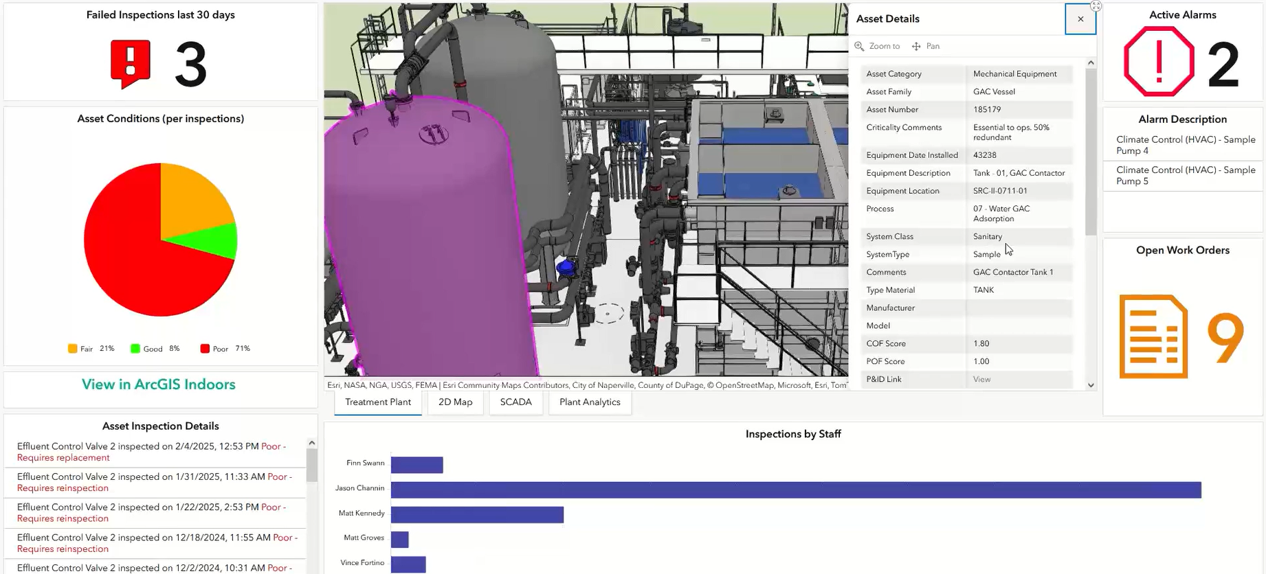
- Maintenance Planning—Web maps, mobile applications, and dashboards help utilities plan, schedule, and perform maintenance activities for vertical assets. By tracking maintenance history, scheduling inspections, and prioritizing repairs, utilities can ensure the optimal functioning and longevity of their infrastructure. Asset information paired with maintenance data enables staff to perform analysis that reveals patterns and trends.
- Collaboration and Communication—Easy-to-use applications like mobile apps, web apps, dashboards, and interactive maps enable collaboration and communication among different departments by providing a common platform for sharing spatial data and asset information. These applications can also be used to inform and engage stakeholders, regulators, and the public. Collaboration and transparent communication foster trust and loyalty, improving customer satisfaction.
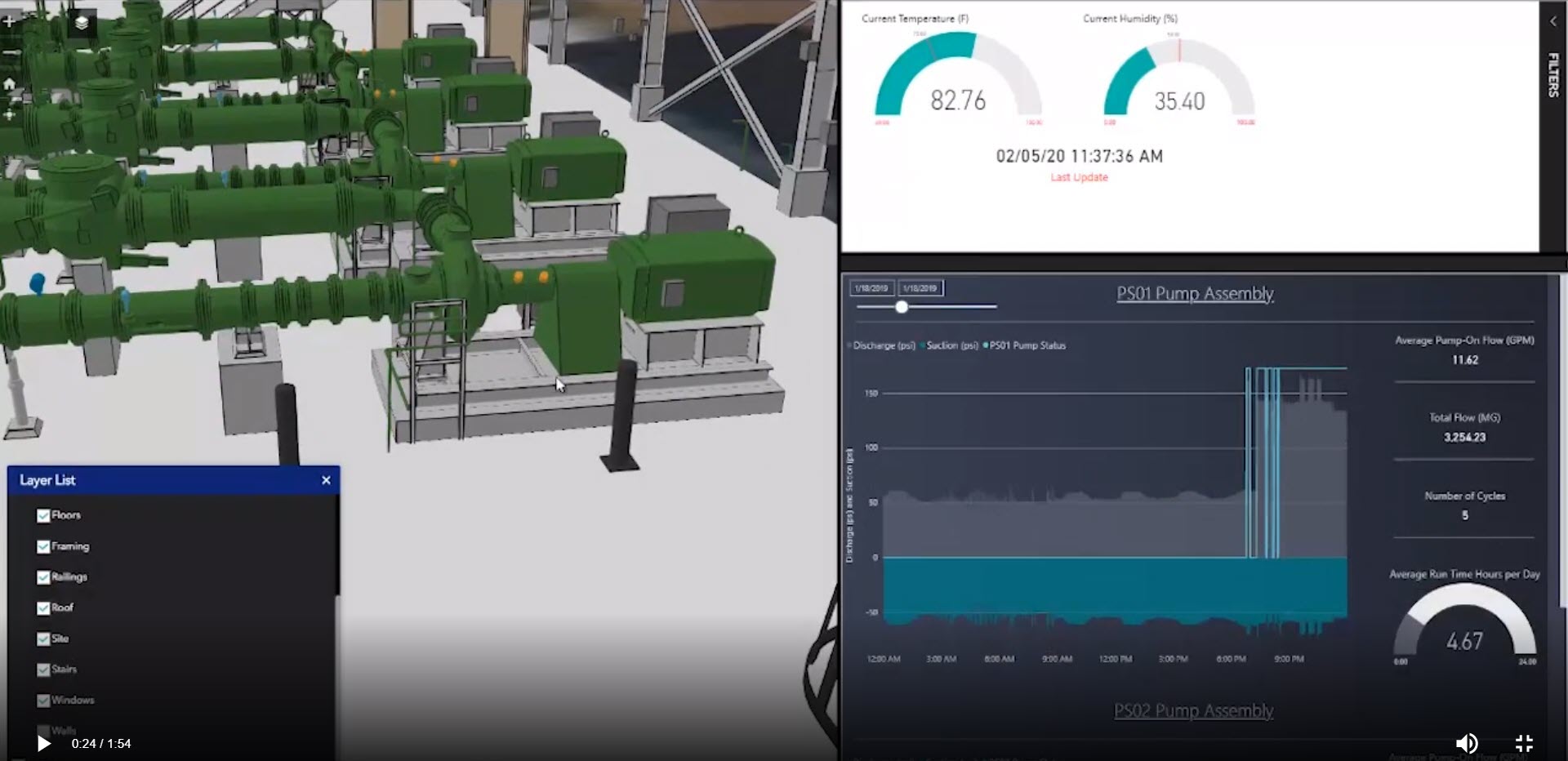
- Integration with Business Systems—ArcGIS can be integrated with critical business systems like SCADA, CMMS, and EAM as well as IoT sensors. Real-time data on performance, condition, and environmental factors allows utilities to monitor asset health, detect anomalies, and proactively address issues. Building information models can be integrated with GIS to allow utilities to combine spatial data with detailed building information. Integrating business systems allows for a more unified and efficient workflow. Having quick access to system information leads to better resource allocation and reduced expenses.
Getting Started with GIS-Based Vertical Asset Management
Build a System of Record: Visualize, Locate, and Understand Assets
Building a system of record involves creating a centralized repository for storing and managing data that serves as the single source of truth. Various types of documents can be used to gather essential information. These include asset inventories, facility plans and layouts, maintenance records, CAD files, and BIM. Utilities may decide to use lidar or photogrammetry to create 3D views.
It’s important to identify a starting point, which is often the creation of 2D floor plans and location of assets. This becomes the foundation for more advanced visualization and interaction with facility and asset information.
Improve Access to Important Documents and System Information
Utilities often have documents in multiple places, physically or digitally, with various teams or departments maintaining ownership. Record drawings, operations and maintenance manuals, safety manuals, standard operating procedures, and process and instrumentation diagrams provide important information for plant management. These types of documents can be hyperlinked within ArcGIS to make them easily accessible to staff, increasing workflow efficiency.
Where documents are stored depends on the utility’s business requirements. They can be stored in an enterprise document management system, in a commonly used system like SharePoint, or as attachments in ArcGIS.
Integrate Critical Business Systems
Integrating GIS and asset management enables utilities to display and monitor work within facilities, providing spatial awareness that was not previously available. Integration of GIS, CMMS, and SCADA greatly enhances asset management by combining spatial data, real-time operational data, and maintenance information within a visual platform. The benefits that utilities gain by integrating critical business systems include better decision-making, efficient task management, improved safety, and limited downtime—all of which lead to significant cost savings.
Integrating systems is not always easy and requires a strategic approach. It’s critical to have a strong understanding of your data and define clear objectives to meet business needs. And don’t forget about change management! Establishing clear communication and providing training must be done to ensure success.


Article Discussion: