ArcGIS Indoors forms the basis of an indoor geographic information system (indoor GIS) that enhances asset and space management, safety and security, and building occupant and visitor experiences. This release introduces 360-degree image support in ArcGIS Enterprise, point cloud-to-floorplan creation, a redesigned Indoors Mobile app, and more.
ArcGIS Indoors for ArcGIS Enterprise 11.4 and ArcGIS Online (24R03) November Updates
ArcGIS Indoors apps have been updated to include an immersive way to visualize spaces and to plan space allocations.
Business unit space planning
Organizations are made up of different business units. Some examples of business units include School of Engineering or School of Arts at a university for higher education, Administration or Accounting for state and local government offices, Pediatrics or Cardiology at a hospital and Sales, Marketing, or Human Resources at a corporate campus.
Space usage varies across different business units within an organization and constantly changes based on growing or shrinking needs. For instance, the Sales department may need fewer individual office spaces due to employees’ frequent travel. Human Resources on the other hand, where more in-person collaboration is necessary, need to be co-located and have designated spaces.
At this release, organization areas have been introduced in the ArcGIS Indoors Space Planner. Organization areas can be used to plan and review space allocations to various business units and further facilitate workspace area planning by giving space planners insight into which units are available for assignment. This way, organizations can plan effective distribution of available spaces across the different business units, consolidate space usage for efficient use, ensure the business units are located around the type of spaces like labs or conference rooms that they need to operate effectively, and eventually help with overall cost savings.
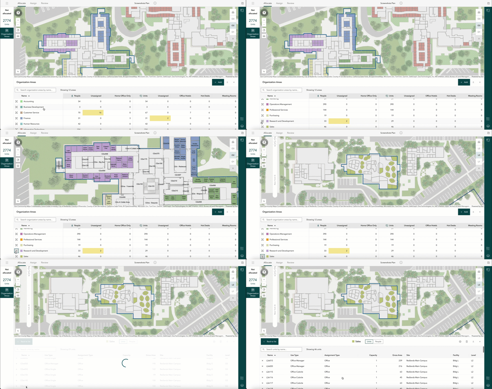
The organization areas table gives a comprehensive view of space allocations across various business units, while also providing further details related to assigned people and units for individual areas. The map theme is updated to reflect different space allocations. The Create Indoors Database and Update Indoors Database tools have been updated to include the information model updates required to create and manage organization areas. Organization areas can be created for every unique value specified in the ORG_LEVEL_1 field of the Occupants layer which is meant for storing business units of the organization.
ArcGIS Indoors for ArcGIS Enterprise 11.4
Immersive 360 Degree Photos
Support for 360-degree photos was already released in the previous ArcGIS Online release (24R02) and is now also available in ArcGIS Enterprise 11.4.
Portable and easy-to-use reality capture devices are being used today to scan building interiors. These devices are equipped with sensors for LiDAR scanning and cameras that capture 360-degree photos.
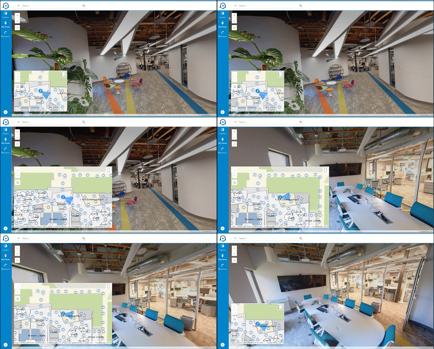
The Import Indoor Images tool allows these photos to be included in the indoor maps and viewed using the Indoors Viewer web app. These photos provide a more comprehensive view of the indoor space and can be very helpful in various situations.
For example:
A mobile worker who needs to complete an indoor work order can better understand the indoor space and its surroundings to make informed decisions before heading to the location. Remote employees who plan to visit the office can better familiarize themselves with the various locations, including reserved office hotels and meeting rooms they plan to visit, before traveling on-site.
ArcGIS Indoors Mobile 2.0 Beta (Update 1)
The Indoors mobile apps for iOS and Android are being completely redesigned. In the 2.0 version, the new app sports a new modern look, is more intuitive to use, includes innovative new features, and is built on the new ArcGIS Maps SDK.
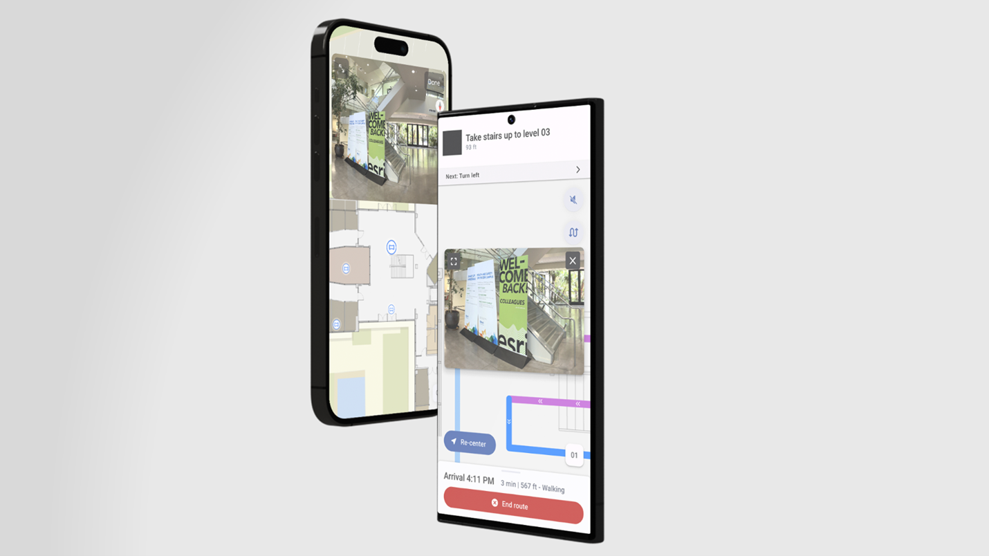
The Beta version was made available in the Early Adopter Program back in August. 360 photos, progressive navigation using ArcGIS IPS , and support for dark mode were some notable new features along several improvements to common workflows that involve searching, directions and office hotel reservations.
The recently released Update 1 includes the capabilities for launch actions and meeting room reservations.
Join the Early Adopter Program to learn more about everything new and improved in Indoors Mobile 2.0 Beta and instructions to install the app. Provide your feedback in the forums to help us improve the app to ensure it meets all your needs.

ArcGIS Indoors Pro 3.4
The latest release of ArcGIS Indoors Pro includes new tools and enhancements to create indoor data, including floor plans and routable networks, as well as new capabilities to existing workflows that simplify them and boost productivity.
Create floor plans from point clouds
Many buildings don’t have CAD or BIM as built files or, if they do, they are often out of date. An alternative is scanning building interiors with portable reality capture devices, which enable Lidar scanning and 360-degree photo capture.
Once you have processed your scans in the reality capture provider’s software, you can export point clouds as .LAS files and use a new tool, Generate Floor Plan From Point Cloud, and generate polylines based on the point cloud.
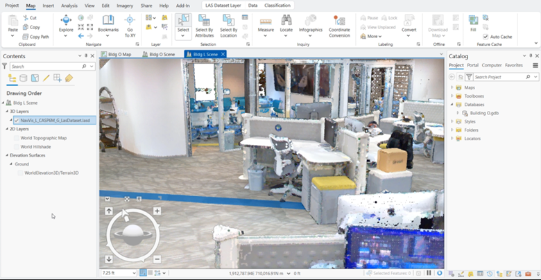
Once polylines are created, you can use editing tools in ArcGIS Pro to clean up the linework—such as accounting for data gaps, further straightening lines, or removing artifacts like furniture or reflections. At the latest release, this workflow has been improved by enhancing the Align tool to provide an option to align parallel polylines based on an offset, such as two sides of a wall.
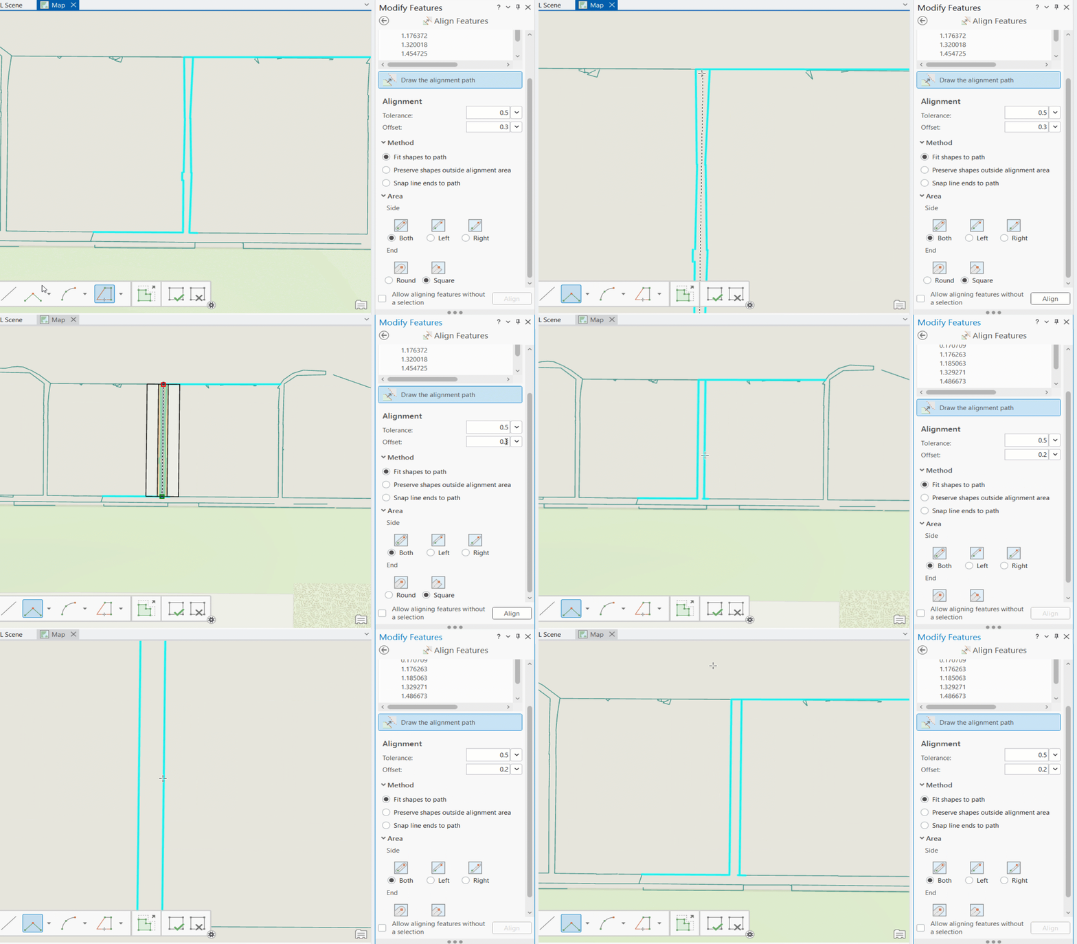
After ensuring that polylines represent the floorplan of the floor in an acceptable way, the Import Features To Indoor Dataset tool can be used to take those polylines and create Facilities, Levels, Units, and optionally Details in an Indoors workspace.
New pathway generation approach for indoor routable networks
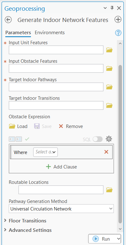
Given that indoor spaces aren’t uniform—some may have different orientations for each wing, lots of curved hallways, or be all 90-degree angles—every building may not call for the same type of pathway generation. A new tool, Generate Indoor Pathway Features, is now available that provides a new option for creating pathways using more of a natural walking algorithm, as well as shrinking the workflow to create both horizontal pathways and vertical transitions between floors in a single tool run.
Floor-aware feature creation
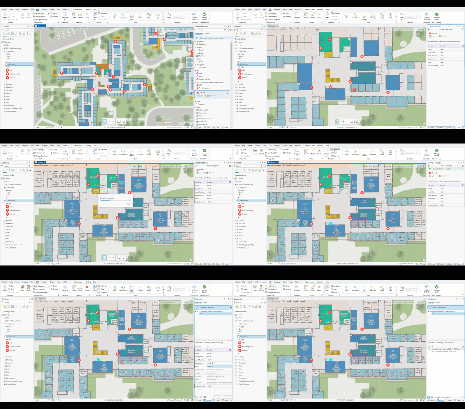
Some workflows may require creating new units, details, or other floor-aware features such as assets or points of interest. In the latest release, when you create features in a floor-aware layer using the Create tool, important Indoors fields will be automatically populated, including the Level ID and z-value (populated based on the geometry of the feature and the level filtered in the map), as well as the Gross Area for units and a generated ID for units and details (if a custom value isn’t provided).
Support for absolute elevation from BIM
Historically, features in an Indoors workspace have been created to artificially set the z-value of the ground floor at 0. This provides a simple solution for floor-aware maps and apps that focus on 2D visualizations or simple, extrusion-based 3D scenes. Because facilities management is increasingly implementing 3D solutions and Indoors models are being built from robust BIM models, ArcGIS Indoors now supports importing BIM models at the absolute elevation defined in the model and through georeferencing.
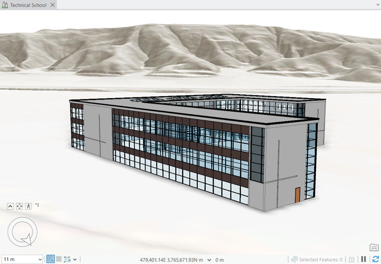
The Import BIM To Indoor Dataset and Import IFC To Indoor Dataset tools include an option to honor the absolute elevation when importing features. This simplifies the workflow to integrate additional BIM data into floor-aware maps and scenes (such as bringing in points of interest or furniture). Furthermore, it opens up the option to share floor-aware scenes with an elevation layer, to better represent the context of a building (such as hillsides, mountains, or valleys) to use in Indoor Viewer or other custom apps. The latest release of ArcGIS Online includes support in Indoor Viewer for scenes based on absolute elevation. This feature is planned to be made available in the ArcGIS Enterprise with the Q2 2025 (11.5) release.
CAD & BIM enhancements for productivity
The latest release of ArcGIS Pro includes the following capabilities for importing CAD and BIM to help streamline workflows and reduce post-processing requirements:
- At ArcGIS Pro 3.4, the Import BIM To Indoor Dataset and Import IFC To Indoor Dataset tools automatically create units for stairways if they aren’t already modeled and include them in the level boundary, minimizing post-processing work required before building a routable network.
- The Import CAD To Indoor Dataset tool now creates a configuration file that preserves the CAD mappings for geometry and attribution, as well as any advanced settings, such as minimum unit width or gap tolerance. When running the tool against subsequent CAD files, you can provide the configuration file and skip manually re-mapping the rest of the parameters. This is well suited for organizations that maintain a consistent CAD layer organization across their floorplans, as well as supporting update workflows after a CAD file has been changed.
- Some third-party asset management systems use the identifying CAD handle for spaces as a key to map asset information. The Import CAD To Indoor Dataset tool now supports mapping the CAD handle as an attribute to units that are modeled as closed polylines in CAD to support integrating with asset management systems.
For more information, please visit the ArcGIS Indoors product page. Join our Esri Community place to stay up to date and ask us any questions.


Commenting is not enabled for this article.