
The 2025 Esri Partner Conference and Esri Developer & Technology Summit in Palm Springs, California are just around the corner! This is a great opportunity to learn about the latest advancements in Indoor GIS that are designed to elevate indoor asset and space management, improve safety and security, and enhance the occupant and visitor experience.
Indoor GIS is a unified floor-aware ArcGIS system for visualizing, analyzing, and managing indoor spaces. This ability enables organizations to make their operations more efficient and make the people who use and visit their buildings feel better. Indoor GIS is powered by indoor maps created with ArcGIS Indoors, and indoor positioning could be overlaid through ArcGIS IPS.
Esri Partner Conference (EPC) | March 9–10 | Palm Springs Convention Center
The Indoor GIS team is excited to network with new and familiar partners while showcasing the latest innovations in indoor mapping! Don’t miss our session:
Monday, Mar 10 | Sales Enablement Session | 1:30 PM – 2:30 PM PDT | Madera, Renaissance Hotel
Discover the latest indoor GIS product technical updates as well as business opportunities around indoor GIS. This presentation also details common trends and use cases and provides best practices for indoor GIS implementations. Additionally, speakers discuss the Indoor GIS specialty opportunity and requirements.
Explore the 2025 Esri Partner Conference Event Map to find sessions and see where events are taking place.
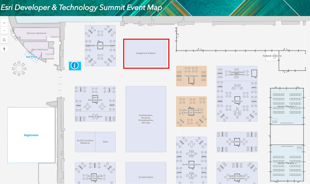
Esri Developer & Technology Summit | March 11-14 | Palm Springs Convention Center
Esri Developer & Technology Summit is the place to connect with a vibrant community of developers, system architects, administrators, and security and DevOps engineers as you explore the latest advancements in ArcGIS. Here are our Indoor GIS sessions that you won’t want to miss:
Indoor GIS: Developer Options for Building Indoor Mapping Apps
Wednesday, Mar 12 | Technical Session | 5:30 PM – 6:30 PM PDT | Primrose C, Palm Springs Convention Center
In this session we will demonstrate building indoor mapping apps by covering the floor-aware ArcGIS Maps SDK for JavaScript and ArcGIS Maps SDKs for Native Apps, as well as how to use ArcGIS Experience Builder to build an indoor mapping experience. We will touch on the benefits and drawbacks of each approach to help you determine which is the most appropriate for your use case.
Indoor GIS: Building Indoor Mapping Web Applications
Thursday, Mar 13 | Demo Theater Session | 10:30 AM – 11:00 AM PDT | Demo Theater 2: Oasis 1-2, Palm Springs Convention Center
In this session, you will learn how to use the ArcGIS Maps SDK for JavaScript to build indoor mapping web applications for floor aware maps. In addition, you will also see how to build indoor mapping experiences with low or no code using Experience Builder.
Using ArcGIS Maps SDKs for Native Applications to Build Indoor Mapping Apps
Thursday, Mar 13 | Demo Theater Session | 11:15 AM – 11:45 AM PDT | Demo Theater 2: Oasis 1-2, Palm Springs Convention Center
In this session, you will learn how to use the ArcGIS Maps SDKs for Native Applications to build native mobile indoor mapping applications for floor aware maps.
Indoor GIS: Developing Indoor Positioning in Native Mobile Applications
Thursday, Mar 13 | Technical Session | 4:00 PM – 5:00 PM PDT | Mojave Learning Center, Renaissance Hotel
Learn how to add indoor positioning to your custom developed native mobile (iOS and Android) application using ArcGIS Maps SDKs for Kotlin and Swift. The session also includes a brief overview and road ahead on Esri’s indoor positioning technology.
Showcase: Talk to Our Experts
Come visit us at the indoor mapping and indoor positioning kiosks in the Imagery and Indoors showcase area! Our team will be there to chat with you about the latest updates and capabilities. You’ll also get the chance to see live demonstrations of ArcGIS Indoors maps, indoor data migration, routing, space planning, and more. Plus, the ArcGIS IPS team will showcase the indoor blue dot experience, allowing you to visualize your real-time position inside the convention center on the map.
Explore the 2025 Developer Technology Event Map

This year, we are featuring an indoor mapping experience powered by ArcGIS Indoors. Attendees can use the web map linked above or the Esri Events mobile app to easily navigate the conference center. You can locate and navigate to sessions saved to your schedule or simply click on the map to select your destination and get turn-by-turn directions. Additionally, interactive touchscreen kiosks will be available on-site to help you find your way.
These gatherings are an amazing opportunity to network with experts, learn more about indoor GIS, and discover how to leverage the technology to drive business success. Let’s make the most of this chance to share insights, explore new ideas, and build a network of connections! We can’t wait to see you !


Article Discussion: