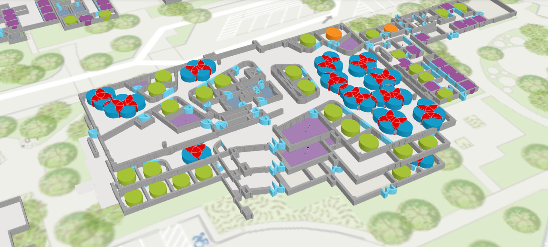
Space Planning for COVID 19 Recovery
Current Situation
Since the outbreak of Global COVID-19 Pandemic the demands for our real estate and facilities management customers have rapidly evolved. Many organizations that occupy dozens – or even hundreds of facilities – completely transitioned to working from home. This has left entire portfolios un-occupied for months, and restricted access to secure environments and information some employees need to fully perform their duties. Now, many organizations are planning to enable certain employees to re-enter their facilities in phases of a re-opening.
Unfortunately, as we’ve seen in numerous studies, sharing indoor space is a major SARS-CoV-2 infection risk. While organizations are faced with many important decisions as recovery efforts are underway, perhaps the most important question of all, is how can we prioritize employee health and safety in our facility re-entry plans?
Companies must properly plan how their indoor space is used to ensure safety and security of their employees. Yet, their data is often limited, or siloed at best, and time consuming to process. The current solutions are only short-term, leaving stakeholders disconnected, and the occupants as an after-thought. These task forces need a common platform to visualize, analyze, and share new plans to ensure the health and safety of mission critical employees.
"All identified outbreaks of three or more cases occurred in an indoor environment, which confirms that sharing indoor space is a major SARS-CoV-2 infection risk."
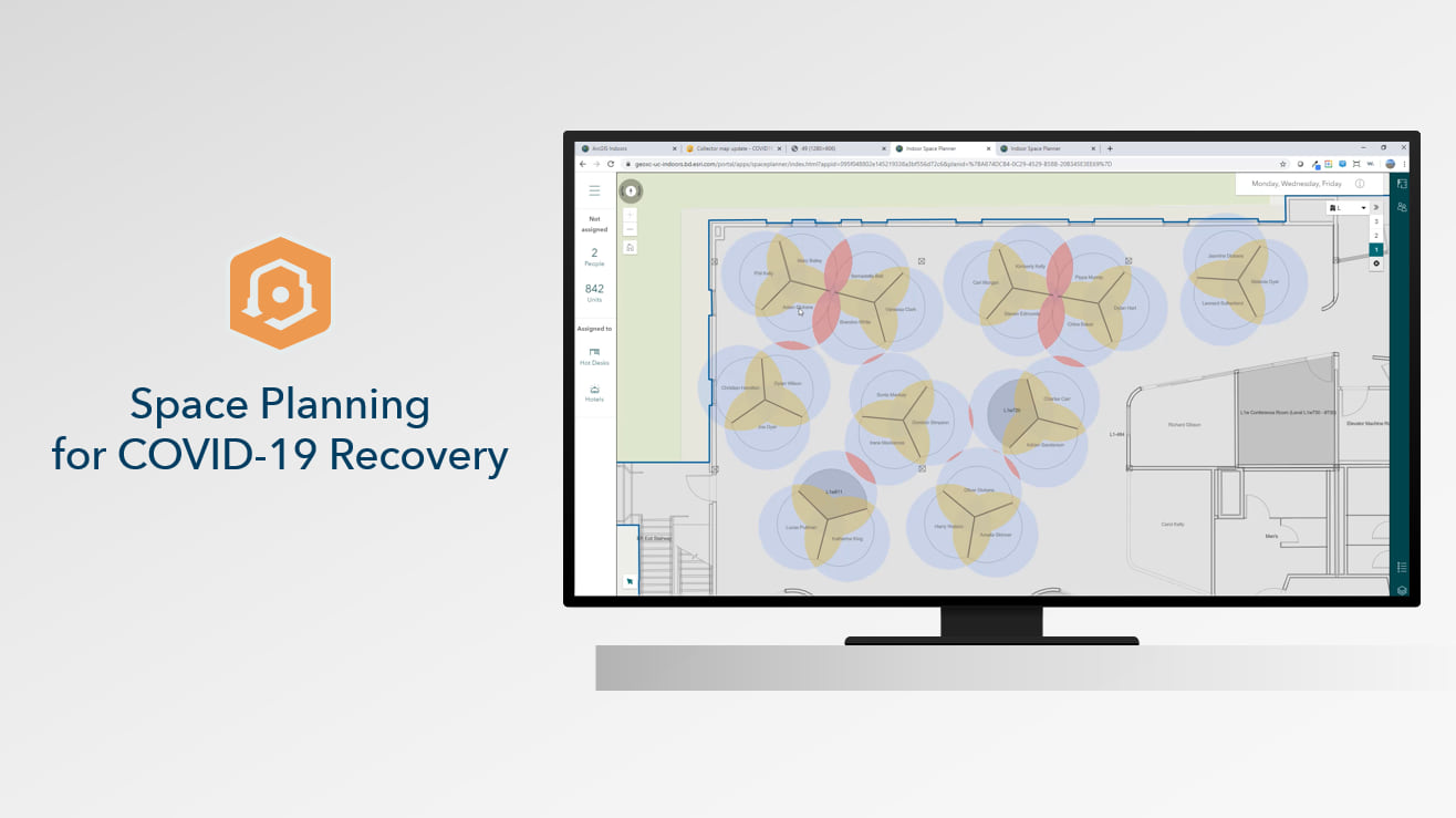
Space Planning for COVID-19 Recovery
Space Planning for COVID-19 Recovery with ArcGIS Indoors leverages a set of tools that modernize your floorplan data management, facilitates better planning across the portfolio, and engages occupants involved in new seating arrangements and protocols. The solution is an easy to deploy SaaS offering with as many secure user identities as needed. Read more about space planning for COVID-19 Recovery below.
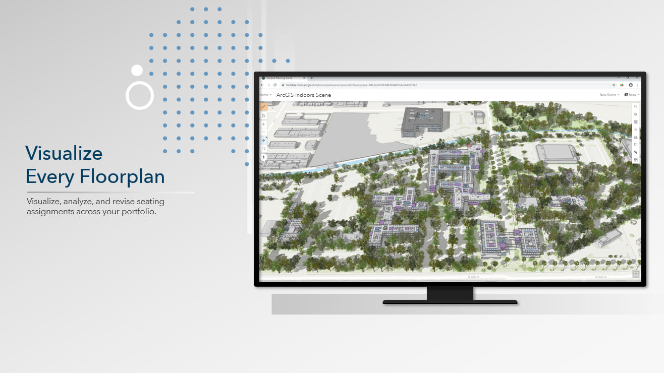
Visualize every floorplan
Rather than relying on individual CAD drawings – modernize your floorplan data management with indoor mapping. Users can securely access and visualize indoor maps of every floorplan across the facility or portfolio in just a few clicks. Indoor maps are configured to represent seat safety or occupancy by person, business unit, return phase, or any other attribute of the unit. Use these visualizations to help your task force easily see who is assigned to sit where to better engage stakeholders in the decision-making process. Operationalize your CAD and BIM for re-use across any business process.
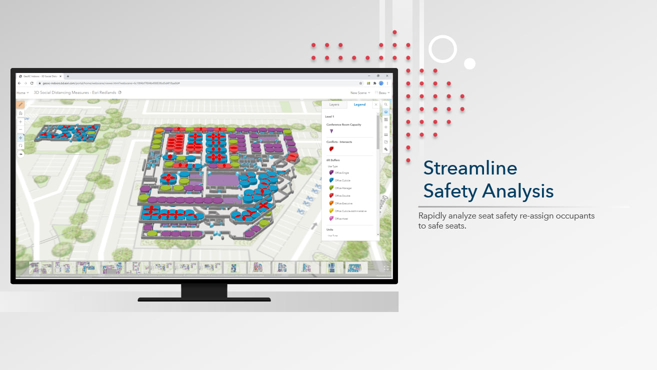
Streamline Safety Analysis
You can eliminate tedious, individual analysis of each seat across every floor. ArcGIS Indoors tools are configurable to your organization’s preferred social distance measures and can run on every seat on every floor – improving the speed of safety analysis. Further refine the analysis by running on specific space types, or other attributes such as an occupant’s business unit, tenure, or return phase. Use these analyses to re-assign occupants to safe seats to ensure their health and safety.
Improve Planning Transparency
Coordinating with stakeholders to operationalize plans can often be difficult due to conflicts of interest or organizational priorities. Use web-based visualizations of floorplans and safety analysis in the space move process to improve communication of where conflicts of social distance measures are and make the most critical space moves first. Even use these indoor maps to show where flexible space could allow employees to reserve safe seats on a rolling basis, or only on specific days of the week. The increased transparency will show everyone that employee health and safety is the top priority and ensure the successful implementation of new protocols.
Ensure Safety and Security
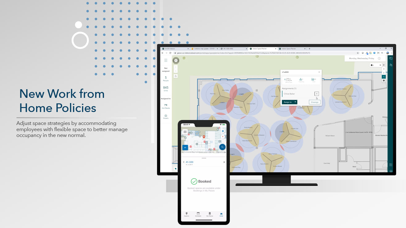
Engage occupants in these new protocols with end user applications that help them get more comfortable and confident in their new workspaces. As the most important stakeholders in the re-opening of facilities, occupants can access new workplace maps that help them understand the new configuration of their facilities. Web and mobiles apps show updated seating arrangements, location of wellness stations, or other workspace availability – offering the ability to book safe workspaces and conference rooms or request sanitation to a specific location. Internal memos and bulletins will not be enough to make such a big transition.
New Work from Home Policies
Due to improved employee happiness and productivity, flexible work from home (WFH) policies have long been on the rise. With the opportunity adapt space strategies that enable better space utilization and access to new talent pools, organizations that make updates to their own long-term protocols will keep employees safe in the near-term, and differentiate themselves, be more competitive, or continue to lead their industries in employee experience for the long-term. With ArcGIS Indoors, organizations have a solution that will drive valuable employee interactions for years after COVID-19 recovery concludes.

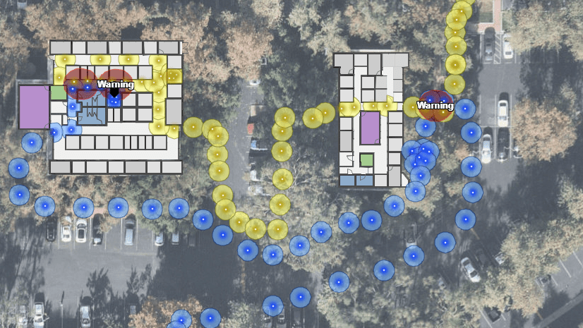

The contact tracking on my iPhone8 reported 12 contacts over the past 3 days, including a hospital visit none near an infected area.