The Engagement Matters Podcast
Season 1, Episode 5
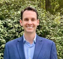
Joseph Griffin, the Program Manager for the Adopt-A-Spot program at the City of Berkeley, California shares how GIS helps him engage residents to support environmental and safety programs.
Listen now
Click on the audio player below to listen to this episode.
(Listen on any of these platforms:
Apple Podcasts, Spotify, Amazon Music, iHeartRadio, PlayerFM, Podbean)
Background
Many cities encourage residents to “adopt” infrastructure to reduce roadside trash, paint over graffiti, and much more. These programs collectively help save city governments millions of dollars each year through volunteer labor, but more importantly, the programs help residents connect with their city in a physical way. This sense of co-ownership of small, neighborhood assets exemplifies the civic-mindedness that the City of Berkeley’s Public Works department has successfully fostered for decades. Now, the City is aiming to take these programs to the next level of engagement with technology.
Attracting resident volunteers
Adopting a traffic circle or a storm drain doesn’t immediately resonate with most people, but then again, Berkeley isn’t just any city. Joseph Griffin, the City’s first full-time manager of the Adopt-A-Spot programs, is quick to point out that “residents in Berkeley really have a long history of being civic-minded.” Many of us know Berkeley as a national epicenter of cultural change and activism but there’s also a deeply rooted culture of giving back to the city in which we live. Joseph is committed to building on the 20+ years of success that the City has cultivated in the Adopt-A-Spot programs by retaining the volunteers the programs have and recruiting new volunteers along the way.
His goal is to identify the personas – or common characteristics of residents – that tend to volunteer for the programs already: : individuals that like the outdoors, parents that want to instill a sense of city pride in their kids, business owners interested in giving back to their neighborhood, school groups, community organizations, and many more. The challenge is in finding these people, capturing their attention, and then demonstrating the value of the programs. In the end, it’s a two-pronged approach of educating people and then motivating them to volunteer. Most of the time, Joseph finds potential volunteers at City events or in events like the Berkeley Bayfest (an extension of Earth Day), The Berkeley Project, Keep Berkeley Beautiful, and the Coastal Cleanup Day. In all of these events, he’s trying to leverage the marketing that has already happened for the core event to bring out people that are interested in environmental issues, rather than re-do this marketing only for the Adopt-A-Spot programs.
When Joseph is talking to residents/potential volunteers, he doesn’t just lecture about the issues. He uses everything he can get his hands on to help tell the story: a custom-built diorama that shows how water moves through Berkeley (off of roads, into storm drains, into creeks, and then into the bay), flyers, maps, and more. Using the diorama helps demonstrate how important it is to adopt a storm drain and keep it free of pollutants. The maps show the extent of the challenges the city faces and the locations where traffic circles or storm drains need to be adopted. Lastly, the flyers use text and images to continue the “conversation” with the resident/potential volunteer after events. All of these mediums work together to explain how important traffic circles are as traffic calming devices, making roads safer, and how planting native pollinator plants to the traffic circles also helps beautify the city and improve biodiversity. The blend of practical impact (like less flooding and safer roads) is paired with the bigger goals of improved water quality and better natural habitat.
Showing value and evolving programs
Of course, long term success of the Adopt-A-Spot programs is only possible if the volunteers feel – and see – progress. To that end, Joseph has dramatically increased his level of outreach after volunteer events are held. This has resulted in a 147% increase in subscribers of his monthly newsletters in the last year alone. These newsletters use the data that Joseph collects with GIS “to tell stories, to show metrics and measure our progress.”
He also makes sure that volunteers know that they can participate as much as they want because of the site-specific nature of the projects available. Once a storm drain is cleaned or a traffic circle beautified, that’s the end of that phase of project. For the rest of the year, volunteers continue performing small maintenance as necessary. Volunteers can opt to participate in more projects but by signing up for one project aren’t automatically expected or obligated to continue to other projects, even though many do continue. In this way Joseph helps reduce the possibility that any single volunteer gets exhausted with the workload and drops out. The same approach is true for student groups like the Berkeley Project which draws 2,000 students twice a year. Students are busy too and can volunteer with their peers in the Project or opt to increase their participation just like residents.
A major driver of continual engagement with the volunteers is Joseph’s desire to make volunteering fun. With financial assistance from the UC Berkeley Chancellor’s Grant and the UC Botanical Garden, Joseph was able to lead a native pollinator plant giveaway. If a resident participated in a traffic circle planting project, they are automatically eligible to receive a plant to put in their own local traffic circle. This is a key differentiator between the City of Berkeley’s volunteer projects and others: using swag that is both appropriate for the volunteer event but that also supports the goals of the event. It makes no sense to have environmental-focused programs that give away disposable, plastic trinkets that don’t benefit the long-term health of the community.
Leveraging technology
For much of the Adopt-a-Spot program’s existence, one on one interactions have been key. There’s no replacement for being present at an event, connecting directly with residents, and telling stories. Joseph has found that there are huge opportunities to use technology to broaden the reach of the stories he tells and to help make the volunteer sign-up and work tracking much more efficient. He uses interactive maps inside of ArcGIS Hub to show where volunteers are needed in the City. Using the Hub, volunteers can see a map of project locations and their home location residents. They can even “figure out which one they want to adopt, they can also share their maintenance activities with the general public, and even request supplies” to support their work. These tools help reduce the staffing burden on the City’s side but also helps programs scale up dramatically with just Joseph supporting the backend. This gives him more time to focus on improving traffic circles and storm drains and spend less time managing stacks of paper and doing data entry.
At the end of the day, Joseph boils down GIS’ impact on Berkeley’s Adopt-A-Spot programs into four main benefits:
- Impact: Drive community access and focus work on the highest priority areas
- Co-Management: Empower volunteers to team up and collaborate easier with one another
- Transparency: Be clear about where things are improving and where more work needs to be done
- Engagement: Helping volunteers see – and share – their impact with the community
Learn More or Get Involved
To learn more about the volunteering opportunities in Berkeley, check out either of the City’s Hub sites at:
If you want to know more about the City of Berkeley, California’s volunteering opportunities (including the Adopt-A-Spot programs), visit their website.


Article Discussion: