Governments and organizations have been hard at work creating Open Data sites to make their authoritative data accessible, discoverable, explorable, and collaborative. There are over 100 sites in the ArcGIS Open Data site gallery for you to explore! The Site of the Week is a series that profiles one ArcGIS Open Data site each week.
—
December 15th, 2014: Charlotte, NC
The City of Charlotte’s site has been months in the making, and on December 15th the City officially released their masterpiece. Their open data portal, intended for all City of Charlotte data—both spatial and non-spatial data, is the result of a collaborative effort from offices across the City. Charlotte was a 2014 Code for America partner city and hosted fellows who focused on civic engagement for the past year, and developed Citygram to demonstrate the value of open data. The Charlotte Open Data Portal advances the City’s reputation as an emerging IT leader.
Charlotte hits the nail on the head when explaining why they set up the open data site. In the spirit of transparency and open government, Charlotte has provided the public with access to over 40 authoritative datasets. This readily available and unbiased information provides Charlotte’s citizens with a higher degree of visibility into public services, which can enhance and sustain trust in local government.
On top of contributing to a sleek site for their community, the Code for America fellows have created a demonstration project of the portal. Citygram is a geographic notifications platform that is built on top of the open data portal, and is just one example of the kinds of things the community can build with open data. The City of Charlotte anticipates that the site will become an economic development driver for the city as app developers, engineers, and designers have new fodder to create great services.
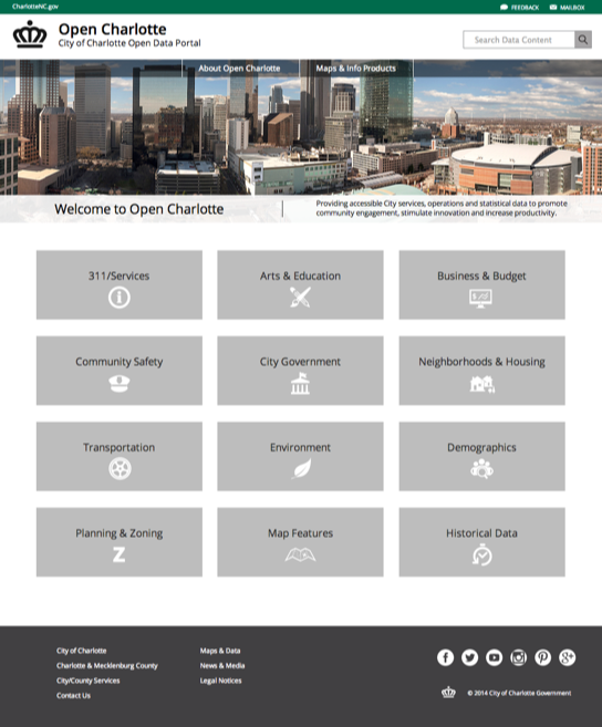
As for the layout of the site, it’s obvious that Charlotte has put a ton of effort into creating a completely custom configuration to match their city’s branding. Site users can discover maps in the City and County Maps Gallery and can communicate with the City through their various social media channels. However, the real value comes from the clean and user-friendly datasets. Charlotte’s data have great titles, descriptions, and icons, which helps their discoverability and creates a great user experience.
The site will continue to grow as Charlotte adds more datasets, and Charlotte will continue to grow as leader in the open government space.
—
Stay tuned for next week’s Site of the Week. In the meantime, check out the interactive Explore Open Data map to view more awesome sites, and get started with making your own Open Data site here.

Commenting is not enabled for this article.