This article was originally published on 06/27/2024, and has been updated.
Share maps in Microsoft Teams through the chat or a call, and allow others to annotate and use ArcGIS for Teams to collaborate spatially. In this ArcGIS for Teams Esri Community video Maya and Cory hop on a Microsoft Teams call and collaborate on a shared map to manage and schedule coffee delivery routes via ArcGIS for Teams.
…………………………………………………………………………………
The February 2024 ArcGIS for Teams release introduced Present a map—our first foray into collaborating with colleagues in real time on a map during a Microsoft Teams call or chat.
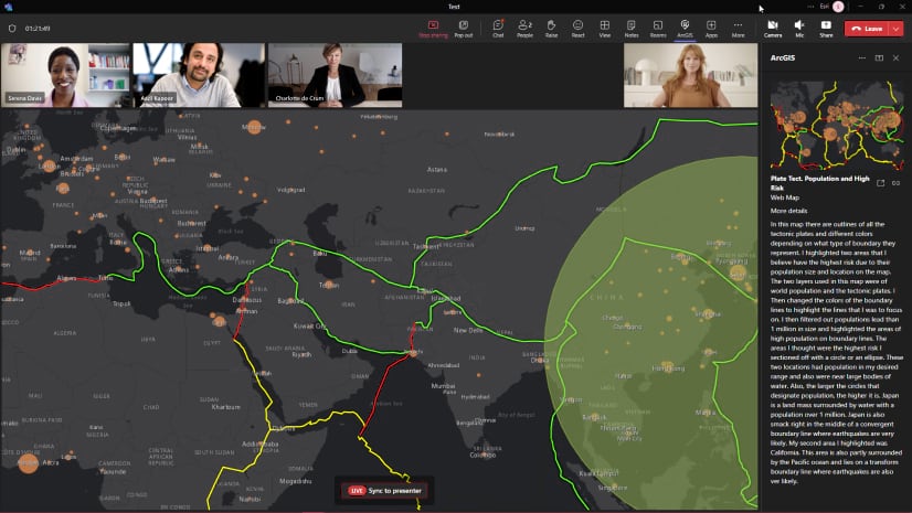
The June 2024 release brings a new, immersive way to collaborate during an ArcGIS for Teams call or chat. Join geo-spatial forces with your colleagues to edit and save a shared map using our new Sketch and annotate tool.
With the November 2024 release you can now batch delete different sketch types in sketch and annotate — such as points, lines, polygons, and symbols—during meetings. This enhancement gives you greater control over meeting sketches, making your live collaboration sessions more organized and efficient.

Sketch and annotate is similar to the Microsoft Teams meeting option Share content or ArcGIS for Teams Present a map, but with a great twist.
Whether you are the meeting host or a participant, you can now not only explore shared content independently from the presenter but can use the annotation tools to change the content shown. Add text, geometry (points, lines, or polygons), and custom symbols to edit the shared map. Hosts can save the annotated layer to their ArcGIS organizational account.
If you are the meeting host, share a map in a Microsoft Teams meeting and open permissions via the Settings pane in the ArcGIS for Teams Sketch and annotate tool.

Once everyone agrees on a plan, all participants can annotate the map to emphasize and add key features. Your team can make the map vibrant with information before saving the edits as a layer hosted in ArcGIS Online or ArcGIS Enterprise.

Learn more about Administrator or host settings in ArcGIS for Teams Sketch and annotate
Note: You must be signed in to ArcGIS to access the sketch and annotate tool. The host and the participant have different views and privileges.
Sketch and annotate as a participant
If you are a member of a Microsoft Teams channel, chat, or meeting where the administrator or host has enabled the Sketch and annotate feature for all participants, you can access the tool made available by the host.

Use the Sketch annotation tools to add content to the shared map.

Note: Participants cannot save the map or grant editing access to other participants.
Save your Sketch and annotate layer to ArcGIS (host or administrator)
After your team has created an annotated layer during a Microsoft Teams presentation, you can save the annotated layer to an ArcGIS organizational account.
Do you want to make the annotated layer available to others? Change the sharing permissions by right-clicking the layer and changing the audience from Owner to My Organization or Everyone.
Learn how to change sharing permissions in ArcGIS Online
Summary
Sketch and annotate in ArcGIS for Teams enables real-time collaboration, allowing you to share, sync, and interact with ArcGIS spatial content directly within your Microsoft Teams meetings.
To learn more about other features available in ArcGIS for Teams start with our ArcGIS for Teams online help. For more information about ArcGIS for Teams, including access to GIS professionals, tips and tricks, and a preview of what’s coming next, join our ArcGIS for Teams Esri Community.


Article Discussion: