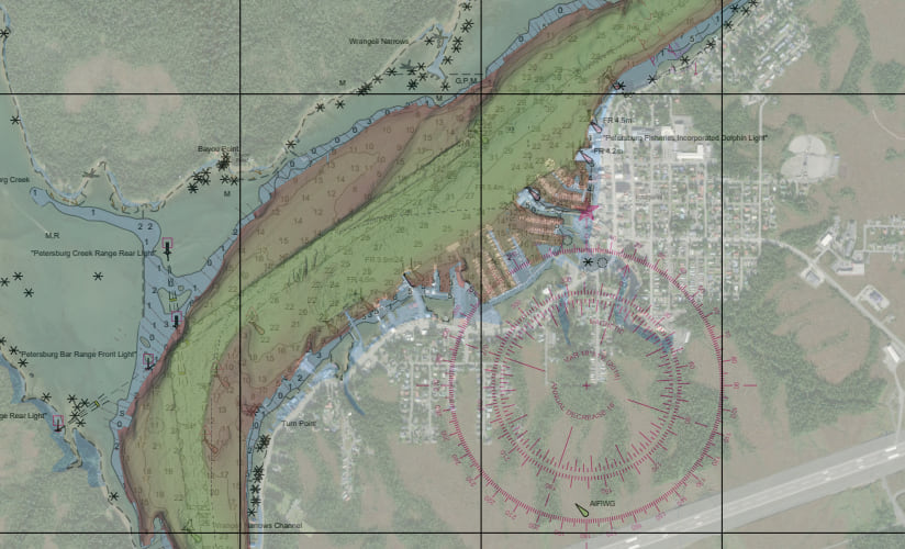
Even with the advent of electronic navigational charts (ENCs), many mariners and hydrographic offices rely on paper. Paper charts are becoming complementary to electronic navigational charts (ENCs), and in addition to being a requirement for most agencies, also provide a logical backup against potential electronic system failure. However, the creation and maintenance of paper products is significantly more expensive and time-consuming than ENCs. As a result, hydrographic offices are trying to find ways to improve the efficiency of their traditional paper chart production systems.
Esri offers two solutions for expediting paper nautical chart production: Custom Chart Builder (CCB), a fully-automated web app that requires no manual finishing; and the Chart Automation tool, which provides a streamlined process for initial chart creation while still allowing cartographers to perform cartographic edits in ArcGIS Pro. Read on to learn more about how these tools can reduce chart production time to minutes instead of days.
Custom Chart Builder
Custom Chart Builder (CCB) is a fully automated chart production system that simplifies the paper chart production process by using ENCs directly without requiring a database. Consequently, any new data updates to the ENC will automatically be reflected in your paper chart.
The CCB app allows you to create charts anywhere you have ENC coverage on any sized sheet of paper at any scale. You can create mashups that include imagery, topographic data, bathymetric survey data, and more. With CCB, you can also do the following:
- Share data as web layers within your organization, or with other key stakeholders.
- Use S-52 (ECDIS) or paper chart (S-4) symbology.
- Toggle the visibility and transparency of layers.
- Create custom fit-for-purpose mashups with thousands of datasets available on ArcGIS Living Atlas.

CCB combines a user-friendly interface with the framework of ArcGIS Maritime to make chart creation adaptable to various uses. The output is fully automated and requires no manual cartographic finishing.
Chart Automation tool
The Chart Automation tool (CAT) streamlines paper chart production by automating several chart processes while still allowing cartographers to edit the output for use cases like perfecting the location of labels and masking. The automated processes include creating INT2 grids and graticules, masking label and symbology conflicts, applying S-4 symbology, generating light sectors, and many more. With CAT, you can also do the following:
- Create digital raster or vector charts.
- Automate a majority of the cartographic process.
- Generate S-4 compliant light sectors.
- Manually control the placement of text and other features.

CAT automates the creation of traditional S-4 compliant paper charts while still allowing for cartographic refinement to ensure accurate and up-to-date chart production. Using advanced algorithms for data integration and automation, this tool improves both efficiency and accuracy in maritime charting operations.
With ArcGIS Maritime, you can create cartographic products to support a variety of uses, such as safe navigation, custom fit-for-mission charts, and collaboration with other agencies. Supplemental charting tools also provide an opportunity to further refine your nautical charts with compass roses, scale bars, and zones of confidence diagrams.
For more information, visit the ArcGIS Maritime page, post your questions in the ArcGIS Maritime board in Esri Community, or contact us directly at maritime@esri.com.


Article Discussion: