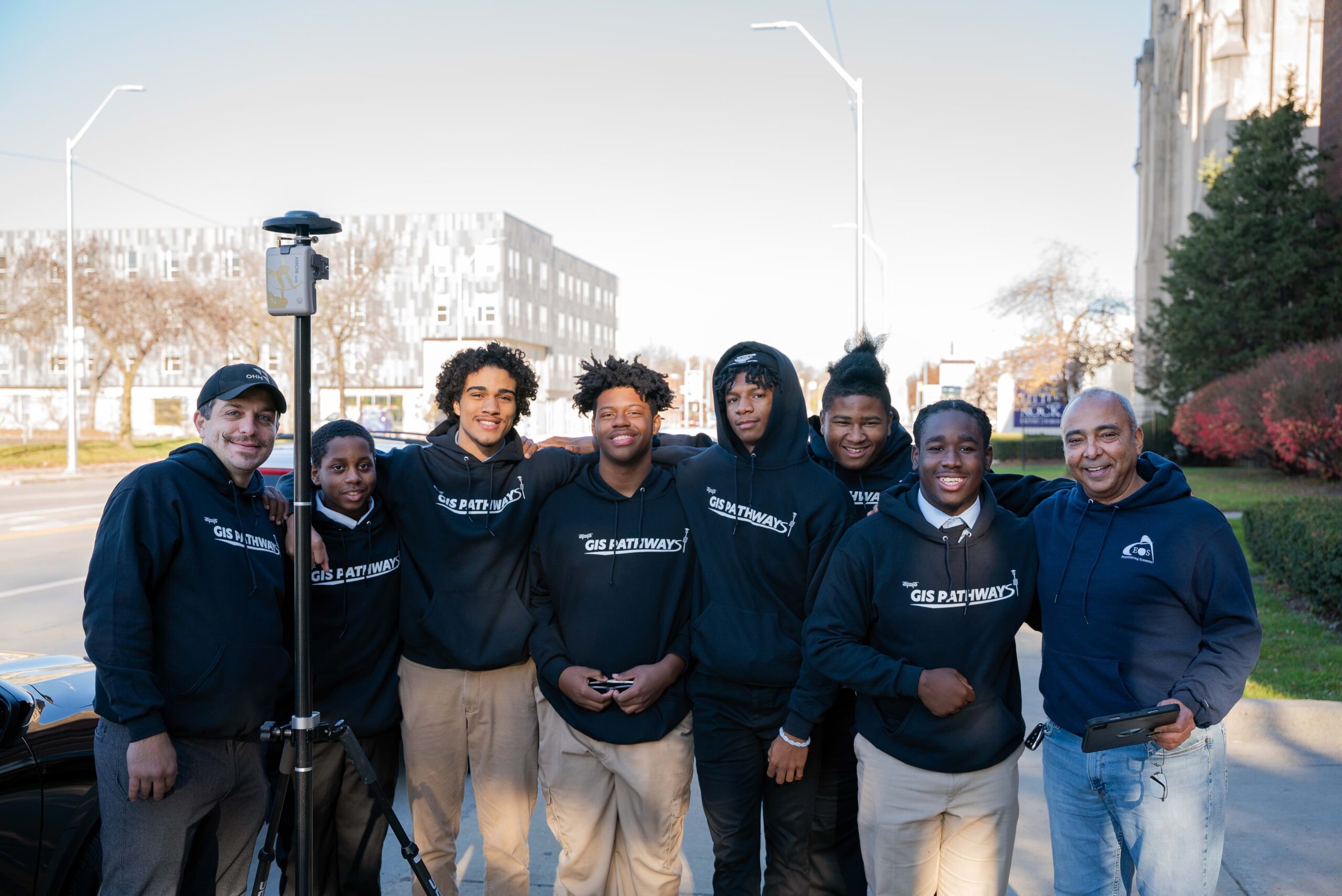
Listen Here
In Detroit, Michigan there exists a very special high school with a geospatial program centered around equipping the young men of the city for life beyond the classroom. At Frederick Douglass Academy (FDA), one educator, one entrepreneur, and one local businessman invest their time, effort, and resources to establish a presence in the community. Chad Segrist (FDA), Frank Romo (Romo GIS), and Michael Cousins (OHM Advisors), have brought GIS into the academic realm at FDA with the revolutionary GIS Pathways Program and have given the students who complete it not only a set of marketable skills they can utilize in college as well as the working world.
I met the FDA team via my friend, Sarah Alban, with Eos Positioning Systems. Sarah and I had an excellent conversation during Season 1 of Geospatial Experiences, after which she mentioned the GIS Pathways Program. I was intrigued and excited to learn more about what was happening in the geospatial academic high school realm. I expected to have a neat conversation with some interesting people; my expectations were blown out of the water and I was really both amazed and stunned. At FDA, I met a team who take their roles very seriously. They are here to educate, cultivate relationships, invoke a sense of pride and accomplishment, build rapport as well as confidence. I also met a crew of graduating and rising high school seniors who are articulate, intelligent, proud of their geospatial skills, highly accomplished, and very appreciative of their educators. They were incredibly interesting to speak with and I had an absolutely fantastic time interviewing the whole group. The adults were informative and provided fantastic details about the program and how it began, while the students brought so much energy to the conversation that I found myself just letting them go and talk to their hearts’ content. They had so much to say and it was important for us to listen.
These students are an inspiration. The GIS Pathways program should give us cause to think about not only what we could do to help assist them, but what could each of us do in our own community with our geospatial skills, our connections, and our resources. Michael, Chad, and Frank, along with their teams, have set the bar very high. The team at Eos Positioning Systems recognized how important this program is and got involved. The challenge for the rest of us is this: what can we do to make a difference?
Commenting is no longer enabled for this article