ArcGIS Enterprise 11.4 is a short-term support release with new features and enhancements that simplify administrative and data management workflows for maximum efficiency.
Some exciting highlights of ArcGIS Enterprise 11.4 on Windows and Linux include:
- Licensing updates that streamline access with updated user types and the ability to manage named user licenses for select products directly in the ArcGIS Enterprise portal.
- Update to base deployment definition that supports hosted 3D tiles layers, and the cached query responses for hosted feature layers which provides the option to have the object store provided by a cloud service.
- The option to update public Enterprise portal URLs through APIs to reduce risks and ensure continuous service.
- Ability to assign item classification labels to support specific organizational needs, like stringent data management and compliance requirements.
- A new audit logging feature that offers continuous monitoring by recording the occurrence of an action and its’ details, which can be analyzed for real-time insights and reporting.
Quick Links
Jump to a section in this blog to start exploring.
- Licensing updates
- Object Store Requirement
- Enterprise Portal
- Content and Data Management
- Extensibility
- Upgrades
- Apps & Extensions
Licensing updates
Updated User Types Are Now Available in ArcGIS Enterprise 11.4
Effective June 2024, Esri updated the user type license model to six (6) role-based user types that extend capabilities, simplify administration, and allow you to scale as your organization’s needs grow. The updated user types are now available in ArcGIS Enterprise 11.4. Explore updated user types.
As with any release, consider when the best time is for your organization to upgrade. The updated user types will be available whenever your organization chooses to upgrade to 11.4 or later.
Upon upgrading to Enterprise 11.4, there may be some actions you need to take as an administrator related to these user type changes. If your organization has add-on licenses, such as ArcGIS Pro, prior to upgrading to Enterprise 11.4, you will see that some members now have duplicate licenses. This is because ArcGIS Pro is included with some of the new user types. You will need to unassign these duplicate licenses in the Enterprise portal following your upgrade.
You may also need to unassign licenses that no longer exist with the updated user type model, For example, if you have users assigned a GIS Professional Basic license, those licenses will need to be unassigned and those users will need to be assigned a new user type before they are able to sign into the Enterprise portal.
For more details about this and other potential workflows related to user type updates, refer to product documentation. Also, stay tuned for a blog coming in the near future that will delve into more details.
Experience a few of the benefits before upgrading to 11.4
Effective June 2024, Esri delivered ArcGIS Pro Basic to all ArcGIS Enterprise 10.9 to 11.3 customers who purchased Creator user types or received Creator entitlements as part of their ArcGIS Enterprise purchase. These licenses are valid for the duration of the remaining maintenance or subscription term.
Additionally, users are able to begin using ArcGIS Excalibur licenses by assigning them to any Creator user type, and ArcGIS GeoBIM to any Editor user type.
Log-in to My Esri to activate these newly available add-ons at your discretion and use them until you upgrade to ArcGIS Enterprise 11.4 or later.
ArcGIS License Manager requirement removal
As more users transition to named user licensing, organizations are seeking a simplified administration experience while ensuring robust security measures to safeguard license integrity. To meet this need ArcGIS License Manager is no longer required for named user licensing of ArcGIS Pro, ArcGIS Drone2Map, or ArcGIS AllSource starting with Enterprise 11.4. Instead, named user licenses are managed directly the ArcGIS Enterprise portal. For users, adoption will be a snap with the new experience being almost identical to licensing ArcGIS Pro with ArcGIS Online named users.
Instead of providing a MAC address, the use of an organization URL will now tie the ArcGIS Pro, ArcGIS Drone2Map, and ArcGIS AllSource licenses to your Enterprise portal organization. Then, ArcGIS Pro will communicate directly with the Enterprise portal to validate membership and obtain user licenses.
This enhancement simplifies administrative workflows by reducing the number of system components to manage and reduces the intricacies associated with running License Manager in virtualized or cloud environments.
It is important to note, despite no longer requiring License Manager to license named users, ArcGIS Enterprise 11.4 will remain compatible with ArcGIS Pro 3.3 and earlier.
Object store requirement
ArcGIS Enterprise’s tile cache data store is leveraged as the underlying storage mechanism to support hosted scene layers. With the ArcGIS Enterprise 11.4 release, this type of ArcGIS Data Store is deprecated and its functionality is replaced by the object store.
With this change, the definition of a base ArcGIS Enterprise deployment has been updated, as the object store is now required instead of the tile cache data store. This change also supports two really exciting new features in this release, hosted 3D tiles layers, and the option to have the object store provided by a cloud object storage service.
This alternative to using the ArcGIS Data Store object store is available to organizations who have deployed ArcGIS Enterprise in the Amazon Web Services (AWS) or Microsoft Azure clouds and have upgraded to ArcGIS Enterprise 11.4 or later. While both serve the same purpose, cloud object storage services such as AWS S3 and Azure Blob Storage offer benefits in terms of scalability, availability, and resiliency.
Whether your hosting server’s object store is provided by the ArcGIS Data Store object store, or one of our supported cloud storage services, all organizations who have upgraded from 11.3 or earlier are encouraged to migrate all hosted scene layers caches from the deprecated tile cache data store to the object store after upgrading to ArcGIS Enterprise 11.4 using the Esri-provided tooling.
Tooling to migrate hosted scene layer caches
Migrating hosted scene layer caches to the object store is extremely easy, can be accomplished without any service downtime, and offers organizations flexibility in the approach that best suits their preference for migration: you can either migrate the caches on a layer-by-layer basis from the Enterprise portal, or you can do this in bulk using a new migration utility that comes installed with ArcGIS Server.
For organizations who don’t have very many hosted scene layer items published to their Enterprise portal, migrating a hosted scene layer’s cache from the Enterprise portal item page may be the preferred approach. Item owners and organization administrators can initiate the migration of the cache by going to the hosted scene layer’s item page, Settings tab. Any hosted scene layer items that need to have their cache migrated to the object store will show a Migrate Cache button. The amount of time a cache takes to migrate will vary depending on the size of the cache, but the layer will be available during the migration without any service downtime. Additionally, users will be able to view the progress of the cache migration by viewing the resulting job’s status.
For organizations who want a more streamlined approach, it is recommended to use the new MigrateSceneServices utility as an alternative to migrating the caches on an individual layer basis from the Enterprise portal. This utility was designed specifically to aid in this migration and features different modes (analysis and execution) as well as logging. The default mode for the utility is analysis mode, which will return details about all services that have their caches stored in the tile cache data store, including their estimated sizes, while the execution mode is used to migrate the caches, like what is done on the back end when a user clicks the Migrate Cache button from the Enterprise portal.
This migration utility can also be used to confirm that your migration is complete, as it will return that no services are eligible for migration once all hosted scene layer caches have successfully been migrated to the object store.
This move to the object store is essential for future-proofing your systems, as the tile cache data store is being phased out and will not be supported after the ArcGIS Enterprise 11.5 release.
Enterprise portal
Administration
In ArcGIS Enterprise 11.4, users can now more easily update their public portal URL for ArcGIS Enterprise deployments on Windows or Linux. This enhancement is particularly beneficial during rebranding or organizational changes such as mergers and acquisitions. This feature will simplify the process of aligning public-facing URLs with new company identities or structural changes, eliminating the need for complex manual reconfigurations. Users will no longer face challenges or errors changing established URLs. By enabling URL updates through APIs, the software reduces risks and ensures continuous service.
The new item classification functionality in the Enterprise portal helps support data management policies for working with content with sensitive information. This feature allows users to assign classification labels to items, clearly marking the level of sensitivity and the necessary protection measures. Item classification supports customizable classification schemas, which can be tailored to meet specific organizational needs, including attributes like dissemination controls and program assignments. An item’s classification will be visible when viewing the item via the item page, or viewing the item in Map Viewer. Users are also able to easily search for items with a particular classification.
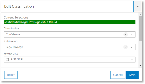
This functionality is especially useful for industries with stringent data management and compliance requirements, such as defense, banking, and healthcare. By assigning labels that reflect data sensitivity, classification aids in organizing content and ensuring that it is handled with the appropriate level of security. It is important to note that item classification is a labeling mechanism but will not manage access or security related to the item. Please ensure permissions for accessing items are being managed in line with your data management policy.
Audit logs are crucial for maintaining accountability, complying with regulatory standards, and identifying security threats. At 11.4 the audit logging feature offers continuous monitoring by recording the occurrence of an action, the time it happened, and the responsible user or service as files within the portal logs folder and can be analyzed with tools like Splunk to offer real-time insights and reporting. In 11.4, portal actions will be tracked such as user logins and token generation and create, update and delete operations for users, roles, groups and items. This new feature, for ArcGIS Enterprise deployments on Windows and Linux, underscores our commitment to providing secure and compliant solutions to our clients.
Map Viewer
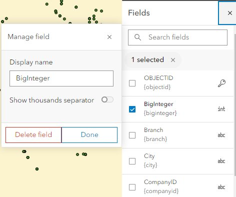
This release provides important Map Viewer Classic equivalency features with an improved experience. Previously, any field management for a feature layer was only available from the item page and in Map Viewer Classic. At 11.4 you can manage, add, and delete fields from the Fields pane in Map Viewer.
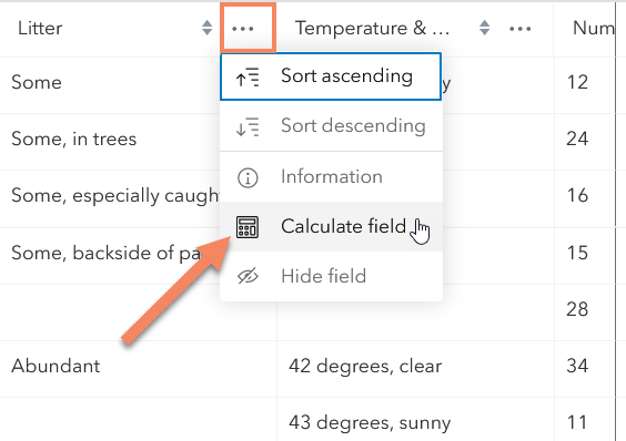
Another key enhancement for 11.4 is the ability to Calculate fields in Map Viewer for hosted layers. Field calculation was available in Map Viewer Classic and from the Data tab. ArcGIS Enterprise 11.4 provides a new immersive calculation experience to manage your data. This enhancement enables you to easily filter data, visualize impacted features on the map, run test calculations, and download your field calculation script without leaving Map Viewer. This feature is available for both feature layer owners and administrators by selecting the overflow menu for a field attribute table.
Support for catalog layers is also introduced at 11.4. This new layer type enables you to organize multiple layers into a single experience within a map for easier viewing. Any layer displayed in the catalog can easily be added to the map as a layer you can configure, and save, in the map.
You can now view related records for layer in attribute table. When working with feature layers and map image layers that contain related data, you can see and explore relationships through the table. Simply scroll to the relationship field, then click on the link to view a filtered table of your related features or records. The table header also displays “breadcrumb” guides to navigate your way back to previously viewed relationships and tables.
At 11.4 you also have access to additional analysis and visualization options like the Open Raster function. This new feature enables you to utilize the Open Raster Function Editor directly from Map Viewer. Also, there are new Zonal Statistics options for the Statistics type parameter and Zonal Statistics as Table which include Majority count, Majority percentage, Minority count, and Minority percentage; to name a few.
Scene Viewer
The new time slider in Scene Viewer is a powerful tool designed to enhance the visualization and exploration of time-enabled data. This feature supports 2D layers with time attributes, as well as time-enabled point, 3D object, and voxel scene layers, providing a comprehensive view of data changes over time. You can interact with the time slider by playing, pausing, and navigating through different time periods. Time settings can be saved in slides for easy access or integrated into other applications like ArcGIS StoryMaps, maintaining the same temporal context.
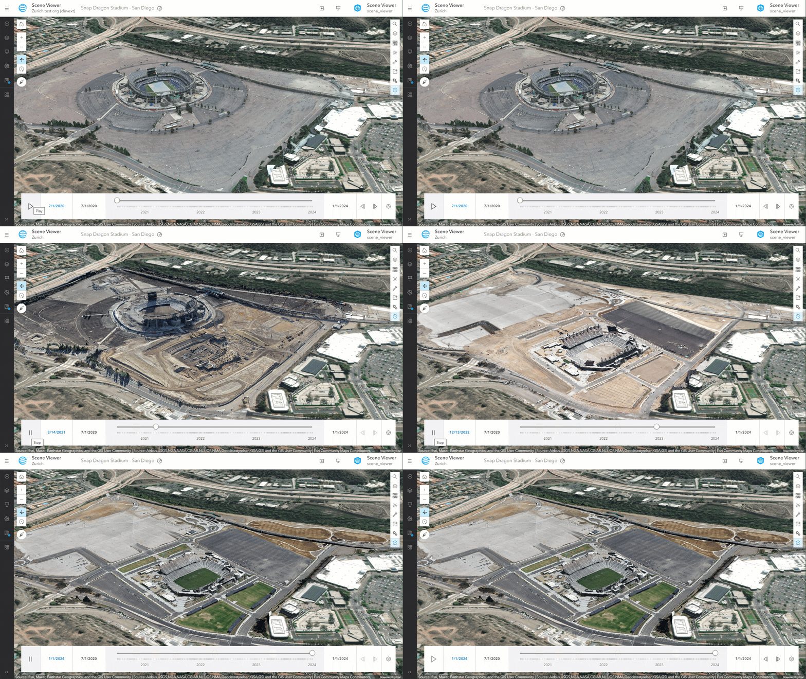
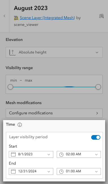
Additionally, you can define a period for layer visibility in Layer Properties with layer-specific time controls. This feature enables users to show or hide entire layers based on selected time frames, facilitating the integration of diverse datasets into a seamless temporal narrative. For example, in a construction project, you can now visualize drone imagery of a construction site or compare imagery before and after a natural event like a landslide, providing you with deeper insights and improved project management.
Content and Data Management
Living Atlas
The ArcGIS Living Atlas in ArcGIS Enterprise 11.3 introduced a dynamic approach to accessing the most current geographic content. Now this has been built upon in Enterprise 11.4. Initially, the Living Atlas is not preconfigured with the organization; however, by completing a package update, users can deploy the initial content package. This ensures that the latest ArcGIS Living Atlas items are readily available, enhancing the richness and relevance of geographic data. Furthermore, as new items become available, updates can be seamlessly integrated, continuously enriching your experience with the most up-to-date and comprehensive geographic information.
New UI For Group Export/Import
Moving content across tiered ArcGIS Enterprise environments just got easier. At 11.4 you are able to migrate hosted content across environments with a User Interface (UI), eliminating the need to use the REST API.
Explore more details →

Service management in Enterprise portal
The types of service supported for management in Enterprise portal has expanded at 11.4, minimizing the need to go to Server Manager to complete certain workflows. Now, organization administrators and owners of imagery layers with publishing privileges can stop and start a service exposed by the layer by navigating to the imagery layer section of the item settings page. Here they can also manage their image service’s server object extensions (SOEs) and server object interceptors (SOIs) in the Enterprise portal. These features empower organizations to optimize their server operations, ensuring that their systems are both adaptable and secure. Another cool feature accessible through the item page, this time of the locator, is the ability to start and stop geocode services and configure properties.
Extensibility
With the new “applyEdits” operation for custom data feeds, you now have access to enhanced editing capabilities on feature services published from a custom data feed. This operation streamlines data management processes, offering increased control to customize data feeds according to specific operational requirements.
Also, we are excited to announce the launch of the Long Lived API Token feature, offering developers the ability to create API tokens that extend beyond the traditional 14-day limit directly through the user interface. This enhancement empowers developers to embed these extended credentials for up to 365 days within their custom applications, providing extended flexibility and convenience in managing their authentication processes.
Upgrades
If you are upgrading via the command line utility – you can now get real-time status information about ArcGIS Server post-upgrade operation. This information allows you to have insight as to how far along you are in your Server upgrade that was not available previously by tracking progress through seven key upgrade stages.
Apps & Extensions
ArcGIS Web Editor
ArcGIS Web Editor is a lightweight editing app designed to make editing faster and easier than ever before. In ArcGIS Enterprise 11.4, users can take advantage of this powerful new app at the Creator user type, without any separate install.

New ArcGIS Enterprise Imagery Capabilities
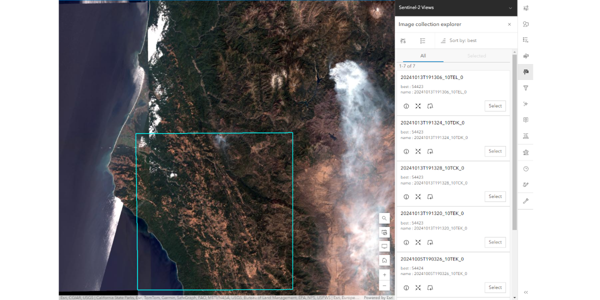
We continue to add imagery capabilities to ArcGIS Enterprise extensions and apps to ensure a seamless and consistent user experience throughout ArcGIS. From making complex image processing tasks more accessible with raster function templates in ArcGIS Image Server, to including ArcGIS Excalibur in the Creator and above user types for easier access with no additional licenses, and enhanced stability and support for more diverse video sources in ArcGIS Video Server, these improvements help increase organization-wide access to efficient imagery workflows. Read the blog about what’s new!
Explore more details →
ArcGIS GeoBIM
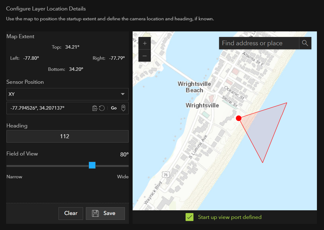
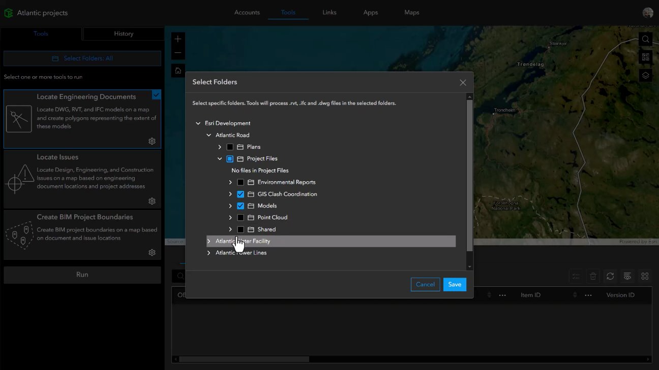
ArcGIS GeoBIM is a cloud-to-cloud application that connects geospatial data in ArcGIS with architecture, engineering, and construction (AEC) information in Autodesk Construction Cloud. This release on ArcGIS Enterprise 11.4 expands access to ArcGIS GeoBIM through the updated user types, simplifying administration by removing the need to manage add-on licenses. With new Folder Selection, it’s now easier to choose relevant BIM project data from a connected Autodesk account for faster processing and more control over your data.
ArcGIS StoryMaps
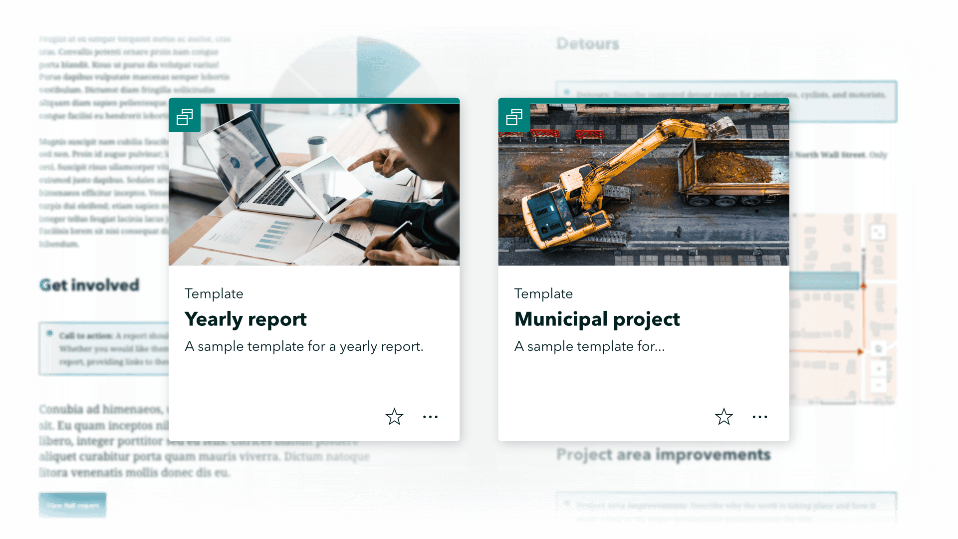
Exciting new features in ArcGIS StoryMaps include templates (beta) to help your organization maintain consistent, high-quality stories. Collections are a great way to bundle related content and now you can share your collection items on a map (beta). In briefings, the image gallery, code, and table blocks have been added and you can present slides in full-screen view and collect metrics using Google or Adobe Analytics. Explore these updates and more for a richer storytelling experience.
ArcGIS Urban
Design the spaces between buildings to explore how various surfaces and ground cover influence urban environments. By integrating elevation layers into each planning scenario, you can examine how different surfaces interact with changes in elevation. Plus, with enhanced drawing tools you can design these spaces with greater precision, ensuring your plans accurately reflect real-world dimensions. Read the release blog to learn more.

ArcGIS Experience Builder
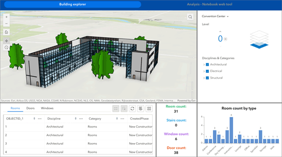
Enterprise 11.4 introduces new improvements and features. The Track widget lets you record your location and movement on a map, capturing vital data like time, altitude, speed, and accuracy. The Measurement widget allows for easy calculation of distances, perimeters, and areas using your preferred units. With the Feature Report widget, generate reports from ArcGIS Survey123 records and gather user feedback seamlessly. Subtype Group Layer is now supported as a data source. Finally, the Building Explorer widget enables you to filter and explore intricate components of building scene layers by level and construction date.
ArcGIS Instant Apps
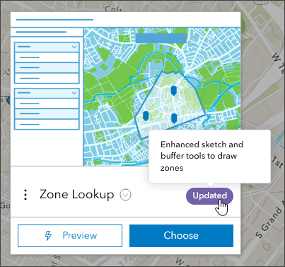
Enterprise 11.4 includes new templates and improvements to ArcGIS Instant Apps. Discover, explore, and analyze maps with the new Atlas template, manage and edit data with the new Manager template, and report issues and observations with the new Reporter template. Additional templates offer enhanced features like autoplay for Attachment Viewer, customizable slide notes for Exhibit, and improved sketch capabilities for Zone Lookup. Additionally, we have made enhancements to the home page, and added additional configuration options for the Language Switcher.
ArcGIS Workflow Manager
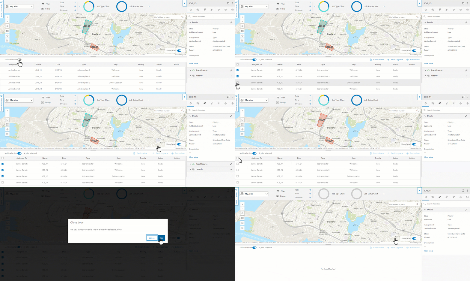
The latest release includes the ability to efficiently manage multiple jobs, close a job without completing the last step, and an enhancement to the Arcade expression menu.
Learn more
For even more details on what is included with this release, delve into the documentation available in the What’s new in ArcGIS Enterprise topic to discover the full range of enhancements and how they can benefit your organization.
We will also be sharing additional blogs on specific topics related to this release such as the user type changes, the migration to the object store, and item classification. Keep an eye out on the ArcGIS Blog site!
When you’re ready to get started with ArcGIS Enterprise 11.4, head over to your My Esri account for your licenses and software.
We’d love to hear what you think of this latest release of ArcGIS Enterprise in the Esri Community! Your feedback helps ArcGIS Enterprise be the best it can be.


Commenting is not enabled for this article.