ArcGIS Enterprise Sites features a user-friendly website builder, enabling anyone, regardless of technical background, to design custom websites and pages.
Using a Site, you can build a custom web-experience to provide people, including colleagues, members of your organization, and the public with fast access to spatial and non-spatial data. Users can search for and download datasets, documents, and other items for their own workflows and projects without having to navigate around your ArcGIS Enterprise portal. You can also create sites and pages to highlight specific topics or goals.
In the newest version of ArcGIS Enterprise 10.8, new and existing users can use the following features to access their content, add team members, and create new sites:
- The new Sites Overview page
- New header customization options
- The global navigation capability
- A core team for every site
- An improved content library for every site with new ways to upload content
- Support for 3D maps and vector tile basemaps with an update to JSAPI 4
Get started on the new Overview page
Whether you’re new to Sites or already have several sites of your own, the new Sites Overview improves how you create and manage sites and content.
This simple interface introduces new users to Sites’ capabilities and provides existing users with a comprehensive list of their sites and content, as well sites and content that others have shared with them.
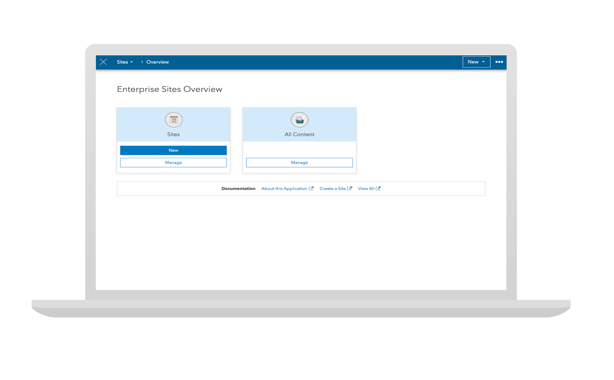
To get started, sign in to your ArcGIS Enterprise portal and click the app switcher next to your user profile and choose Sites. You’ll land on the new Overview page where you can click New on the Sites card. Or, you can click Manage to choose from a list of your existing sites.
To get back to the Overview page, click the first dropdown menu on your site’s edit navigation bar and choose Overview.
Customize your site’s header with new design options
Your site’s header is where you can establish your content as authoritative with your organization’s logo and branding. The following new styling options now make it easier for you to configure your site’s header and provide visitors with fast access to additional resources.
Logo and header layouts
Add a logo to your site’s header and choose how it’s displayed in the new Appearance menu. To get there, click Header on the side panel in the Site Editor, and click Appearance. For more information, on how to configure your site’s header and branding, see Brand a site with header and theme options.
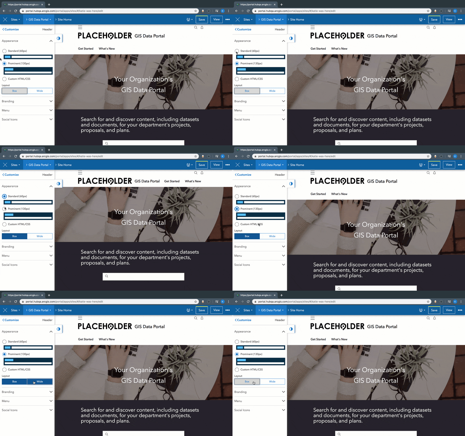
Pages added to a site will adopt the same header as the one configured for the original site.
Menu Links
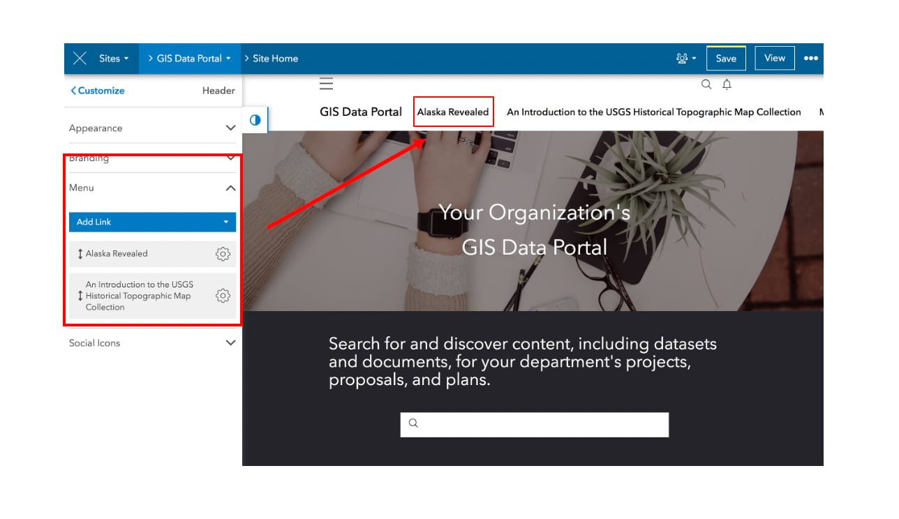
You can also add menu links to your site’s header to create navigation to other parts of your site, such as to story maps, pages, and external links. If the item (page, app, story map, etc.) is shared differently than the site, only people with whom the item is shared will be able to see the menu link when signed in. For information on how to adjust the visibility of individual items, see Share items.
To add menu links, click Header on the side panel in the Site Editor and click Menu. For more information, see Add a menu link to a header.
A new global navigation capability
Global navigation is a thin, compact bar added to the top your site’s and pages’ header. It includes the option to Sign In, view notifications, and search for content shared across Sites. This new capability provides visitors with consistent access to their profile and the ability to search, while freeing up space in your site’s header for more customization and branding.
For more information, see Global Navigation: New Ways to Get Around and Brand your Site with ArcGIS Hub and ArcGIS Enterprise Sites.
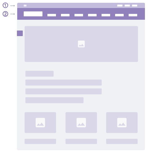
All newly created sites automatically enable the global navigation capability. For information on how to manage this new site capability and others, see Configure capabilities.
A core team for every site
Before this release, any members who needed to customize and administer sites were added to the Sites Administration Group. This group gave members access to edit any site created in the portal. Now, new and existing sites will have their own core team, giving site administrators greater control of who can edit the site.
The core team for existing sites will include all members of the Sites Administration Group. You can remove members or clone a site to get started with a fresh core team and set your old your site to private or delete it.
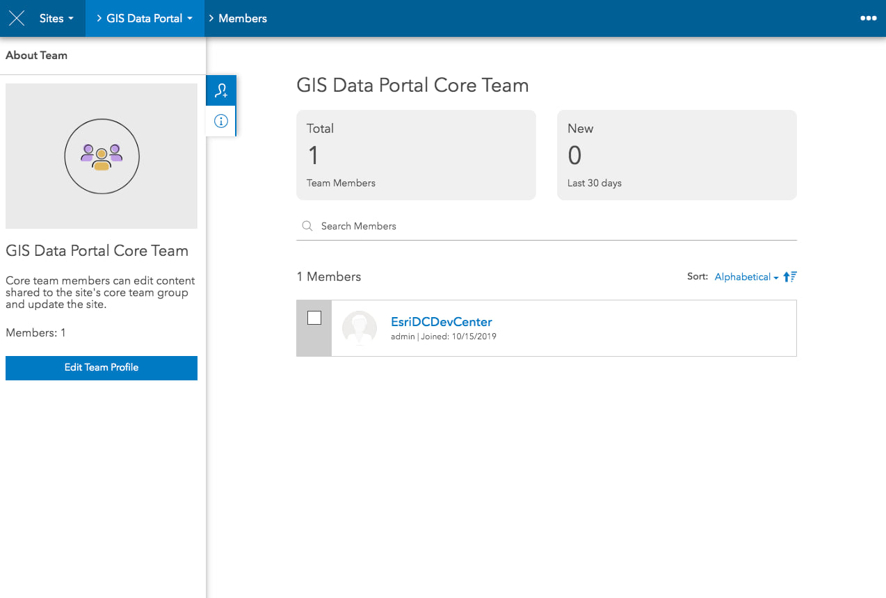
To add someone to a core team, open your site in edit mode and click the second dropdown menu in the edit navigation bar and choose Teams. Then, click the Add Members button on the side panel and select your team members. If you don’t see the person you want to add, check with your administrator to see if they’re members of your ArcGIS Enterprise environment.
As a core team member, a person can edit the site and any items shared to the site’s core team group.
Enhanced support for the maps you share
The latest version of the ArcGIS API Javascript delivers mapping features and performance improvements. This transition won’t affect your existing content or sites. However, if you notice that older versions of your web map don’t work, follow the link provided in the warning message to open your map. Just save the map again, and we’ll take care of updating it to the latest version.
Share 3D web maps
You can now add 3D web scenes to your sites and pages using the map card. Scenes create an interactive 3D model for showcasing a variety of scenarios, like proposed development, underground utilities, and more.
To add one to your site, add a map card onto your site’s layout and select a map that’s your own or one that’s been shared with your team or organization. You can also choose from publicly shared scenes.
Don’t have a scene yet? Learn how to create one.
Support for vector tile base maps
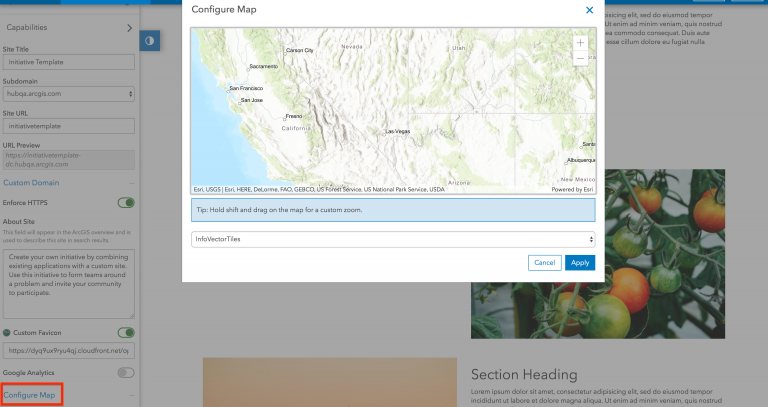
For more information see 3D Web Scenes, Vector Tile Base maps, and more in ArcGIS Hub and Sites for ArcGIS Enterprise.
Adding groups to a site
Every site now includes an updated Content Library and Groups Manager so that you can more easily add content to your sites. This catalog of content is powered by the site’s two default groups: the content group and the core team group. You can share items to these groups or use your own groups. These groups also power your site’s search results.
To get started, open a site in edit mode and click the second dropdown menu to choose the Groups Manager.
Try it out
To get started, sign in and create your first site or click Manage on the overview page to access your existing sites.
In order to create and edit sites, you will need to be an administrator or an ArcGIS Enterprise administrator will need to assign you a custom role based on the Publisher role with the following administrative privileges:
- Groups: Create with update capabilities
- Assign Members
For more information on creating a new site and recommended next steps, see the Create a site documentation.


Article Discussion: